Muroc, California

Last updated
Muroc
Former settlement
Index map of the Mohave Desert region of California 1929 02.png
Mojave Desert, 1929, including Muroc along the Santa Fe rail line
Muroc, California
Coordinates: 34°55′23″N117°52′20″W / 34.92306°N 117.87222°W / 34.92306; -117.87222
Country United States
State California
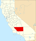
County Kern County
Elevation
[1]
2,283 ft (696 m)

Muroc (also known as, Rogers, Rod, Yucca, and Rodriguez) [2] is a former settlement in Kern County, California in the Mojave Desert. [1]

It was located on Rogers Dry Lake 3 miles (4.8 km) east of Edwards, [2] at an elevation of 2283 feet (696 m). [1] Circa 1929, Valyermo, Llano, Wilsona, Neenach, Domino, and Muroc, were all described as "post offices that serve scattered ranches. All these communities are reached by automobile, and roads lead from the [ Antelope Valley] to desert towns lying to the north and east." [3]

Muroc still appeared on maps as of 1942. [1] Muroc's site is now on Edwards Air Force Base. [2] After World War II Muroc served as an important test flight location; in 1947 Chuck Yeager broke the sound barrier in the Muroc vicinity.

A post office operated at Muroc from 1910 to 1951. [2] The name honors early settlers Ralph and Clifford Corum — their surname spelled backwards is "Muroc". [2]
See also

Related Research Articles

<span class="mw-page-title-main">Boron, California</span> Census-designated place in California, United States

Boron is a census-designated place (CDP) in Kern County, California, United States. Boron is 15 miles (24 km) southwest of Red Rock Mountain at an elevation of 2,467 feet (752 m). The population was 2,086 at the 2020 census, up from 2,025 at the 2000 census. Boron is named after the element boron and is the site of the world's largest source of the boron compound boric acid.

<span class="mw-page-title-main">Edwards Air Force Base</span> US Air Force base near Lancaster, California, United States (founded 1935)

Edwards Air Force Base (AFB) is a United States Air Force installation in California. Most of the base sits in Kern County, but its eastern end is in San Bernardino County and a southern arm is in Los Angeles County. The hub of the base is Edwards, California. Established in the 1930s as Muroc Field, the facility was renamed Muroc Army Airfield and then Muroc Air Force Base before its final renaming in 1950 for World War II USAAF veteran and test pilot Capt. Glen Edwards.

<span class="mw-page-title-main">North Edwards, California</span> Census-designated place in California, United States

North Edwards is a census-designated place (CDP) in Kern County, California. Situated in the Mojave Desert, North Edwards is located about 7.2 miles (11.6 km) north-east of Edwards Air Force Base, at an elevation of 2,293 feet (699 m). As of the 2010 census it had a population of 1,058.

<span class="mw-page-title-main">Rosamond, California</span> Unincorporated community in Kern County, California

Rosamond is an unincorporated community in Kern County, California, US, near the Los Angeles county line. Rosamond is part of Greater Los Angeles and is located in the Mojave Desert just north of Lancaster and Palmdale, two of the largest cities in Antelope Valley. As of the 2010 Census, Rosamond's population was 18,150. For statistical purposes, the United States Census Bureau has defined Rosamond as a census-designated place (CDP).

<span class="mw-page-title-main">Antelope Valley</span> Valley in Southern California, United States

The Antelope Valley is located in northern Los Angeles County, California, United States, and the southeast portion of California's Kern County, and constitutes the western tip of the Mojave Desert. It is situated between the Tehachapi, Sierra Pelona, and the San Gabriel Mountains. The valley was named for the pronghorns that roamed there until they were all eliminated in the 1880s, mostly by hunting, or resettled in other areas. The principal cities in the Antelope Valley are Palmdale and Lancaster.

<span class="mw-page-title-main">Glen Edwards (pilot)</span> United States Air Force officer

Glen Walter Edwards was a test pilot for the United States Air Force. He is the namesake of Edwards Air Force Base.

Edwards is an unincorporated community in Kern County, California.

<span class="mw-page-title-main">Pancho Barnes</span> American aviator

Florence Lowe "Pancho" Barnes was a pioneer aviator and a founder of the first movie stunt pilots' union. In 1930, she broke Amelia Earhart's air speed record. Barnes raced in the Women's Air Derby and was a member of the Ninety-Nines. In later years, she was known as the owner of the Happy Bottom Riding Club, a bar and restaurant in the Mojave Desert, Southern California, catering to the legendary test pilots and aviators who worked nearby.

<span class="mw-page-title-main">Air Force Test Center</span> US Air Force flight test center

The Air Force Test Center (AFTC) is a development and test organization of the United States Air Force. It conducts research, development, test, and evaluation of aerospace systems from concept to deployment. It has test flown every aircraft in the Army Air Force's and the Air Force's inventory since World War II. The center employs nearly 13,000 people, and controls the second largest base in the Air Force.

<span class="mw-page-title-main">Rogers Dry Lake</span> Dry lake in the state of California, United States

Rogers Dry Lake is an endorheic desert salt pan in the Mojave Desert of Kern County, California. The lake derives its name from the Anglicization from the Spanish name, Rodriguez Dry Lake. It is the central part of Edwards Air Force Base as its hard surface provides a natural extension to the paved runways. It was formerly known as Muroc Dry Lake.

<span class="mw-page-title-main">Blythe Airport</span> Airport

Blythe Airport is seven miles west of Blythe, in Riverside County, California, United States. The National Plan of Integrated Airport Systems for 2011–2015 categorized it as a general aviation facility.

Ogilby is a ghost town in Imperial County, California, United States. Ogilby is located on the Southern Pacific Railroad 42 miles (68 km) east of El Centro, and 3.8 miles (6.1 km) north of Interstate 8 on County Road S34. The name is official for federal use, and a feature ID number of 252950 has been assigned. Ogilby is defined by the US Geological Survey as a populated place at 356 feet (109 m) AMSL elevation. NAD27 latitude and longitude are listed at 32°49′01″N114°50′20″W on the "Ogilby, California" 7.5-minute quadrangle (map). It is included in the Imperial County Air Pollution Control District. It lies at an elevation of 364 feet (111 m).

<span class="mw-page-title-main">High Desert (California)</span> Geographic area of southern California

The High Desert is a vernacular region with non-discrete boundaries covering areas of the western Mojave Desert in Southern California. The region encompasses various terrain with elevations generally between 2,000 and 4,000 ft above sea level, and is located just north of the San Gabriel, San Bernardino, and Little San Bernardino Mountains.

<span class="mw-page-title-main">Earp, California</span> Unincorporated community in California, United States

Earp, California is an unincorporated community in San Bernardino County in the Sonoran Desert close to the California/Arizona state line at the Colorado River in Parker Valley.

Muroc Joint Unified School District is a public K-12 unified school system of approximately 2,000 students, located in the Mojave Desert approximately 110 miles (180 km) northeast of Los Angeles. It was founded as an elementary school in 1911 at Edwards. Boron students were bussed to the air base for their education. As the area became more populated, another school was established in 1929, in Boron. The schools became a unified district in 1953, encompassing 578 square miles (1,500 km2) in Kern and San Bernardino counties.

<i>Speed</i> (1936 film) 1936 film by Edwin L. Marin

Speed is a 1936 Metro-Goldwyn-Mayer action film directed by Edwin L. Marin. It starred James Stewart, in his first starring role, and Wendy Barrie. Although only a low-budget "B" movie, the film was notable for its realistic cinematography by Lester White, incorporating scenes from the Indianapolis 500 race and on-location shooting at the Muroc dry lake bed, used for high-speed racing by "hot rodders" in the 1930s. Advance publicity trumpeted that Stewart drove the specially-prepared "Falcon" to 140 mph (230 km/h).

Aerial Acres is an unincorporated community in Kern County, California.

North Muroc is a former settlement in Kern County, California. It was located 8 miles (13 km) south-southeast of Castle Butte, at an elevation of 2290 feet. North Muroc still appeared on maps as of 1947.

<span class="mw-page-title-main">Wilsona, California</span> Former settlement in California, United States

Wilsona was a 20th-century settlement in the Antelope Valley section of Los Angeles County, California. It lay in the vicinity of Big Rock Wash, at an elevation of 2726 feet in the far northeastern corner of the county, the near the border junction of Los Angeles, Kern, and San Bernardino Counties. Wilsona had a post office beginning in 1916 between the Llano and Gray Mountain post offices. Circa 1929, Valyermo, Llano, Wilsona, Neenach, Domino, and Muroc, were all described as "post offices that serve scattered ranches. All these communities are reached by automobile, and roads lead from the [Antelope Valley] to desert towns lying to the north and east." A 1939 guide to Los Angeles County stated "Antelope Valley has many small communities, among which are Acton, Littlerock, Fairmont, Vincent, Harold, Pearblossom, Llano, Valyermo, Wilsona, Hi Vista, Tierra Bonita, Roosevelt, Redman, Del Sur, Esperanza, Rogers, Lake Hughes, Neenach, Sandberg, and Gorman. Most of these are trading centers for populations, most of which are active either in mining or agricultural pursuits."

<i>Muroc Maru</i>

Muroc Maru, officially AAF Temporary Building (Target) T-799, was a replica of a Japanese Takao-class cruiser constructed on the floor of Rogers Dry Lake in southern California during World War II. Used to train bomber pilots and bombardiers in techniques for attacking warships, Muroc Maru remained in place until 1950, when it was demolished.

References

  1. 1 2 3 4 U.S. Geological Survey Geographic Names Information System: Muroc, California
  2. 1 2 3 4 5 Durham, David L. (1998). California's Geographic Names: A Gazetteer of Historic and Modern Names of the State. Clovis, Calif.: Word Dancer Press. p. 1079. ISBN   1-884995-14-4.
  3. The Mohave Desert region, California, a geographic, geologic, and hydrologic reconnaissance (Report). 1929. pp. 289–290. doi: 10.3133/wsp578 .