Current listings
| [2] | Name on the Register [3] | Image | Date listed [4] | Location | Description |
|---|---|---|---|---|---|
| 1 | Allen House | 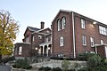 | August 11, 1982 (#82001992) | 2 Solomont Way 42°38′33″N71°20′12″W / 42.6425°N 71.336667°W | Listed at 57 Rolfe Street, now on the campus of University of Massachusetts Lowell. |
| 2 | Andover Street Historic District |  | June 2, 2000 (#00000568) | 245–834 Andover St., 569, 579 E. Merrimack St. 42°38′37″N71°17′11″W / 42.643611°N 71.286389°W | |
| 3 | Belvidere Hill Historic District |  | May 26, 1995 (#95000656) | Fairview, Talbot and Summit Sts. and parts of Nesmith, Mansur and Fairmount Sts. and Belmont Ave. 42°38′17″N71°17′34″W / 42.638056°N 71.292778°W | |
| 4 | Jerathmell Bowers House |  | January 28, 1994 (#93001588) | 150 Wood St. 42°37′50″N71°21′19″W / 42.630556°N 71.355278°W | |
| 5 | Jonathan Bowers House |  | June 18, 1976 (#76000253) | 58 Wannalancit St. 42°38′46″N71°19′42″W / 42.646111°N 71.328333°W | |
| 6 | Brown-Maynard House |  | July 2, 1986 (#86001460) | 84 Tenth St. 42°39′16″N71°17′58″W / 42.654444°N 71.299444°W | |
| 7 | Butler School |  | February 2, 1995 (#94001634) | 812 Gorham St. 42°37′50″N71°18′30″W / 42.630556°N 71.308333°W | |
| 8 | Chelmsford Glass Works' Long House |  | January 25, 1973 (#73000302) | 139–141 Baldwin St. 42°38′02″N71°20′57″W / 42.633943°N 71.34921°W | |
| 9 | City Hall Historic District |  | April 21, 1975 (#75000156) | Roughly area between Broadway and French Sts., Colburn St. and both sides of Kirk St. 42°38′46″N71°18′48″W / 42.646111°N 71.313333°W | Boundary increase (added 1988-10-13): 165 Market St. |
| 10 | Colburn School | 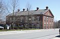 | May 19, 1995 (#94001592) | 136 Lawrence St. 42°38′23″N71°18′16″W / 42.639722°N 71.304444°W | |
| 11 | Flagg-Coburn House |  | May 15, 1986 (#86001052) | 722 E. Merrimack St. 42°38′45″N71°17′14″W / 42.645833°N 71.287222°W | |
| 12 | Warren Fox Building |  | October 12, 1989 (#89001609) | 190–196 Middlesex St. 42°38′26″N71°18′45″W / 42.640556°N 71.3125°W | |
| 13 | Grace Universalist Church |  | March 11, 2011 (#11000069) | 44 Princeton Boulevard 42°38′07″N71°19′58″W / 42.635278°N 71.332778°W | Now known as the St. George Hellenic Orthodox Church |
| 14 | Holy Trinity Greek Orthodox Church | 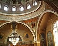 | April 13, 1977 (#77000181) | 62 Lewis St. 42°38′44″N71°19′02″W / 42.645556°N 71.317222°W | |
| 15 | Howe Building |  | October 12, 1989 (#89001608) | 208 Middlesex St. 42°38′26″N71°18′46″W / 42.640556°N 71.312778°W | |
| 16 | Hoyt-Shedd Estate | 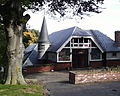 | May 17, 1984 (#84002697) | 386–396 Andover St., 569–579 E. Merrimack St. 42°38′35″N71°17′28″W / 42.643056°N 71.291111°W | |
| 17 | Lowell Cemetery |  | May 20, 1998 (#98000543) | 984 Lawrence St. 42°37′40″N71°17′42″W / 42.627778°N 71.295°W | |
| 18 | Lowell Historic Preservation District | 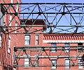 | January 19, 2001 (#03000170) | Lowell area around Merrimack River 42°38′48″N71°18′29″W / 42.6468°N 71.3081°W | |
| 19 | Lowell Locks and Canals Historic District |  | August 13, 1976 (#76001972) | Between Middlesex St. and the Merrimack River 42°38′44″N71°19′12″W / 42.645556°N 71.32°W | National Historic Landmark |
| 20 | Lowell National Historical Park |  | June 5, 1978 (#78003149) | Merrimack St. 42°38′47″N71°19′11″W / 42.646389°N 71.319722°W | |
| 21 | Lowell Post Office |  | October 4, 2002 (#02001084) | 89 Appleton St. 42°38′28″N71°18′34″W / 42.641111°N 71.309444°W | |
| 22 | Middlesex Canal |  | August 21, 1972 (#72000117) | Running SE between towns of Lowell and Woburn 42°38′16″N71°21′02″W / 42.637842°N 71.350586°W | |
| 23 | Middlesex Canal Historic and Archaeological District |  | November 19, 2009 (#09000936) | Numerous locations along the historic route of the Middlesex Canal 42°38′48″N71°18′29″W / 42.6468°N 71.3081°W | Extends into Suffolk County and other parts of Middlesex County; encompasses Middlesex Canal and other listings. |
| 24 | Monarch Diner |  | November 28, 2003 (#03001207) | 246 Appleton St. 42°38′21″N71°18′50″W / 42.639167°N 71.313889°W | Now operating as The Owl Diner. |
| 25 | Musketaquid Mills | 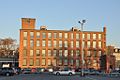 | December 9, 1999 (#99001480) | 131 Davidson St. 42°38′37″N71°18′16″W / 42.643611°N 71.304444°W | |
| 26 | Pawtucket Congregational Church |  | March 21, 2007 (#07000167) | 15 Mammoth Rd. 42°39′02″N71°19′56″W / 42.650556°N 71.332222°W | |
| 27 | Rogers Fort Hill Park Historic District | 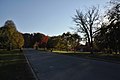 | May 27, 1999 (#99000635) | Roughly bounded by High St., Mansur St., Concord R., and Lowell Cemetery 42°38′06″N71°17′47″W / 42.635°N 71.296389°W | |
| 28 | St. George Antiochian Orthodox Church |  | June 10, 2008 (#08000507) | 61 Bowers St. 42°38′53″N71°19′26″W / 42.647919°N 71.323992°W | |
| 29 | St. Joseph's Convent and School |  | July 19, 2002 (#02000789) | 517 Moody St. 42°39′02″N71°19′20″W / 42.650556°N 71.322222°W | |
| 30 | Saint Joseph's Roman Catholic College for Boys |  | February 24, 2010 (#10000041) | 760 Merrimack St. 42°38′56″N71°19′14″W / 42.648953°N 71.320417°W | |
| 31 | St. Patrick's Church |  | January 3, 1985 (#85000027) | 284 Suffolk St. 42°38′43″N71°19′03″W / 42.645292°N 71.317517°W | |
| 32 | South Common Historic District | 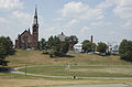 | August 10, 1982 (#82001993) | Roughly bounded by Summer, Gorham, Thorndike, and Highland Sts. 42°38′13″N71°18′41″W / 42.636944°N 71.311389°W | |
| 33 | Tyler Park Historic District | 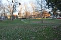 | August 17, 1989 (#89001056) | Roughly bounded by Princeton, Foster, and Pine Sts. 42°37′52″N71°20′27″W / 42.631111°N 71.340833°W | |
| 34 | US Post Office |  | March 10, 1986 (#86000373) | 50 Kearny Sq. 42°38′43″N71°18′24″W / 42.645278°N 71.306667°W | Renamed the F. Bradford Morse Federal Building in 2006. [5] |
| 35 | Varnum Building |  | December 19, 1988 (#88002752) | 401–405 Bridge St. 42°39′01″N71°18′14″W / 42.650278°N 71.303889°W | Demolished after fire |
| 36 | Varnum School |  | January 24, 1995 (#94001591) | 103 Sixth St. 42°39′04″N71°17′58″W / 42.651111°N 71.299444°W | |
| 37 | Wamesit Canal-Whipple Mill Industrial Complex |  | August 11, 1982 (#82001994) | 576 Lawrence St. 42°37′57″N71°18′03″W / 42.6325°N 71.300833°W | |
| 38 | Wannalancit Street Historic District |  | May 20, 1998 (#98000541) | 14–71 Wannalancit St., and 390, 406 Pawtucket St. 42°38′48″N71°19′46″W / 42.646667°N 71.329444°W | |
| 39 | Washington Square Historic District |  | August 11, 1982 (#82001995) | Roughly bounded by Merrimack, Park, Andover, Oak, Harrison, and Willow Sts. 42°38′35″N71°17′54″W / 42.643056°N 71.298333°W | Boundary increase (added 1999-11-12): 140-160 Andover St. |
| 40 | Wilder Street Historic District |  | May 26, 1995 (#95000662) | 284–360 Wilder St. 42°38′11″N71°19′56″W / 42.636389°N 71.332222°W | |
| 41 | Worcester House |  | December 22, 1983 (#83004091) | 658 Andover St. 42°38′42″N71°16′50″W / 42.645°N 71.280556°W |
