National Weather Service St. Louis, Missouri

Last updated

National Weather Service St. Louis is the National Weather Service office located in St. Charles, Missouri, just outside St. Louis, Missouri. There are 46 counties in its County Warning Area (CWA). Some of the cities in its CWA are Columbia, Farmington, Hannibal and Jefferson City in Missouri, and Belleville, Centralia, Edwardsville, and Quincy in Illinois.

Contents

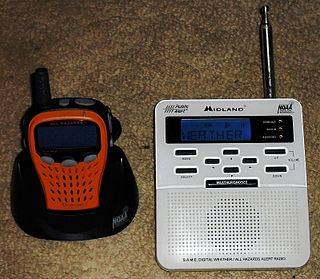
NOAA Weather Radio stations

Noaa all hazards.svg

The St. Louis office operates 11 stations in western Illinois and eastern Missouri.

KDO-89

KDO89 - St. Louis All Hazards
Broadcast area Greater St. Louis
Frequency 162.550 MHz
Branding NOAA All Hazards Radio
Programming
Format Weather/Civil Emergency
Ownership
Owner NOAA/National Weather Service
Technical information
Class C
Power 1,000 Watts
HAAT 1,079 M
Links
Webcast KDO89 Online
Website www.weather.gov/lsx

KDO89 (sometimes referred to as St. Louis All Hazards) is a NOAA Weather Radio station that serves Greater St. Louis and surrounding cities. It is programmed from the National Weather Service forecast office in St. Louis, Missouri with its transmitter located in Shrewsbury. It broadcasts weather and hazard information for the independent city of St. Louis as well as the following counties: Franklin, Jefferson, Lincoln, St. Charles, St. Louis, and Warren in Missouri as well as Madison, Monroe, and St. Clair counties in Illinois. [1]

WWF-75

WWF-75
Frequency 162.525 MHz
Branding NOAA All Hazards Radio
Programming
Format Weather/Civil Emergency
Technical information
Power 1,000 Watts
Links
Website www.weather.gov/lsx

WWF-75 is located just northeast of Bourbon, Missouri operating at 162.525 MHz. The station serves Cuba, Sullivan, and Union and provides weather and hazard information for Gasconade, Franklin, Crawford, Washington, Iron, and Phelps counties in Missouri. Programming for Phelps County is provided by the National Weather Service office in Springfield, Missouri. [2]

WXK-82

WXK-82
Frequency 162.475 MHz
Branding NOAA All Hazards Radio
Programming
Format Weather/Civil Emergency
Technical information
Power 1,000 Watts
Links
Website www.weather.gov/lsx

WXK-82 is located adjacent to Palmyra Rd. in northwest Hannibal, Missouri, operating at 162.475 MHz. The station provides weather and hazard information for Lewis, Shelby, Marion, Monroe, Ralls, and Pike counties in Missouri, as well as Adams, Brown, and Pike counties in Illinois. [3]

WXL-45

WXL-45
Frequency 162.400 MHz
Branding NOAA All Hazards Radio
Programming
Format Weather/Civil Emergency
Technical information
Power 1,000 Watts
Links
Website www.weather.gov/lsx

WXL-45 is located adjacent to County Rd. 202 just northwest of Fulton in Callaway County, Missouri, operating at 162.400 MHz. The station provides weather and hazard information for Audrain, Boone, Callaway, Cole, Osage, and Gasconade counties in Missouri. [4] Licensed to Columbia but identifying on-air as "WXL45 Fulton," it provides local forecasts for Columbia, Jefferson City and Mexico. Columbia and Jefferson City are also served by KWN55 in Jamestown, a newer transmitter that provides a stronger signal than WXL45 to much of Boone County and Cole County.

WWG-49

WWG-49
Frequency 162.500 MHz
Branding NOAA All Hazards Radio
Programming
Format Weather/Civil Emergency
Technical information
Power 1,000 Watts
Links
Website www.weather.gov/lsx

WWG-49 is located near Cedar Mountain southwest of Fredericktown on Route C in Madison County, Missouri, operating at 162.500 MHz. The station provides weather and hazard information for St. Francois, Ste. Genevieve, Iron, Reynolds, Madison, Wayne, and Bollinger counties in Missouri. Watches and warnings for Wayne and Bollinger counties are provided by the National Weather Service office located in Paducah, Kentucky. [5]

KXI-49

KXI-49 is located southeast of Salem, IL. It operates at 162.475 MHz and serves Salem, Mt. Vernon, and Centralia in south-central Illinois.

KXI-70

KXI70 - Jerseyville All Hazards
Broadcast area Jerseyville/Greater St. Louis
Frequency 162.450 MHz
Branding NOAA All Hazards Radio
Programming
Format Weather/Civil Emergency
Ownership
Owner NOAA/National Weather Service
Technical information
Class C
Power 300 Watts
HAAT 84 M
Links
Website www.weather.gov/lsx

KXI70 (sometimes referred to as Jerseyville All Hazards) is a NOAA Weather Radio station that serves Jerseyville, Illinois and surrounding cities as well as the northern and northeastern portions of the Greater St. Louis area. It is programmed from the National Weather Service forecast office in St. Louis, Missouri with its transmitter located southeast of Jerseyville. It broadcasts weather and hazard information for the following counties in Illinois: Calhoun, Greene, Jersey, Macoupin, and Madison. [6]

KXI-42

Located northwest of Chester, IL and operating at 162.450 MHz, KXI-42 serves Chester, Illinois, Ste. Genevieve, Missouri and Perryville, Missouri.

KXI-79

Located just east of Coffeen Lake near Hillsboro, IL and operating at 162.425 MHz, KXI-79 serves Litchfield and Vandalia in south-central Illinois.

KWN-55

Located west of Jamestown in Moniteau County and operating at 162.425 MHz, KWN-55 serves Columbia, Jefferson City, and California in central Missouri. Together with WXL45, the station serves the Columbia and Jefferson City areas.

WNG-728

Located immediately north of Hawk Point in Lincoln County, WNG-728 operates at 162.425 MHz and serves parts of east-central Missouri including Bowling Green, Warrenton, Troy, Wentzville, and fringe coverage extending from Hermann to Louisiana. This station was relocated from Bellflower in 2023 after being off the air for nearly two years. The new location has resulted in diminished coverage on the western side of the former site's coverage area, especially in Monroe, Audrain, Callaway, Osage, and Gasconade counties.

Related Research Articles

<span class="mw-page-title-main">Columbia, Missouri</span> City in Missouri, United States

Columbia is a city in the U.S. state of Missouri. It is the county seat of Boone County and home to the University of Missouri. Founded in 1821, it is the principal city of the five-county Columbia metropolitan area. It is Missouri's 4th most populous and fastest growing city, with an estimated 128,555 residents in 2022.

<span class="mw-page-title-main">Jefferson City, Missouri</span> Capital city of Missouri, United States

Jefferson City, informally Jeff City, is the capital of the U.S. state of Missouri. It had a population of 43,228 at the 2020 census, ranking as the 15th most populous city in the state. It is also the county seat of Cole County and the principal city of the Jefferson City Metropolitan Statistical Area, the second-most-populous metropolitan area in Mid-Missouri and the fifth-largest in the state. Most of the city is in Cole County, with a small northern section extending into Callaway County. Jefferson City is named for Thomas Jefferson, the third President of the United States.

<span class="mw-page-title-main">Callaway County, Missouri</span> County in Missouri, United States

Callaway County is a county located in the U.S. state of Missouri. As of the 2020 United States Census, the county's population was 44,283. Its county seat is Fulton. With a border formed by the Missouri River, the county was organized November 25, 1820, and named for Captain James Callaway, grandson of Daniel Boone. The county has been historically referred to as "The Kingdom of Callaway" after an incident in which some residents confronted Union troops during the U.S. Civil War.

<span class="mw-page-title-main">Scouting in Missouri</span>

Scouting in Missouri has a long history, from the 1910s to the present day.

<span class="mw-page-title-main">Quincy, Illinois</span> City in Illinois, United States

Quincy, known as Illinois's "Gem City", is a city in and the county seat of Adams County, Illinois, United States, located on the Mississippi River. The 2020 census counted a population of 39,463 in the city itself, down from 40,633 in 2010. As of July 1, 2015, the Quincy Micro Area had an estimated population of 77,220. During the 19th century, Quincy was a thriving transportation center as riverboats and rail service linked the city to many destinations west and along the river. It was Illinois' second-largest city, surpassing Peoria in 1870. The city has several historic districts, including the Downtown Quincy Historic District and the South Side German Historic District, which display the architecture of Quincy's many German immigrants from the late 19th century.

<span class="mw-page-title-main">Jerseyville, Illinois</span> City in Illinois, United States

Jerseyville is the largest city in and the county seat of Jersey County, Illinois, United States. At the 2020 census, the city had a total population of 8,337.

<span class="mw-page-title-main">Mexico, Missouri</span> City in Missouri, United States

Mexico, formerly known as New Mexico, is a city in and the county seat of Audrain County, Missouri. It is home to the Missouri Military Academy and annually hosts the Miss Missouri Pageant. The city's population was 11,469 at the 2020 census. The micropolitan statistical area consists of Audrain County. It is a part of the Columbia, Missouri metropolitan area.

<span class="mw-page-title-main">NOAA Weather Radio</span> 24-hour network of VHF FM weather radio stations in the United States

NOAA Weather Radio (NWR), also known as NOAA Weather Radio All Hazards, is an automated 24-hour network of VHF FM weather radio stations in the United States that broadcast weather information directly from a nearby National Weather Service office. The routine programming cycle includes local or regional weather forecasts, synopsis, climate summaries or zone/lake/coastal waters forecasts. During severe conditions the cycle is shortened into: hazardous weather outlooks, short-term forecasts, special weather statements or tropical weather summaries. It occasionally broadcasts other non-weather related events such as national security statements, natural disaster information, environmental and public safety statements, civil emergencies, fires, evacuation orders, and other hazards sourced from the Federal Communications Commission's (FCC) Emergency Alert System. NOAA Weather Radio uses automated broadcast technology that allows for the recycling of segments featured in one broadcast cycle into another and more regular updating of segments to each of the transmitters. It also speeds up the warning transmitting process.

<span class="mw-page-title-main">Greater St. Louis</span> Metropolitan area in the United States

Greater St. Louis is a bi-state metropolitan statistical area in the United States with its core in both Missouri and Illinois. Its largest principal city is the independent city of St. Louis, and its largest employer is St Louis County, Missouri which lies immediately to the west. The pre-war city core is on the Mississippi Riverfront on the border with Illinois in the geographic center of the metro area. The Mississippi River bisects the metro area geographically between Illinois and Missouri; however, the Missouri portion is much more populous. St. Louis is the focus of the largest metro area in Missouri and the Illinois portion known as Metro East is the second largest metropolitan area in that state. St. Louis County is independent of the City of St. Louis and their two populations are generally tabulated separately.

<span class="mw-page-title-main">Weather radio</span> Specialized radio receiver for weather forecasts

A weather radio is a specialized radio receiver that is designed to receive a public broadcast service, typically from government-owned radio stations, dedicated to broadcasting weather forecasts and reports on a continual basis, with the routine weather reports being interrupted by emergency weather reports whenever needed. Weather radios are typically equipped with a standby alerting function—if the radio is muted or tuned to another band and a severe weather bulletin is transmitted, it can automatically sound an alarm and/or switch to a pre-tuned weather channel for emergency weather information. Weather radio services may also occasionally broadcast non-weather-related emergency information, such as in the event of a natural disaster, a child abduction alert, or a terrorist attack.

The St. Louis metropolitan area has a history of tornadoes. The third-deadliest, and the costliest in United States history, the 1896 St. Louis–East St. Louis tornado, injured more than one thousand people and caused at least 255 fatalities in the City of St. Louis and in East St. Louis. The second-costliest tornado also occurred in St. Louis in September 1927. More tornado fatalities occurred in St. Louis than any other city in the United States. Also noteworthy is that destructive tornadoes occurred in winter and autumn, as well as the typical months of spring. Additionally, damaging tornadoes occurred in the morning and late at night, as well as the more common late-afternoon to early-evening maximum period.

Weatheradio Canada is a Canadian weather radio network owned and operated by Environment and Climate Change Canada's Meteorological Service of Canada division. Weatheradio Canada is headquartered in Montreal, Quebec and transmits in both official languages from 230 sites across Canada. Weatheradio Canada, as well as Environment Canada's weather telephone service Hello Weather, utilizes Nuance Communications text to speech voices. Starcaster Text to Speech, owned by STR-SpeechTech Ltd, was used from 1994 to 2021.

<span class="mw-page-title-main">Mid-Missouri</span> Central area of the U.S. state of Missouri

Mid-Missouri is a loosely-defined region comprising the central area of the U.S. state of Missouri. The region's largest city is Columbia ; the Missouri state capital, Jefferson City, and the University of Missouri are also located here. The region also includes portions of the Lake of the Ozarks, the Ozark Mountains, and the Missouri Rhineland. Mid-Missouri is centered on two contiguous metropolitan areas: the Columbia Metropolitan Area and the Jefferson City Metropolitan Area, which together have a population of over 400,000.

KXEN is a commercial AM radio station licensed to St. Louis, Missouri, United States. The station is owned by Louis Eckelkamp, through licensee East Central Broadcasting, LLC, and operated by Ellis Media & Broadcasting.

National Weather Service Chicago, currently based in Romeoville, Illinois, is a weather forecast office responsible for monitoring weather conditions for 23 counties in Northern Illinois, the Chicago metropolitan area and Northwest Indiana. The Army Signal Service established the first federal weather office in the region in Chicago on October 15, 1870. During May 1894 the Chicago Weather Bureau was given a new forecast area extending from the Great Lakes region all the way to the Rocky Mountains. The current National Weather Service Chicago is located in Romeoville and is in charge of issuing local forecasts and weather warnings for the Chicago area. It is one of only two National Weather Service offices in Illinois, the other being National Weather Service Central Illinois in Lincoln, Illinois. The National Weather Service Chicago forecast office is located adjacent to the Lewis University Airport in Romeoville, Illinois.

National Weather Service Paducah is a weather forecast office responsible for monitoring weather conditions for 58 counties in the states of Kentucky, Illinois, Indiana and Missouri. The Paducah office is relatively new compared to others, having been built in 1984. The office is in charge of weather forecasts, warnings and local statements as well as aviation weather. It is also equipped with a WSR-88D (NEXRAD) radar, and an Automated Surface Observing System (ASOS) that greatly increase the ability to forecast.

<span class="mw-page-title-main">National Weather Service Wichita, Kansas</span>

The National Weather Service Wichita, Kansas is a local weather forecast office of the National Weather Service responsible for monitoring weather conditions for 26 counties in central, south-central, and southeastern Kansas, including the Wichita Metropolitan Area and Salina, Kansas.

<span class="mw-page-title-main">Education in Greater St. Louis</span>

Education in Greater St. Louis is provided by more than two dozen public school districts, independent private schools, parochial schools, and several public library systems. Greater St. Louis also is home to more than thirty colleges and universities.

<span class="mw-page-title-main">National Weather Service New Orleans/Baton Rouge, Louisiana</span> Forecast office of the National Weather Service

The National Weather Service Weather Forecast Office New Orleans/Baton Rouge, Louisiana is a National Weather Service office located in Slidell, Louisiana.

<span class="mw-page-title-main">National Weather Service Topeka, Kansas</span> Weather forecast office serving northeast Kansas

National Weather Service – Topeka, Kansas is a local National Weather Service forecast office based in Topeka, the state capital of Kansas. Its offices are located near Philip Billard Municipal Airport. It provides weather and emergency information to 23 counties in north-central, northeast, and east-central Kansas. Communities that rely on the Topeka Weather Office for forecasts and severe storm warnings include Abilene, Clay Center, Concordia, Council Grove, Emporia, Hiawatha, Junction City, Lawrence, Manhattan, Marysville, Ottawa, and Topeka.

References

  1. KDO-89 - St. Louis, Mo - Frequency 162.550 MHz noaa.gov. Accessed September 2, 2012
  2. WWF-75 - Bourbon, Mo - Frequency 162.525 MHz noaa.gov. Accessed September 2, 2012
  3. WXK-82 - Hannibal, Mo - Frequency 162.475 MHz noaa.gov. Accessed September 2, 2012
  4. WXL-45 - Columbia - Frequency 162.400 MHz noaa.gov. Accessed September 2, 2012
  5. WWG-49 - Fredericktown, Mo - Frequency 162.500 MHz noaa.gov. Accessed September 2, 2012
  6. KXI-70 - Jerseyville, Il - Frequency 162.450 MHz noaa.gov. Accessed September 2, 2012