A Naval Air Station (NAS) is a military air base, and consists of a permanent land-based operations locations for the military aviation division of the relevant branch of a navy (Naval aviation). These bases are typically populated by squadrons, groups or wings, their various support commands, and other tenant commands.

Naval Air Station (NAS) Oceana or NAS Oceana is a United States Navy Naval Air Station located in Virginia Beach, Virginia.

Naval Air Station Whiting Field is a United States Navy base located near Milton, Florida, with some outlying fields near Navarre, Florida, in south and central Santa Rosa County, and is one of the Navy's two primary pilot training bases. NAS Whiting Field provides training for U.S. Navy, U.S. Marine Corps, Coast Guard, and Air Force student pilots, as well as those of several allied nations. NAS Whiting Field is home to Training Air Wing Five.

Joint Forces Training Base – Los Alamitos is a joint base in Los Alamitos, California, United States. Formerly operated as a naval air station, the base contains the Los Alamitos Army Airfield and is sometimes called by that name. The base is also known as JFTB – Los Al or just JFTB. The base covers 1,319 acres and "supports 850 full-time employees and more than 6,000 National Guard and Reserve troops."

Camp Kearny was a U.S. military base located in Linda Vista, California. Established in 1917, it was named for Brigadier General Stephen W. Kearny. Camp Kearny closed in 1946.

Marine Corps Air Station Eagle Mountain Lake was a United States Marine Corps (USMC) air station that was located 23 miles (37 km) northwest of Fort Worth, Texas during World War II, next to the lake of the same name. Commissioned on 1 December 1942, the air station was originally home to the Marine Corps military glider program. When the program was cancelled in 1943 the station was used to train USMC dive bomber pilots and later became home to the Marines' night fighter program. After the war the air station went into caretaker status in December 1946, became an outlying landing field of Naval Air Station Dallas, and was later used by the Texas Army National Guard and other branches of the U.S. military before being sold to a private owner in the 1970s. Today, the facility is a private airport run by Kenneth Copeland Ministries as Kenneth Copeland Airport.

Naval Base Coronado (NBC) is a consolidated Navy installation encompassing eight military facilities stretching from San Clemente Island, located 70 miles west of San Diego, California, in Los Angeles County, California, to Mountain Warfare Training Camp Michael Monsoor and Camp Morena, located 60 miles east of San Diego.

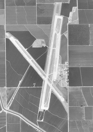
NASA Crows Landing Airport is a private use airport owned by the NASA Ames Research Center, 1 nautical mile northwest of the central business district of Crows Landing, in Stanislaus County, California, United States. The airfield was formerly named Naval Auxiliary Landing Field Crows Landing or NALF Crows Landing when operated by the U.S. Navy. In January 2011, Airport-data.com reported the airport status as closed permanently. In March 2022, Stanislaus County announced the former airfield would be redeveloped into a business park.
Naval Outlying Landing Field Barin is a United States Navy airfield located in Foley, a city in Baldwin County, Alabama, United States.

California during World War II was a major contributor to the World War II effort. California's long Pacific Ocean coastline provided the support needed for the Pacific War. California also supported the war in Europe. After the Japanese attack on Pearl Harbor on December 7, 1941, most of California's manufacturing was shifted to the war effort. California became a major ship builder and aircraft manufacturer. Existing military installations were enlarged and many new ones were built. California trained many of the troops before their oversea deployment. Over 800,000 Californians served in the United States Armed Forces. California agriculture, ranches and farms were used to feed the troops around the world. California's long coastline also put the state in fear, as an attack on California seemed likely. California was used for the temporary and permanent internment camps for Japanese Americans. The population grew significantly, largely due to servicemen who were stationed at the new military bases/training facilities and the mass influx of workers from around the U.S. in the growing defense industries. With all the new economy activity, California was lifted out of the Great Depression. Over 500,000 people moved to California from other states to work in the growing economy. California expanded its oil and mineral production to keep up with the war demand.

Naval Air Base San Pedro, NAS Terminal Island was a US Navy World War II 410-acre airfield on Terminal Island in San Pedro, California part of the City of Los Angeles. Before the Navy took control of the airfield, the airstrip was the civilian Allen Field. Allen Field was built in 1927 by filling with sand the Port of Los Angeles and enlarging Terminal Island. Terminal Island is located between San Pedro Harbor and Long Beach Harbor. Allen Field was serviced by the Pacific Electric and pedestrian ferries. The air terminal has three runways in a triangle shape, two short runways and one 4,200 foot runway. A large seaplane ramp was also built at the terminal. A Naval Air Reserve Training Facility was built next to Allen Field in 1927 and used the runway - ramp. Civilian use ended in 1935 and the site began an air base, later renamed Reeves Field San Pedro, after Rear Admiral Joseph M. Reeves. On 25 September 1941 Naval Air Base San Pedro became part of Naval Operating Base Terminal Island. In 1942 many Reserve troops were trained at the Naval Air Base. In 1943 the Navy took over operations and the Reserve was moved to Naval Air Base Los Alamitos. The base was renamed Naval Air Station Terminal Island and continued as a training base until the end of the war in 1945.

Helm Field also called Lemoore Auxiliary Army Airfield A-7 is a former US Army Airfield use for training during World War II. Helm Field was location in the town of Coalinga, California, 70 miles south of Fresno. Helm Field had two 3,000 foot runways, one oriented east/west and one oriented northwest–southeast. The Airfield was on a 773 acres site of form farm land. The US Army purchased the land on January 11, 1943 for training pilots. The Airfield was used by the Lemoore Basic Flying School, based at the Lemoore Army Air Field. Helm Field was 15 miles northwest of Lemoore Army Air Field. The Army built at Helm Field to support training stage house, control tower, motor pool building, crash truck shelter and latrines. Helm Field was used by Air Corps Basic Flying School, the AAF Basic Flying School, the AAF Pilot School, the 88th Air Base Squadron, the 3023rd Army Air Force Pilot School and the 461st Army Air Force Base Unit. The army closed Helm Field on October 15, 1844 and the Airfield was sold by the War Assets Administration. Helm Field was used as a farm labor camp in the 1950s. The east–west runway was returned to farmland. The northwest–southeast runway was still intact and was used as a civilian airfield till 1971.

Victorville Army Airfield auxiliary fields were four airfields used during World War II to support the Victorville Army Airfield pilot training near Victorville, California, and Adelanto, California. After the war the Victorville Army Airfield was renamed George Air Force Base on January 13, 1948. The airfields were built in 1941 by the United States Army Air Corps just before the war. Victorville Army Airfield covered 2,200-acre in the Mojave Desert. The US Army held a groundbreaking ceremony on 12 July 1941. The base, called Victorville Army Flying School, was ready to use before the attack on Pearl Harbor on December 7, 1941. The Army built four runways in a triangle configuration, with one runway down the middle of the triangle. Seven hangars were built to support operation. On April 23, 1943, the base was renamed Victorville Army Airfield.

Merced Army Air Field auxiliary fields were built to support pilot training at the Merced Army Air Field. In 1940 the US Army wanted to build near Merced, California a 30,000 per year basic pilot training base. The former city of Cuba, Merced County, California near the Atchison, Topeka and Santa Fe Railway rail line was chosen at 37°22′50″N120°34′05″W at an elevation of 181 feet (55 m) for the main base, in Atwater, California. United States Army Air Corps leased the land from the City of Merced on 16 June 1941. Building the airbase school started on 8 July 1941 and opened on 20 September 1941 as a sub-base of Army Air Forces Western Flying Training Command at Moffett Field. First called Air Corps Basic Flying School, Merced. The US Army moved part of the: 98th Bombardment Group, 539th School Squadrons, 540th School Squadrons, 541st School Squadrons, the 90th Air Base Squadron, and the 340th Material Squadron at Moffett Field to the new base in November 1941. The Air Corps Basic Flying School was renamed the Merced Army Flying School on 7 April 1942. To support the training auxiliary fields near the Merced Army Flying School were to be built for the flight training program. Merced Army Flying School was renamed the Merced Army Air Field in May 1943 and became part of the Western Flying Training Command.

Borrego Valley Maneuver Area also called the Borrego Springs Naval Maneuver Area was a US Army Anti-Aircraft Training Center (AARTC) and a subcamp of Camp Callan. Located near Borrego Springs, California in San Diego County in the Imperial Valley. Opened in March 1942 and in use until August 1944, it was operated by the Western Defense Command. Marine Corps also used the site to train troops in driving army vehicles. The site was picked as it was 400 square miles, 255,840 acres, of barren desert, barren mountains, and badlands. When closed the land returned to the State of California. Built at the site were bombing stations, strafing stations, and rocket targets. Also installed was Anti-Aircraft Artillery for training. First week troop did dry run training and the second week live-fire training. Ammo fired was from .33cal to 90mm. The US Navy trained in the bombing, gunnery, and rocketry ranges. California Institute of Technology help with the rocket training. The air support for the base was Naval Outlying Landing Field Clark's Dry Lake, Naval Outlying Field, Ocotillo Dry Lake and Borrego Hotel Naval Outlying Landing Field.

Condor Field was an airbase located in Twentynine Palms, California used for training both in World War II and the Korean War. From 1939 to 1942, and from 1945 to 1949, it was operated as a civil airport. The now-abandoned airfield is on the Marine Corps Air Ground Combat Center Twentynine Palms. In about 1939, a 3,000-foot runway was built at the southeast edge of dry lake Mesquite Lake as a civil field and named Twenty Nine Palms Airfield.

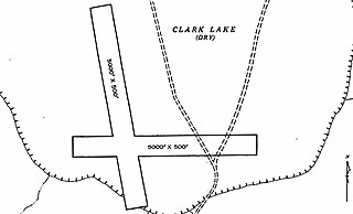
Naval Outlying Field Clark's Dry Lake was a United States Navy facility built for World War II. The site had two runways and a bombing range for training. The base was a subcamp of NAS San Diego. The site was built in 1938 and closed in 1962, but not used continuously. The range is in the Anza-Borrego desert, west of Salton Sea, north of Borrego Springs, California. The Field Clark's Dry Lake was supported and used by Naval Auxiliary Air Station Salton Sea 27 miles away. The airfield was on the western side of Clark's Dry Lake. The airfield was mostly used as an Emergency Landing strip. The bombing target range was northeast of the runways. When in use the ground staff had a radio communication station to talk the aircraft. In addition to bombing training, the base had gunnery and rocketry targets for training. The main runway was 7,500-feet, the other 5,000-feet, and both not usable when wet.

Naval Air Station Livermore has nearby airfield landing strips to support the training of US Navy pilots during World War 2. The airfield are called Naval Outlying Landing Field (NOLFs). For the war many new trained pilots were needed. The Naval Outlying Landing Fields provided a place for pilots to practice landing and take off without other air traffic. The remotes sites offered flight training without distractions. Most of the new pilots departed to the Pacific War after training. The Outlying Landing Fields had little or no support facilities. Naval Air Station Livermore opened in 1942 and closed in 1951. The Outlying field closed in 1945, having completed the role of training over 4000 new pilots. To open the needed Outlying Landing Fields quickly, the Navy took over local crop dusting and barnstorming airfields.

Sweetwater Dam Naval Outlying Landing Field was a airfield near Naval Auxiliary Air Station Brown Field and Naval Air Station North Island used to support the training of US Navy pilots during World War II. The runway, built in 1944, was located in what is now a neighborhood, eight miles east of San Diego, California. The Navy leased 135.45 acres of grassland from Rancho de la Nación to complete the airfield; it had a single 3,000-foot east/west asphalt runway. The airfield closed in 1946.

San Clemente Naval Auxiliary Air Station is a closed airfield located near the center of the San Clemente Island, California. Also called San Clemente Airfield, the airfield was built in 1934 with two 1,600-foot dirt runways. San Clemente Island is owned and operated by the United States Navy since November 7, 1934. The Works Progress Administration and a civilian contractor improved the airfield in 1938. The two runways were rebuilt to paved at 3,000-feet and 2,000 feet long by the WPA. The WPA also built a new hangar at the base. The airfield became a US Marines training base with the start of World War 2. A Marines squadron was station at Airfield and began air scouting training in 1942. The Marines trained in 19 Vought SB2U Vindicator carcraft and a one Grumman J2F Duck seaplane. The US Army installed two radar stations nearby and the runways were improved in 1941, the 3,000-foot runway was made into a 5,000-foot runway. In 1943 the airfield was renamed Naval Auxiliary Air Facility San Clemente Island. The Airfield supported bomb testing, radar training, Naval fighter gunnery training, and electronic countermeasures on the Island during the war. Over the years the size and scope of the airfield deduced, by 1977 the 2,000-foot runways was removed, and the east/west 5,000-foot runway was used rarely and closed at times. The deduced airfield was sometimes used for training in amphibious and air assault operational, also UAV operations. Today the runways as two helipads on the old runway. Naval Auxiliary Landing Field San Clemente Island became the main active Airfield.


