Navy Yard City, Washington

Last updated

Navy Yard City, Washington
Navy Yard City, WA.png
Aerial view of the neighborhood, with West Hills S.T.E.M. Academy in the center left and Puget Sound Naval Shipyard on the far right.
Kitsap County Washington Incorporated and Unincorporated areas Navy Yard City Highlighted.svg
Location of Navy Yard City, Washington
Coordinates: 47°33′6″N122°40′8″W / 47.55167°N 122.66889°W / 47.55167; -122.66889
CountryUnited States
State Washington
County Kitsap
Area
  Total1.0 sq mi (2.7 km2)
  Land0.6 sq mi (1.6 km2)
  Water0.4 sq mi (1.1 km2)
Elevation
115 ft (35 m)
Population
 (2020)
  Total2,759
  Density2,600/sq mi (1,000/km2)
Time zone UTC-8 (Pacific (PST))
  Summer (DST) UTC-7 (PDT)
ZIP code
98312
Area code 360
FIPS code 53-48225 [1]
GNIS feature ID1512496 [2]

Navy Yard City is a census-designated place (CDP) in Kitsap County, Washington, United States. The population was 2,759 at the 2020 census. [3]

Contents

History

Navy Yard City was established in 1909 and resisted several attempts at annexation from the City of Bremerton, which now surrounds the unincorporated community. [4] [5]

In late 1932, the West Side Improvement Club was established in the community, using the motto "A BIGGER AND BETTER NEIGHBORHOOD". The club first sought out to improve the local roads and utilities, with a particular focus on connecting more homes to water lines. In June of 1933, the club purchased 18 lots to build a clubhouse, as current meetings were being held in the local elementary school or the Bremerton Booster Clubhouse. Ground was broken in the Spring of 1934, and the clubhouse was finished in June of 1937. Built by volunteers and the Works Progress Administration, the large clubhouse and grounds included a playfield and event hall. During World War II, the clubhouse became the regimental headquarters for the Army's 202nd Coast Artillery, protecting the Navy installations in the area. The clubhouse still stands today, with regular events such as bingo and potlucks, along with the regularly scheduled club meetings. [6]

Geography

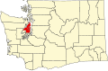
Navy Yard City is located in south-central Kitsap County at 47°33′6″N122°40′8″W / 47.55167°N 122.66889°W / 47.55167; -122.66889 (47.551717, -122.669000). [7] It is bordered to the north, east, and west by the city of Bremerton and to the south, across Sinclair Inlet, by the city of Port Orchard, the Kitsap county seat. Washington State Route 3 passes through the west side of Navy Yard City, leading north 16 miles (26 km) to Poulsbo and southwest 34 miles (55 km) to Shelton. Tacoma is 30 miles (48 km) to the southeast via State Route 16.

According to the United States Census Bureau, the Navy Yard City CDP has a total area of 1.0 square mile (2.7 km2), of which 0.62 square miles (1.6 km2) are land and 0.42 square miles (1.1 km2), or 41.18%, are water. [8]

Demographics

Historical population
CensusPop.Note
2000 2,638
2010 2,477−6.1%
2020 2,75911.4%
Sources: [1] [8] [3]

As of the census [1] of 2000, there were 2,638 people, 1,151 households, and 645 families residing in the CDP. The population density was 4,408.7 people per square mile (1,697.6/km2). There were 1,264 housing units at an average density of 2,112.4/sq mi (813.4/km2). The racial makeup of the CDP was 76.8% White, 7.7% African American, 1.5% Native American, 5.2% Asian, 1.1% Pacific Islander, 2.3% from other races, and 5.3% from two or more races. Hispanic or Latino of any race were 6.4% of the population.

There were 1,151 households, out of which 27.5% had children under the age of 18 living with them, 39.8% were married couples living together, 12.6% had a female householder with no husband present, and 43.9% were non-families. 31.6% of all households were made up of individuals, and 8.4% had someone living alone who was 65 years of age or older. The average household size was 2.29 and the average family size was 2.87.

In the CDP, the population was spread out, with 23.3% under the age of 18, 15.3% from 18 to 24, 33.4% from 25 to 44, 18.1% from 45 to 64, and 10.0% who were 65 years of age or older. The median age was 30 years. For every 100 females, there were 105.1 males. For every 100 females age 18 and over, there were 101.4 males.

The median income for a household in the CDP was $36,285, and the median income for a family was $40,938. Males had a median income of $30,801 versus $21,875 for females. The per capita income for the CDP was $18,532. About 8.8% of families and 12.6% of the population were below the poverty line, including 16.3% of those under age 18 and 2.6% of those age 65 or over.

Related Research Articles

<span class="mw-page-title-main">Kitsap County, Washington</span> County in Washington, United States

Kitsap County is located in the U.S. state of Washington. As of the 2020 census, its population was 275,611. Its county seat is Port Orchard; its largest city is Bremerton. The county, formed out of King County and Jefferson County on January 16, 1857, is named for Chief Kitsap of the Suquamish Tribe. Originally named Slaughter County, it was soon renamed.

<span class="mw-page-title-main">Warrington, Florida</span> CDP in Florida, United States

Warrington is a census-designated place (CDP) in Escambia County, Florida, United States. Warrington is located between downtown Pensacola and the state line with Alabama; it is 6 miles (10 km) away from both.

<span class="mw-page-title-main">San Mar, Maryland</span> CDP in Maryland, United States

San Mar is a census-designated place (CDP) in Washington County, Maryland, United States. The population was 515 at the 2000 census.

<span class="mw-page-title-main">Vadito, New Mexico</span> CDP in New Mexico, United States

Vadito is a census-designated place (CDP) in southern Taos County, New Mexico, United States. It is on the scenic High Road to Taos. The population was 270 at the 2010 census.

<span class="mw-page-title-main">Inman Mills, South Carolina</span> CDP in South Carolina, United States

Inman Mills is a census-designated place (CDP) in Spartanburg County, South Carolina, United States. The population was 1,050 at the 2010 census.

<span class="mw-page-title-main">Las Lomitas, Texas</span> Census-designated place & Unincorporated community in Texas, United States

Las Lomitas is an unincorporated community and census-designated place (CDP) in Jim Hogg County, Texas, United States. The population was 244 at the 2010 census.

<span class="mw-page-title-main">Moses Lake North, Washington</span> Census-designated place in Washington, United States

Moses Lake North is a census-designated place (CDP) in Grant County, Washington, United States. It is also included in the Moses Lake micropolitan area. The population was 4,050 at the 2020 census.

<span class="mw-page-title-main">Lake Morton-Berrydale, Washington</span> Census-designated place in Washington, United States

Lake Morton-Berrydale is a census-designated place (CDP) in King County, Washington, United States. The population was 10,474 at the 2020 census.

<span class="mw-page-title-main">East Port Orchard, Washington</span> CDP in Washington, United States

East Port Orchard is a census-designated place (CDP) in Kitsap County, Washington, United States. The population was 5,262 at the 2020 census.

<span class="mw-page-title-main">Erlands Point-Kitsap Lake, Washington</span> Former CDP in Washington, United States

Erlands Point-Kitsap Lake is an unincorporated area and former census-designated place (CDP) in Kitsap County, Washington, United States. The population was 2,935 at the 2010 census. For the 2020 census, the area was split into two CDPs, Erlands Point and Kitsap Lake.

<span class="mw-page-title-main">Indianola, Washington</span> CDP in Washington, United States

Indianola is a census-designated place (CDP) in Kitsap County, Washington, United States, located on the north shore of Port Madison on the Port Madison Indian Reservation, home of the Suquamish Indian Tribe. The population was 3,664 at the 2020 census. It was originally established as a summer community and was a stop for Mosquito Fleet ferries until the 1950s.

<span class="mw-page-title-main">Kingston, Washington</span> Census-designated place in Washington, United States

Kingston is an unincorporated community and census-designated place (CDP) in Kitsap County, Washington, United States. The population was 2,515 at the 2020 census. Kingston is along the shores of Appletree Cove and Puget Sound, and is home to a major Washington State Ferry terminal linking it to Edmonds.

<span class="mw-page-title-main">Manchester, Washington</span> Census-designated place in Washington, United States

Manchester is an unincorporated community and census-designated place (CDP) in Kitsap County, Washington, United States. The population was 5,714 at the 2020 census. Manchester is located on the Puget Sound approximately 10 miles from downtown Seattle, and is adjacent to county seat Port Orchard to its east. Today, Manchester labels itself as a village. It is small in size but is home to a Kitsap Regional Library (KRL) branch, a post office, an elementary school, and a beachfront park to serve its residents.

<span class="mw-page-title-main">Parkwood, Washington</span> CDP in Washington, United States

Parkwood is a census-designated place (CDP) in Kitsap County, Washington, United States. The population was 7,635 at the 2020 census.

<span class="mw-page-title-main">Port Orchard, Washington</span> City in Washington, United States

Port Orchard is a city in and the county seat of Kitsap County, Washington, United States. It is located 13 miles (21 km) due west of West Seattle and is connected to Seattle and Vashon Island via the Washington State Ferries run to Southworth. It is named after Port Orchard, the strait that separates Bainbridge Island from the Kitsap Peninsula.

<span class="mw-page-title-main">Poulsbo, Washington</span> City in Washington, United States

Poulsbo is a city on Liberty Bay in Kitsap County, Washington, United States. It is the smallest of the four cities in Kitsap County. The population was 11,970 at the 2020 census and an estimated 10,927 in 2018.

<span class="mw-page-title-main">Silverdale, Washington</span> Place in Washington, United States

Silverdale is an unincorporated community in Kitsap County, Washington, in the United States. Despite many failed attempts at incorporation, Silverdale has not become a city. The population was 20,733 at the 2020 census. For statistical purposes, the United States Census Bureau has defined Silverdale as a census-designated place (CDP).

<span class="mw-page-title-main">Suquamish, Washington</span> Census-designated place in Washington, United States

Suquamish is a census-designated place (CDP) in Kitsap County, Washington, United States. The population was 4,266 at the 2020 census. Comprising the Port Madison Indian Reservation, it is the burial site of Chief Seattle and was the site of the Suquamish tribe winter longhouse known as the Old Man House.

<span class="mw-page-title-main">Tracyton, Washington</span> Census-designated place in Washington, United States

Tracyton is a census-designated place (CDP) in Kitsap County, Washington, United States. Its population was 5,967 at the 2020 census. It was named for 19th century Secretary of the Navy Benjamin F. Tracy.

<span class="mw-page-title-main">Bangor Base, Washington</span> Census-designated place in Washington, United States

Bangor Base is a census-designated place (CDP) in Kitsap County, Washington, within U.S. Naval Base Kitsap on the Kitsap Peninsula. Its population was 5,482 at the 2020 census.

References

  1. 1 2 3 "U.S. Census website". United States Census Bureau. Retrieved January 31, 2008.
  2. "Navy Yard City". Geographic Names Information System . United States Geological Survey, United States Department of the Interior.
  3. 1 2 "Census Bureau profile: Navy Yard City, Washington". United States Census Bureau. May 2023. Retrieved May 8, 2024.
  4. Farley, Josh (June 22, 2015). "A city without one: Who'll claim Navy Yard City?". Kitsap Sun . Retrieved October 30, 2021.
  5. Baker, Travis (April 27, 1997). "Community: Navy Yard City...or West Hills?". Kitsap Sun. Archived from the original on November 29, 2021. Retrieved October 30, 2021.
  6. "West Side Improvement Club History" . Retrieved December 17, 2023.
  7. "US Gazetteer files: 2010, 2000, and 1990". United States Census Bureau. February 12, 2011. Retrieved April 23, 2011.
  8. 1 2 "Geographic Identifiers: 2010 Census Summary File 1 (G001), Navy Yard City CDP, Washington". American FactFinder. U.S. Census Bureau. Archived from the original on February 13, 2020. Retrieved July 1, 2019.