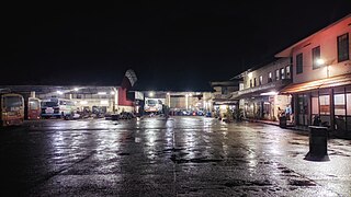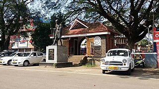
Kottayam is one of 14 districts in the Indian state of Kerala. Kottayam district comprises six municipal towns: Kottayam, Changanassery, Pala, Erattupetta, Ettumanoor, and Vaikom. It is the only district in Kerala that does not border either the Arabian Sea or another Indian state.

Ernakulam is one of the 14 districts in the Indian state of Kerala, and takes its name from the eponymous city division in Kochi. It is situated in the central part of the state, spans an area of about 2,924 square kilometres (1,129 sq mi), and is home to over 9% of Kerala's population. Its headquarters are located at Kakkanad. The district includes Kochi, also known as the commercial capital of Kerala, which is famous for its ancient churches, Hindu temples, synagogues and mosques.

Changanassery, is a municipality in the Kottayam district of Kerala, India. It is located 17 km (10.6 mi) south of the district headquarters in Kottayam and about 115 km (71.5 mi) north of the state capital Thiruvananthapuram. As per the 2011 Indian census, Changanassery has a population of 47,485 people, and a population density of 3,517/km2 (9,110/sq mi).

Thodupuzha is a municipality in the Idukki district of Kerala, India. It is located 26 km (16.2 mi) west of the district headquarters in Painavu and about 157 km (97.6 mi) north of the state capital Thiruvananthapuram. As per the 2011 Indian census, Thodupuzha has a population of 52,045 people, and a population density of 1,468/km2 (3,800/sq mi).

Palakkad is one of the 14 districts in the Indian state of Kerala. It was carved out of the southeastern region of the former Malabar District on 1 January 1957. It is located at the central region of Kerala and is the second largest district in the state after Idukki. The city of Palakkad is the district headquarters. Palakkad is bordered on the northwest by the Malappuram district, on the southwest by the Thrissur district, on the northeast by Nilgiris district, and on the east by Coimbatore district of Tamil Nadu. The district is nicknamed "The granary of Kerala". Palakkad is the gateway to Kerala due to the presence of the Palakkad Gap, in the Western Ghats. The 2,383 m high Anginda peak, which is situated in the border of Palakkad district, Nilgiris district, and Malappuram district, in Silent Valley National Park, is the highest point of elevation in Palakkad district. Palakkad city is about 347 kilometres (216 mi) northeast of the state capital, Thiruvananthapuram.

Idukki is one of the 14 districts in the Indian state of Kerala in the southwest of the country. It is the largest district in Kerala and lies amid the Cardamom Hills of Western Ghats in Kerala. Idukki district contains two municipal towns – Kattappana and Thodupuzha, and five taluks.

Vaikom is a municipality in the Kottayam district of Kerala, India. It is located 33 km (20.5 mi) north of the district headquarters in Kottayam and about 152 km (94.4 mi) north of the state capital Thiruvananthapuram. As per the 2011 Indian census, Vaikom has a population of 23,234 people, and a population density of 2,661/km2 (6,890/sq mi).

Muvattupuzha is a municipality in the Ernakulam district of Kerala, India. It is located 26 km (16.2 mi) east of the district headquarters in Thrikkakara and about 170 km (105.6 mi) north of the state capital Thiruvananthapuram. As per the 2011 Indian census, Perumbavoor has a population of 30,397 people, and a population density of 2,306/km2 (5,970/sq mi).

Perumbavoor is a municipality in the Ernakulam district of Kerala, India. It is located 18 km (11.2 mi) north of the district collectorate in Thrikkakara and about 187 km (116.2 mi) north of the state capital Thiruvananthapuram. Perumbavoor is part of the Kochi metropolitan area and is located 26 km (16.2 mi) northeast of the Kochi city centre. As per the 2011 Indian census, Perumbavoor has a population of 28,110 people, and a population density of 2,065/km2 (5,350/sq mi).

Kothamangalam is a municipality at the foot of the Western Ghats in the Ernakulam district of Kerala, India. It is located 31 km (19.3 mi) east of the district collectorate in Thrikkakara and about 177 km (110.0 mi) north of the state capital Thiruvananthapuram. As per the 2011 Indian census, Kothamangalam has a population of 38,837 people, and a population density of 969/km2 (2,510/sq mi).
North Paravur, is a municipality in the Ernakulam district of Kerala, India. It is located 20 km (12.4 mi) north of the district collectorate in Thrikkakara and about 201 km (124.9 mi) north of the state capital Thiruvananthapuram. North Paravur is part of the Kochi metropolitan area and is located 19 km (11.8 mi) north of the Kochi city centre. As per the 2011 Indian census, North Paravur has a population of 31,503 people, and a population density of 3,490/km2 (9,000/sq mi).

Adoor is a municipality in the Pathanamthitta district of Kerala, India. It is the headquarters of the Adoor Taluk and Adoor Revenue Division. Adoor is located 18 km (11.2 mi) southwest of the district headquarters Pathanamthitta and 85 km (52.8 mi) north of the state capital Thiruvananthapuram.

Peravoor is a town and Grama Panchayat in Kannur district of Kerala state in India. It is located 50 km (31 mi) east of Kannur and 40 km (25 mi) north east of Thalassery. And Iritty, the nearest municipality is 14 km (8.7 mi) north of Peravoor. Peravoor is situated in the Western Ghats mountain range.

Thalavoor is a village located in the district of Kollam in the Kerala state of India. It is 77 km to the north of the State Capital, Thiruvananthapuram, and 28 km to the east of District Capital, Kollam. Thalavoor village is bordered by Pattazhy village to the north, Pidavoor village to the north-east, Vilakkudy village to the south-east, Melila village to the south and Mylom village to the west. Thalavoor is a part of Pathanapuram Block Panchayat

Pathanapuram is a Town in Pathanapuram Taluk Kollam district, Kerala, India. Pathanapuram is a part of Grama Panchayat and Block panchayat of same name and part of Kollam District Panchayat.
Kothamangalam is a Taluk headquarters and a municipality Ernakulam district in the state of Kerala in India. It is 15 kilometres from Muvattupuzha. Kothamangalam is a small town lying at the foothills of the Western Ghats and is known as The Gateway to the High Ranges. Until the recent past, the town was also a very important trading center for spices and hill produce. Present Kothamangalam region was historically known as Malakhachira. Kothamangalam is known for its old Christian churches and its prominent educational institutions. One of the first colleges in the region is the Mar Athanasius College of Arts and Science inaugurated in 1955 by the Emperor of Ethiopia, Haile Selassie I during his visit to Kerala.
Thirumarady is situated in the eastern part of Ernakulam District in Kerala, South India. Thirumarady is the headquarters of Thirumarady Grama Panchayath which won an award for the "Best Panchayat in the State" two times for its commendable achievements in the rural area.
Kottappady is a village in Kothamangalam Taluk in Ernakulam district of Kerala State, India. It belongs to Central Kerala Division. It is located 10 km from Kothamangalam. The village came into existence in the year 1953.


