Northern Highway (Victoria)

Last updated

Northern Highway

Location Northern Hwy.svg
General information
TypeHighway
Length166 km (103 mi) [1]
Route number(s) AUS Alphanumeric Route B75.svg B75 (1997–present)
Former
route number
  • Australian national route 75.svg National Route 75 (1955–1997)
    Entire route
  • Australian national highway 31.svg National Highway 31 (1974–1976)
    (Kilmore–Beveridge)
  • Australian national route 31.svg National Route 31 (1954–1974)
    (Kilmore–Beveridge)
Major junctions
North endAUS Alphanumeric Route B75.svg Cobb Highway
VIC/NSW border
 
South endAUS Alphanumeric Route M31.svg Hume Freeway
Beveridge, Victoria
Location(s)
Major settlements Rochester, Elmore, Heathcote, Kilmore, Wallan
Highway system

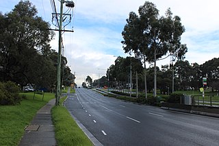
The Northern Highway [2] is a secondary highway in northern Victoria. Along with the M/A79 Calder Highway (Melbourne to Mildura) and the M/A39 Goulburn Valley Highway (Melbourne to Tocumwal), it provides primary arterial links in the region. In conjunction with the B280 McIvor Highway, the B75 Northern Highway provides an important link between Melbourne and Bendigo.

Contents

It runs from the M31 Hume Freeway south of Wallan to the New South Wales border at Echuca, on the banks of the Murray River, a distance of 166 kilometres. The highway traverses moderately hilly terrain from Wallan to Toolleen, then flat open country to the border at Echuca. Beyond Echuca across the NSW border, it continues as Cobb Highway.

The Northern Highway and the beginning of the McIvor Highway form a junction at Heathcote. The McIvor Highway leads to Bendigo and the Northern Highway continues to Echuca.

The B75 Northern Highway is a significant freight route providing access to markets, airport and port in Melbourne and the rural primary production areas of the Murray Valley and southern New South Wales. It serves a number of agricultural and tourism-related industries along its length.

History

The passing of the Highways and Vehicles Act of 1924 [3] through the Parliament of Victoria provided for the declaration of State Highways, roads two-thirds financed by the State government through the Country Roads Board (later VicRoads). The Northern Highway was declared a State Highway on 1 July, 1925, [4] cobbled from a collection of roads from Bendigo through Victoria (today the Midland Highway) and Rochester to Echuca (for a total of 55 miles); before this declaration, the road between Bendigo and Echuca was referred to as Bendigo-Echuca Road. [5] In the 1947/48 financial year, it was rerouted south of Elmore: instead of running from Bendigo, another section between the Hume Highway at Kilmore via Heathcote to Elmore was added, [6] along the former Heathcote-Elmore Road and Kilmore-Heathcote-Bendigo Roads; [7] the previous alignment of the Northern Highway from Elmore to Bendigo was subsumed into the Midland Highway. The Northern Highway was extended south for the last time from Kilmore to Beveridge (just south of Wallan) along the former Hume Highway alignment, when the Kilmore bypass was opened in 1976.

The Northern Highway was later signed National Route 75 in 1955; with Victoria's conversion to the newer alphanumeric system in the late 1990s, this was updated to route B75.

The passing of the Road Management Act 2004 [8] granted the responsibility of overall management and development of Victoria's major arterial roads to VicRoads: in 2007, VicRoads re-declared this road as Northern Highway (Arterial #6540), beginning in Echuca and ending in Beveridge. [9]

Attractions

See also

Australia road sign W5-29.svg   Australian Roadsportal

Related Research Articles

<span class="mw-page-title-main">Hume Highway</span> Major national highway in Australia

Hume Highway, inclusive of the sections now known as Hume Freeway and Hume Motorway, is one of Australia's major inter-city national highways, running for 840 kilometres (520 mi) between Melbourne in the southwest and Sydney in the northeast. Upgrading of the route from Sydney's outskirts to Melbourne's outskirts to dual carriageway was completed on 7 August 2013.

<span class="mw-page-title-main">Shire of Mitchell</span> Local government area in Victoria, Australia

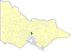
The Shire of Mitchell is a local government area in the Hume region of Victoria, Australia, located North of Melbourne. It covers an area of 2,862 square kilometres (1,105 sq mi) and, in June 2018, had a population of 44,299. It includes the towns of Broadford, Kilmore, Seymour, Tallarook, Pyalong and Wallan. It was formed in 1994 from the amalgamation of the Shire of Pyalong, the Shire of Kilmore, most of the Shire of Broadford, and parts of the Shire of McIvor and Rural City of Seymour.

<span class="mw-page-title-main">Princes Highway</span> Highway in Australia

Princes Highway is a major road in Australia, extending from Sydney via Melbourne to Adelaide through the states of New South Wales, Victoria and South Australia. It has a length of 1,941 kilometres (1,206 mi) or 1,898 kilometres (1,179 mi) via the former alignments of the highway, although these routes are slower and connections to the bypassed sections of the original route are poor in many cases.

<span class="mw-page-title-main">Hoddle Highway</span> Highway in Melbourne, Victoria

Hoddle Highway is an urban highway in Melbourne linking CityLink and the Eastern Freeway, itself a sub-section of Hoddle Main Road. Both these names are not widely known to most drivers, as the entire allocation is still best known as by the names of its constituent parts: Hoddle Street, Punt Road and Barkly Street. This article will deal with the entire length of the corridor for sake of completion, as well to avoid confusion between declarations.

<span class="mw-page-title-main">Calder Highway</span> Highway in Victoria

Calder Highway is a rural highway in Australia, linking Mildura and the Victoria/New South Wales border to Bendigo, in North Central Victoria. South of Bendigo, where the former highway has been upgraded to freeway-standard, Calder Freeway links to Melbourne, subsuming former alignments of Calder Highway; the Victorian Government completed the conversion to freeway standard from Melbourne to Bendigo on 20 April 2009.
The Loddon Valley Highway runs roughly north-west from Bendigo to Kerang on the Murray Valley Highway. It constitutes part of the direct route from Melbourne to the popular Murray River holiday areas around Swan Hill.

<span class="mw-page-title-main">Sunraysia Highway</span> Highway in Victoria

The Sunraysia Highway is a 344 kilometres (214 mi) arterial north-south route in western Victoria. The highway extends north a length of 331 km starting from the Western Freeway near Ballarat to the Calder Highway near Ouyen. It is the north-west arterial road, linking Ballarat and Ouyen, and acts as a secondary route to the Calder Highway, the primary route between Melbourne and Mildura.

<span class="mw-page-title-main">Goulburn Valley Highway</span>

Goulburn Valley Highway is a highway located in Victoria, Australia. The section north of the Hume Freeway is part of the Melbourne to Brisbane National Highway and is the main link between these two cities as well as a major link between Victoria and inland New South Wales. It is also the most direct route between Melbourne and the major regional centre of Shepparton in Victoria.
<span class="mw-page-title-main">Murray Valley Highway</span> Highway in Victoria and New South Wales

Murray Valley Highway is a 663-kilometre (412 mi) state highway located in Victoria and New South Wales, Australia. The popular tourist route mostly follows the southern bank of the Murray River and effectively acts as the northernmost highway in Victoria. For all but the western end's last three kilometres, the highway is allocated route B400.

McIvor Highway is a short Victorian highway (44 km) linking Bendigo and Heathcote. Together with Hume Freeway and Northern Highway, it provides an alternative route between Melbourne and Bendigo. The name 'McIvor' refers to the original name of the Heathcote region, used during the Victorian Gold Rush.

The Midland Highway is a major rural highway linking major towns in Victoria, beginning from Geelong and winding through country Victoria in a large arc through the cities of Ballarat, Bendigo and Shepparton, eventually reaching Mansfield at the foothills of the Victorian Alps.

The Deniliquin railway line is a broad-gauge railway line serving northwestern Victoria, Australia. The line runs from the New South Wales town of Deniliquin into Bendigo, before turning south-southeast towards Melbourne, terminating in Docklands near the central business district. It is a major trunk line both for passenger and freight trains, with many railway lines branching off from it.

<span class="mw-page-title-main">Burwood Highway</span>

Burwood Highway is a major transportation link with Melbourne's eastern suburbs. It begins in the suburb of Kooyong, Melbourne at the junction of the Monash Freeway as Toorak Road between Monash Freeway and Warrigal Road, and finishes in Belgrave, Victoria in the Dandenong Ranges. The highway is considered a major link for people who live in the Dandenong Ranges, as it is the only major feeder roadway in the general area other than Canterbury Road, Ferntree Gully Road, EastLink and Wellington Road.

<span class="mw-page-title-main">Pascoe Vale Road</span> Road in Melbourne, Victoria

Pascoe Vale Road is a major thoroughfare through the northern suburbs of Melbourne, connecting the outer northern fringe to the inner northern suburbs.

<span class="mw-page-title-main">Mount Alexander Road</span> Road in Melbourne, Victoria

Mount Alexander Road is a major road in Melbourne's inner northern suburbs, connecting the northern edges of the city district to just south of Essendon Airport. It was named after its original destination: the Gold Fields of Mount Alexander, now known as Castlemaine.

Warrigal Road is a major inner urban road in southeastern Melbourne, Australia. On weekdays, it is heavily trafficked as it runs through many major suburbs along its route, traversing some of Melbourne's eastern and south-eastern suburbs. These suburbs include Chadstone, Oakleigh, and Cheltenham. The Chadstone Shopping Centre can be accessed directly from Warrigal Road at its eastern entrance.

<span class="mw-page-title-main">Wimmera Highway</span> Highway in Victoria and South Australia

Wimmera Highway is a 345 kilometre highway that connects the towns of Marong, Victoria and Naracoorte, South Australia, through the major junctions of Sunraysia Highway, Henty Highway and Western Highway.

<span class="mw-page-title-main">State (Bell/Springvale) Highway</span> Highway in Melbourne, Victoria

State (Bell/Springvale) Highway, also known as Bell Street/Springvale Road State Highway, is the longest self-contained urban highway in Melbourne, Australia, linking Tullamarine Freeway and Nepean Highway through Melbourne's north-eastern suburbs. These names are not widely known to most drivers, as the entire allocation is still best known as by the names of its constituent parts : Bell Street, Banksia Street, Manningham Road, Williamsons Road, Doncaster Road, Mitcham Road, Springvale Road and Edithvale Road. This article will deal with the entire length of the corridor for sake of completeness, as well to avoid confusion between declarations.

<span class="mw-page-title-main">Shire of Kilmore</span> Local government area in Victoria, Australia

The Shire of Kilmore was a local government area about 60 kilometres (37 mi) north of Melbourne, the state capital of Victoria, Australia. The shire covered an area of 508.9 square kilometres (196.5 sq mi), and existed from 1856 until 1995.

The Heathcote railway line was a cross-country link between Bendigo and Heathcote Junction. It was partly opened in 1888 and, by 1890, it was fully operational. It was partially closed in 1958 and fully closed in 1968.

References

  1. Google (14 October 2021). "Northern Highway" (Map). Google Maps . Google. Retrieved 14 October 2021.
  2. Northern Highway (B75), Expressway – Paul Rands. Retrieved on 5 October 2013.[ self-published source ]
  3. State of Victoria, An Act to make further provision with respect to Highways and Country Roads Motor Cars and Traction Engines and for other purposes 30 December 1924
  4. "Country Roads Board Victoria. Twelfth Annual Report: for the year ended 30 June 1925". Country Roads Board of Victoria. Melbourne: Victorian Government Library Service. 31 December 1925. p. 3.
  5. "Country Roads Board Victoria. Second Annual Report". Country Roads Board of Victoria. Melbourne: Victorian Government Library Service. 1 November 1915. p. 74.
  6. "Country Roads Board Victoria. Thirty-Fifth Annual Report: for the year ended 30 June 1948". Country Roads Board of Victoria. Melbourne: Victorian Government Library Service. 1 November 1948. p. 7.
  7. "Country Roads Board Victoria. Twenty-Sixth Annual Report: for the year ended 30 June 1939". Country Roads Board of Victoria. Melbourne: Victorian Government Library Service. 10 November 1939. pp. 92, 96.
  8. State Government of Victoria. "Road Management Act 2004" (PDF). Government of Victoria. Archived (PDF) from the original on 18 October 2021. Retrieved 19 October 2021.
  9. VicRoads. "VicRoads – Register of Public Roads (Part A)" (PDF). Government of Victoria. pp. 972–3. Archived from the original on 1 May 2020. Retrieved 19 October 2021.