Orange Grove, Maryland

Last updated
Orange Grove, Maryland
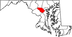
Howard County Maryland Incorporated and Unincorporated areas Savage-Guilford Highlighted.svg
Location of Orange Grove, Maryland
Coordinates: 39°14′28″N76°44′58″W / 39.24111°N 76.74944°W / 39.24111; -76.74944
CountryFlag of the United States.svg  United States
State Flag of Maryland.svg  Maryland
County Flag of Howard County, Maryland.svg Howard
Time zone UTC−5 (Eastern (EST))
  Summer (DST) UTC−4 (EDT)

Orange Grove was a town straddling the Patapsco River in Howard County and Baltimore County, Maryland, United States.

The Orange Grove area was the site of two parallel roads running along the Patapsco River settled by the Elliotts in 1762. The road to then North was referred to as "George Washington's Gun Road" as the path of General Lafayette's troops en route to the battle of Yorktown. In 1856, the land was sold by George Elliot for $9,000 to George Worthington and George Baily. They started a construction of a six story mill and sold the property to C.A Gambrill for $45,000. The Gamrill Mill was renamed to Orange Grove producing "Patpasco Superlative Patent" and "Orange Grove" flour. Citizens lived on the Howard County side, using a rope bridge to travel to the mill and B&O railroad siding. In 1869, the mill was purchased by R.G. and P.H. MacGill keeping the name C.A. Gambill & Company, who added steam power in 1873 and modern rollers in 1879. [1] [2] In 1898, the Orange Grove school opened. In 1904, ice stacked up, tearing down the bridge. The same year, the company owned Phoenix mill burned in the [[Great Baltimore Fire great Baltimore fire]]. On 6 May 1905, the mill and train station burned in a fire started in the engine room monitored by George W. Carr. The town did not recover, and the ruins are part of the Patapsco Valley State Park with a modern suspended bridge along the trail. [3]
See also

Related Research Articles

<span class="mw-page-title-main">Catonsville, Maryland</span> Census-designated place in Maryland, United States

Catonsville is a census-designated place (CDP) in Baltimore County, Maryland. The population was 44,701 at the 2020 US Census. The community is a streetcar suburb of Baltimore along the city's western border. The town is known for its proximity to the Patapsco River and Patapsco Valley State Park, making it a regional mountain biking hub. The town is also notable as a local hotbed of music, earning it the official nickname of "Music City, Maryland." Catonsville contains the majority of the University of Maryland, Baltimore County (UMBC), a major public research university with close to 14,000 students.

<span class="mw-page-title-main">Elkridge, Maryland</span> Census-designated place in Maryland, United States of America

Elkridge is an unincorporated community and census-designated place (CDP) in Howard County, Maryland, United States. The population was 15,593 at the 2010 census. Founded early in the 18th century, Elkridge is adjacent to two other counties, Anne Arundel and Baltimore.

<span class="mw-page-title-main">Ellicott City, Maryland</span> Census-designated place in Maryland, United States

Ellicott City is an unincorporated community and census-designated place in, and the county seat of, Howard County, Maryland, United States. Part of the Baltimore metropolitan area, its population was 75,947 at the 2020 census, making it the most populous unincorporated county seat in the country.

<span class="mw-page-title-main">Patapsco River</span> River in Maryland, United States

The Patapsco River mainstem is a 39-mile (63 km) river in central Maryland that flows into the Chesapeake Bay. The river's tidal portion forms the harbor for the city of Baltimore. With its South Branch, the Patapsco forms the northern border of Howard County, Maryland. The name "Patapsco" is derived from the Algonquian pota-psk-ut, which translates to "backwater" or "tide covered with froth."

<span class="mw-page-title-main">Oella, Maryland</span> Historic district in Maryland, United States

Oella is a mill town on the Patapsco River in western Baltimore County, Maryland, United States, located between Catonsville and Ellicott City. It is a 19th-century village of millworkers' homes.

<span class="mw-page-title-main">Woodbine, Maryland</span> Unincorporated community in Maryland, United States

Woodbine is an unincorporated rural community in Howard and Carroll counties, Maryland, United States. It is part of the Baltimorean metropolitan area. It is located southeast of Frederick, west of Baltimore, north of Washington, D.C., and east of Mount Airy. The community was named for the woodbine plant, which grew in the community in fields and along riverbanks.

Patapsco may refer to:

<span class="mw-page-title-main">Thomas Viaduct</span> Railroad bridge in Maryland, US

The Thomas Viaduct spans the Patapsco River and Patapsco Valley between Relay, Maryland and Elkridge, Maryland, USA. It was commissioned by the Baltimore and Ohio Railroad (B&O); built between July 4, 1833, and July 4, 1835; and named for Philip E. Thomas, the company's first president. Some claim it to be the world's oldest multiple arched stone railroad bridge. However, the Sankey Viaduct on the Liverpool and Manchester Railway was opened in 1830, and finally completed in 1833.

<span class="mw-page-title-main">Ilchester, Maryland</span> Census-designated place in Maryland

Ilchester is an unincorporated community and census-designated place in Howard County, Maryland, United States. The population was 23,476 at the 2010 census. It was named after the village of Ilchester in the English county of Somerset.

<span class="mw-page-title-main">Patapsco Swinging Bridge</span>

The Patapsco Swinging Bridge is located in the Avalon/Orange Grove area of Patapsco Valley State Park in central Maryland, United States. It is a suspension bridge consisting of a wooden deck supported by large cables. The Patapsco Valley has a history of "swinging" bridges built for pedestrian travel from one side of the river to the other. The Orange Grove Flour Mill was one such popular crossing and is where the current bridge now stands. The first bridge was built by the Orange Grove Flour Mill for employees to cross the river. The new swinging bridge, built by the Maryland Department of Natural Resources, is one of the most well known and most popular attractions at the Patapsco Valley State Park.

<span class="mw-page-title-main">Patapsco Valley State Park</span> State park in Maryland, United States

Patapsco Valley State Park is a Maryland state park extending along 32 miles (51 km) of the Patapsco River south and west of the city of Baltimore, Maryland. The park encompasses multiple developed areas on over 14,000 acres (5,700 ha) acres of land, making it Maryland's largest state park. In 2006, it was officially celebrated as Maryland's first state park, its first formation being in 1906. Patapsco Valley State Park is managed by the Maryland Department of Natural Resources.

Woodstock is an unincorporated community which is a suburb of Baltimore, Maryland, United States. The original village of Woodstock is located in Howard County, and also includes portions of Baltimore County and Carroll County.

The Historical Ellicott City/Baltimore Trolley Line #9 Trail is a 1.25-mile (2.0 km) trail in western Baltimore County, Maryland. It begins at the west end of Edmondson Avenue and extends from Catonsville through Oella to Main Street, Ellicott City. The trail follows what was originally part of the Catonsville and Ellicott City Electric Railway Company trolley line that shuttled passengers between Ellicott City and Baltimore from the late 1890s to the mid-1950s.

The Orange Grove Flour Mill was a flour mill established in 1856. It was one of the leading flour mills in the Mid-Atlantic states until it was destroyed in a fire in 1905.

St. Marys College was a Roman Catholic school in Ilchester, Maryland near modern Ellicott City, Maryland in Howard County. The ruins are near Ilchester and Bonnie Branch roads. The upper college building was built in 1868 consisting of a cupola-topped eighteen-bay-by-five-bay building with a five-bay-by-five-bay projection. A three-bay-by-three-bay, five-story L-shaped addition is included, with all of the structure on a stone foundation. A three-story chapel was attached to the building in 1882. In 1934 a fifth floor was added throughout. A statue of Madonna with Child was situated in a niche.

Thistle Manufacturing Company factory was a historic factory located along the Patapsco River, which runs through Catonsville, Maryland across from Ilchester, Maryland. The 1800s factory was in continuous operation until 2003.

<span class="mw-page-title-main">Hockley Forge and Mill</span> Mill in Elkridge, Maryland

The Hockley Forge and Mill are a collection of colonial-era industrial buildings along the Patapsco River near modern Elkridge, Maryland. Located at the river's head of navigation, the site is a flat section of land along the Patapsco River valley with steep embankments on either side. At its 19th-century peak, the site held more than 30 industrial buildings.

<span class="mw-page-title-main">Elkridge Landing</span> Historic seaport, now part of Elkridge, MD, US

Elkridge Landing was a Patapsco River seaport in Maryland, and is now part of Elkridge, Maryland. The historic Elkridge Furnace Inn site resides within the Patapsco Valley State Park.

Elysville is an unincorporated community in Howard County, Maryland, United States. A postal stop operated between February 22, 1834, and February 3, 1854.

<span class="mw-page-title-main">Patapsco Valley</span> Valley surrounding the Patapsco River in the U.S. state of Maryland

The Patapsco Valley is a small valley surrounding the Patapsco River in central Maryland. The region is known for its historical significance as a major economic and industrial center in the eighteenth and nineteenth centuries.

References

  1. Robert J. Brugger. Maryland, A Middle Temperament: 1634-1980. p. 330.
  2. Association of Centenary Firms and Corporations of the United States. Association of Centenary Firms and Corporations of the United States. p. 56.
  3. Barbra Feaga. Howard's Roads to the Past. p. 48.