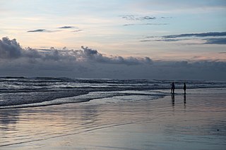
Cox's Bazar is a city, fishing port, tourism centre, and district headquarters in southeastern Bangladesh. Cox's Bazar Beach, one of the most popular tourist attractions in Bangladesh, is the longest uninterrupted natural beach in the world. Located 150 km (93 mi) south of the city of Chittagong, Cox's Bazar is also known by the name Panowa, which translates literally as "yellow flower." An old name was "Palongkee".

Narsingdi District is a district in central Bangladesh. It is located 50 km north-east of Dhaka, the Bangladeshi capital. It is a part of the Dhaka Division. The district is famous for its textile craft industry. Narsingdi is bordered by Kishoreganj in the north and north-east, Brahmanbaria in the east and south-east, Narayanganj in the south and south-west and Gazipur in the west.

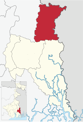
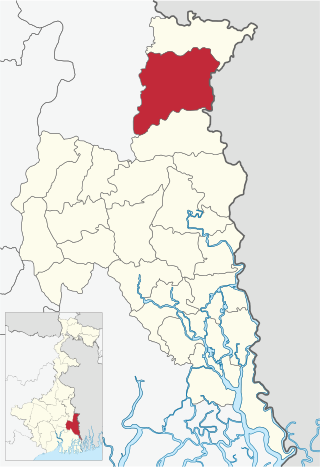
North 24 Parganas (abv. 24 PGS (N)) or sometimes North Twenty Four Parganas is a district in southern West Bengal, of eastern India. North 24 Parganas extends in the tropical zone from latitude 22° 11′ 6″ north to 23° 15′ 2″ north and from longitude 88º20' east to 89º5' east. Barasat is the district headquarters of North 24 Parganas. North 24 Parganas is West Bengal's most populous district and also (since 2014) the most populated district in the whole of India. It is the tenth-largest district in the State by area.

Bangaon is a city and a municipality in North 24 Parganas district in the state of West Bengal, India. It is the headquarters of the Bangaon subdivision.
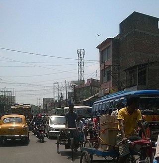
Habra is a city and a municipality under Barasat sadar subdivision in North 24 Parganas district of the Indian state of West Bengal. It is situated on the Jessore Road between Kolkata and the Bangladesh border at Petrapole. Its location makes it an important town for export and import of goods between India and Bangladesh.
Maslandpur (also spelled as “Maslandpur” “Maslandpur” "Maslandpur" is is a Suburban in the Habra I CD block in Barasat sadar subdivision in North 24 Parganas district in the Indian state of West Bengal.
Bangaon subdivision is an administrative subdivision of the North 24 Parganas district in the Indian state of West Bengal.
Dharmmapukuria is a village and a gram panchayat in Bangaon CD Block in Bangaon subdivision of North 24 Parganas district in the state of West Bengal, India.
Ghola is a neighbourhood in Panihati of North 24 Parganas district in the Indian state of West Bengal. It is a part of the area covered by Kolkata Metropolitan Development Authority (KMDA).
Bangaon is a community development block that forms an administrative division in Bangaon subdivision of North 24 Parganas district in the Indian state of West Bengal.
Chanda Lalit Mohan High School is a co-ed secondary school located in Panchita in Bongaon sub-division in the North 24 Parganas district, state of West Bengal, in India. It was established in 1956.

Gonpur is an old village in Mohammad Bazar CD Block in Suri Sadar subdivision of Birbhum district, West Bengal, India.
National Highway 231 is a National Highway in India. It connects Maheshkhunt, Saharsa, Madhepura, Purnia and Kora.

Kharua Rajapur is a village in Bangaon CD Block in Bangaon subdivision of North 24 Parganas district in the Indian state of West Bengal.

Chandpara is a census town in the Gaighata CD block in the Bangaon subdivision of the North 24 Parganas district in the state of West Bengal, India.

Nahata is a village in the Bangaon CD Block in the Bangaon subdivision of the North 24 Parganas, West Bengal.

Dum Dum Cantonment railway station is a Kolkata Suburban Railway station in Dum Dum. Its code is DDC. The Dum Dum Cantonment metro station is adjacent to Dum Dum Cantonment railway station. It was named by the Cantonment area near Dum Dum. It serves Dum Dum Cantonment and the surrounding areas. The station consists of three platforms. The platform is very much well sheltered with newly installed seating arrangements and fans.
Helencha is a village in the Bagdah CD block in the Bangaon subdivision of the North 24 Parganas district in the state of West Bengal, India.
Palla is a village and a gram panchayat in the Bangaon CD block in the Bangaon subdivision of the North 24 Parganas district in the state of West Bengal, India.
Chak is a village in Bahraich district of the Indian state of Uttar Pradesh. It is 6 km west of Fakharpur and 21 km south of district headquarters Bahraich. This village is under Ramgadhi Panchayat Police Station Baundi Development Block Tajwapur Tehsil Mahsi. and Chak village is 114 km from Lucknow, the capital of Uttar Pradesh. The village is administered by the village headman, who is an elected representative.


