Related Research Articles

The electoral division of Braddon is one of the five electorates in the Tasmanian House of Assembly, it includes north-west and western Tasmania as well as King Island. Braddon takes its name from the former Premier of Tasmania, Sir Edward Braddon. The division shares its name and boundaries with the federal division of Braddon.

Waterhouse Island, part of the Waterhouse Island Group, is a 287-hectare (710-acre) granite island situated in Banks Strait, part of Bass Strait, lying close to the north-eastern coast of Tasmania, Australia.
The Hunter Island, the main island of the Hunter Island Group, is a 7,330-hectare (18,100-acre) island, located in Bass Strait, that lies between King Island and north-west Tasmania, Australia.
The Dial Range is a small mountain range in northwest Tasmania, south of the town of Penguin near the coast. It extends about 14 km (9 mi) north to south and 4-5 km west to east. It is bordered on the east and south by the Leven River, with the Gunns Plains to the south.
Leven Canyon is a tourist destination on the River Leven (Tasmania). It is located 42 kilometres (26 mi) from Ulverstone in Tasmania.

Leighland Christian School is an independent, co-educational, non-denominational Christian School, situated in Tasmania, Australia.

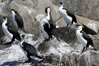
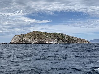
Egg Island is a small island, with an area of 0.83 ha, in south-eastern Australia. It is part of the North Coast Group, lying in Bass Strait on Horseshoe Reef near Devonport in north-west Tasmania. It has been identified as an Important Bird Area (IBA) because of its globally significant colony of black-faced cormorants. Wright Island is nearby.
The Carbuncle is a small island, part of the North Coast Group of islands, lying in southern Bass Strait near Port Sorell in north-west Tasmania, with an area of 1.91 ha. It is part of the Narawntapu National Park.

The Twin Islets form a close pair of small, steep-sided, granite islands, with a combined area of 5.61 ha, in south-eastern Australia. They are part of Tasmania’s Hogan Group, lying in northern Bass Strait between the Furneaux Group and Wilsons Promontory in Victoria.

Curtis Island is a granite island, with an area of 150 ha, in south-eastern Australia. It is part of Tasmania’s Curtis Group, lying in northern Bass Strait between the Furneaux Group and Wilsons Promontory in Victoria. It is a nature reserve and has been identified as an Important Bird Area because it supports up to 390,000 breeding pairs of short-tailed shearwaters or Tasmanian muttonbirds.

North Pasco Island is a granite island, with an area of 28 ha, in south-eastern Australia. It is part of Tasmania’s Pasco Island Group, lying in eastern Bass Strait off the north-west coast of Flinders Island in the Furneaux Group. It was previously used for sheep grazing.

The Chalky Island, part of the Big Green Group within the Furneaux Group, is a 41-hectare (100-acre) unpopulated granite island with limestone outcrops and dolerite dykes, located in the Bass Strait, west of the Flinders Island, in Tasmania, in south-eastern Australia. The island is contained within a conservation area and is part of the Chalky, Big Green and Badger Island Groups Important Bird Area.
The Ninth Island, officially Tareerpattel-tarerenner / Ninth Island, is a 32-hectare (79-acre) uninhabited granite island situated in Bass Strait as part of the Waterhouse Island Group, lying close to the north-eastern coast of Tasmania, Australia. In November 2018, it was listed for sale for the fourth time, at $1.98 million. The property for sale is a landlocked title within a conservation covenant, preventing access to the island by any means except helicopter.

Ile des Phoques is a rugged granite island, with an area of 8 ha, part of the Schouten Island Group, lying close to the eastern coast of Tasmania, Australia near the Freycinet Peninsula.

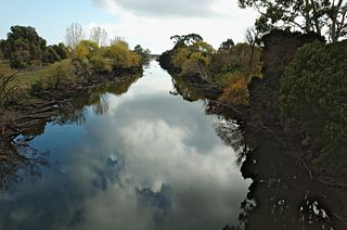
The River Forth is a perennial river located in northwest Tasmania, Australia.
Sterile Island is a 3.68 ha island game reserve in south-eastern Australia. It is part of the Actaeon Island Group, lying close to the south-eastern coast of Tasmania, at the southern entrance to the D'Entrecasteaux Channel between Bruny Island and the mainland.

Walker Island is an island located close to the south-western coast of Tasmania, Australia. The 15-hectare (0.058 sq mi) island is part of the Maatsuyker Islands Group, and comprise part of the Southwest National Park and the Tasmanian Wilderness World Heritage Site.

Ardley Island is an island 1.9 kilometres (1 nmi) long, lying in Maxwell Bay close off the south-west end of King George Island, in the South Shetland Islands of Antarctica. It was charted as a peninsula in 1935 by Discovery Investigations personnel of the Discovery II and named for Lieutenant R.A.B. Ardley, Royal Naval Reserve, an officer on the ship in 1929–31 and 1931–33. Aerial photography has since shown that the feature is an island with Braillard Point being the headland forming the northeast end of Ardley Island. It has been designated an Antarctic Specially Protected Area because of the importance of its seabird colonies.
References
- ↑ Brothers, Nigel; Pemberton, David; Pryor, Helen; & Halley, Vanessa. (2001). Tasmania’s Offshore Islands: seabirds and other natural features. Tasmanian Museum and Art Gallery: Hobart. ISBN 0-7246-4816-X