
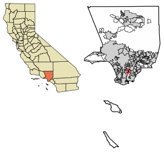
The South Bay is a region of the Los Angeles metropolitan area, located in the southwest corner of Los Angeles County. The name stems from its geographic location stretching along the southern shore of Santa Monica Bay. The South Bay contains sixteen cities plus portions of the City of Los Angeles and unincorporated portions of the county. The area is bounded by the Pacific Ocean on the south and west and generally by the City of Los Angeles on the north and east.
Carson is a city in the South Bay and the Harbor regions of Los Angeles County, California, located 13 miles (21 km) south of downtown Los Angeles and approximately 14 miles (23 km) away from Los Angeles International Airport. It was Incorporated on February 20, 1968. The city is locally known for its plurality of Filipino-Americans and immigrants. As of the 2020 United States Census, the city had a population of 95,558.
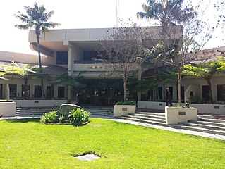
Compton is a city located in the Gateway Cities region of southern Los Angeles County, California, United States, situated south of downtown Los Angeles. Compton is one of the oldest cities in the county, and on May 11, 1888, was the eighth city in Los Angeles County to incorporate. As of the 2020 census, the city had a total population of 95,740. It is known as the "Hub City" due to its geographic centrality in Los Angeles County. Neighborhoods in Compton include Sunny Cove, Leland, downtown Compton, and Richland Farms.
East Rancho Dominguez, also known as East Compton, is an unincorporated community and census-designated place (CDP) located in southern Los Angeles County, California. The population was 15,135 at the 2010 census, up from 9,286 at the 2000 census. East Rancho Dominguez is an accepted city name according to the USPS, and shares the 90221 ZIP Code with Compton.

West Rancho Dominguez, formerly known as West Compton and also known as East Gardena, is an unincorporated census-designated place (CDP) located in southern Los Angeles County, California. Per the 2020 census, the population was 24,347. The community lies to the west of the city of Compton. The ZIP Codes encompassing the CDP area are 90220 & 90248.

Rancho Santa Margarita is a city in Orange County, California, United States. One of Orange County's youngest cities, Rancho Santa Margarita is a master-planned community. The population was 47,853 at the 2010 census, up from 47,214 at the 2000 census. Although it is named for Rancho Santa Margarita y Las Flores, which was in San Diego County, the city limits fall within the borders of Rancho Mission Viejo. At 20 characters long, it is the longest city name in California.

The San Fernando Valley, known locally as the Valley, is an urbanized valley in Los Angeles County, California. Situated to the north of the Los Angeles Basin, it contains a large portion of the city of Los Angeles, as well as several unincorporated areas; and the incorporated cities of Burbank, Calabasas, Glendale, Hidden Hills, and San Fernando. The valley is well known for its film studios such as Warner Bros. Studios and Walt Disney Studios. In addition, it is home to the Universal Studios Hollywood theme park.
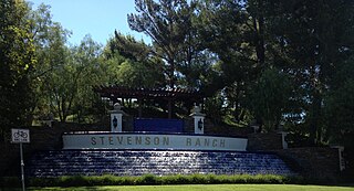
Stevenson Ranch is an unincorporated community in the Santa Clarita Valley of Los Angeles County, California. Stevenson Ranch is set in the foothills of the Santa Susana Mountains and lies west of Interstate 5 and the city of Santa Clarita. Stevenson Ranch encompasses about 6.4 square miles (17 km2). About 1,000 acres (4.0 km2) are set aside as parks, recreation areas, and open space. A master-planned community, it was approved by the county in 1987. The population was 20,178 at the time of the 2020 census. For statistical purposes, the Census Bureau has designated it a census-designated place (CDP).
Compton Unified School District is a school district headquartered in Compton, California, United States.

California's 44th congressional district is a congressional district in the U.S. state of California. The district is centered in South Los Angeles and the Los Angeles Harbor Region. It is currently represented by Democrat Nanette Barragán. The 44th district was created as a result of the redistricting cycle after the 1980 census.

Artesia station is an at-grade light rail station on the A Line of the Los Angeles Metro Rail system. The station is located alongside the Union Pacific freight railroad's Wilmington Subdivision, at its intersection with Artesia Boulevard, after which the station is named, in the city of Compton, California.

Rancho de los Palos Verdes was a 31,629-acre (128.00 km2) Mexican land grant in present-day Los Angeles County, California given in 1846 by Governor Pío Pico to José Loreto and Juan Capistrano Sepulveda. The name means "ranch of the green trees". The grant encompassed the present-day cities of the Palos Verdes Peninsula, as well as portions of San Pedro and Torrance.

Don Manuel Domínguez e Ybáñez (1803–1882) was a Californio ranchero, politician, and a signer of the California Constitution in 1849. He served as two terms as Alcalde of Los Angeles (mayor). He was one of the largest landowners in Southern California, having inherited Rancho San Pedro in 1825, one of the largest ranchos in California. He was one of the founders of the cities of Carson and Compton and of the fishing village of San Pedro. Today, California State University, Dominguez Hills and the communities of Rancho Dominguez, East Rancho Dominguez, and West Rancho Dominguez bear his family's name.
Rancho San Pedro was one of the first California land grants and the first to win a patent from the United States. The Spanish Crown granted the 75,000 acres (300 km2) of land to soldier Juan José Domínguez in 1784, with his descendants validating their legal claim with the Mexican government at 48,000 acres (190 km2) in 1828, and later maintaining their legal claim through a United States patent validating 43,119 acres (174.50 km2) in 1858. The original Spanish land grant included what today consists of the Pacific coast cities of Los Angeles harbor, San Pedro, the Palos Verdes peninsula, Torrance, Redondo Beach, Hermosa Beach, and Manhattan Beach, and east to the Los Angeles River, including the cities of Lomita, Gardena, Harbor City, Wilmington, Carson, Compton, and western portions of Long Beach and Paramount.
Rancho Santiago de Santa Ana was a 63,414-acre (256.63 km2) Spanish land concession in present-day Orange County, California, given by Spanish Alta California Governor José Joaquín de Arrillaga in 1810 to Jose Antonio Yorba and his nephew Pablo Peralta. The grant extended eastward from the Santa Ana River to the Santa Ana Mountains, with a length of more than 22 miles (35 km).

Rancho Santa Ana del Chino was a 22,193-acre (89.81 km2) Mexican land grant in the Chino Hills and southwestern Pomona Valley, in present-day San Bernardino County, California.

The Dominguez Rancho Adobe is California Historical Landmark Number 152, and in 1976 was placed on the National Register of Historic Places by the United States Department of the Interior.

Rancho Las Vírgenes was a 17,760-acre (71.9 km2) land grant in the Santa Monica Mountains and Simi Hills, in present day western Los Angeles County, California. The lands of the Rancho Las Vírgenes included present day Agoura Hills, Oak Park, and Westlake Village and part of the Santa Monica Mountains.
George Cady Carson (1832–1901) was a merchant, road builder, rancher and member of the Los Angeles, California, Common Council in the 1850s.

The Los Angeles Harbor Region is in Los Angeles County, California. The area is impacted by the harbor complex consisting of the Port of Los Angeles and the Port of Long Beach.
