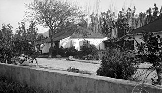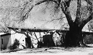
Rancho Camulos, now known as Rancho Camulos Museum, is a ranch located in the Santa Clara River Valley 2.2 miles (3.5 km) east of Piru, California and just north of the Santa Clara River, in Ventura County, California. It was the home of Ygnacio del Valle, a Californio alcalde of the Pueblo de Los Angeles in the 19th century and later elected member of the California State Assembly. The ranch was known as the Home of Ramona because it was widely believed to have been the setting of the popular 1884 novel Ramona by Helen Hunt Jackson. The novel helped to raise awareness about the Californio lifestyle and romanticized "the mission and rancho era of California history."

Rancho Petaluma Adobe is a historic ranch house in Sonoma County, California. It was built from adobe bricks in 1836 by order of Mariano Guadalupe Vallejo. It was the largest privately owned adobe structure built in California and is the largest example of the Monterey Colonial style of architecture in the United States. A section of the former ranch has been preserved by the Petaluma Adobe State Historic Park and it is both a California Historic Landmark and a National Historic Landmark. The Rancho Petaluma Adobe State Historic Park is located on Adobe Road on the east side of the present-day town of Petaluma, California.

Kentucky Camp is a ghost town and former mining camp along the Arizona Trail in Pima County, Arizona, United States, near the community of Sonoita. The Kentucky Camp Historic District is listed on the National Register of Historic Places and has been since 1995. As it is located within Coronado National Forest, the United States Forest Service is responsible for the upkeep of the remaining buildings within the Kentucky Camp Historic District.

The Sierra Bonita Ranch, founded in 1872 by Henry C. Hooker, is one of the oldest cattle ranches in the United States and the ranch buildings have been designated a National Historic Landmark. It was the first permanent American cattle ranch in Arizona. Hooker bought neighboring ranches until his operation became the largest ranch in Arizona, totaling 800 square miles (2,100 km2), or about 30 by 27 miles. It is located in Sulphur Springs Valley about 27 miles (43 km) north of present-day Willcox, Arizona. The modern ranch is much smaller but is still operational and owned by Jesse Hooker Davis, the sixth generation to live and work on the ranch.
The Rio Grande Ranch Headquarters Historic District is a historic one-story residence located 3 miles (4.8 km) east of Okay in Wagoner County, Oklahoma. The site was listed on the National Register of Historic Places September 9, 1992. The site's Period of Significance is 1910 to 1935, and it qualified for listing under NRHP criteria A and C.

The Cunningham Cabin is a double-pen log cabin in Grand Teton National Park in the US state of Wyoming. It was built as a homestead in Jackson Hole and represents an adaptation of an Appalachian building form to the West. The cabin was built just south of Spread Creek by John Pierce Cunningham, who arrived in Jackson Hole in 1885 and subsisted as a trapper until he established the Bar Flying U Ranch in 1888. The Cunninghams left the valley for Idaho in 1928, when land was being acquired for the future Grand Teton National Park.

Joshua Tree National Park is an American national park in southeastern California, east of San Bernardino and Los Angeles and north of Palm Springs. It is named after the Joshua trees native to the Mojave Desert. Originally declared a national monument in 1936, Joshua Tree was redesignated as a national park in 1994 when the U.S. Congress passed the California Desert Protection Act. Encompassing a total of 795,156 acres – slightly larger than the state of Rhode Island – the park includes 429,690 acres of designated wilderness. Straddling San Bernardino and Riverside Counties, the park includes parts of two deserts, each an ecosystem whose characteristics are determined primarily by elevation: the higher Mojave Desert and the lower Colorado Desert. The Little San Bernardino Mountains traverse the southwest edge of the park.

Rooney Ranch is an historic ranch near Morrison, unincorporated Jefferson County, Colorado. Alexander Rooney came west in 1859 seeking an opportunity. He did a variety of work to earn his keep from stone masonry, cartage of lumber and other supplies to the mining camps around Denver and South Park, to a dairy farm. He found the high altitude uncomfortable, so he sought out winter pasture at lower elevations for his cattle. In the fall of 1861 he found what he was looking for along the eastern edge of the hogback, between the mountains and the plains. He brought his wife, Emeline, and his family west from Anamosa, Iowa.

The TA Ranch was the site of the principal events of the Johnson County Range War in 1892. The TA was established in 1882 as one of the first ranches in Johnson County, Wyoming. The TA is the only intact site associated with the range war, with trenches used by both sides still visible and scars on the nearby buildings. The ranch also documents the expansion and development of cattle ranching in Wyoming.

The Desert Queen Mine in the Colorado Desert was one of the more long-lived gold mines of Southern California's high desert region. The abandoned mine is located in Riverside County, California within the boundaries of the Joshua Tree National Park and is included on the National Register of Historic Places. A hiking trail leads to the mine.

Cow Camp, located in Joshua Tree National Park, was associated with cattle rustling in the 1880s and 1890s. It was then later used as a line camp for cattle ranching. A stone chimney, two small dams, watering troughs and a well remain. One dam was built by local rancher and character William F. Keys.

The Keys Ranch is the prime example of early settlement in the Joshua Tree National Park area. Bill Keys was the area's leading character, and his ranch is a symbol of the resourcefulness of early settlers. The ranch is an extensive complex of small frame buildings built between 1910 and Keys' death in 1964. Keys pursued both ranching and mining to make a living in the desert.

The Faraway Ranch Historic District is part of the Chiricahua National Monument in southeastern Arizona, and preserves an area associated with the final conflicts with the local Apache, one of the last frontier settlements, and in particular, its association with the people who promoted the establishment of the Chiricahua National Monument. Faraway Ranch is located in Bonita Canyon, which lies at an approximate altitude of 5160 feet and opens in a southwesterly direction into the Sulphur Springs Valley.

The David L. Shirk Ranch is a historic ranch located in the Guano Valley of eastern Lake County, Oregon, United States. The ranch was originally homesteaded in 1881. It was purchased by David L. Shirk in 1883. He operated the ranch until 1914. The property was acquired by the United States Government in 1942. The ranch is now administered by the Bureau of Land Management. The remaining historic ranch buildings are listed on the National Register of Historic Places.

The Daniels Farm House represents one of the last vestiges of West Texas pioneer farming in Big Bend National Park, Texas. Most of the small-scale farms in the Big Bend area quickly fell into ruin after the park was established in 1944. Larger-scale ranch structures survived in greater numbers, but the small-scale irrigated bottomland farms have not. The farm is located next to the Rio Grande.

The El Tovar Stables at the south rim of the Grand Canyon were built about 1904, at the same time the nearby El Tovar Hotel was built, to house the animals used in general transportation around the park. Collectively called the "transportation department" in the early 20th century, the three structures comprised a horse barn or stable, a mule barn and a blacksmith shop.
J.D. Ryan was a Montana rancher and pioneer mining operator in Joshua Tree National Park. The popular park destination Ryan Mountain is named after him.

Eagar Townsite Historic District is a section of the town of Eagar, Arizona which has been designated a National Historic Place. Sitting on roughly 54 acres, the site contains 37 structures, 21 of which have historical significance. The period of significance is from 1886, the year the townsite was founded, through 1942, which represents the significant period of development of the town. The site was added to the Register on July 23, 1993.

The Acadia Ranch, now the Acadia Ranch Museum and home of the Oracle Historical Society, at 825 E. Mt. Lemmon Highway in Oracle in Pinal County, Arizona, is a historic ranch complex built up during 1885 to 1930. A portion of the ranch was listed on the National Register of Historic Places in 1984. The listing included two contributing buildings: the Acadia Ranch House and an outbuilding which includes a smokehouse and a garage. It also included a contributing structure: a water tower.

The Bear Spring House, Guardhouse, and Spring is a late 19th century ranch situated in the Chiricahua Mountains in Cochise County, Arizona


