Salmo, Wisconsin | |
---|---|
Coordinates: 46°46′53″N90°51′55″W / 46.78139°N 90.86528°W Coordinates: 46°46′53″N90°51′55″W / 46.78139°N 90.86528°W | |
Country | |
State | |
County | Bayfield |
Town | Bayfield |
Elevation | 190 m (620 ft) |
Time zone | UTC-6 (Central (CST)) |
• Summer (DST) | UTC-5 (CDT) |
Area code(s) | 715 and 534 |
GNIS feature ID | 1573636 [1] |
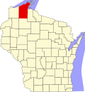
Salmo is an unincorporated community in Bayfield County, Wisconsin, United States.
In law, an unincorporated area is a region of land that is not governed by a local municipal corporation; similarly an unincorporated community is a settlement that is not governed by its own local municipal corporation, but rather is administered as part of larger administrative divisions, such as a township, parish, borough, county, city, canton, state, province or country. Occasionally, municipalities dissolve or disincorporate, which may happen if they become fiscally insolvent, and services become the responsibility of a higher administration. Widespread unincorporated communities and areas are a distinguishing feature of the United States and Canada. In most other countries of the world, there are either no unincorporated areas at all, or these are very rare; typically remote, outlying, sparsely populated or uninhabited areas.
Bayfield County is a county located in the U.S. state of Wisconsin. As of the 2010 census, the population was 15,014. Its county seat is Washburn. The county was created in 1845 and organized in 1850.
Wisconsin is a U.S. state located in the north-central United States, in the Midwest and Great Lakes regions. It is bordered by Minnesota to the west, Iowa to the southwest, Illinois to the south, Lake Michigan to the east, Michigan to the northeast, and Lake Superior to the north. Wisconsin is the 23rd largest state by total area and the 20th most populous. The state capital is Madison, and its largest city is Milwaukee, which is located on the western shore of Lake Michigan. The state is divided into 72 counties.
Wisconsin Highway 13 serves as a main route in the community. Salmo is located 3 miles southwest of the city of Bayfield, in the town of Bayfield.
State Trunk Highway 13 is a Wisconsin state highway running north–south across northwest and central Wisconsin. WIS 13 serves as a major north–south route connecting the communities of Wisconsin Dells, Wisconsin Rapids, Marshfield and Ashland. Highway 13 is part of the Lake Superior Circle Tour from its northern/western terminus to Ashland at is eastern junction with U.S. Highway 2. The road also provides access to the Apostle Islands National Lakeshore off the Lake Superior shoreline at Bayfield. The highway is two-lane surface road with the exception of various urban multilane road sections.
Bayfield is a city in Bayfield County, Wisconsin, United States. The population was 530 at the 2010 census.
Bayfield is a town in Bayfield County, Wisconsin, United States. The population was 680 at the 2010 census. The unincorporated communities of Pureair and Salmo are located in the town, as are Eagle Island and Sand Island of the Apostle Islands.
The community is also located 19 miles north of the city of Ashland.
Ashland is a city in Ashland and Bayfield counties in the U.S. state of Wisconsin. The city is a port on Lake Superior, near the head of Chequamegon Bay. The population was 8,216 at the 2010 census, all of which resided in the Ashland County portion of the city. The unpopulated Bayfield County portion is in the city's southwest, bordered by the easternmost part of the town of Eileen.
The community was named after Salmo , a genus of fish which includes the Atlantic salmon. [2]
Salmo is a genus of fish in the salmon family Salmonidae that includes the European species of salmon and trout, among them the familiar Atlantic salmon Salmo salar and the brown trout Salmo trutta. The natural distribution of Salmo also extends to Northern Africa and to Western Asia around the Black Sea basin. The single Salmo species naturally found in the Atlantic North America is the Atlantic salmon, whereas the salmon and trout of the Pacific basin belong to another genus, Oncorhynchus. The generic name Salmo derives from the Latin salmō (salmon). The number of distinct species and subspecies in Salmo is a debated issue. Atlantic salmon and brown trout are widespread species, while most of the other taxa are narrowly distributed forms endemic to single watersheds.
The Bayfield Fish Hatchery, which is listed on the National Register of Historic Places, is located in Salmo. [3]
The Bayfield Fish Hatchery is a historic fish hatchery in Salmo, Wisconsin, located 2.3 miles (3.7 km) southwest of Bayfield. The hatchery was built in 1897 in the Queen Anne style and Shingle style using local brownstone and played a historically significant role in the fishing industry on Lake Superior. On July 22, 1981, the hatchery was listed on the National Register of Historic Places.
The National Register of Historic Places (NRHP) is the United States federal government's official list of districts, sites, buildings, structures, and objects deemed worthy of preservation for their historical significance. A property listed in the National Register, or located within a National Register Historic District, may qualify for tax incentives derived from the total value of expenses incurred preserving the property.
The Raspberry Island Lighthouse is a lighthouse located on the southern part of Raspberry Island, marking the west channel of the Apostle Islands in Lake Superior in Bayfield County, Wisconsin, near the city of Bayfield. It was erected in 1862, marking the western channel.
Benoit is an unincorporated community in the towns of Keystone and Mason, Bayfield County, Wisconsin, United States. It is located two miles southwest of the intersection of U.S. Highway 2 and U.S. Highway 63; and located 14 miles southwest of the city of Ashland.
Gulf is an unincorporated community and census-designated place (CDP) in southwestern Chatham County, North Carolina, United States, southeast of the town of Goldston. As of the 2010 census, the Gulf CDP had a population of 144. The community is home to a general store and several historic homes. It received its name from its location at a wide bend in the Deep River.
Winona is a historic train station in Winona, Minnesota, United States. It is served by Amtrak's daily Empire Builder service. It was originally built in 1888 by the Chicago, Milwaukee, St. Paul and Pacific Railroad, known later as the Milwaukee Road. A former Milwaukee Road freight house also exists here.
Frontenac is an unincorporated community and census-designated place (CDP) in Florence Township, Goodhue County, Minnesota, United States, on the Mississippi River. As of the 2010 census, its population was 282.
Grand View is an unincorporated, census-designated place located in the town of Grandview, Bayfield County, Wisconsin, United States.
This is a list of the National Register of Historic Places listings in Bayfield County, Wisconsin. It is intended to provide a comprehensive listing of entries in the National Register of Historic Places that are located in Bayfield County, Wisconsin. The locations of National Register properties for which the latitude and longitude coordinates are included below may be seen in a map.
Mountain is an unincorporated census-designated place in Oconto County, Wisconsin, United States. The community is located at the intersection of Wisconsin Highway 32 and Wisconsin Highway 64, in the town of Mountain. It is located at latitude 45.185 and longitude -88.474 and elevation 971 feet. The postal code for Mountain is 54149. As of the 2010 census, its population is 363. Mountain has an area of 6.699 square miles (17.35 km2), all of it land.
Cable is an unincorporated, census-designated place located in the town of Cable, Bayfield County, Wisconsin, United States.
Drummond is an unincorporated, census-designated place located in the town of Drummond, Bayfield County, Wisconsin, United States.
Sioux is an unincorporated community located in the town of Bayview, Bayfield County, Wisconsin, United States.
Barksdale is an unincorporated community in the town of Barksdale, Bayfield County, Wisconsin, United States. Barksdale is located on Wisconsin Highway 13 4 miles (6.4 km) south-southwest of Washburn.
Ashland Junction is an unincorporated community located in the town of Eileen, Bayfield County, Wisconsin, United States.
Leonards is an unincorporated community located in the town of Cable, Bayfield County, Wisconsin, United States.
The Riverton Railroad Depot is a historic railway station located at 1st and Main Streets in Riverton, Wyoming. The depot was built by the Chicago and North Western Railway from 1906 to 1907 along a new line through central Wyoming built by the railway in 1906. The city of Riverton formed only two weeks before the railroad reached it when land in the area opened to new residents under the Homestead Act. The railroad spurred economic development in the region by exporting agricultural products and oil and creating demand for the local coal and lumber industries. When the railroad industry declined after World War II, the Chicago and North Western gradually decreased its service west of Casper, and by 1974 it was prepared to demolish the Riverton station as well. A group of Riverton residents instead bought and restored the depot, which now houses businesses. The depot is the last surviving Chicago and North Western station west of Casper.
The Guttenberg National Fish Hatchery and Aquarium Historic District is a nationally recognized historic district located in Guttenberg, Iowa, United States. It was listed on the National Register of Historic Places in 1991. At the time of its nomination the district consisted of four resources, all of which are contributing buildings. This district also contributes to the Front Street Historic District. The U.S. Fish and Wildlife Service had a long history of involvement with wildlife conservation in Iowa, especially fisheries. They established fish rescue program along the Mississippi River in 1903 and a research station at Fairport in 1910. The development of the lock and dam system in the 1930s brought the fish rescue operations to an end because they eliminated of the backwaters that trapped them. The fish hatchery was developed at that time.
The Old Bayfield County Courthouse is located in Bayfield, Wisconsin.
Pureair Sanatorium is located in Bayfield County, Wisconsin.
The Chicago and North Western Depot is located in Reedsburg, Wisconsin.
This article about a location in Bayfield County, Wisconsin is a stub. You can help Wikipedia by expanding it. |