Senador Camará

Last updated
Senador Camará
Neighborhood
Rio De Janeiro location map.svg
Red pog.svg
Senador Camará
Location in Rio de Janeiro
Brazil location map.svg
Red pog.svg
Senador Camará
Senador Camará (Brazil)
Coordinates: 22°54′16″S43°29′30″W / 22.90444°S 43.49167°W / -22.90444; -43.49167 Coordinates: 22°54′16″S43°29′30″W / 22.90444°S 43.49167°W / -22.90444; -43.49167
Country Flag of Brazil.svg  Brazil
State Rio de Janeiro (RJ)
Municipality/City Rio de Janeiro
Zone West Zone

Senador Camará is a populous neighborhood in the West Zone of Rio de Janeiro, Brazil, with 111.231 residents (according to information of the Instituto Brasileiro de Geografia e Estatística - IBGE- Demographic Census of 2000) distributed in an area of 1,723.59 hectares, of lower class. It borders the neighborhoods of Bangu and Santíssimo.

Rio de Janeiro Second-most populous municipality in Brazil

Rio de Janeiro, or simply Rio, is the second-most populous municipality in Brazil and the sixth-most populous in the Americas. The metropolis is anchor to the Rio de Janeiro metropolitan area, the second-most populous metropolitan area in Brazil and sixth-most populous in the Americas. Rio de Janeiro is the capital of the state of Rio de Janeiro, Brazil's third-most populous state. Part of the city has been designated as a World Heritage Site, named "Rio de Janeiro: Carioca Landscapes between the Mountain and the Sea", by UNESCO on 1 July 2012 as a Cultural Landscape.

Brazil Federal republic in South America

Brazil, officially the Federative Republic of Brazil, is the largest country in both South America and Latin America. At 8.5 million square kilometers and with over 208 million people, Brazil is the world's fifth-largest country by area and the fifth most populous. The capital is Brasília, and the most populated city is São Paulo. The federation is composed of the union of the 26 states, the Federal District, and the 5,570 municipalities. It is the largest country to have Portuguese as an official language and the only one in the Americas; it is also one of the most multicultural and ethnically diverse nations, due to over a century of mass immigration from around the world.

Bangu, Rio de Janeiro Neighborhood in Rio de Janeiro, Rio de Janeiro, Brazil

Bangu is a neighborhood in the West Zone of Rio de Janeiro, Brazil. It is a middle-class neighborhood. It is located in the western area of the city being one of the most populated districts, with 244,518 inhabitants [1] distributed in an area of 4570.69 ha. Located in the geographic center of the city, the neighborhood is close to Campo Grande, Senador Camará, Vila Aliança, Padre Miguel and Realengo. On November 22, 2004 the mayor of Rio de Janeiro César Maia created by decree the district Gericinó. The neighborhood was originally part of the neighborhood of Bangu, the region where the penitentiary of Bangu is located, besides Bangu dump. The region is where Gericinó was located containing the sub-district of the Aqueduct. Since 2004, the complex of Bangu and dump of Bangu, no longer belong to the neighborhood of Bangu.

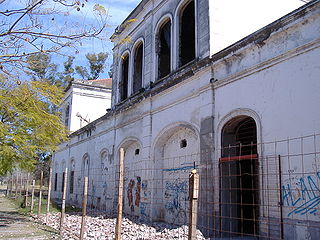
The name originated from the railroad station that attends the neighborhood and is named "Estação Senador Camará" (Senador Camará Station in English), in honor of the Senator Otacílio de Carvalho Camará, that was the Senator of the Republic in 1919 and 1920.

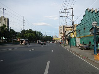
The neighborhood is divided by the railway of the extension line of Santa Cruz, nowadays operated by the company SuperVia. On the left of the railway, on the direction to Santa Cruz, the neighborhood is cut by the Santa Cruz Avenue, that connects the neighborhoods of Realengo and Santa Cruz. On the right side, the neighborhood is cut by the Taquaral Roadway, that starts and finishes on the neighborhood of Senador Camará.

SuperVia

SuperVia Trens Urbanos is a Brazilian train operator founded in Rio de Janeiro in November 1998. It carries around 750 million passengers a year on a railroad network comprising 100 stations in 12 cities: Rio de Janeiro, Duque de Caxias, Guapimirim, Nova Iguaçu, Nilópolis, Mesquita, Queimados, São João de Meriti, Belford Roxo, Japeri, Paracambi and Magé.

Santa Cruz, Rio de Janeiro Neighborhood in Rio de Janeiro, Rio de Janeiro, Brazil

Santa Cruz is an extensive and populous neighborhood of the high class, lower middle and low in the West Zone of the municipality of Rio de Janeiro, Brazil, the farthest from the center of Rio de Janeiro. Cut by the Santa Cruz extension of the urban passenger rail network of the metropolitan region of Rio de Janeiro, it has a very diverse landscape, with commercial areas, residential and industrial.

Related Research Articles

Viçosa, Minas Gerais Municipality in Southeast, Brazil

Viçosa is a Brazilian municipality in the state of Minas Gerais. Its population in July 2016 was estimated at 77,863 inhabitants. 

Campo Grande, Rio de Janeiro Neighborhood in Rio de Janeiro, Rio de Janeiro, Brazil

Campo Grande is the largest neighborhood in the West Zone of Rio de Janeiro. Campo Grande has a population of 328,370 inhabitants and an area of 119,1253 sq km, on both counts Rio's largest. It is situated 50 kilometers away from Downtown Rio.

Sants human settlement in Spain

Sants is a neighborhood in the southern part of Barcelona, Catalonia, Spain. Formerly an industrial town on the plain bordering Barcelona, known as Santa Maria de Sants, it belongs nowadays to the district of Sants-Montjuïc and is bordered by the districts of Eixample to the northeast, Les Corts to the northwest, and by the municipality of l'Hospitalet de Llobregat to the south. Although old-fashioned, its name is sometimes still written Sans in some Spanish-language sources.

General Manuel Belgrano Railway

The General Manuel Belgrano Railway (FCGMB), named after the Argentine politician and military leader Manuel Belgrano, is a 1,000 mmmetre gauge railway and the longest of the Argentine system. It was one of the six State-owned Argentine railway companies formed after President Juan Perón's nationalisation of the railway network in 1948.

Santa Fe Western Railway railway system

The Santa Fe Western Railway was an Argentine railway company which became British-owned in 1900 when it was taken over by the Central Argentine Railway. The company was based in the south of the province of Santa Fe.

Santíssimo Neighborhood in Rio de Janeiro, Rio de Janeiro, Brazil

Santíssimo is a neighborhood in the West Zone of Rio de Janeiro, Brazil, near Campo Grande. Most residents are in the low-income group.

Vila Vintém is an urban low income living community located between the neighbourhoods of Realengo and Padre Miguel, in the West Zone of the city of Rio de Janeiro. Situated on the borders of the railroad, it shelters the headquarters of Mocidade Independente de Padre Miguel and also Unidos de Padre Miguel, as well as a lot of their components. Its principal road is called Rua Belisário de Souza, that goes from the ensemble of IAPI, in Padre Miguel, until Realengo.

Oswaldo Cruz, Rio de Janeiro Neighborhood in Rio de Janeiro, Rio de Janeiro, Brazil

Oswaldo Cruz is a neighborhood of the North Zone of Rio de Janeiro, of middle-class and lower middle-class situated near the neighborhoods of Madureira (east), Bento Ribeiro (west), Vila Valqueire (south), and Turiaçu (north). It is known nationally for being the birthplace of Portela, the great champion of the Carioca Carnival.

Paciência Neighborhood in Rio de Janeiro, Rio de Janeiro, Brazil

Paciência is a neighborhood in the West Zone of Rio de Janeiro, Brazil.

Rio Vermelho (neighborhood) Place in Salvador, Brazil

Rio Vermelho is a neighborhood in the southern zone of Salvador, Bahia. It is located between the neighborhoods of Ondina and Amaralina, and south of Engenho Velho da Federação, Santa Cruz, and Nordeste de Amaralina. Rio Vermelho is noted for its beaches, notably Buracão, Mariquita, Santana, Paciência, and Sereia.

Dr. J. Armando Caro was an Argentine politician, statesman and ham radio born in Cerrillos, a small town in the northern province of Salta.

Jorge Esteban Banicevich is an Argentine Justicialist Party politician. He sits in the Argentine Senate representing Santa Cruz Province in the majority block of the Front for Victory.

Bartolomeu de Gusmão Airport

Bartolomeu de Gusmão Airport was a Brazilian airport built to handle the operations with the rigid airships Graf Zeppelin and Hindenburg. The airport was named after Bartolomeu Lourenço de Gusmão (1685–1724), a Portuguese priest born in Brazil who did research about transportation with balloons.

Terceiro Comando Puro is a Brazilian criminal organization in Rio de Janeiro. They split from the Terceiro Comando in 2002.

Eastern Suburbs (Mumbai) Precinct of Mumbai in Maharashtra, India

East Mumbai consists the localities of Bhandup, Ghatkopar, Kanjurmarg, Kurla, Mulund, Nahur, Powai, Vidyavihar and Vikhroli. To the south-east lie the neighborhoods of Chembur, Govandi, Mankhurd ,Trombay and Wadala.

Gil Puyat Avenue road in the Philippines

The Gil Puyat Avenue, formerly and still referred to as Buendia Avenue, is a major arterial thoroughfare which travels east–west through the cities of Makati and Pasay in western Metro Manila, Philippines. It is one of the busiest avenues in Metro Manila linking the Makati Central Business District with the rest of the metropolis. Its western end begins at Roxas Boulevard and continues through San Isidro District, Pasay until intersecting with Taft Avenue. Past the intersection with the elevated Gil Puyat LRT Station, the road runs through Tramo Street and Barangay Palanan in Makati. East of Osmeña Highway, Gil Puyat intersects with the busy streets of the Central Business District before finally reaching its terminus at Epifanio de los Santos Avenue (EDSA).

Recto Avenue major road in Manila, Philippines

Claro M. Recto Avenue, more popularly known as simply Recto Avenue, is the principal commercial thoroughfare in north central Manila, Philippines. It spans seven districts just north of the Pasig River in what is generally considered Manila's old downtown area.

References