This page is based on this
Wikipedia article Text is available under the
CC BY-SA 4.0 license; additional terms may apply.
Images, videos and audio are available under their respective licenses.

Shrewsbury Township is a township in York County, Pennsylvania, United States. The population was 6,447 at the 2010 census.
The Rattlesnake River is a 3.6-mile-long (5.9 km) river in eastern New Hampshire in the United States. It is a tributary of the Cocheco River, part of the Piscataqua River watershed leading to the Atlantic Ocean.

Dupont Park is a residential neighborhood located in southeast Washington, D.C. It is bounded by Fort Dupont Park to the north, Pennsylvania Avenue SE to the south, Branch Avenue to the west, and Fort Davis Park to the east. The neighborhood civic association uses Fairlawn Avenue and the Anacostia Freeway as the western boundary of the neighborhood.
Menemsha Hills is a protected nature reserve located on Martha's Vineyard, Massachusetts in the town of Chilmark. The property is owned by The Trustees of Reservations through three grants of land, the first in 1966.

Little Acre is an unincorporated community in Redding Township, Jackson County, Indiana.

Cale is an unincorporated community in Mitcheltree Township, Martin County, in the U.S. state of Indiana.

The Caia is a river in the Iberian Peninsula, a tributary to the Guadiana. It is one of the main water courses in the Portalegre District, Portugal. Portugal does not recognise the border between the Caia and Ribeira de Cuncos River deltas, since the beginning of the 1801 occupation of Olivenza by Spain. This territory, though under de facto Spanish occupation, remains a de jure part of Portugal, consequently no border is henceforth recognised in this area.

Bilanga is a department or commune of Gnagna Province in northern Burkina Faso. Its capital lies at the town of Bilanga.

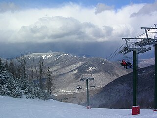
Loon Mountain Ski Resort is a ski resort in Lincoln, Grafton County, New Hampshire, United States. It is located on Loon Mountain and sits within the White Mountain National Forest. Its vertical drop of 2,109 feet (643 m) is the tenth largest in New England.

Cedarville State Forest is a state forest and protected area in the state of Maryland, near Brandywine, Cedarville, and Waldorf. It offers hiking trails, campsites, a fishing pond, hunting land, and picnic and recreation areas.
Bull Neck is an unincorporated community in Westmoreland County, in the U. S. state of Virginia.

Sarbsk is a village in the administrative district of Gmina Wicko, within Lębork County, Pomeranian Voivodeship, in northern Poland. It lies approximately 10 kilometres (6 mi) north of Wicko, 23 km (14 mi) north of Lębork, and 76 km (47 mi) north-west of the regional capital Gdańsk.
Corn Island is a forested island of Essex County, Massachusetts.
Five Points is an unincorporated community in Washington County, Florida, United States. It is located along State Road 280 north of Vernon. It primarily based on the Five Points Recreation Center.
Coleman is an unincorporated community in Cass County, in the U.S. state of Missouri.
Coulstone is an unincorporated community in Dent County, in the U.S. state of Missouri.
Mill Creek is a stream in Washington and St. Francois counties of eastern Missouri. It is a tributary of the Big River.
Sammy Martinez is a census-designated place (CDP) in Starr County, Texas, United States. This was a new CDP for the 2010 census with a population of 110.
All is an unincorporated community in Webster County, in the U.S. state of Missouri.
Knob Creek is a stream in Cass and Henry counties of central western Missouri. It is a tributary of South Grand River.


