Assateague State Park

Last updated
Assateague State Park
IUCN category V (protected landscape/seascape)
Assateague fg02.jpg
Feral horses in Assateague State Park
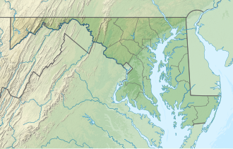
USA Maryland relief location map.svg
Red pog.svg
Location in Maryland
Location Worcester County, Maryland, United States
Nearest city Ocean City, Maryland
Coordinates 38°13′45″N75°08′37″W / 38.22917°N 75.14361°W / 38.22917; -75.14361 Coordinates: 38°13′45″N75°08′37″W / 38.22917°N 75.14361°W / 38.22917; -75.14361 [1]
Area855 acres (346 ha) [2]
Elevation0 ft (0 m) [1]
Designation Maryland state park
Established1956
Administrator Maryland Department of Natural Resources
Website Assateague State Park

Assateague State Park is a public recreation area in Worcester County, Maryland, USA,, located at the north end of Assateague Island, a barrier island bordered by the Atlantic Ocean on the east and Sinepuxent Bay on the west. The state park is bordered on both its north and south sides by Assateague Island National Seashore and is reached via the Verrazano Bridge which carries Maryland Route 611 across Sinepuxent Bay. The park offers wildlife viewing, beach activities, and camping facilities. It is managed by the Maryland Park Service of the larger Maryland Department of Natural Resources with the support of volunteers working under the auspices of the non-profit Friends of Assateague State Park. [3] [4]
Contents

History

State planners suggested establishing a state park on Assateague Island in 1940 and again in 1952. The park was finally created in 1956 when the state Board of Public Works accepted a gift of 540 acres from North Ocean Beach, Incorporated. Funds for further acquisitions were allocated by the General Assembly of Maryland in 1959 and 1962, with funding for facility development allocated in 1965. [5]

A tradition of New Year's Day walks in the park began on January 1, 1980, the same year President Jimmy Carter proclaimed "Year of the Coast." [6] The walk was started by two women, Ilea Fehrer and Judy Johnson, founder of the Committee to Preserve Assateague Island (now known as the Assateague Coastal Trust), who sought to celebrate the beauty of the island and rally against plans to develop areas around it. [7] [8] It subsequently became an annual tradition, with the 40th iteration taking place in 2020, [9] and became very popular over time, with people driving from various other parts of the state to join in with up to 300 others. [10] The Ilia Fehrer / Judy Johnson Memorial Beach Walk, named after the two women who started it, is now part of Maryland's roster of the nationwide offering of First Day Hikes in state parks. [7]

Wildlife

Wildlife found in the park's marsh areas include deer, waterfowl, and feral Assateague horses.

Activities and amenities

Rackliffe House, which overlooks Sinepuxent Bay, is a restored 18th-century coastal plantation building that houses the Coastal Maryland Heritage Center. The park campground has 350 sites. [3]

See also

Related Research Articles

Worcester County, Maryland County in Maryland, US

Worcester County is the easternmost county of the U.S. state of Maryland. As of the 2010 census, the population was 51,454. Its county seat is Snow Hill. It is the only county of Maryland that borders the Atlantic Ocean, and the only county bordering both Delaware and Virginia. The county was named for Mary Arundell, the wife of Sir John Somerset, a son of Henry Somerset, 1st Marquess of Worcester. She was sister to Anne Arundell, wife of Cecil Calvert, 2nd Baron Baltimore, the first Proprietor and Proprietary Governor of the Province of Maryland.

Ocean City, Maryland Town in Maryland, United States

Ocean City, officially the Town of Ocean City, is an Atlantic resort town in Worcester County, Maryland, United States. Ocean City is a major beach resort area along the East Coast of the United States. The population was 7,102 at the 2010 U.S. census, although during summer weekends the city hosts between 320,000 and 345,000 vacationers, and up to 8 million visitors annually. During the summer, Ocean City becomes the second most populated municipality in Maryland, after Baltimore. Located on Fenwick Island, it is part of the Salisbury, MD-DE Metropolitan Statistical Area, as defined by the United States Census Bureau.

Cape Henlopen State Park

Cape Henlopen State Park is a Delaware state park on 5,193 acres (2,102 ha) on Cape Henlopen in Sussex County, Delaware, in the United States. William Penn made the beaches of Cape Henlopen one of the first public lands established in what has become the United States in 1682 with the declaration that Cape Henlopen would be for "the usage of the citizens of Lewes and Sussex County." Cape Henlopen State Park has a 24-hour and year-round fishing pier as well as campgrounds. The remainder of the park is only open from sunrise to sunset, and includes a bathhouse on the Atlantic Ocean, an area for surf-fishing, a disc golf course, and bicycle and walking paths. The beach at Herring Point is a popular surfing spot. The park is a stop on Delaware's Coastal Heritage Greenway.

Año Nuevo State Park State park in California

Año Nuevo State Park is a state park of California, United States, encompassing Año Nuevo Island and Año Nuevo Point, which are known for their pinniped rookeries. Located in San Mateo County, the low, rocky, windswept point juts out into the Pacific Ocean about 55 miles (89 km) south of San Francisco and the Golden Gate. Año Nuevo State Natural Reserve, formerly a separate unit of the California state park system, was merged into Año Nuevo State Park in October 2008. The coastal geographic center, or coastal-midpoint of California is located at the Northern end of this park at N 37°09′58″, W 122°21'40", as the absolute geographic center of California falls at N 37°09′58″, W 119°26′58″W.

Assateague Island Barrier island in Maryland and Virginia, United States

Assateague Island is a 37-mile (60 km) long barrier island located off the eastern coast of the Delmarva Peninsula facing the Atlantic Ocean. The northern two-thirds of the island is in Maryland while the southern third is in Virginia. The Maryland section contains the majority of Assateague Island National Seashore and Assateague State Park. The Virginia section contains Chincoteague National Wildlife Refuge and a one-mile stretch of land containing the lifeguarded recreational beach and interpretive facilities managed by the National Park Service. It is best known for its herds of feral horses, pristine beaches and the Assateague Lighthouse. The island also contains numerous marshes, bays, and coves, including Toms Cove. Bridge access for cars is possible from both Maryland and Virginia, though no road runs the full north/south length of the island.

Assateague Island National Seashore Barrier island operated by the National Park Service of the United States

Assateague Island National Seashore is a unit of the National Park Service system of the U.S. Department of the Interior. Located on the East Coast along the Atlantic Ocean in Maryland and Virginia, Assateague Island is the largest natural barrier island ecosystem in the Middle Atlantic states region that remains predominantly unaffected by human development. Located within a three-hour drive to the east and south of Richmond, Washington, Baltimore, Wilmington, Philadelphia major metropolitan areas plus north of the several clustered smaller cities around Hampton Roads harbor of Virginia with Newport News, Hampton, Norfolk, Portsmouth, Chesapeake and Virginia Beach. The National Seashore offers a setting in which to experience a dynamic barrier island and to pursue a multitude of recreational opportunities. The stated mission of the park is to preserve and protect “unique coastal resources and the natural ecosystem conditions and processes upon which they depend, provide high-quality resource-based recreational opportunities compatible with resource protection and educate the public as to the values and significance of the area”.

Chincoteague Pony American horse breed

The Chincoteague pony, also known as the Assateague horse, is a breed of horse that developed and lives in a feral condition on Assateague Island in the states of Virginia and Maryland in the United States. The breed was made famous by the Misty of Chincoteague series of novels written by Marguerite Henry starting in 1947. While phenotypically horse-like, they are commonly called "ponies". This is due in part to their smaller stature, created by the poor habitat on Assateague Island. Variation is found in their physical characteristics due to blood from different breeds being introduced at various points in their history. They can be any solid color, and are often found in pinto patterns, which are a favorite with breed enthusiasts. Island Chincoteagues live on a diet of salt marsh plants and brush. This poor-quality and often scarce food combined with uncontrolled inbreeding created a propensity for conformation faults in the Chincoteague before outside blood was added beginning in the early 20th century.

Delaware Seashore State Park

Delaware Seashore State Park is located near Dewey Beach, in Delaware, United States. It is bounded on the east by the Atlantic Ocean and on the west by Rehoboth Bay and Indian River Bay. The park covers 2,825 acres (1,143 ha). It is a major attraction for millions of visitors who come to the Delaware Beaches for water-related activities. Delaware Seashore State Park was created in 1965.

Sinepuxent Bay

Sinepuxent Bay is an inland waterway which connects Chincoteague Bay to Isle of Wight Bay, and is connected to the Atlantic Ocean via the Ocean City Inlet. It separates Sinepuxent Neck, in Worcester County, Maryland from Assateague Island, and West Ocean City, Maryland from downtown Ocean City. Islands in the Sinepuxent Bay include Horn Island and Skimmer Island. It is crossed by the Harry W. Kelley Memorial Bridge on U.S. Route 50 and the Verrazano Bridge on Maryland Route 611. The bay is the location of the islands that compose the Sinepuxent Bay Wildlife Management Area. Historically the area was referred to by various names including Sinepuxent, Sene Puxon, Synepuxent, Cinnepuxon, et al.

Maryland Route 611 Highway in Maryland

Maryland Route 611 is a state highway in the U.S. state of Maryland. Known as Stephen Decatur Highway, the state highway runs 8.51 miles (13.70 km) from Assateague Island north to U.S. Route 50 in West Ocean City. MD 611 is named for Stephen Decatur, the U.S. naval officer of the early 19th century who was born in nearby Berlin. The state highway provides access to Assateague State Park and Assateague Island National Seashore via the Verrazano Bridge named for Giovanni da Verrazzano. MD 611 was first paved in West Ocean City in the mid-1930s. The highway was extended south to MD 376 at Lewis Corner in the 1940s. A ferry crossed Sinepuxent Bay to Assateague Island from the southern end of the county highway that continued south from Lewis Corner until MD 611 was extended across the Verrazano Bridge in the mid-1960s.

Verrazano Bridge (Maryland)

The Verrazano Bridge in Maryland is a bridge on Maryland Route 611 over Sinepuxent Bay that connects Assateague Island to the mainland.

Fenwick Island State Park

Fenwick Island State Park is a 344-acre (139 ha) Delaware state park between Ocean City, Maryland and South Bethany, Delaware in Sussex County, Delaware, US. Fenwick Island State Park is open for year-round recreation from 8:00 am until sunset. Originally part of Delaware Seashore State Park, it was established in 1966 and renamed in 1981. The park is located on Fenwick Island, a narrow strip of land between the Atlantic Ocean and Little Assawoman Bay. It is largely undeveloped in comparison to the beach communities that surround it.

Chincoteague Bay

Chincoteague Bay is a lagoon between the Atlantic barrier islands of Assateague and Chincoteague and the mainland of Worcester County, Maryland and northern Accomack County, Virginia. At the bay's northern end, where it narrows between Assateague and Sinepuxent Neck, it becomes Sinepuxent Bay; Chincoteague Bay's southern end drains into the Atlantic Ocean via Queen Sound and Chincoteague Inlet. No major river flows into Chincoteague Bay—its largest tributaries are Newport Creek in Worcester County and Swans Gut Creek in Accomack County.

Chincoteague National Wildlife Refuge

The Chincoteague National Wildlife Refuge is a 14,000-acre (57 km2) wildlife preserve operated by the U.S. Fish & Wildlife Service. It is primarily located on the Virginia half of Assateague Island with portions located on the Maryland side of the island, as well as Morris Island and Wildcat Marsh. The refuge contains a large variety of wildlife animals and birds, including the Chincoteague Pony. The purpose of the refuge is to maintain, regulate and preserve animal and plant species as well as their habitats for present and future generations.

Maryland Coastal Bays Program

The Maryland Coastal Bays Program (MCBP) is one of the 28 United States National Estuary Programs created in the 1987 Amendments to the Clean Water Act. The program, organized by the United States Environmental Protection Agency, is a non-regulatory federal-state-local collaboration working to restore water quality and conserve the natural resources of the bay system adjacent to Ocean City, Maryland and Assateague Island. The partnership works with municipalities, non-profits, governmental agencies, and businesses; and helps develop, find funding for, and implement projects and programs aimed at improving the health of the estuary. The partnership either directly implements these projects, or administers and manages grants, holds educational workshops and highlights project results.

Rackliffe House (Assateague State Park) Historic house museum in Assateague Island, Maryland

Rackliffe House is a restored 18th-century coastal plantation house overlooking Sinepuxent Bay. The house is located at 11700 Tom Patton Lane, Berlin, Maryland, 21811, within walking distance of the Assateague Island Visitor Center at Assateague State Park, Maryland. Built of Flemish bond brick with random glazed headers, the house would have been "one of the most impressive gentry dwellings in the region" in the 18th century. The plantation house is one of a small number of remaining tidewater dwellings from colonial times, and may be the only one of its kind and vintage in the Mid-Atlantic region that is open to the public.

First Day Hikes

First Day Hikes is a program of free, guided hikes offered by the fifty state park systems of the United States each year on New Year's Day. The program began locally in Massachusetts in 1992 and then went nationwide in 2012 under the aegis of the America's State Parks alliance.

Ilia Fehrer was an environmentalist and member of the Maryland Women's Hall of Fame most widely known for fighting to preserve Assateague Island, Chincoteague Bay, and other Chesapeake Bay coastal regions from destructive urban development.

Gaviota Coast Rural area in Santa Barbara County, California

The Gaviota Coast in Santa Barbara County, California is a rural coastline along the Santa Barbara Channel roughly bounded by the city of Goleta and the north boundary of the county. This last undeveloped stretch of Southern California coastline consists of dramatic bluffs, isolated beaches and terraced grasslands.

References

  1. 1 2 "Assateague State Park". Geographic Names Information System . United States Geological Survey.
  2. "DNR Lands Acreage" (PDF). Maryland Department of Natural Resources. p. 8. Retrieved February 12, 2020.
  3. 1 2 "Assateague State Park". Maryland Department of Natural Resources. Retrieved February 8, 2016.
  4. "Friends of Assateague State Park". Maryland Department of Natural Resources. Retrieved February 12, 2020.
  5. Preferred Planning Alternative for Assateague Island Comprehensive Plan (Report). NPS Fish and Wildlife Service/Maryland State Park Service. August 1979. p. 14. Retrieved October 7, 2016.
  6. Pilz, Morgan (2019-12-24). "ACT ready for 40th New Year's Day beach walk". Ocean City Today. Retrieved 2020-04-30.
  7. 1 2 "Maryland State Park First Day Hikes 1/1/2018". Maryland Department of Natural Resources. Retrieved January 16, 2018.
  8. Pilz, Morgan (2019-12-24). "ACT ready for 40th New Year's Day beach walk". Ocean City Today. Retrieved 2020-04-30.
  9. Pilz, Morgan (2019-12-24). "ACT ready for 40th New Year's Day beach walk". Ocean City Today. Retrieved 2020-04-30.
  10. Klingaman, Mike (December 27, 2015). "First Day Hikes give a 'great perspective for the coming year'". The Baltimore Sun. Retrieved January 16, 2018.