South Mountain State Park

Last updated
South Mountain State Park
IUCN category V (protected landscape/seascape) [1]
Annapolis rocks overlook.jpg
View from the Annapolis Rocks Overlook,
found in the southern part of the park
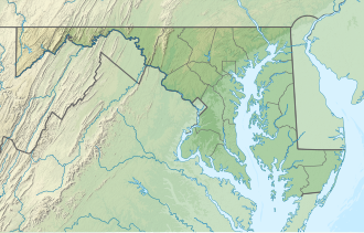
USA Maryland location map.svg
Red pog.svg
Location in Maryland
Location Frederick County & Washington County, Maryland, United States
Nearest town Boonsboro, Maryland
Coordinates 39°33′15″N77°35′59″W / 39.55417°N 77.59972°W / 39.55417; -77.59972 Coordinates: 39°33′15″N77°35′59″W / 39.55417°N 77.59972°W / 39.55417; -77.59972 [2]
Area7,520 acres (30.4 km2) [3]
Elevation1,555 ft (474 m) [2]
Designation Maryland state park
Administrator Maryland Department of Natural Resources
Website South Mountain State Park

South Mountain State Park is a public recreation area that runs for nearly the entire length of South Mountain through Washington and Frederick counties in Maryland. [4] The state park is contiguous with several other national, state and local parks on the mountain, including the Chesapeake and Ohio Canal National Historical Park, Gathland State Park, Washington Monument State Park, Greenbrier State Park and Pen Mar County Park (Washington County).

Contents

Features

Maryland's 40-mile (64 km) section of the Appalachian Trail traverses the length of the park, [5] offering access to scenic overlooks that include High Rock, Black Rock, Annapolis Rock, White Rock, and Weverton Cliffs. [6] The park also contains part of the South Mountain Battlefield. [7] Camping is permitted at shelters and backpackers campgrounds off the AT. [4] The park also has two hunting areas: Black Rock Hunting Lands and Lambs Knoll Hunting Lands. [6]

Related Research Articles

Appalachian Trail 2,160-mile hiking trail going through fourteen US states

The Appalachian National Scenic Trail, generally known as the Appalachian Trail or simply the A.T., is a marked hiking trail in the Eastern United States extending between Springer Mountain in Georgia and Mount Katahdin in Maine. The trail is about 2,200 miles (3,500 km) long, though the exact length changes over time as parts are rerouted or modified. The Appalachian Trail Conservancy describes the Appalachian Trail as the longest hiking-only trail in the world. More than 2 million people are said to take a hike on part of the trail at least once each year.

Deep Creek Lake State Park

Deep Creek Lake State Park is a public recreation area occupying more than 1,100 acres (450 ha) on the northeast side of Deep Creek Lake in Garrett County, Maryland, in the United States. The park features water activities, camping facilities, and recreational trails and is located about 18 miles (29 km) south of Interstate 68 on U.S. Route 219.

Franconia Notch State Park State park in New Hampshire, United States

Franconia Notch State Park is a public recreation area and nature preserve that straddles eight miles (13 km) of Interstate 93 as it passes through Franconia Notch, a mountain pass between the Kinsman Range and Franconia Range in the White Mountains of northern New Hampshire, United States. The northern part of the park, including Cannon Mountain and Echo and Profile lakes, is in the town of Franconia, and the southern part, including Lonesome Lake and the Flume, is in Lincoln. Attractions in the state park include the Flume Gorge and visitor center, the Old Man of the Mountain historical site, fishing in Echo Lake and Profile Lake, and miles of hiking, biking and ski trails.

George Washington and Jefferson National Forests

The George Washington and Jefferson National Forests is an administrative entity combining two U.S. National Forests into one of the largest areas of public land in the Eastern United States. The forests cover 1.8 million acres (7,300 km2) of land in the Appalachian Mountains of Virginia, West Virginia, and Kentucky. Approximately 1 million acres (4,000 km2) of the forest are remote and undeveloped and 139,461 acres (564 km2) have been designated as wilderness areas, which eliminates future development.

Washington Monument State Park

Washington Monument State Park is a public recreation area located approximately one mile (1.6 km) southeast of Boonsboro, Maryland. The park preserves the Washington Monument, a 40-foot-tall (12 m) tower honoring George Washington, the first President of the United States. The monument sits along the Appalachian Trail near the summit of South Mountain's Monument Knob. It was added to the National Register of Historic Places in 1972. The park is managed by the Maryland Department of Natural Resources.

Seneca Creek State Park State park in Montgomery County, Maryland, United States

Seneca Creek State Park is a public recreation area encompassing more than 6,300 acres (2,500 ha) along 14 miles of Seneca Creek in its run to the Potomac River in Montgomery County, Maryland. The park features facilities for boating and fishing as well as trails for hiking, cycling, and horseback riding. It is managed by the Maryland Department of Natural Resources.

Mountains-to-Sea Trail

The Mountains-to-Sea State Trail (MST) is a long-distance trail for hiking and backpacking, that traverses North Carolina from the Great Smoky Mountains to the Outer Banks. The trail's western endpoint is at Clingman's Dome, where it connects to the Appalachian Trail in the Great Smoky Mountains National Park. Its eastern endpoint is in Jockey's Ridge State Park on the tallest sand dune on the east coast. The trail is envisioned as a scenic backbone of an interconnected trail system spanning the state. As such, the trail's route attempts to connect as many trail systems and natural scenic areas as practicable. A little over half of the trail is complete in multiple segments across the state.

Ohiopyle State Park

Ohiopyle State Park is a Pennsylvania state park on 19,052 acres (7,710 ha) in Dunbar, Henry Clay and Stewart Townships, Fayette County, Pennsylvania in the United States. The focal point of the park is the more than 14 miles (23 km) of the Youghiogheny River Gorge that passes through the park. The river provides some of the best whitewater boating in the Eastern United States. Ohiopyle State Park is bisected by Pennsylvania Route 381 south of the Pennsylvania Turnpike. The park opened to the public in 1965, but was not officially dedicated until 1971.

Caledonia State Park

Caledonia State Park is a 1,125-acre (455 ha) Pennsylvania state park in Greene Township, Franklin County and Franklin Township, Adams County in southern Pennsylvania.

Joseph E. Ibberson Conservation Area

Joseph E. Ibberson Conservation Area is a 783-acre (317 ha) Pennsylvania state park in Middle Paxton and Wayne Townships, Dauphin County, Pennsylvania in the United States.

Dans Mountain State Park

Dans Mountain State Park is a public recreation area located nine miles (14 km) south of Frostburg and to the east of the town of Lonaconing in Allegany County, Maryland. The state park occupies 482 acres (195 ha) on 16-mile-long (26 km) Dans Mountain and is managed by the Maryland Department of Natural Resources.

Pine Grove Furnace State Park

Pine Grove Furnace State Park is a protected Pennsylvania area that includes Laurel and Fuller Lakes in Cooke Township of Cumberland County. The Park accommodates various outdoor recreation activities, protects the remains of the Pine Grove Iron Works (1764), and was the site of Laurel Forge (1830), Pine Grove Park (1880s), and a brick plant (1892). The Park is 8 miles (13 km) from exit 37 of Interstate 81 on Pennsylvania Route 233.

Cunningham Falls State Park

Cunningham Falls State Park is a public recreation area located west of Thurmont, Maryland, in the United States. The state park is the home of Cunningham Falls, the largest cascading waterfall in Maryland, a 43-acre (17 ha) man-made lake, and the remains of a historic iron furnace. The park is one of several protected areas occupying 50-mile-long Catoctin Mountain; it is bordered on its north by Catoctin Mountain Park and on its south by Frederick Municipal Forest.

Big Run State Park

Big Run State Park is a public recreation area located at the northern end of the Savage River Reservoir, an impoundment of the Savage River, in Garrett County, Maryland. The state park occupies 300 acres (120 ha) in Savage River State Forest and encompasses the confluence of Monroe Run and Big Run. Park activities include boating, fishing, hiking, picknicking, and camping.

Greenbrier State Park

Greenbrier State Park is a public recreation area located on South Mountain, three miles (4.8 km) northeast of Boonsboro in Washington County, Maryland, USA. The state park has camping, hiking trails, and a 42-acre (17 ha) man-made lake. It is managed by the Maryland Department of Natural Resources.

Patuxent River State Park

Patuxent River State Park is a public recreation area located along the upper reaches of the Patuxent River in Howard and Montgomery counties in Maryland. The state park features hunting, fishing, mountain biking, horseback riding, and hiking on unsigned and untended trails. Planning for the park began in 1963, with the Maryland General Assembly funding land purchases in each year from 1964 to 1968. It is part of the Northeastern coastal forests ecoregion.

Savage River State Forest

Savage River State Forest is located in the north and northeastern part of Garrett County, in the U.S. state of Maryland. The state forest has many waterways, including Savage River Reservoir, which was built in 1952 by the U.S. Army. The dam was built as an emergency water supply for Washington, D.C. Savage River State Forest is known for its hunting, fishing, camping, and hiking trails.

St. Marys River State Park

St. Mary's River State Park is a public recreation area located in St. Mary's County, Maryland. The state park consists of two sites: one encompasses 250-acre (100 ha) St. Mary's Lake; the second covers 2,200 acres (890 ha) and is largely undeveloped. The park is managed by the Maryland Department of Natural Resources.

Environment of Virginia

The natural environment of Virginia encompasses the physical geography and biology of the U.S. state of Virginia. Virginia has a total area of 42,774.2 square miles (110,784.67 km2), including 3,180.13 square miles (8,236.5 km2) of water, making it the 35th-largest state by area. Forests cover 65% of the state, wetlands and water cover 6% of the land in the state, while 5% of the state is a mixture of commercial, residential, and transitional.

Calvin Coolidge State Forest, also known as Coolidge State Forest, covers 22,564 acres (91.31 km2) in two parts in Rutland and Windsor Counties in Vermont. The West portion cover 17,259 acres (69.84 km2) in Killington, Mendon, Plymouth and Shrewsbury in both counties. The East portion cover 5,305 acres (21.47 km2) in Bridgewater, Plymouth, Reading, and Woodstock in Windsor County.

References

  1. "South Mountain State Park". Protected Planet. IUCN. Retrieved May 1, 2018.
  2. 1 2 "South Mountain Natural Environmental Area". Geographic Names Information System . United States Geological Survey.
  3. "DNR Lands Acreage" (PDF). Maryland Department of Natural Resources. Retrieved December 30, 2019.
  4. 1 2 "South Mountain State Park". Maryland Department of Natural Resources. Retrieved November 8, 2017.
  5. "Appalachian Trail". Maryland Department of Natural Resources. Retrieved November 8, 2017.
  6. 1 2 "Explore: South Mountain Recreation Area and More". Maryland Department of Natural Resources. 2014. pp. 18–19. Retrieved June 9, 2016.
  7. "Battle of South Mountain". Maryland Department of Natural Resources. Archived from the original on September 23, 2015. Retrieved November 30, 2013.