Susquehanna State Park (Maryland)

Last updated
Susquehanna State Park
Susquehanna State Park 09.jpg
Boat docked near Susquehanna State Park in 2015
USA Maryland relief location map.svg
Red pog.svg
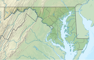
Location in Maryland
Location Cecil County & Harford County, Maryland, United States
Nearest city Havre de Grace, Maryland
Coordinates 39°39′30″N76°08′54″W / 39.65833°N 76.14833°W / 39.65833; -76.14833 [2]
Area2,753 acres (11.14 km2) [3]
Elevation213 ft (65 m) [2]
Designation Maryland state park
Established1960
Administrator Maryland Department of Natural Resources
Website Susquehanna State Park

Susquehanna State Park is a public recreation area located on the banks of the lower Susquehanna River north of the city of Havre de Grace, Maryland. [4] The state park's main area is on the west bank of the river; the park also manages land on the river islands and east bank. The park offers fishing, boating, camping, and trails for hiking and equestrian use. It is managed as a complex with Rocks State Park and Palmer State Park by the Maryland Department of Natural Resources. [4]

Contents

History

The park saw its genesis in 1958 when the former president of the Baltimore Museum of Art, J. Gilman D’Arcy Paul, offered to donate 300 acres to the state. [5] The state began its acquisition of land for the park in 1960. [6]

Features

The park's Rock Run Historical Area includes: the Rock Run Grist Mill; the 1804 Carter-Archer Mansion, which was once the home of mill owner John Archer; remnants of the Susquehanna and Tidewater Canal; and the restored Jersey Toll House, where fees were collected for the historic Port Deposit Bridge. [5] The privately run Steppingstone Museum, which preserves and demonstrates Harford County's rural arts and crafts of the 1880-1920 period, is also located on the park grounds. [7]

Activities and amenities

The park's 15 miles (24 km) of trails include the Susquehanna Ridge Trail (three miles (4.8 km)), which offers views of the river valley, the Land of Promise (1.6 miles (2.6 km)), the Farm Road Trail (two miles (3.2 km)) and other named trails. The Lower Susquehanna Greenways Trail, which is co-located with the Mason-Dixon Trail, starts at the park and runs north along the river to the Conowingo Dam. The park also offers boating and fishing on the Susquehanna, campgrounds, and picnicking facilities. [4]

Related Research Articles

<span class="mw-page-title-main">Torrey C. Brown Rail Trail</span>

The Torrey C. Brown Rail Trail (TCB), the official name of the Northern Central Railroad (NCR) Trail, is a rail trail that runs along an abandoned railroad corridor where the Northern Central Railway once operated. The trail extends 19.7 miles from Ashland Road in Cockeysville, Maryland to the boundary with Pennsylvania. At the Pennsylvania line, the Torrey C. Brown Trail becomes the York County Heritage Rail Trail and continues to the city of York.

<span class="mw-page-title-main">Seneca Creek State Park</span> State park in Montgomery County, Maryland, United States

Seneca Creek State Park is a public recreation area encompassing more than 6,300 acres (2,500 ha) along 14 miles of Seneca Creek in its run to the Potomac River in Montgomery County, Maryland. The park features facilities for boating and fishing as well as trails for hiking, cycling, and horseback riding. It is managed by the Maryland Department of Natural Resources.

<span class="mw-page-title-main">White Deer Hole Creek</span> Tributary of the West Branch Susquehanna River

White Deer Hole Creek is a 20.5-mile (33.0 km) tributary of the West Branch Susquehanna River in Clinton, Lycoming and Union counties in the U.S. state of Pennsylvania. A part of the Chesapeake Bay drainage basin, the White Deer Hole Creek watershed drains parts of ten townships. The creek flows east in a valley of the Ridge-and-valley Appalachians, through sandstone, limestone, and shale from the Ordovician, Silurian, and Devonian periods.

<span class="mw-page-title-main">Susquehanna State Park (Pennsylvania)</span> State park in Lycoming County, Pennsylvania

Susquehanna State Park is a Pennsylvania state park on 20 acres (8.1 ha) in Williamsport in Lycoming County, Pennsylvania in the United States. The park is on the West Branch Susquehanna River in the western part of Williamsport, and is operated by the Williamsport / Lycoming Chamber of Commerce in cooperation with the Bureau of State Parks of the Pennsylvania Department of Conservation and Natural Resources. Susquehanna State Park offers cruises on a paddlewheeler, boating, fishing, and picnicking.

<span class="mw-page-title-main">White Clay Creek Preserve</span> State park in Chester County, Pennsylvania

White Clay Creek Preserve is a 3,050-acre (1,230 ha) Pennsylvania state park along the valley of White Clay Creek in London Britain Township in Chester County, Pennsylvania in the United States. The park was donated by the DuPont Company in 1984 for the purpose of "preserving the diverse and unique plant and animal species, and the rich cultural heritage of the area". Dupont also donated an additional 528 acres (214 ha) for the adjoining White Clay Creek State Park to the state of Delaware. White Clay Creek Preserve is 3 miles (4.8 km) north of Newark, Delaware on Pennsylvania Route 896.

<span class="mw-page-title-main">Gambrill State Park</span> State park in Maryland, United States

Gambrill State Park is a public recreation area located on Catoctin Mountain near the city of Frederick in Frederick County, Maryland. The state park is known for the dramatic views of the surrounding area that can be seen from stone overlooks built in the 1930s by the Civilian Conservation Corps. The park is operated by the Maryland Department of Natural Resources.

<span class="mw-page-title-main">Black Moshannon State Park</span> State park in Pennsylvania, United States

Black Moshannon State Park is a 3,480-acre (1,410 ha) Pennsylvania state park in Rush Township, Centre County, Pennsylvania, United States. It surrounds Black Moshannon Lake, formed by a dam on Black Moshannon Creek, which has given its name to the lake and park. The park is just west of the Allegheny Front, 9 miles (14 km) east of Philipsburg on Pennsylvania Route 504, and is largely surrounded by Moshannon State Forest. A bog in the park provides a habitat for diverse wildlife not common in other areas of the state, such as carnivorous plants, orchids, and species normally found farther north. As home to the "largest reconstituted bog in Pennsylvania", it was chosen by the Pennsylvania Department of Conservation and Natural Resources for its "25 Must-see Pennsylvania State Parks" list.

<span class="mw-page-title-main">Conewago Creek (west)</span> West tributary of the Susquehanna River in Pennsylvania, United States

Conewago Creek is an 80.2-mile-long (129.1 km) tributary of the Susquehanna River in Adams and York counties in Pennsylvania in the United States, with its watershed also draining a small portion of Carroll County, Maryland. The source is at an elevation of 1,440 feet (440 m), east of Caledonia State Park, in Franklin Township in Adams County. The mouth is the confluence with the Susquehanna River at York Haven in York County at an elevation of 259 feet (79 m).

<span class="mw-page-title-main">Susquehannock State Park</span>

Susquehannock State Park is a Pennsylvania state park on 224 acres (91 ha) in Drumore Township, Lancaster County, Pennsylvania in the United States. The park is on a scenic plateau overlooking the Susquehanna River and Conowingo Reservoir. The park is named for the Susquehannock people, who lived in the area. Susquehannock State Park is located on small roads a few miles south of Pennsylvania Route 372 and west of Pennsylvania Route 272. The nearest city is Quarryville, Pennsylvania, about 12 miles (19 km) East.

<span class="mw-page-title-main">Ravensburg State Park</span>

Ravensburg State Park is a Pennsylvania state park in Crawford Township in Clinton County, Pennsylvania in the United States. It is in a gorge carved by Rauchtown Run through the side of Nippenose Mountain. Ravensburg State Park is 78 acres (32 ha) of wooded land that is almost entirely surrounded by Tiadaghton State Forest. This state park is on Pennsylvania Route 880, 8 miles (13 km) north of Carroll and 8 miles (13 km) south-east of Jersey Shore. The nearest city is Williamsport.

<span class="mw-page-title-main">Little Buffalo State Park</span>

Little Buffalo State Park is a Pennsylvania state park on 923 acres (3.7 km2) in Centre and Juniata Townships, Perry County, Pennsylvania in the United States. The park is a historical destination as well as a recreational destination. Visitors to the park can cross a covered bridge and observe a restored and operating grist mill. The park is also home to Holman Lake a popular fishing lake in Perry County and several hundred acres are open to hunting. Little Buffalo State Park is a mile southwest of Newport just off Pennsylvania Route 34.

<span class="mw-page-title-main">Evansburg State Park</span>

Evansburg State Park is a 3,349-acre (1,355 ha) Pennsylvania state park in Lower Providence, Lower Salford, Skippack, Towamencin, and Worcester Townships in Montgomery County, Pennsylvania in the United States. The park has a variety of habitats including forests, meadows, old fields, and farmland. The park offers a variety of recreational opportunities including picnicking, golf, ball fields, biking, hiking, hunting, horseback riding, and fishing. Evansburg State Park is near Collegeville and Norristown just off Pennsylvania Route 363.

<span class="mw-page-title-main">Liberty Reservoir</span> Reservoir in near Eldersburg, Maryland

Liberty Reservoir is a reservoir west of Baltimore, Maryland; about a mile north of Patapsco Valley State Park's McKeldin area. It is owned by the City of Baltimore Department of Public Works, but is located outside the city, and it divides Baltimore and Carroll Counties.

<span class="mw-page-title-main">Elk Neck State Park</span> Public recreation area in Maryland, US

Elk Neck State Park is a public recreation area located between Chesapeake Bay and the Elk River near the southern tip of the Elk Neck Peninsula in Cecil County, Maryland. The state park is home to the historic Turkey Point Light and offers land-based and water-based recreation. The park is located on MD 272, eight miles (13 km) south of the town of North East, and 13 miles (21 km) south of exit 100 on I-95. It is operated by the Maryland Department of Natural Resources.

<span class="mw-page-title-main">Patapsco Valley State Park</span> State park in Maryland, United States

Patapsco Valley State Park is a Maryland state park extending along 32 miles (51 km) of the Patapsco River south and west of the city of Baltimore, Maryland. The park encompasses multiple developed areas on over 14,000 acres (5,700 ha) acres of land, making it Maryland's largest state park. In 2006, it was officially celebrated as Maryland's first state park, its first formation being in 1906. Patapsco Valley State Park is managed by the Maryland Department of Natural Resources.

<span class="mw-page-title-main">New Germany State Park</span> State park in Maryland, United States

New Germany State Park is a public recreation area covering 483 acres (195 ha) adjacent to Savage River State Forest in Garrett County, Maryland. The state park is administered by the Maryland Department of Natural Resources.

<span class="mw-page-title-main">Waterloo State Recreation Area</span> State recreation area in Michigan, United States

Waterloo State Recreation Area is the third-largest park in Michigan, encompassing over 21,000 acres (85 km2) of forest, lakes and wetlands. Located in northeast Jackson County and parts of Washtenaw County, the park is the largest in the Lower Peninsula of Michigan and features 4 campgrounds, 11 lakes, a nature center, and over 50 miles (80 km) of trails - some for horses, bicycles, hiking and cross-country skiing. Waterloo SRA includes the Black Spruce Bog Natural Area, a National Natural Landmark and borders the 11,000-acre (45 km2) Pinckney Recreation Area on the east and the 950-acre (3.8 km2) Phyllis Haehnle Memorial Audubon Sanctuary to the west. The land preserved by the park is not all contiguous and numerous private landholdings and roads run through the park area. The area is characterized by moraines, kettle lakes, swamps and bogs left by retreating glaciers after the last ice age. The park was created by the federal government during the Great Depression and is long-term leased to the state.

<span class="mw-page-title-main">Gunpowder Falls State Park</span> State park in Maryland, United States

Gunpowder Falls State Park is a public recreation area comprising six non-contiguous areas covering 18,000 acres (7,300 ha) in northeastern Baltimore County and western Harford County, Maryland. The state park is primarily made up of the stream valleys of the Big and Little Gunpowder Falls and the Gunpowder River; its natural features range from tidal marshes to rugged interior slopes. The park has over 120 miles of trails for hiking, biking, horseback riding, and cross-country skiing plus facilities for picnicking, tubing, canoeing and kayaking, tide-water fishing and crabbing, fly fishing, and hunting, among other activities. It is managed by the Maryland Department of Natural Resources.

<span class="mw-page-title-main">Big Run State Park</span> State park in Garrett County, Maryland

Big Run State Park is a public recreation area located at the northern end of the Savage River Reservoir, an impoundment of the Savage River, in Garrett County, Maryland. The state park occupies 300 acres (120 ha) in Savage River State Forest and encompasses the confluence of Monroe Run and Big Run. Park activities include boating, fishing, hiking, picknicking, and camping.

<span class="mw-page-title-main">Greenbrier State Park</span> State park in Maryland, United States

Greenbrier State Park is a public recreation area located on South Mountain, three miles (4.8 km) northeast of Boonsboro in Washington County, Maryland, USA. The state park has camping, hiking trails, and a 42-acre (17 ha) man-made lake. It is managed by the Maryland Department of Natural Resources.

References

  1. "Susquehanna State Park". Protected Planet. IUCN. Retrieved December 18, 2019.
  2. 1 2 "Susquehanna State Park". Geographic Names Information System . United States Geological Survey, United States Department of the Interior.
  3. "DNR Lands Acreage" (PDF). Maryland Department of Natural Resources. Retrieved December 18, 2019.
  4. 1 2 3 "Susquehanna State Park". Maryland Department of Natural Resources. Retrieved February 3, 2016.
  5. 1 2 "History". Susquehanna State Park. Maryland Department of Natural Resources. Retrieved December 18, 2019.
  6. "Maryland State Park History". Maryland Department of Natural Resources. Retrieved November 7, 2017.
  7. "Steppingstone Farm Museum" . Retrieved February 3, 2016.