Elk Neck State Park | |
---|---|
Location | Cecil County, Maryland, United States |
Nearest town | North East, Maryland |
Coordinates | 39°29′14″N75°59′24″W / 39.48722°N 75.99000°W [1] |
Area | 2,369 acres (959 ha) [2] |
Elevation | 262 ft (80 m) [1] |
Established | 1936 |
Administered by | Maryland Department of Natural Resources |
Designation | Maryland state park |
Website | Official website |
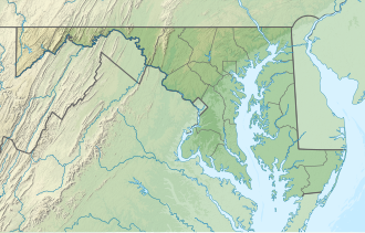
Elk Neck State Park is a public recreation area located between Chesapeake Bay and the Elk River near the southern tip of the Elk Neck Peninsula in Cecil County, Maryland. The state park is home to the historic Turkey Point Light and offers land-based and water-based recreation. [3] The park is located on MD 272, eight miles (13 km) south of the town of North East, and 13 miles (21 km) south of exit 100 on I-95. It is operated by the Maryland Department of Natural Resources.
The park had its genesis when, in 1936, naturalist Dr. William Abbott bequeathed his holdings along the Elk River to the state for use as a state park. Although he originally intended the land to be a gift to the Boy Scouts, a meeting with State Forester Fred W. Besley in 1935 persuaded Abbott to change the terms of his will. Following the state's purchase of additional acreage, the Civilian Conservation Corps created park improvements from 1937 to 1941. [4]
Dating from 1833, the Turkey Point Lighthouse sits on a 100-foot (30 m) bluff overlooking the Upper Chesapeake Bay. The 35-foot (11 m) tower is a "private aid to navigation" maintained by a non-profit organization, Turkey Point Light Station, Inc., which offers weekend tours seasonally. [5]
The park offers more than 250 campsites, rustic cabins, camper cabins, and youth group sites. [6]
The park offers a swimming beach, fishing, and crabbing, plus a boat launch and launch area for canoeing and kayaking. [7] [8]
The park has 12 miles (19 km) of trails for hiking and biking. [9]
Trail Name | Length | Difficulty |
---|---|---|
White Banks Trail | 3 miles (4.8 km) | Difficult |
Pond Loop | 1 mile (1.6 km) | Moderate |
Beaver Marsh Loop | 4 miles (6.4 km) | Difficult |
Lighthouse Trail | 2 miles (3.2 km) | Easy |
The park is part of the Northeastern coastal forests ecoregion, with a landscape characterized by deep forests, bluffs, beaches, and marshlands. [10]
The park was used as a filming location for the 1997 Clint Eastwood movie Absolute Power , [11] [12] The Curve , [13] and as the setting of an episode of the television series Hannibal .[ citation needed ]
Point Reyes National Seashore is a 71,028-acre (287.44 km2) park preserve located on the Point Reyes Peninsula in Marin County, California. As a national seashore, it is maintained by the US National Park Service as an important nature preserve. Some existing agricultural uses are allowed to continue within the park. Clem Miller, a US Congressman from Marin County, wrote and introduced the bill for the establishment of Point Reyes National Seashore in 1962 to protect the peninsula from development which was proposed at the time for the slopes above Drake's Bay. About half of the national seashore is protected as wilderness.
Calvert Cliffs State Park is a public recreation area in Lusby, Calvert County, Maryland, that protects a portion of the cliffs that extend for 24 miles along the eastern flank of the Calvert Peninsula on the west side of Chesapeake Bay from Chesapeake Beach southward to Drum Point. The state park is known for the abundance of mainly Middle Miocene sub-epoch fossils that can be found on the shoreline.
Point Lookout State Park is a public recreation area and historic preserve occupying Point Lookout, the southernmost tip of a peninsula formed by the confluence of Chesapeake Bay and the Potomac River in St. Mary's County, Maryland. The state park preserves the site of an American Civil War prisoner of war camp and the Point Lookout Light, which was built in 1830. It is the southernmost spot on Maryland's western shore, the coastal region on the western side of the Chesapeake Bay.
Seneca Creek State Park is a public recreation area encompassing more than 6,300 acres (2,500 ha) along 14 miles of Seneca Creek in its run to the Potomac River in Montgomery County, Maryland. The park features facilities for boating and fishing as well as trails for hiking, cycling, and horseback riding. It is managed by the Maryland Department of Natural Resources.
Wilderness State Park is a public recreation area bordering Lake Michigan, five miles southwest of Mackinaw City in Emmet County in Northern Michigan. The state park's 10,512 acres (4,254 ha) include 26 miles (42 km) of shoreline, diverse forested dune and swale complexes, wetlands, camping areas, and many miles of hiking trails. The state park is operated by the Michigan Department of Natural Resources, which has, as of 2006, approved a proposal that 4,492 acres (1,818 ha) be officially dedicated as a wilderness area. Wilderness State Park was designated a Michigan "dark sky preserve" in 2012.
Cheboygan State Park is a public recreation area covering 1,250 acres (510 ha) on the shores of Lake Huron in Cheboygan County, Michigan, United States. The state park offers views of the Fourteen Foot Shoal Light and the remains of the 1859 Cheboygan Point Light plus a distant view of the Poe Reef Light, some six miles to the northeast.
Ludington State Park is a public recreation area located two miles north of Ludington, Michigan, occupying 5,300 acres (2,100 ha) between the shores of Lake Michigan and Hamlin Lake. The state park is crossed by a one-mile stretch of the Big Sable River and is home to the 112-foot-high (34 m) Big Sable Point Lighthouse, which dates from 1876.
The Turkey Point Light is a historic lighthouse at the head of the Chesapeake Bay. Although only a 35-foot (11 m) tower, the 100-foot (30 m) height of the bluffs on which it stands makes it the third highest light off the water in the bay. It is also known for the large number of women who served as lightkeeper.
Lums Pond State Park is a 1,790-acre (720 ha) Delaware state park near Bear, New Castle County, Delaware in the United States. The park surrounds Lums Pond, an impoundment built by the Chesapeake and Delaware Canal on St. Georges Creek. The C&D built the pond as a source of water to fill the locks of the canal that connected the Chesapeake Bay with the Delaware River during the early 19th century. Lums Pond State Park is open for a wide variety of year-round recreation.
Matapeake State Park is a public recreation area on Chesapeake Bay occupying the site of a former ferry landing in Matapeake, Kent Island, Maryland. The landing served the state-owned Chesapeake Bay Ferry System before the Chesapeake Bay Bridge opened. The park is leased and managed by Queen Anne's County.
Sandy Point State Park is a public recreation area on Chesapeake Bay, located at the western end of the Chesapeake Bay Bridge in Anne Arundel County, Maryland. The state park is known for the popularity of its swimming beach, with annual attendance exceeding one million visitors. The park grounds include the Sandy Point Farmhouse, which is listed on the National Register of Historic Places. The historic Sandy Point Shoal Lighthouse stands in about five feet of water some 1,000 yards (910 m) east of the park's beach.
North Point State Park is a public recreation area located on Chesapeake Bay in Edgemere, Baltimore County, Maryland. The state park includes the site of the former Bay Shore Park, which was one of the state's premiere amusement parks during the first half of the 20th century. The park features restored remnants of the old amusement park as well as facilities for swimming, picnicking, bicycling, and hiking. Black Marsh, a 667-acre (270 ha) state wildlands area, makes up half the park's area. The park is administered by the Maryland Department of Natural Resources.
Elk Neck State Forest belongs to the Maryland Department of Natural Resources and is managed by the Maryland Forest Service, and is adjacent to the town of North East, in Cecil County. It is often confused with Elk Neck State Park, which lies further south, near the end of the same peninsula.
Greenbrier State Park is a public recreation area located on South Mountain, three miles (4.8 km) northeast of Boonsboro in Washington County, Maryland, USA. The state park has camping, hiking trails, and a 42-acre (17 ha) man-made lake. It is managed by the Maryland Department of Natural Resources.
Hart-Miller Island State Park is a 244-acre (99 ha) public recreation area located at the mouth of Back River in Essex, Maryland. The state park consists of Hart-Miller Island, a man-made landfill linking two natural Chesapeake Bay islands, Hart and Miller, and also includes Hawk Cove and Pleasure Island. The park is accessible only by boat.
Janes Island State Park is a public recreation area on Chesapeake Bay lying adjacent to the city of Crisfield in Somerset County, Maryland. The state park features some 30 miles (48 km) of marked water trails through the island's salt marsh leading to isolated pristine beaches. The park is managed by the Maryland Department of Natural Resources.
Patuxent River State Park is a public recreation area located along the upper reaches of the Patuxent River in Howard and Montgomery counties in Maryland. The state park features hunting, fishing, mountain biking, horseback riding, and hiking on unsigned and untended trails. Planning for the park began in 1963, with the Maryland General Assembly funding land purchases in each year from 1964 to 1968. It is part of the Northeastern coastal forests ecoregion.
South Mountain State Park is a public recreation area that runs for nearly the entire length of South Mountain through Washington and Frederick counties in Maryland. The state park is contiguous with several other national, state and local parks on the mountain, including the Chesapeake and Ohio Canal National Historical Park, Gathland State Park, Washington Monument State Park, Greenbrier State Park and Pen Mar County Park.
Elk Neck Peninsula is in Cecil County, Maryland, between the towns of Elkton and North East, Maryland. Native American and colonial travelers often canoed or sailed up the Chesapeake Bay to Elkton, where the Elk River became unnavigable, and then walked or took some form of surface transportation to the Delaware Bay watershed, since this was the shortest surface crossing. Native Americans of the area, including the Nanticoke and Lenni Lenape, hunted and fished, as well as established semi-permanent camps.
Newtowne Neck State Park is a public recreation area located four miles (6.4 km) southwest of Leonardtown in St. Mary's County, Maryland. The state park sits on a peninsula that is surrounded by Breton Bay, St. Clements Bay, and the Potomac River. It is managed by the Maryland Department of Natural Resources.