Gambrill State Park | |
---|---|
Location | Frederick County, Maryland, United States |
Nearest city | Frederick, Maryland |
Coordinates | 39°28′43″N77°29′29″W / 39.47861°N 77.49139°W [1] |
Area | 1,207 acres (4.88 km2) [2] |
Elevation | 1,549 ft (472 m) [1] |
Designation | Maryland state park |
Established | 1934 |
Administrator | Maryland Department of Natural Resources |
Website | Gambrill State Park |
Gambrill State Park is a public recreation area located on Catoctin Mountain near the city of Frederick in Frederick County, Maryland. The state park is known for the dramatic views of the surrounding area that can be seen from stone overlooks built in the 1930s by the Civilian Conservation Corps. The park is operated by the Maryland Department of Natural Resources. [3]
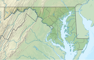
The park is approximately 51 miles (82 km) northwest of Washington, D.C., and 53 miles (85 km) west of Baltimore on Catoctin Mountain. Gambrill Park Road is located approximately six miles (10 km) away from Frederick on Route 40 West. The park road traverses Catoctin Mountain, and accesses the campground, the trailhead, and the High Knob areas of this park.
The park is named after James H. Gambrill, Jr. (1866–1951), a participant in the grain industry and in Frederick city politics, who was a conservationist and frequent visitor to Catoctin Mountain. In an effort to establish a park, Gambrill persuaded his fellow businessmen to purchase the land that now makes up the park and donate it to the city of Frederick. The city then donated the land one year later to the state of Maryland. The state park was dedicated on September 7, 1934. [4] A majority of the park's buildings and structures including its roads, stone overlooks, wooden picnic shelters, Tea Room, and ranger’s residence were constructed in the 1930s by the Civilian Conservation Corps. [5]
The park offers trails for hikers and mountain bikers as well as a picnic area with a playground and a small fishing pond.
Each park trail is blazed with its own color scheme; each is maintained by a different volunteer group. The descriptions below are adapted from the official trail guide offered by the State of Maryland. [6]
Trail Name | Blaze | Length | Notes |
---|---|---|---|
White Oak | White | 1 mile (1.6 km) | Open only to hikers |
Red Maple | Red | 1 mile (1.6 km) | Connects campground with the rest of the park; one short steep section; maintained by The Trail House store |
Green Ash | Green | 2 miles (3.2 km) | Several steep slopes and very little level ground; maintained by the Wheel Base bike shop |
Black Locust | Black-on-white | 3.3 miles (5.3 km) | Several steep slopes mixed with level areas; wooded slopes and views of Frederick Valley to the east and Middletown Valley to the west; maintained by the Potomac Appalachian Trail Club, West Virginia Chapter |
Yellow Poplar | Yellow | 7.1 miles (11.4 km) | Longest Gambrill trail; passes stone overlooks built by the CCC as it ascends the mountain and goes into the far reaches of the park; maintained by Mid-Atlantic Off Road Enthusiasts |
Catoctin Trail | Blue | 26.5 miles (42.6 km) | Traverses the state park for approximately 3.0 miles (4.8 km), and continues north through the Frederick City Watershed, Cunningham Falls State Park, and Catoctin Mountain Park, where it ends at Mt. Zion Road, 1.3 miles (2.1 km) north of Owens Creek Campground |
Three native stone overlooks located on the 1600-foot (490 m) summit of High Knob, midway between the Mason–Dixon line and the Potomac River, offer views of the surrounding area: north – the rugged tree-covered mountains of the Frederick City Municipal Forest; south – Crampton's Gap, a Civil War landmark and the location of Gathland State Park, as well as the Middletown and Monocacy valleys; west – South Mountain, the site of numerous Civil War engagements.
F.D. Roosevelt State Park is a 9,049 acres (36.62 km2) Georgia state park located near Pine Mountain and Warm Springs. The park is named for former U.S. President Franklin Delano Roosevelt, who sought a treatment for his paralytic illness in nearby Warm Springs at the Little White House. The park is located along the Pine Mountain Range. The western portion of the park, formerly named Pine Mountain State Park, was named a National Historic Landmark in 1997. F.D. Roosevelt State Park is Georgia's largest state park.
Monte Sano State Park is a public recreation area and mountaintop retreat encompassing 2,140 acres (870 ha) on the eastern portion of the top and slopes of Monte Sano Mountain on the east side of Huntsville, Alabama. The state park has 1930s-era, Civilian Conservation Corps–built rustic cottages, hiking trails and picnic areas with scenic overlooks, and modern campsites. It is managed by the Alabama Department of Conservation and Natural Resources.
Catoctin Mountain Park, located in north-central Maryland, is part of the forested Catoctin Mountain ridge−range that forms the northeastern rampart of the Blue Ridge Mountains, in the Appalachian Mountains System.
Catoctin Mountain, along with the geologically associated Bull Run Mountains, forms the easternmost mountain ridge of the Blue Ridge Mountains, which are in turn a part of the Appalachian Mountains range. The ridge runs northeast–southwest for about 50 miles (80 km) departing from South Mountain near Emmitsburg, Maryland, and running south past Leesburg, Virginia, where it disappears into the Piedmont in a series of low-lying hills near New Baltimore, Virginia. The ridge forms the eastern rampart of the Loudoun and Middletown valleys.
Washington Monument State Park is a public recreation area located approximately one mile (1.6 km) southeast of Boonsboro, Maryland. The park preserves the Washington Monument, a 40-foot-tall (12 m) tower honoring George Washington, the first President of the United States. The monument sits along the Appalachian Trail near the summit of South Mountain's Monument Knob. It was added to the National Register of Historic Places in 1972. The park is managed by the Maryland Department of Natural Resources.
Blue Knob State Park is a 6,128-acre (2,480 ha) Pennsylvania state park in Kimmel, Lincoln, and Pavia townships in Bedford County, Pennsylvania, in the United States. The average annual snowfall at the park is about 12 feet (370 cm). The park is named for Blue Knob, the second highest mountain in Pennsylvania at 3,146 feet (959 m). It is the location of Blue Knob All Seasons Resort, the ski slope in Pennsylvania with the highest elevation. Blue Knob State Park is just off Interstate 99 on Pennsylvania Route 869 west of Pavia.
Loyalsock State Forest is a Pennsylvania state forest in Pennsylvania Bureau of Forestry District #20. The forest spans across the northern tier's "Endless Mountains" and is a total of 114,552 acres (46,358 ha). The Loyalsock is a “working forest” and is managed for pure water, recreation, plant and animal habitats, sustainable timber, and natural gas.
Ohiopyle State Park is a Pennsylvania state park on 20,500 acres (8,300 ha) in Dunbar, Henry Clay and Stewart Townships, Fayette County, Pennsylvania in the United States. The focal point of the park is the more than 14 miles (23 km) of the Youghiogheny River gorge that passes through the park. The river provides whitewater boating, recreational fishing, and kayaking. Ohiopyle State Park is bisected by Pennsylvania Route 381 south of the Pennsylvania Turnpike. The park opened to the public in 1965 but was not officially dedicated until 1971.
Swallow Falls State Park is a public recreation area located on the west bank of the Youghiogheny River nine miles (14 km) northwest of Oakland in Garrett County, Maryland, in the United States. The state park features Maryland's highest free-falling waterfall, the 53-foot (16 m) Muddy Creek Falls, as well as smaller waterfalls on the Youghiogheny River and Tolivar Creek. The park is notable for its stand of old hemlock trees, some more than 300 years old, "the last stand of its kind in Maryland."
P. H. Hoeft State Park is a public recreation area on the shores of Lake Huron, four miles (6.4 km) northwest of Rogers City on US 23 in Presque Isle County, Michigan. The park was added to the National Register of Historic Places in 2009.
Caledonia State Park is a 1,125-acre (455 ha) Pennsylvania state park in Greene Township, Franklin County and Franklin Township, Adams County in southern Pennsylvania.
Cowans Gap State Park is a 1,085-acre (439 ha) Pennsylvania state park in Todd Township, Fulton County and Metal Township, Franklin County, Pennsylvania in the United States. The park is largely surrounded by Buchanan State Forest in Allens Valley just off Pennsylvania Route 75 near Fort Loudon.
The Catoctin National Recreation Trail is a 26.6 mi (42.4 km) hiking trail that traverses federal, state, and municipal woodlands along the northern half of Catoctin Mountain in Frederick County in central Maryland, USA. The hilly terrain is typical of western Maryland with large sections canopied under dense forest cover.
Douthat State Park is a state park located in the Allegheny Mountains in Virginia. It is in Bath County and Alleghany County. The park is 4,545 acres (18 km2) total with a 50-acre (20 ha) lake, making it the third-largest Virginia state park after Pocahontas State Park and Fairy Stone State Park. It is one of the original Virginia state parks built in the 1930s by the Civilian Conservation Corps.
Table Rock State Park is a 3,083-acre (12.48 km2) park at the edge of the Blue Ridge Mountains in northern Pickens County, South Carolina. The park includes Pinnacle Mountain, the tallest mountain totally within the state.
Cunningham Falls State Park is a public recreation area located west of Thurmont, Maryland, in the United States. The state park is the home of Cunningham Falls, the largest cascading waterfall in Maryland, a 43-acre (17 ha) man-made lake, and the remains of a historic iron furnace. The park is one of several protected areas occupying 50-mile-long Catoctin Mountain; it is bordered on its north by Catoctin Mountain Park and on its south by Frederick Municipal Forest.
Backbone State Park is Iowa's oldest state park, dedicated in 1919. Located in the valley of the Maquoketa River, it is approximately three miles (5 km) south of Strawberry Point in Delaware County. It is named for a narrow and steep ridge of bedrock carved by a loop of the Maquoketa River originally known as the Devil's Backbone. The initial 1,200 acres (490 ha) were donated by E.M. Carr of Lamont, Iowa. Backbone Lake Dam, a relatively low dam built by the Civilian Conservation Corps (CCC) in the 1930s, created Backbone Lake. The CCC constructed a majority of trails and buildings which make up the park.
Patapsco Valley State Park is a Maryland state park extending along 32 miles (51 km) of the Patapsco River south and west of the city of Baltimore, Maryland. The park encompasses multiple developed areas on over 14,000 acres (5,700 ha) acres of land, making it Maryland's largest state park. In 2006, it was officially celebrated as Maryland's first state park, its first formation being in 1906. Patapsco Valley State Park is managed by the Maryland Department of Natural Resources.
New Germany State Park is a public recreation area covering 483 acres (195 ha) adjacent to Savage River State Forest in Garrett County, Maryland. The state park is administered by the Maryland Department of Natural Resources.
Cedarville State Forest is a state forest and protected area in the state of Maryland, near Brandywine, Cedarville, and Waldorf. It offers trails, campsites, a fishing pond, hunting land, and picnic and recreation areas. Trails are available for hikers, bikers and horse riders.