Queen Anne's County is located on the Eastern Shore of the U.S. state of Maryland. As of the 2020 census, the population was 49,874. Its county seat and most populous municipality is Centreville. The census-designated place of Stevensville is the county's most populous place with population of 7,442 as of 2020. The county is named for Queen Anne of Great Britain, who reigned when the county was established in 1706 during the colonial period.

The Delmarva Peninsula, or simply Delmarva, is a large peninsula on the East Coast of the United States, occupied by the vast majority of the state of Delaware and parts of the Eastern Shore of Maryland and Eastern Shore of Virginia.
Claiborne is an unincorporated community in Talbot County, Maryland, United States. The village is located on the eastern shore of the Chesapeake Bay near the mouth of the Eastern Bay at 38°50′15″N76°16′40″W, and uses ZIP code 21624. The 2000 U.S. Census listed the population as 147 and the number of homes as 84, slightly down from its 1941 population of 156. Between 1890 and 1930, the village was a busy port for passenger and then automobile ferry service across the Chesapeake Bay, with numerous stores and motels/resorts, including Maple Hall and the Bellfonte Hotel. A post office was added in 1893 and the Protestant Episcopal Church of Claiborne was built in 1898. In 1912, an elementary school and Methodist Church were added. Before 1912, students attended school in nearby McDaniel. The town's first school consisted of the kitchen of the local railroad pavilion, used as a classroom. In 1913, the town became home to the Claiborne Fresh Air Association, Inc., which was formed for the purpose of providing 10 weeks of fresh air and summer vacation for children who had been exposed to tuberculosis. The role of Claiborne as a terminal for cross-Bay ferries was diminished in 1930 when the primary route shifted to Matapeake in Kent Island. It ended altogether in 1938 when the direct connection from Annapolis to Claiborne was terminated and only an auxiliary shuttle between Claiborne and Romancoke on Kent Island remained. This shuttle service ended in 1952, a few months after the opening of the Chesapeake Bay Bridge; thus ending all ferry service to Claiborne after more than six decades.

The Chesapeake Bay Bridge–Tunnel is a 17.6-mile (28.3 km) bridge–tunnel that crosses the mouth of the Chesapeake Bay between Delmarva and Hampton Roads in the U.S. state of Virginia. It opened in 1964, replacing ferries that had operated since the 1930s. A major project to dualize its bridges was completed in 1999, and in 2017 a similar project was started to dualize one of its tunnels.
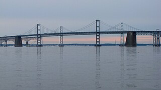
The Gov. William Preston Lane Jr. Memorial Bridge is a major dual-span bridge in the U.S. state of Maryland. Spanning the Chesapeake Bay, it connects the state's rural Eastern Shore region with its urban and suburban Western Shore, running between Stevensville and Sandy Point State Park near the capital city of Annapolis. The original span, opened in 1952 and with a length of 4 miles (6.4 km), was the world's longest continuous over-water steel structure. The parallel span was added in 1973. The bridge is named for William Preston Lane Jr., who as the 52nd Governor of Maryland launched its construction in the late 1940s after decades of political indecision and public controversy.

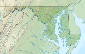
The Eastern Shore of Maryland is a part of the U.S. state of Maryland that lies mostly on the east side of the Chesapeake Bay. Nine counties are normally included in the region. The Eastern Shore is part of the larger Delmarva Peninsula that Maryland shares with Delaware and Virginia.

Kent Island is the largest island in the Chesapeake Bay and a historic place in Maryland. To the east, a narrow channel known as the Kent Narrows barely separates the island from the Delmarva Peninsula, and on the other side, the island is separated from Sandy Point, an area near Annapolis, by roughly four miles (6.4 km) of water. At only four miles wide, the main waterway of the bay is at its narrowest at this point and is spanned here by the Chesapeake Bay Bridge. The Chester River runs to the north of the island and empties into the Chesapeake Bay at Kent Island's Love Point. To the south of the island lies Eastern Bay. The United States Census Bureau reports that the island has 31.62 square miles (81.90 km2) of land area.
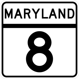
Maryland Route 8 is a state highway in the U.S. state of Maryland. Known for most of its length as Romancoke Road, the state highway runs 8.37 miles (13.47 km) from Romancoke Pier in Romancoke north to MD 18 in Stevensville. MD 8 is the main north–south highway of Kent Island in western Queen Anne's County. The state highway is also the first highway encountered on U.S. Route 50 /US 301 east of the Chesapeake Bay Bridge. South of Matapeake, MD 8 is paralleled by the Kent Island South Trail.
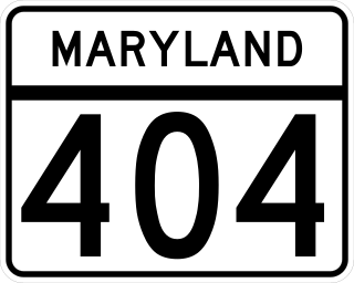
Maryland Route 404 (MD 404) is a major highway on Maryland's Eastern Shore in the United States. Signed east-west, it runs 24.61 miles (39.61 km) from MD 662 in Wye Mills on the border of Queen Anne's and Talbot counties, southeast to the Delaware state line in Caroline County, where the road continues as Delaware Route 404 (DE 404) to the Five Points intersection near Rehoboth Beach. The Maryland and Delaware state highways together cross the width of the Delmarva Peninsula and serve to connect the Baltimore–Washington Metropolitan Area by way of the Chesapeake Bay Bridge and U.S. Route 50 (US 50) with the Delaware Beaches. Along the way, MD 404 passes through mostly farmland and woodland as well as the towns of Queen Anne, Hillsboro, and Denton. The route is a four-lane divided highway between US 50 and east of Denton, with the remainder of the route a two-lane undivided road.

U.S. Route 50 is a major east–west route of the U.S. Highway system, stretching just over 3,000 miles (4,800 km) from West Sacramento, California, east to Ocean City, Maryland, on the Atlantic Ocean. In the U.S. state of Maryland, US 50 exists in two sections. The longer of these serves as a major route connecting Washington, D.C., with Ocean City; the latter is the eastern terminus of the highway. The other section passes through the southern end of Garrett County for less than 10 miles (16 km) as part of the Northwestern Turnpike, entering West Virginia at both ends. One notable section of US 50 is the dual-span Chesapeake Bay Bridge across the Chesapeake Bay, which links the Baltimore–Washington metropolitan area with the Eastern Shore region, allowing motorists to reach Ocean City and the Delaware Beaches.

U.S. Route 301 (US 301) in the state of Maryland is a major highway that runs 122.85 miles (197.71 km) from the Governor Harry W. Nice Memorial Bridge over the Potomac River into Virginia northeast to Delaware. It passes through three of Maryland's four main regions: Southern Maryland, the Baltimore-Washington Metropolitan Area, and the Eastern Shore. US 301 serves mainly as a bypass of Baltimore and Washington, D.C. from Virginia to Delaware.
The Claiborne–Annapolis Ferry Company ran both passenger and automobile ferry service across the Chesapeake Bay from 1919 to 1952. The initial service was between Annapolis, Maryland, on the western shore and Claiborne, Maryland, on the eastern shore. In July 1930, a second shorter route was added between Annapolis, Maryland, and Matapeake on Kent Island, Maryland. Business increased so rapidly at that point that another ferryboat was added. In May, 1938 the Claiborne route was changed to run from Claiborne to Romancoke, Maryland, on the lower end of Kent Island, from which passengers could then connect to the Matapeake to Annapolis run. In 1943, the Annapolis United States Naval Academy absorbed the property where the ferry terminal had been, so service was switched from Annapolis to a new terminal at Sandy Point on the western shore. By May 1951, the ferries were handling 1 million vehicles and 2 million passengers annually. Ferry service stopped running in 1952 when the Chesapeake Bay Bridge was completed.

The Queen Anne’s Railroad was a railroad that ran between Love Point, Maryland, and Lewes, Delaware, with connections to Baltimore via ferry across the Chesapeake Bay. The Queen Anne's Railroad company was formed in Maryland in 1894, and received legislative authorization from Delaware in February 1895. The railroad's original western terminus was in Queenstown, Maryland, and was moved via a 13-mile (21 km) extension to Love Point in 1902, which shortened the ferry trip to Baltimore.

The Cross Island Trail is a rail trail in Queen Anne's County, Maryland occupying a section of the abandoned Queen Anne's Railroad corridor that traverses the width of Kent Island. It was completed in 2001 and is part of the American Discovery Trail.
Matapeake is an unincorporated community located south of Stevensville on Kent Island, Maryland, United States.

Sandy Point State Park is a public recreation area on Chesapeake Bay, located at the western end of the Chesapeake Bay Bridge in Anne Arundel County, Maryland. The state park is known for the popularity of its swimming beach, with annual attendance exceeding one million visitors. The park grounds include the Sandy Point Farmhouse, which is listed on the National Register of Historic Places. The historic Sandy Point Shoal Lighthouse stands in about five feet of water some 1,000 yards (910 m) east of the park's beach.

Maryland Route 908 is a collection of unsigned state highways in the U.S. state of Maryland. These five highways are service roads that parallel and provide access to U.S. Route 50 and US 301 along their western approach to the Chesapeake Bay Bridge; the highways also provide access to Sandy Point State Park. The first modern highway from Cape St. Claire to Skidmore was constructed in the late 1920s and replaced by the modern alignment of US 50 in the late 1940s. The frontage roads on either side of the U.S. Highway were constructed in the early 1950s. The mainline segments of MD 908 assumed their present form when US 50 and US 301 were upgraded to a freeway in the early 1990s.

Fort Smallwood Park is a county park in northeastern Anne Arundel County, near Riviera Beach and Pasadena, Maryland, United States. It is located on the outer Patapsco River as it meets the Chesapeake Bay, on a peninsula known as Rock Point.
The Broadneck Peninsula is an area in Anne Arundel County, Maryland. The area is north of the Severn River, south of the Magothy River and west of the Chesapeake Bay. At the lower end of the Broadneck Peninsula is the 4.3 mile Chesapeake Bay Bridge.