
Warrior Mountain Wildlife Management Area is a Wildlife Management Area in Oldtown, Allegany County, Maryland.
Warrior Mountain Wildlife Management Area is a Wildlife Management Area in Oldtown, Allegany County, Maryland.
39°35′40″N78°38′20″W / 39.59444°N 78.63889°W

The Big Bend is part of the Trans-Pecos region in southwestern Texas, United States along the border with Mexico, north of the prominent bend in the Rio Grande for which the region is named. Here the Rio Grande passes between the Chisos Mountains in Texas and the Sierra Madre Oriental in Mexico as it changes from running east-southeast to north-northeast. The region covers three counties: Presidio County to the west, Brewster County to the east, and Jeff Davis County to the north.

The Trough is a 6-mile long wooded gorge carved by the South Branch Potomac River (SBPR) and situated in the Allegheny Mountains of Hampshire and Hardy Counties, West Virginia, USA. The area was the site of a 1756 skirmish of the French and Indian War, known as the "Battle of the Trough".

Edwards Run is a 7.9-mile-long (12.7 km) tributary stream of the Cacapon River, belonging to the Potomac River and Chesapeake Bay watersheds. The stream is located in Hampshire County in the U.S. state of West Virginia's Eastern Panhandle. Edwards Run is named for Joseph Edwards and his family, whose plantation encompassed most of the stream's course. George Washington surveyed his property in the late 1740s. It is a major source of various species of elodea.
Capon Springs Run is a 4.8-mile-long (7.7 km) tributary stream of the Cacapon River in Hampshire County of West Virginia's Eastern Panhandle. Capon Springs Run is a shallow, stony, non-navigable stream fed by the famous "Capon Springs" at its source on the flanks of Great North Mountain east of the hamlet of Capon Springs. The stream flows west through Capon Springs Resort, parallel to Capon Springs Road along Middle Ridge and meets with Himmelwright Run. To the south, Capon Springs Run is bound by the George Washington National Forest. At its confluence with Dry Run at Capon Springs Station, the stream is met by the old Winchester and Western Railroad grade where a trestle and passenger station once existed. Capon Springs Run enters the Cacapon at the old Capon Lake Whipple Truss Bridge in Capon Lake.

Ravenswood Park is a nature reserve in the western section of Gloucester, Massachusetts owned and managed by the Trustees of Reservations, which acquired the property in 1993. It can be accessed from Western Avenue, the road to Manchester through the Magnolia area. Ravenswood Park is frequented by cross-country skiers during the winter.

Cherry Run is a 7.2-mile-long (11.6 km) meandering stream that forms the northern section of the boundary between Morgan and Berkeley counties in West Virginia's Eastern Panhandle. While it is mostly non-navigable, Cherry Run provides many pools of varying depths for fishing and swimming. As a tributary of the Potomac River, Cherry Run is part of the Potomac and Chesapeake Bay watersheds.
Greenstone Mountain Provincial Park is a provincial park in British Columbia, Canada, located south of Kamloops Lake on the northern edge of the Thompson Plateau.

Town Creek is a 41.6-mile-long (66.9 km) tributary stream of the Potomac River in the U.S. states of Maryland and Pennsylvania. The creek is formed from the confluence of Sweet Root Creek and Elk Lick Creek, about 0.5 miles (0.8 km) south of Buchanan State Forest in Bedford County, Pennsylvania. Town Creek flows south along the base of Warrior Mountain into Allegany County, Maryland. The Chesapeake and Ohio Canal crosses it at the Town Creek Aqueduct. It empties into the Potomac about 4 miles (6 km) east of Oldtown, Maryland.
Little Conococheague Creek is a 12.4-mile-long (20.0 km) tributary stream of the Potomac River in the U.S. states of Maryland and Pennsylvania. The stream rises on Two Top Mountain, west of the Whitetail Ski Resort in Franklin County, Pennsylvania, and proceeds south into Washington County, Maryland. It empties into the Potomac about 2 miles (3 km) southeast of Big Spring, Maryland. The watershed of the creek is 18 square miles (47 km2) and includes Indian Springs Wildlife Management Area. Tributaries include Toms Run.

Hampstead is a village in northeastern Dominica. Along with Bense, the area has a population of 495, and was used as a filming location for 2006's Pirates of the Caribbean: Dead Man's Chest.
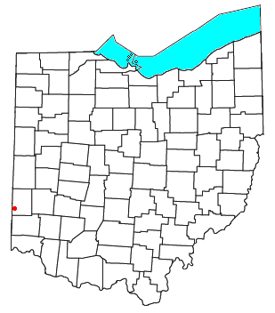
Fairhaven is an unincorporated community in eastern Israel Township, Preble County, Ohio, United States. It lies along State Route 177 at its intersection with Israel-Somers Road. Four Mile Creek, which feeds into Acton Lake in southern Preble County, runs on the western edge of Fairhaven. It is located 10½ miles southwest of Eaton, the county seat of Preble County. The community is part of the Dayton Metropolitan Statistical Area. Fairhaven Church and Fairhaven Community Church are both located in Fairhaven along State Route 177. Fairhaven Community Church hosts a free annual Dinner Drama for the community. Fairhaven is home to the historic Bunker Hill house, a stop along the Underground Railroad.

Pleasant Valley is a small valley in Washington County, Maryland, United States.
Belle Grove Wildlife Management Area is a Wildlife Management Area in Allegany County, Maryland.
Sideling Hill Wildlife Management Area is a Wildlife Management Area in Allegany and Washington County, Maryland. The area is named for Sideling Hill, where a spectacular manmade notch was cut to allow Interstate 68 to pass through.
Strider Wildlife Management Area is a Wildlife Management Area in Montgomery County, Maryland.
Mill Run is a 9.1-mile-long (14.6 km) tributary stream of the South Branch Potomac River, belonging to the Potomac River and Chesapeake Bay watersheds. The stream is located in Hampshire County in the Eastern Panhandle of the U.S. state of West Virginia. Mill Run rises on Nathaniel Mountain and flows northeast, then northwest into the South Branch south of Romney near Hampshire Park on South Branch River Road.
Old Bohemia Wildlife Management Area is a Wildlife Management Area in Cecil County, Maryland.

The Mason Valley is a valley in western Nevada, between the Singatse Range and the Wassuk Range in Lyon County, Nevada.
Indian Creek is an unincorporated community in northeastern Monroe County, in the U.S. state of Missouri.
Cincinnati is an unincorporated community in Ralls County, in the U.S. state of Missouri. The community is on the Salt River approximately 3.5 miles downstream from the Mark Twain Lake dam.