Related Research Articles

Garrett County is the westernmost county of the U.S. state of Maryland. As of the 2020 census, the population was 28,806, making it the third-least populous county in Maryland. Its county seat is Oakland. The county was named for John Work Garrett (1820–1884), president of the Baltimore and Ohio Railroad. Created from Allegany County, Maryland in 1873, it was the last Maryland county to be formed.
The Little Monocacy River is a 10.1-mile-long (16.3 km) tributary stream of the Potomac River. Despite its name, the stream does not feed into the Monocacy River. The Little Monocacy is located almost entirely in Montgomery County, Maryland, and enters the Potomac just downstream from where the Monocacy enters the Potomac. Its headwaters rise southwest of Comus, and most of its approximately 17-square-mile (44 km2) watershed is farmland and pasture (60.56%) or forested land (36.03%).

The Savage River is a 29.5-mile-long (47.5 km) river in Garrett County, Maryland, and is the first major tributary of the North Branch Potomac River from its source. The river was named for 18th century surveyor John Savage.
The Potomac Highlands of West Virginia centers on five West Virginian counties in the upper Potomac River watershed in the western portion of the state's Eastern Panhandle, bordering Maryland and Virginia. Because of geographical proximity, similar topography and landscapes, and shared culture and history, the Potomac Highlands region also includes Pocahontas, Randolph, and Tucker counties, even though they are in the Monongahela River or New River watersheds and not that of the Potomac River.

Catoctin Creek is a 27.9-mile-long (44.9 km) tributary of the Potomac River in Frederick County, Maryland, USA. Its source is formed in the Myersville, Maryland area and flows directly south for the entire length of the stream. Catoctin Creek enters the Potomac River east of Brunswick. The stream flows through Catoctin Creek Park.
Alacakaya, is a town and district of Elazığ Province of Turkey. The mayor is Başaran Yaşlı (Independent). The population is 2545.
Licking Creek is a 56.6-mile-long (91.1 km) tributary of the Potomac River in Pennsylvania and Maryland in the United States.

Town Creek is a 41.6-mile-long (66.9 km) tributary stream of the Potomac River in the U.S. states of Maryland and Pennsylvania. The creek is formed from the confluence of Sweet Root Creek and Elk Lick Creek, about 0.5 miles (0.8 km) south of Buchanan State Forest in Bedford County, Pennsylvania. Town Creek flows south along the base of Warrior Mountain into Allegany County, Maryland. The Chesapeake and Ohio Canal crosses it at the Town Creek Aqueduct. It empties into the Potomac about 4 miles (6 km) east of Oldtown, Maryland.

Fifteenmile Creek is a 19.9-mile-long (32.0 km) tributary stream of the Potomac River in the U.S. states of Maryland and Pennsylvania. The creek enters the Potomac River through Maryland's Green Ridge State Forest.
Tonoloway Creek, also known as Great Tonoloway Creek, is a 31.4-mile-long (50.5 km) tributary stream of the Potomac River in the U.S. states of Maryland and Pennsylvania.
Little Conococheague Creek is a 12.4-mile-long (20.0 km) tributary stream of the Potomac River in the U.S. states of Maryland and Pennsylvania. The stream rises on Two Top Mountain, west of the Whitetail Ski Resort in Franklin County, Pennsylvania, and proceeds south into Washington County, Maryland. It empties into the Potomac about 2 miles (3 km) southeast of Big Spring, Maryland. The watershed of the creek is 18 square miles (47 km2) and includes Indian Springs Wildlife Management Area. Tributaries include Toms Run.
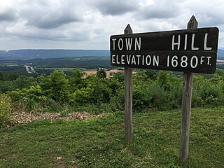
Town Hill is a mountain range located in Allegany County, Maryland and Bedford and Fulton Counties in Pennsylvania. Its southern end is 2.25 miles northwest of Kiefer in Allegany County. It trends northeasterly, and ends about 1.5 miles south of the town of Emmaville in Fulton County. Its highest elevation is 2000 feet.
WWPN is a Contemporary Christian formatted broadcast radio station licensed to Westernport, Maryland, serving Western Maryland and the Potomac Highlands of West Virginia. WWPN is owned and operated by Santmyire Broadcasting.
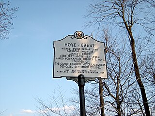
Hoye-Crest is a summit along Backbone Mountain just inside of Garrett County, Maryland. It is the highest natural point in Maryland at an elevation of 3,360 feet (1,020 m).
Garrett State Forest is a state forest located in the state of Maryland northwest of Oakland.
Mount Nebo State Forest is a state forest in the state of Maryland.

Muddy Branch is a tributary stream of the Potomac River in Montgomery County, Maryland, United States, located about 14 miles (23 km) northwest of Washington, D.C.

Tuscarora Creek is a 12.8-mile-long (20.6 km) tributary of the Potomac River in Frederick County, Maryland, in the United States.
Patten Mills is an unincorporated community in Washington County, in the U.S. state of Ohio.

Big Run is a river of 13 miles in length, located one-and-a-half miles west of Spruce Knob in Monongahela National Forest, in Pendleton County, West Virginia. It is a tributary of the North Fork South Branch Potomac River.
References
- 1 2 "Potomac-Garrett State Forest - Forest Service". Maryland Department of Natural Resources. Archived from the original on 19 April 2011. Retrieved 17 May 2021.
Coordinates: 39°29′31″N79°27′26″W / 39.49194°N 79.45722°W