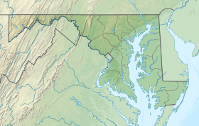
Anne Arundel County, also notated as AA or A.A. County, is a county located in the U.S. state of Maryland. As of the 2010 United States Census, its population was 537,656, a population increase of just under 10% since 2000. Its county seat is Annapolis, which is also the capital of the state. The county is named for Lady Anne Arundell (1615–1649), a member of the ancient family of Arundells in Cornwall, England, and the wife of Cecilius Calvert, 2nd Baron Baltimore (1605–1675), founder and first Lord Proprietor of the colony Province of Maryland.

Annapolis is the capital of the U.S. state of Maryland, as well as the county seat of Anne Arundel County. Situated on the Chesapeake Bay at the mouth of the Severn River, 25 miles (40 km) south of Baltimore and about 30 miles (50 km) east of Washington, D.C., Annapolis is part of the Baltimore–Washington metropolitan area. Its population was measured at 38,394 by the 2010 census.

Crofton is a census-designated place and planned community in Anne Arundel County, Maryland, United States, located 9.8 miles (15.8 km) west of the state capital Annapolis, 24 miles (39 km) south of Baltimore, and 24 miles (39 km) east-northeast of Washington, D.C. The community was established in 1964. As of the 2010 census, it had a population of 27,348.

Crownsville is a census-designated place (CDP) in Anne Arundel County, Maryland, United States. The population was 1,757 at the 2010 census. It hosts the Anne Arundel County Fair each September, as well as the annual Maryland Renaissance Festival for several summer weekends. A state psychiatric hospital was formerly in Crownsville. The area offers waterfront scenery and easy access to urban metropolitan areas and culture.

Millersville is an unincorporated community in Anne Arundel County, Maryland, United States. Population was 20,965 in 2015 based on American Community Survey data.

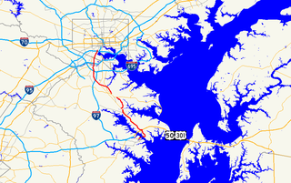
Maryland Route 648 is a collection of state highways in the U.S. state of Maryland. These nine highways are current or former sections of the Baltimore–Annapolis Boulevard between Annapolis and Baltimore via Glen Burnie. There are five signed mainline segments of MD 648 through Arnold, Severna Park, Pasadena, Glen Burnie, Ferndale, and Pumphrey in northern Anne Arundel County; Baltimore Highlands in southern Baltimore County; and the independent city of Baltimore. MD 648 mainly serves local traffic along its meandering route, with long-distance traffic intended to use the parallel and straighter MD 2 south of Glen Burnie and freeway-grade Interstate 97 (I-97), I-695, and MD 295 between Glen Burnie and Baltimore.

Arundel High School is a public high school located in the suburban CPD of Gambrills, Maryland, Anne Arundel County, which lies 15 minutes away from Annapolis, and 30 minutes from both Baltimore and Washington D.C., in the United States.
The Baltimore & Annapolis Trail is a 13.3-mile (21.4 km) rail trail in Anne Arundel County, Maryland. The trail starts at Boulter's Way in Arnold and ends near Baltimore Light Rail's Cromwell Station in Glen Burnie. Starting near Annapolis at Jonas Green Park, the trail passes (northward) through Arnold, Severna Park, Millersville, Pasadena, and Glen Burnie. The Baltimore & Annapolis Trail follows the route of the Baltimore & Annapolis Railroad from which it derives its name. Proposed in 1972 by Jim Hague, it opened on Oct 7, 1990 as the second rail trail in Maryland.
The Washington, Baltimore and Annapolis Trail (WB&A) is a 10.25-mile (16.50 km) long discontinuous rail trail from Lanham to Odenton in Maryland. Despite its name, it does not actually connect with Washington, D.C., Annapolis or Baltimore; its name is taken from the Washington, Baltimore and Annapolis Electric Railway, from which the right-of-way comes. The trail exists in two separate pieces, one in Anne Arundel County and the other in Prince George's County, separated by the lack of a bridge over the Patuxent River. The bridge's construction and the trail's alignment was delayed for over a decade due to a property dispute; however, the trail was realigned and plans exist to complete a bridge by 2021. Additional plans exist to extend the trail southward to the Washington, D.C. border.
The Gazette, founded in 1727 as The Maryland Gazette, is one of the oldest newspapers in America. Its modern-day descendant, The Capital, was acquired by The Baltimore Sun Media Group in 2014. Previously, it was owned by the Capital Gazette Communications group, which published The Capital, Bowie Blade-News, Crofton-West County Gazette, and Capital Style Magazine.

Anne Arundel County Public Schools is the public school district serving Anne Arundel County, Maryland. With over 80,000 students, the AACPS school system is the 5th largest in Maryland and the 46th largest in the United States. The district has over 5,000 teachers supporting a comprehensive curriculum from Pre-K through 12th grade.

Broadneck High School is a school in the United States, located in Anne Arundel County, Maryland on Green Holly Drive, on the border between Arnold and Cape St. Claire, suburbs of Annapolis. The Bruin is the school's mascot. Broadneck is part of the Anne Arundel County Public Schools system and known for the breadth of its Advanced Placement program, among its higher-level courses such as Linear Algebra. It has been the test school for courses such as Calculus III and offers options to take classes at the nearby Anne Arundel Community College and CAT-South schools. The Broadneck Bruins are rivals with the nearby Severna Park High School Falcons. The current BHS feeder middle schools are Severn River Middle School and Magothy River Middle School. Broadneck consistently ranks among the top high schools in Maryland and the nation. In 2018, Newsweek ranked Broadneck as one of the top 20 high schools in Maryland and top 1,000 in the country. In 2013, Broadneck received the highest rank by Newsweek out of all public High Schools in Anne Arundel County. Further, Broadneck High School also ranked among the top 300 high schools in the country by the Washington Post and among the top 10 high schools in Maryland

Russett is an unincorporated planned community of 613 acres (2.48 km2) within the Maryland City CDP in far-western Anne Arundel County, Maryland, United States, near the city of Laurel. It is situated in a park-like setting complemented by 12 miles (19 km) of walking trails and a 70-acre (280,000 m2) lake nature preserve.

Matapeake State Park is a public recreation area on Chesapeake Bay occupying the site of a former ferry landing in Matapeake, Kent Island, Maryland. The landing served the state-owned Chesapeake Bay Ferry System before the Chesapeake Bay Bridge opened. The park is leased and managed by Queen Anne's County.

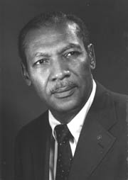
Aris T. Allen was an American politician who was the first African-American chair of the Maryland Republican party and the first to run for a statewide office in Maryland.

Kinder Farm Park is a park located in rural Millersvile, Anne Arundel County, Maryland, United States. The park contains 288 acres (1.17 km2) and is operated by Anne Arundel County Recreation and Parks. It is open year-round. Organizations using the park include the Friends of Kinder Farm Park and the Kinder Farm Park 4H Livestock Club.

Bristol is an unincorporated community in Anne Arundel County, Maryland, United States. Jug Bay Wetlands Sanctuary and the colonial town of Pig Point are on the Patuxent River waterfront portion of Bristol. Pig Point saw War of 1812 action and was the county's largest steamboat port on the Patuxent in the mid-19th century. Pig Point is a very significant Native American Early Archaic Period archaeological site.

Jonas Green was an American newspaper publisher during the Colonial Era in Maryland, and a strong opponent of The Stamp Act.
The Broadneck Peninsula is an area in Anne Arundel County, Maryland. The area is north of the Severn River, South of the Magothy River and west of the Chesapeake Bay. At the lower end of the Broadneck Peninsula is the 4.3 mile Chesapeake Bay Bridge.

Quiet Waters Park is a park in eastern Anne Arundel County, Maryland, United States. It contains 340 acres (1.4 km2) and is operated by the Anne Arundel Recreation and Parks. It is open year-round. Organizations using the park include the Friends of Quiet Waters Park. As of 2010, it attracts 700,000 visitors a year.


