
Diego Garcia is an island of the British Indian Ocean Territory (BIOT), a disputed overseas territory of the United Kingdom also claimed by Mauritius. It is a militarised atoll just south of the equator in the central Indian Ocean, and the largest of the 60 small islands of the Chagos Archipelago. Portuguese sailors under Pedro Mascarenhas were the first Europeans to discover the island, finding it uninhabited in 1512. After a 1786 British colony failed, the French began using the island as a leper colony and, starting in 1793, coconut cultivation by slave labour. It was transferred to British rule after the Napoleonic Wars. It was one of the "Dependencies" of the British Colony of Mauritius until the Chagos Islands were detached for inclusion in the newly created British Indian Ocean Territory in 1965.

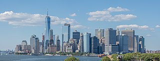
Puerto Rico, officially the Commonwealth of Puerto Rico, is an archipelagic island U.S. territory comprised of the eponymous main island of Puerto Rico and 142 smaller islands, cays, and islets, including Vieques, Culebra, Mona, Desecheo, Caja de Muertos, Palominos, and Icacos, located between the Greater and Lesser Antilles in the northeastern Caribbean Sea of the North Atlantic Ocean. The main island of Puerto Rico is 113 km east of Hispaniola, 60 km west of the Saint Thomas, 705 km north of Venezuela, and 120 km south of the Puerto Rico Trench, the deepest point in the Atlantic. The main island is 178 km long and 65 km wide. With a land area of 8,868 sq km, it is the 4th largest island in the Caribbean, 81st largest island in the world, and 174th largest country, dependency, or disputed territory.

The St. Lawrence River is a large international river in the middle latitudes of North America connecting the Great Lakes to the North Atlantic Ocean. Its waters flow in a northeasterly direction from Lake Ontario to the Gulf of St. Lawrence, traversing Ontario and Quebec in Canada and New York in the United States. A section of the river demarcates the Canada–U.S. border.
The Mid-Atlantic is a region of the United States located in the overlap between the Northeastern and Southeastern states of the United States. Its exact definition differs upon source, but the region typically includes Delaware, the District of Columbia, Maryland, New Jersey, New York, Pennsylvania, Virginia, and West Virginia with other sources including or excluding other states or areas in the Northeast and Southeast. The region has its origin in the Middle Colonies of the 18th century when its states were among the Thirteen Colonies of pre-revolutionary British America. As of the 2020 census, the region had a population of 60,783,913, representing slightly over 18% of the nation's population.

The Susquehanna River is a major river located in the Mid-Atlantic region of the United States, crossing three lower Northeast states. At 444 miles (715 km) long, it is the longest river on the East Coast of the United States. By watershed area, it is the 16th-largest river in the United States, and also the longest river in the early 21st-century continental United States without commercial boat traffic.

Kodiak Island is a large island on the south coast of the U.S. state of Alaska, separated from the Alaska mainland by the Shelikof Strait. The largest island in the Kodiak Archipelago, Kodiak Island is the second largest island in the United States and the 80th largest island in the world, with an area of 3,595.09 sq mi (9,311.2 km2), slightly larger than Cyprus. It is 160 km long and in width ranges from 16 to 97 kilometers. Kodiak Island is the namesake for Kodiak Seamount, which lies off the coast at the Aleutian Trench. The largest community on the island is the city of Kodiak, Alaska.

The Lowcountry is a geographic and cultural region along South Carolina's coast, including the Sea Islands. The region includes significant salt marshes and other coastal waterways, making it an important source of biodiversity in South Carolina.

Pymatuning State Park is a Pennsylvania state park covering 21,122 acres (8,548 ha) in Conneaut, North Shenango, Pine, Sadsbury, South Shenango, West Fallowfield and West Shenango Townships, Crawford County, Pennsylvania, in the United States. Pymatuning State Park is the largest state park in Pennsylvania and contains the 17,088 acres (69.15 km2) of Pymatuning Lake, three-quarters of which is in Pennsylvania and one-quarter of which is in Ohio. A 1.7-mile (2.7 km) causeway extends between Pennsylvania and Ohio near the center of the lake. The lake provides fishing and boating year round. There are two natural areas, Clark Island and Blackjack in the park. The park is also home to the University of Pittsburgh's Pymatuning Laboratory of Ecology. Like all Pennsylvania state parks, admission to the Pymatuning State Park is free. The northern access for Pymatuning State Park can be reached from U.S. Route 6 and the southern access is reached from U.S. Route 322.

Presque Isle State Park is a 3,112-acre (1,259 ha) Pennsylvania State Park on an arching, sandy peninsula jutting into Lake Erie, 4 miles (6 km) west of the city of Erie, in Millcreek Township, Erie County, Pennsylvania, in the United States. The peninsula sweeps northeastward, surrounding Presque Isle Bay along the park's southern coast. It has 13 miles (21 km) of roads, 21 miles (34 km) of recreational trails, 13 beaches for swimming, and a marina. Popular activities at the park include swimming, boating, hiking, biking, and birdwatching.

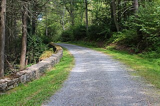
Hickory Run State Park is a 15,990-acre (6,471 ha) Pennsylvania state park in Kidder and Penn Forest Townships in Carbon County, Pennsylvania in the United States. The park is spread across the Pocono Mountains. The park is easily accessible from Interstate 476 and Interstate 80.
Weiser State Forest is a Pennsylvania State Forest in Pennsylvania Bureau of Forestry District #18. The main offices are located in Cressona in Schuylkill County, Pennsylvania in the United States.

Allegheny Islands State Park is a 43-acre (17 ha) Pennsylvania state park in Harmar Township, Allegheny County, Pennsylvania in the United States. The undeveloped park is composed of three alluvial islands located in the middle of the Allegheny River northeast of Pittsburgh. The islands are just north of the boroughs of Oakmont and Plum, and southwest of Cheswick. Bridges for the Pennsylvania Turnpike and the Bessemer and Lake Erie Railroad Branch of the Canadian National Railway cross the Allegheny River at the middle island.

The West Indies is a subregion of North America, surrounded by the North Atlantic Ocean and the Caribbean Sea, which comprises 13 independent island countries and 19 dependencies in three archipelagos: the Greater Antilles, the Lesser Antilles, and the Lucayan Archipelago.

Upper Pine Bottom State Park is a 5-acre (2.0 ha) Pennsylvania state park in Lycoming County, Pennsylvania in the United States. The park is in Cummings Township on Pennsylvania Route 44 and is surrounded by the Tiadaghton State Forest. It is on Upper Pine Bottom Run, which gave the park its name and is a tributary of Pine Creek. Upper Pine Bottom State Park is in the Pine Creek Gorge, where the streams have cut through five major rock formations from the Devonian and Carboniferous periods.

Bucktail State Park Natural Area is a 16,433-acre (6,650 ha) Pennsylvania state park in Cameron and Clinton Counties in Pennsylvania in the United States. The park follows Pennsylvania Route 120 for 75 miles (121 km) between Emporium and Lock Haven. Bucktail State Park Natural Area park runs along Sinnemahoning Creek and the West Branch Susquehanna River and also passes through Renovo. The park is named for the Civil War Pennsylvania Bucktails Regiment and is primarily dedicated to wildlife viewing, especially elk.
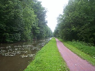
Delaware Canal State Park is a 830-acre (336 ha) Pennsylvania state park in Bucks and Northampton Counties in Pennsylvania. The main attraction of the park is the Delaware Canal which runs parallel to the Delaware River between Easton and Bristol.

McCormick Island is a 100-acre (0.40 km2) island, located in the city of Harrisburg, Pennsylvania. It's one of the larger islands that makes up the Sheets Island Archipelago in the Susquehanna River. Other islands surrounding are Sheets Island, and Governor’s Mansion Island. It is directly south of the I-81 bridge, and can be seen from many different places in Harrisburg. It also is relatively close to Wade Island, another popular stopover for birds in migration. Wade Island is protected and access is not permitted. The various shorebirds present on McCormick Island represent an attraction for bird enthusiasts. Wade Island Rookery, Pennsylvania's largest multi-species nesting island, is also a great attraction.


