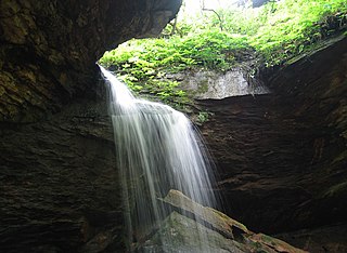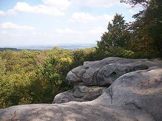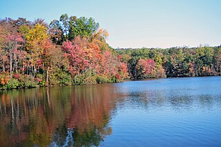
Canoe Creek State Park is a 911.91-acre (369.04 ha) Pennsylvania state park in Frankstown Township in Blair County, Pennsylvania. It is 12 miles east of Altoona, the nearest city. Canoe Lake, at 155 acres (63 ha), is the focus of recreation at the park and is open for fishing year-round. Canoe Creek State Park is a half mile off U.S. Route 22 near the small town of Canoe Creek. The park was opened to the public in 1979 and was developed as part of an expansion effort in the 1970s to improve the state park system in Pennsylvania.

Maurice K. Goddard State Park is a 2,856-acre (1,156 ha) Pennsylvania state park in Deer Creek, Mill Creek, New Vernon and Sandy Lake Townships, Mercer County, Pennsylvania in the United States. It features wildlife, waterways and public recreational facilities. Lake Wilhelm shares its shorelines with Maurice K. Goddard State Park and State Game Land No. 270. The dam, constructed in 1971, creates a 1,860-acre (750 ha) lake providing a resource for people and wildlife. Many species of fish and amphibians make Lake Wilhelm their home. A variety of outdoor activities are available in and around the park vicinity. Special events and programs are held throughout the summer months. Maurice K. Goddard State Park is just off exit 130 of Interstate 79 on Pennsylvania Route 358.

McConnells Mill State Park is a 2,546 acres (1,030 ha) Pennsylvania state park in Perry and Slippery Rock Townships, Lawrence County, Pennsylvania in the United States. The park features a deep scenic gorge with the restored watermill and a covered bridge at the bottom, accessible by a roadway that winds between large, room-sized boulders on the hillside. McConnells Mill State Park is along the Slippery Rock Creek. just southwest of the intersection of US 422 and US 19.

Raccoon Creek State Park is a 7,572-acre (3,064 ha) Pennsylvania state park on Raccoon Creek in Hanover and Independence townships in Beaver County, Pennsylvania in the United States. The park is about 30 miles (48 km) from the city of Pittsburgh, near Hookstown. Raccoon Creek State Park is easily accessed from Pennsylvania Route 18 and U.S Routes 30 and 22. The park offers numerous activities such as hiking, biking, cross-country skiing, camping, swimming, fishing, and boating, the last three at the 101-acre (41 ha) "Raccoon Lake."

The Western Pennsylvania Conservancy (WPC) is a private nonprofit conservation organization founded in 1932 and headquartered in Pittsburgh, Pennsylvania. WPC has contributed land to 12 state parks and conserved more than a quarter million acres of natural lands. The Conservancy plants and maintains more than 132 gardens in 20 Western Pennsylvania counties, as well as planting thousands of trees through its community forestry program. WPC has protected or restored more than 3,000 miles (4,800 km) of rivers and streams. In 1963, Edgar Kaufmann Jr. entrusted Frank Lloyd Wright's masterwork Fallingwater to the Conservancy. The house was called the most important building of the 20th century by the American Institute of Architects.

Forbes State Forest is a Pennsylvania state forest in Pennsylvania Bureau of Forestry District #4. The main offices are located in Laughlintown in Westmoreland County, Pennsylvania in the United States. Mount Davis, the highest peak in Pennsylvania, is located in the forest.

Clear Creek State Forest is a Pennsylvania State Forest in Pennsylvania Bureau of Forestry District #8. The main offices are located in Clarion in Clarion County, Pennsylvania in the United States. Until August 2007, it was named Kittanning State Forest.

Ohiopyle State Park is a Pennsylvania state park on 20,500 acres (8,300 ha) in Dunbar, Henry Clay and Stewart Townships, Fayette County, Pennsylvania in the United States. The focal point of the park is the more than 14 miles (23 km) of the Youghiogheny River Gorge that passes through the park. The river provides some of the best whitewater boating in the Eastern United States. Ohiopyle State Park is bisected by Pennsylvania Route 381 south of the Pennsylvania Turnpike. The park opened to the public in 1965 but was not officially dedicated until 1971.

French Creek State Park is a 7,977-acre (3,228 ha) Pennsylvania state park in North Coventry and Warwick Townships in Chester County and Robeson and Union Townships in Berks County, Pennsylvania. It straddles northern Chester County and southern Berks County along French Creek. It is located in the Hopewell Big Woods. The park is the home of two lakes: Hopewell Lake, a 68-acre (28 ha) warm water lake, and Scotts Run Lake, a 22-acre (8.9 ha) cold water lake. The state record smallmouth bass was caught in Scotts Run Lake. There are extensive forests, and almost 40 miles (64 km) of hiking and equestrian trails. The park is also friendly to mountain bikers, having some renowned technical trails. Hopewell Furnace National Historic Site, which features a cold blast furnace restored to its 1830s appearance, is surrounded by the park. The Six Penny Day Use Area and Group Camp are listed on the National Register of Historic Places. French Creek State Park is located off of Pennsylvania Route 345 to the south of Birdsboro.

Elk State Park is a 3,192-acre (1,292 ha) Pennsylvania state park in Jones Township, Elk County and Sergeant Township, McKean County, Pennsylvania, in the United States. East Branch Clarion River Lake is a man-made lake covering 1,160 acres (470 ha) within the park. The lake and streams in the park are stocked with cold and warm water fish. There are 3,151 acres (1,275 ha) of woods open to hunting.

Black Moshannon State Park is a 3,480-acre (1,410 ha) Pennsylvania state park in Rush Township, Centre County, Pennsylvania, United States. It surrounds Black Moshannon Lake, formed by a dam on Black Moshannon Creek, which has given its name to the lake and park. The park is just west of the Allegheny Front, 9 miles (14 km) east of Philipsburg on Pennsylvania Route 504, and is largely surrounded by Moshannon State Forest. A bog in the park provides a habitat for diverse wildlife not common in other areas of the state, such as carnivorous plants, orchids, and species normally found farther north. As home to the "largest reconstituted bog in Pennsylvania", it was chosen by the Pennsylvania Department of Conservation and Natural Resources for its "25 Must-see Pennsylvania State Parks" list.

Swatara State Park is a 3,515-acre (1,422 ha) Pennsylvania state park in Bethel, Swatara and Union Townships, Lebanon and Pine Grove Township, Schuylkill Counties in Pennsylvania in the United States. 8 miles (13 km) of Swatara Creek lie within the park's boundaries, which are roughly formed by Pennsylvania Route 443 to the north and Interstate 81 to the south. The park is in a valley in the ridge and valley region of Pennsylvania between Second Mountain (north) and Blue Mountain (south).

Hyner Run State Park is a 180-acre (73 ha) Pennsylvania state park in Chapman Township, Clinton County, Pennsylvania in the United States. The park is 6 miles (9.7 km) east of Renovo and 3 miles (5 km) north of Hyner on Pennsylvania Route 120. Hyner Run State Park is surrounded by Sproul State Forest.

Ryerson Station State Park is a 1,164-acre (471 ha) Pennsylvania state park in Richhill Township, Greene County, Pennsylvania in the United States. It was previously home to Ronald J. Duke Lake, a 52-acre (21 ha) artificial lake on the North Fork of the Dunkard Fork of Wheeling Creek, that was constructed in 1960, but drained in 2005 due to structural concerns about the dam. Ryerson Station State Park is 3 miles (5 km) from Wind Ridge just off Pennsylvania Route 21 very close to the West Virginia state line.

Laurel Ridge State Park is a 13,625-acre (5,514 ha) Pennsylvania state park that passes through Cambria, Fayette, Somerset, and Westmoreland counties, Pennsylvania in the United States.

Beaver Creek State Park is a 2,722-acre (1,102 ha) public recreation area in Columbiana County, Ohio in the United States. The park is near East Liverpool on the banks of Little Beaver Creek. Remnants of the historic Sandy and Beaver Canal can be found throughout the park. It is open for year-round recreation including, camping, boating, hunting, fishing and hiking.

Hammersley Wild Area is a 30,253-acre (12,243 ha) wild area in the Susquehannock State Forest in Potter and Clinton counties in north-central Pennsylvania in the United States. It is the largest area without a road in Pennsylvania and the state's second largest wild area. The wild area is named for Hammersley Fork, a tributary of Kettle Creek, which flows through the area. The wild area includes 10.78 miles (17.35 km) of the Susquehannock Trail System, an 83.4-mile (134.2 km) loop hiking trail almost entirely on state forest land.
The Ohio River Water Trail navigates the counties of Allegheny, Beaver, Columbiana, and Hancock in the states of Ohio, Pennsylvania, and West Virginia. The trail is under the stewardship of the Ohio River Trail Council. The water trail or blueway geographically extends from the Three Rivers Water Trail in Pittsburgh, Pennsylvania, to Newell, West Virginia, and East Liverpool, Ohio. The 69-mile Ohio River Water Trail (ORWT) includes 13 miles of the Ohio River along the Three Rivers Water Trail from "The Point" in Pittsburgh at milepost zero downstream to the Dashields Lock and Dam at milepost 13, 33 miles of the Ohio River from Dashields Dam at milepost 13, downstream to Newell at milepost 46.0, 16 miles of the Little Beaver Creek to Beaver Creek State Park, three miles of the Beaver River to the Townsend (Fallston) Dam, and four miles of the Raccoon Creek.
The Pennsylvania State Game Lands Number 189 are Pennsylvania State Game Lands in Beaver County in Pennsylvania in the United States providing hunting, bird watching, cross-country skiing, and other activities.


