Buchanan State Forest

Last updated
Buchanan State Forest
Sideling Hill Tunnel, western portal.jpg
Sideling Hill Tunnel is now surrounded by Buchanan State Forest
USA Pennsylvania relief location map.svg
Red pog.svg
Buchanan State Forest
Location of Buchanan State Forest in southcentral Pennsylvania
TypeState park
Location Bedford, Franklin, Fulton counties
Coordinates 39°49′55″N78°32′54″W / 39.83194°N 78.54833°W / 39.83194; -78.54833 [1]
Area71,683 acres (29,009 ha)
Elevation2,484 feet (757 m)
Createdbetween 1909 (1909) and 1930 (1930)s
Etymology James Buchanan, 15th President of the United States
Owned byCommonwealth of Pennsylvania
Operated by Pennsylvania Department of Conservation and Natural Resources
OpenYes
Camp sitesYes - primitive
Hiking trailsYes
TerrainVarious
Website www.dcnr.state.pa.us/forestry/stateforests/buchanan/index.htm
LocationMcConnellsburg, PA

Buchanan State Forest is a Pennsylvania State Forest in Pennsylvania Bureau of Forestry District #2. The main office is located in McConnellsburg in Fulton County, Pennsylvania, in the United States. The forest also includes tracts in Franklin and Bedford Counties. It is named for James Buchanan of Pennsylvania, the fifteenth President of the United States.

Contents

The forest is found in the Ridge-and-Valley Appalachians of south-central Pennsylvania and comprises 71,683 acres (29,009 ha) divided into several units located in Bedford, Fulton, and Franklin Counties.

History

Buchanan State Forest was formed as a direct result of the depletion of the forests of Pennsylvania that took place during the mid-to-late 19th century. Conservationists like Dr. Joseph Rothrock became concerned that the forests would not regrow if they were not managed properly. Lumber and Iron companies had harvested the old-growth forests for various reasons. The clear cut the forests and left behind nothing but dried tree tops and rotting stumps. The sparks of passing steam locomotives ignited wildfires that prevented the formation of second growth forests. The conservationists feared that the forest would never regrow if there was not a change in the philosophy of forest management. They called for the state to purchase land from the lumber and iron companies and the lumber and iron companies were more than willing to sell their land since that had depleted the natural resources of the forests. [2] The changes began to take place in 1895 when Dr. Rothrock was appointed the first commissioner of the Pennsylvania Department of Forests and Waters, the forerunner of today's Pennsylvania Department of Conservation and Natural Resources. The Pennsylvania General Assembly passed a piece of legislation in 1897 that authorized the purchase of "unseated lands for forest reservations." This was the beginning of the State Forest system. [2]

There are several areas of historical significance in and around Buchanan State Forest. The Forbes Road built during the French and Indian War by John Forbes passed through what is now Buchanan State Forest. Forbes built his road from Carlisle to Pittsburgh as a supply line for the British soldiers that were trying to capture Fort Duquesne. Remnants of the road are still visible in the state forest and are used by visiting hunters, hikers and mountain bikers. Cowans Gap State Park is located in an area that was one of the first to be settled in this part of Pennsylvania. British Major John Cowan and his wife Mary who migrated to the area just after the American Revolution. Buchanan's Birthplace State Park the location of President James Buchanan's birth and his boyhood home. [3]

Buchanan State Forest was acquired by the Commonwealth of Pennsylvania following the lumber era that swept through most of Pennsylvania during the mid-to-late 19th century. Vast stands of old growth forests were harvested by various lumber companies. These lumber companies left behind a "barren wasteland" of stumps and drying treetops that were vulnerable to fire. [4] The sparks cast off by passing steam trains set off massive forest fires. These fires slowed the development of the second growth forest that now covers Buchanan State Forest. The forests have largely regrown with the hemlock and white pine trees being replaced with thriving populations of various hardwood trees, thanks in large part to the efforts of the young men of the Civilian Conservation Corps during the Great Depression. [3]

CCC Camp No. S-52 was built in 1933 on Sideling Hill near Oregon Creek. The young men of the CCC cleared the forest and stream beds of dried underbrush and built many of the forest roads and trails that are in Buchanan State Forest. This camp is now known as Oregon Ranger Station. It also served as quarters for conscientious objectors during World War II and was later turned into a Prisoner of War camp for German prisoners in 1944. [3]

An abandoned aqueduct is hidden in Woodrige Hollow in Buchanan State Forest. It was constructed by several hundred stonemasons who were brought to Pennsylvania from Sicily by a railroad company in the 1880s. The aqueduct was completed in 1884 or 1885. It was constructed of native sandstone and measures 15 feet high, 10 feet wide and is 199 feet in length. It was meant to carry water from Woodridge Run beneath the South Penn Railroad that was being built across the northern portions of Fulton County through tunnels in Sideling and Rays Hills. The project was never completed, but much of the land cleared and the tunnels built by the railroad company was later used by the Pennsylvania Turnpike. [3]

Sideling Hill Tunnel is one of three original Pennsylvania Turnpike tunnels which were abandoned (this one in 1968) after two massive realignment projects. It is now surrounded by Buchanan State Forest. Sideling Hill Tunnel is 6,782 feet (2,067 m) long. It was the longest of the original tunnels on Pennsylvania Turnpike. Alongside the Rays Hill Tunnel, the Sideling Hill Tunnel is now part of the Pike2Bike Trail. Together, the two tunnels as well as the roadway are commonly known as the Abandoned Pennsylvania Turnpike.

Sweet Root Natural Area

Sweet Root Natural Area is a section of the Buchanan State Forest, located near Chaneysville, Pennsylvania. As a state-designated Natural Area, Sweet Root is protected from almost all development, including roads and power transmission lines. The reserve protects the upper reaches of Sweet Root Run and the water gap it has carved through Tussey Mountain. The gap contains a 64-acre (26 ha) old-growth forest of Eastern Hemlock, Sweet Birch, Eastern White Pine, American Basswood, and White and Red Oak, but the hemlock trees are being devastated by the Hemlock woolly adelgid. [5] The remains of an early mill and a saltpetre cave from the Revolutionary War are also within the Natural Area. The saltpetre was used in the production of gunpowder. Current reserve size is 1,400 acres (570 ha).

Nearby state parks and special areas

Special areas in Buchanan State Forest include Sweet Root Natural Area, Pine Ridge Natural Area, Martin Hill Wild Area, Redbud Valley (known for bird watching), and four picnic areas.

There are three other state parks in District #2:

Neighboring state forest districts

The U.S. state of Maryland is to the south:

Related Research Articles

<span class="mw-page-title-main">Rothrock State Forest</span> State forest in Pennsylvania, United States

Rothrock State Forest is a Pennsylvania state forest in Pennsylvania Bureau of Forestry District #5. The main offices are located in Huntingdon in Huntingdon County, Pennsylvania in the United States.

<span class="mw-page-title-main">Bald Eagle State Forest</span> State forest in Pennsylvania, United States

Bald Eagle State Forest is a Pennsylvania state forest in Pennsylvania Bureau of Forestry District #7. The main office is located in Laurelton in Union County, Pennsylvania. The forest is found in Centre, Clinton, Mifflin, Snyder, and Union Counties. Bald Eagle shares a common border on its western extent with Rothrock State Forest and on its northern extent with Tiadaghton State Forest.

Tuscarora State Forest is a Pennsylvania state forest in Pennsylvania Bureau of Forestry District #3. The main office is located in Blain in Perry County, Pennsylvania in the United States.

<span class="mw-page-title-main">Moshannon State Forest</span> State forest in Pennsylvania, United States

Moshannon State Forest is a Pennsylvania State Forest in Pennsylvania Bureau of Forestry District #9. The main offices are located in the unincorporated village of Penfield in Huston Township, Clearfield County, Pennsylvania in the United States.

<span class="mw-page-title-main">Susquehannock State Forest</span> State forest in Pennsylvania, United States

Susquehannock State Forest is a Pennsylvania state forest in Pennsylvania Bureau of Forestry District #15. The main office is located in Coudersport in Potter County, Pennsylvania in the United States.

Cornplanter State Forest is a Pennsylvania State Forest in Pennsylvania Bureau of Forestry District #14. The main office is located in North Warren in Warren County, Pennsylvania, in the United States. It is named for Chief Cornplanter of the Seneca Nation, one of the tribes of the Iroquois Confederacy.

<span class="mw-page-title-main">Forbes State Forest</span> State forest in Pennsylvania, United States

Forbes State Forest is a Pennsylvania state forest in Pennsylvania Bureau of Forestry District #4. The main offices are located in Laughlintown in Westmoreland County, Pennsylvania in the United States. Mount Davis, the highest peak in Pennsylvania, is located in the forest.

<span class="mw-page-title-main">Gallitzin State Forest</span> State forest in Pennsylvania, United States

Gallitzin State Forest is a Pennsylvania State Forest in Pennsylvania Bureau of Forestry District #6. The main offices are located in Ebensburg in Cambria County, Pennsylvania in the United States.

<span class="mw-page-title-main">Clear Creek State Forest</span> State forest in Pennsylvania, United States

Clear Creek State Forest is a Pennsylvania State Forest in Pennsylvania Bureau of Forestry District #8. The main offices are located in Clarion in Clarion County, Pennsylvania in the United States. Until August 2007, it was named Kittanning State Forest.

<span class="mw-page-title-main">William Penn State Forest</span> State forest in Pennsylvania, United States

William Penn State Forest is a Pennsylvania State Forest in Pennsylvania Bureau of Forestry District #17. The main offices are located in Elverson in Chester County, Pennsylvania in the United States.

<span class="mw-page-title-main">Tiadaghton State Forest</span> State forest in Pennsylvania, United States

Tiadaghton State Forest is a Pennsylvania State Forest in the Pennsylvania Department of Conservation and Natural Resources, Bureau of Forestry. The forest is primarily in western and southern Lycoming County, with small portions in Clinton, Potter, Tioga, and Union Counties. The district's topography consists of narrow, flat to sloping plateaus cut by deep, steep-sloped valleys carved by fast moving mountain streams, including Pine Creek, Slate Run, and their tributaries. The Tiadaghton district extends south across the lowland along the west branch of the Susquehanna River to the narrow crests of Bald Eagle Mountain and North and South White Deer Ridge. The majority of forest cover is dominated by mixed oak forests, with some areas of northern hardwoods. The Tiadaghton State Forest is one of eight forest districts in the Pennsylvania Wilds region.

<span class="mw-page-title-main">Tioga State Forest</span> State forest in Pennsylvania, United States

Tioga State Forest is a Pennsylvania State Forest in District #16, in the Allegheny Plateau region within Tioga County, Pennsylvania.

<span class="mw-page-title-main">Pinchot State Forest</span> State forest in Pennsylvania, United States

Pinchot State Forest is a Pennsylvania State Forest in Pennsylvania Bureau of Forestry District #11. The main offices are located in Lackawanna State Park in North Abington Township in Lackawanna County, Pennsylvania, in the United States.

<span class="mw-page-title-main">Delaware State Forest</span> State forest in Pennsylvania, United States

Delaware State Forest is a 85,114-acre (344.44 km2) Pennsylvania state forest in Pennsylvania Bureau of Forestry District #19. The main offices are located in Swiftwater in Monroe County, Pennsylvania in the United States.

<span class="mw-page-title-main">Michaux State Forest</span> State forest in southern Pennsylvania, United States

Michaux State Forest is a Pennsylvania State Forest in Pennsylvania Bureau of Forestry District #1. The main offices are located in Fayetteville in Franklin County, Pennsylvania, USA.

<span class="mw-page-title-main">Trough Creek State Park</span> State park in Huntingdon County, Pennsylvania

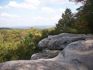
Trough Creek State Park is a 554 acres (224 ha) Pennsylvania state park in Cass, Penn and Todd Townships, Huntingdon County, Pennsylvania in the United States. The majority of the park is in Todd Township along Pennsylvania Route 994, east of the unincorporated village of Entriken. Huntingdon is the nearest borough. The park borders Rothrock State Forest and Raystown Lake National Recreation Area. There is a growing population of bald eagles at the lake. Fourteen eagles were spotted in January 2007. This is up from two that were spotted in 1990, the first year that an eagle survey was taken. These three sections of state and federal owned property combine together to provide hunting, hiking and fishing opportunities for the outdoorsman.

<span class="mw-page-title-main">Big Spring State Park (Pennsylvania)</span> State park in Perry County, Pennsylvania

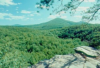
Big Spring State Park is a 45-acre (18 ha) Pennsylvania state park in Toboyne Township, Perry County, Pennsylvania in the United States. The park is on Pennsylvania Route 274, 5.5 miles (8.9 km) southwest of New Germantown. Big Spring State Park is a hiking and picnic area. A partially completed railroad tunnel in Conococheague Mountain is a feature of the park.

<span class="mw-page-title-main">Fowlers Hollow State Park</span> State park in Perry County, Pennsylvania

Fowlers Hollow State Park is a 104-acre (42 ha) Pennsylvania state park in Toboyne Township, Perry County, Pennsylvania in the United States. The park is 0.25 miles (400 m) from Blain just off Pennsylvania Route 274. Fowlers Hollow State Park is on the site of a former sawmill, and was developed as a park by the Works Progress Administration during the Great Depression.

<span class="mw-page-title-main">Laurel Summit State Park</span>

Laurel Summit State Park is a 6-acre (2.4 ha) Pennsylvania state park in Cook Township, Westmoreland County, Pennsylvania in the United States. It is also a picnic area with a scenic view of Linn Run on the summit of Laurel Mountain. The temperatures at Laurel Summit State Park are generally several degrees cooler than the surrounding towns in the valleys. The elevation of the park is 2,739 feet (835 m) above sea level.

<span class="mw-page-title-main">Martin Hill (Pennsylvania)</span>

Martin Hill is a mountain ridge which connects Tussey Mountain to its east and Evitts Mountain to its west. Martin Hill is located in the Martin Hill Wild Area, which is a part of the Buchanan State Forest, in Bedford County, Pennsylvania, United States. The summit of Martin Hill is one of the few in the Commonwealth which is void of any towers or transmitters; such equipment is located instead on a lesser nearby summit in the same mountain complex. Martin Hill is the second highest in Pennsylvania's Ridge and Valley Appalachians, the highest being Wills Mountain to its west at 2,780 ft (850 m).

References

  1. U.S. Geological Survey Geographic Names Information System: Buchanan State Forest
  2. 1 2 "History of the William Penn State Forest". Pennsylvania Department of Conservation and Natural Resources. Archived from the original on 2007-08-23. Retrieved 2007-08-29.
  3. 1 2 3 4 "History of the Buchanan State Forest". Pennsylvania Department of Conservation and Natural Resources. Archived from the original on April 6, 2004. Retrieved 2007-06-12.
  4. "Laurel Mountain State Park". Pennsylvania Department of Conservation and Natural Resources. Archived from the original on June 9, 2011. Retrieved 2007-06-12.
  5. Mary Byrd Davis (23 January 2008). "Old Growth in the East: A Survey. Pennsylvania" (PDF). Archived from the original (PDF) on 2009-12-29.