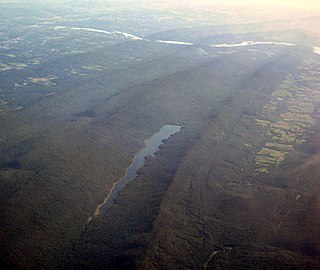
Swatara Creek is a 72-mile-long (116 km) tributary of the Susquehanna River in east central Pennsylvania in the United States. It rises in the Appalachian Mountains in central Schuylkill County and passes through northwest Lebanon Valley before draining into the Susquehanna at Middletown.
Pine Creek is a tributary of Mahantango Creek in Schuylkill and Dauphin counties, Pennsylvania, in the United States. It is approximately 23.7 miles (38.1 km) long. The creek flows through Foster Township, Hegins Township, Hubley Township, and Upper Mahantango Township in Schuylkill County and Lykens Township in Dauphin County. The creek's watershed has an area of 76.8 square miles (199 km2) and its tributaries include Rausch Creek and Deep Creek. Pine Creek is considered by the Pennsylvania Department of Environmental Protection to be impaired by abandoned mine drainage and resource extraction. However, it is designated as a coldwater fishery.

Penns Creek is a 67.1-mile-long (108.0 km) tributary of the Susquehanna River in central Pennsylvania in the United States.

Yellow Breeches Creek, also known as Callapatscink Creek, Callapatschink Creek or Shawnee Creek is a 56.1-mile-long (90.3 km) tributary of the Susquehanna River in central Pennsylvania, USA. There is no agreed upon explanation for the name Yellow Breeches Creek, which it is found in land warrants as early as 1736.
Wiconisco Creek is a tributary of the Susquehanna River in Schuylkill and Dauphin counties, Pennsylvania, in the United States. It is approximately 45.5 miles (73.2 km) long.

Cocalico Creek is a 27.2-mile-long (43.8 km) tributary of the Conestoga River in Lebanon and Lancaster counties in Pennsylvania in the United States. The source is at an elevation of 1,320 feet (400 m) near Stricklerstown in Millcreek Township, Lebanon County. The mouth is the confluence with the Conestoga River at an elevation of 278 feet (85 m) at Talmage in West Earl Township, Lancaster County.
Conewago Creek is a 23.0-mile-long (37.0 km) tributary of the Susquehanna River in Lebanon, Dauphin, and Lancaster counties in Pennsylvania in the United States. The source is at an elevation of 1,100 feet (340 m) at Mount Gretna Heights in Lebanon County. The mouth is the confluence with the Susquehanna River at an elevation of 261 feet (80 m) at the border of Dauphin and Lancaster counties, just south of Three Mile Island in the river and just north of the unincorporated village of Falmouth in Conoy Township, Lancaster County.

Conewago Creek is an 80.2-mile-long (129.1 km) tributary of the Susquehanna River in Adams and York counties in Pennsylvania in the United States, with its watershed also draining a small portion of Carroll County, Maryland. The source is at an elevation of 1,440 feet (440 m), east of Caledonia State Park, in Franklin Township in Adams County. The mouth is the confluence with the Susquehanna River at York Haven in York County at an elevation of 259 feet (79 m).
Rausch Gap is a ghost town in Cold Spring Township, Lebanon County, Pennsylvania in the United States.

Tucquan Creek is a 5.9-mile-long (9.5 km) stream and tributary of the Susquehanna River near Holtwood in southern Lancaster County, Pennsylvania. Together with parts of Clark Run and Tucquan Glen it is a designated Pennsylvania Scenic River. The Tucquan Glen hiking trail goes along both sides of the creek, starting from River Road and ending at the railroad tracks along the Susquehanna. In addition to the rugged loop trail, is a relatively flat dirt road going along and often crossing the creek to said railroad tracks.
Mahantango Creek is a 36.2-mile-long (58.3 km) tributary of the Susquehanna River in Dauphin, Northumberland, Schuylkill, and Snyder County counties, Pennsylvania in the United States.
Powell Creek is a 16.5-mile-long (26.6 km) tributary of the Susquehanna River in Dauphin County, Pennsylvania in the United States.
Fishing Creek is an 11.5-mile-long (18.5 km) tributary of the Susquehanna River in Dauphin County, Pennsylvania, in the United States.

Clark Creek is a 31.4-mile-long (50.5 km) tributary of the Susquehanna River in Dauphin County, Pennsylvania, in the United States. Clark Creek was named for the Clark family who settled near its banks in the 1720s.
Black Run is a 3.9-mile-long (6.3 km) tributary of Paxton Creek in Dauphin County, Pennsylvania, in the United States.
Mahantango Creek is a 2.1-mile-long (3.4 km) tributary of the Susquehanna River in Snyder and Juniata counties, Pennsylvania, in the United States. Its name comes from a Delaware Indian word meaning "where we had plenty to eat". The creek flows along the border between Snyder County and Juniata County.
Spring Creek is a 6.0-mile-long (9.7 km) tributary of the Susquehanna River in Dauphin County, Pennsylvania, in the United States.
Rausch Creek may refer to:
Wolffs Run is a tributary of Stony Creek in Luzerne County, Pennsylvania. It is approximately 0.4 miles (0.64 km) long and flows through Hazle Township. The watershed of the stream has an area of 0.6 square miles (1.6 km2). A reservoir known as the Humboldt Reservoir is located on it. The reservoir serves as a water supply and is dammed by the Humboldt Dam.


