
Lawrence County is a county located in the U.S. state of Arkansas. As of the 2010 census, the population was 17,415. The county seat is Walnut Ridge. Lawrence County is Arkansas's second county, formed on January 15, 1815, and named for Captain James Lawrence who fought in the War of 1812. It is an alcohol prohibition or dry county.

Smithville is a city in Clay and Platte counties in the U.S. state of Missouri and is part of the Kansas City metropolitan area, along the Little Platte River. The population was 8,425 at the 2010 United States Census.

The Confederate State Capitol building in Washington, Arkansas was the capital of the Confederate state government of Arkansas, during 1863–1865, after Little Rock, Arkansas fell to Union forces in the American Civil War. It is located within Historic Washington State Park, and is a National Historic Landmark.

North Scituate is a village in the town of Scituate, Rhode Island. Since 1967, the village has been home to the Scituate Art Festival.
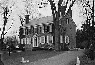
Lawrence Township Historic District is a historic district that preserves the community of Lawrence Township, Mercer County, New Jersey, United States.

Highway 115 is a state highway in Northeast Arkansas. The route begins at US Highway 167 and Highway 58 in Cave City and runs northeast to Missouri Route 21 near Doniphan, Missouri, including a 14 miles (23 km) concurrency with US 62/US 412 between Imboden and Pocahontas. The highway is maintained by the Arkansas Department of Transportation (ARDOT).
Bruno is an unincorporated community in Marion County, Arkansas, United States. It is the location of five places listed on the National Register of Historic Places:

Hiwasse was an unincorporated census-designated place in Benton County, Arkansas, United States. As of the 2010 census, its population was 497. It is the location of Hiwasse Bank Building, which is located at Main St., AR 279 and Banks House, which is located on AR 72 west of Hiwasse. Both are listed on the National Register of Historic Places.
Lake Dick is an unincorporated community in Jefferson County, Arkansas, United States. Lake Dick is northeast of Pine Bluff and south of Altheimer.
Arkansas Highway 117 is a north–south state highway in Lawrence County, Arkansas. The route of 16.54 miles (26.62 km) runs from a junction of Highway 25 and Highway 230 in Strawberry north across US Route 63/US 412 (US 63/US 412) to 3rd Street in Black Rock.

This is a list of the National Register of Historic Places listings in Lawrence County, Arkansas.

Powhatan Historic State Park is a 9.1-acre (3.7 ha) Arkansas state park in Lawrence County, Arkansas in the United States. The park contains the 1888 Powhatan courthouse which served as the home of county government from 1869-1968. Today the structure displays items of cultural and historical significance and hosts the park's Visitor Center. The park includes four additional historical buildings and the Arkansas History Commission's Northeast Arkansas Regional Archives. A tour of the historic structures is available. Powhatan served as an important stop for traffic on the Black River until the installation of the Kansas City-Memphis Railwayline two miles north in 1883 significantly decreased the need for river transportation.
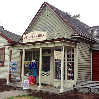
The Smithville Apothecary is a historic building located off Moss Mill Road in Smithville, Atlantic County, New Jersey. It was added to the National Register of Historic Places on June 9, 1978.

Bethel Cemetery is a cemetery in rural western Lawrence County, Arkansas. It is located off County Road 225, about 1.1 miles (1.8 km) north of Arkansas Highway 117, roughly midway between Black Rock and Smithville. Its oldest portion occupies a roughly triangular parcel of land, surrounded by a perimeter road, with a gate at the eastern corner. It is located next to the site of a church which was established in the 1820s, and its oldest grave is supposedly the 1835 burial of an American Revolutionary War veteran. The oldest dated grave marker is marked 1858, and the cemetery continues to be used today. The cemetery is a reminder of the community of Denton, which flourished in the mid-19th century, but declined after it was bypassed by the railroad.

The Clover Bend High School is a historic community building on Arkansas Highway 228 in Clover Bend, Arkansas. It is a single-story wood-frame structure, with a main central hip-roofed block, symmetrical side wings with gable roofs, and a rear projecting auditorium section. It was built in 1937–38 with funding from the Farm Security Administration, with a number of additional buildings added to the complex in later years, including a gymnasium, elementary school, and administrator housing. This complex formed the core of a major rural resettlement project, which included more than 90 farms.

The Portia School is a historic school building at City Park in Portia, Arkansas. The two story red brick structure was built in 1914, and was the small town's only school until 1948. It is by far the most architecturally significant early-20th century building in the community. The building is five bays wide, with each pair of bays flanking the central one stepped back, giving it a rough cross shape. The entrance is housed in the central bay, with a gabled pediment at the roof line. The main roof is hipped, with brackets in the eaves and a cupola at the center.

The Old Springdale High School is a historic former school building on Johnson Street in Springdale, Arkansas. It is a 2+1⁄2-story red brick Romanesque Revival building, with round-arch windows at the second level and a prominent entry pavilion at the center. The school was designed by A. O. Clark and completed in 1909. It is distinguished as a fine example of Clark's early work, and as the city's finest example of Romanesque architecture.

The Woman's Community Club Band Shell is a historic open-air band shell in Spring Park, a public park in downtown Heber Springs, Arkansas. It is a roughly rectangular structure, built out of local fieldstone, with the main half-dome shell formed out of concrete. The sides of the shell are articulated by pilasters, which also appear at the building corners. The rear of the building is enclosed, provide dressing room space for performers. The shell was built in 1933, replacing an older wood-frame performance pavilion.
Tulip is an unincorporated community in Dallas County, Arkansas, United States. The community is on Arkansas Highway 9 5.7 miles (9.2 km) west of Carthage.


