South Yarra railway station

Last updated

South Yarra
PTV commuter rail station
South Yarra station entrance at night.jpg
Station facade and entrance, May 2011
General information
LocationToorak Road,
South Yarra, Victoria 3141
City of Stonnington
Australia
Coordinates 37°50′20″S144°59′32″E / 37.8389°S 144.9922°E / -37.8389; 144.9922
Owned by VicTrack
Operated by Metro Trains
Line(s)
Distance5.41 kilometres from
Southern Cross
Platforms6 (2 side, 2 island)
Tracks6
Connections Melbourne tram logo.svg Tram
Construction
Structure typeGround
AccessibleNo—steep ramp
Other information
StatusOperational, premium station
Station codeSYR
Fare zone Myki Zone 1
Website Public Transport Victoria
History
Opened22 December 1860;163 years ago (1860-12-22)
ElectrifiedMay 1919 (1500 V DC overhead)
Previous namesGardiner's Creek Road (1860–1866)
Passengers
2005–20062,364,291 [1]
Preceding station Melbourne train logo.svg Metro Trains Following station
Richmond Pakenham line Malvern
Limited service
towards Pakenham
Caulfield
towards Pakenham
Cranbourne line Malvern
Limited service
towards Cranbourne
Caulfield
towards Cranbourne
Richmond Frankston line Hawksburn
towards Frankston
Frankston line
Weekday peak express services
Malvern
Citybound express services
towards Frankston
Caulfield
towards Frankston
Richmond Sandringham line Prahran
towards Sandringham
Track layout
BSicon MFADEg.svg
BSicon STR.svg
BSicon MFADEg.svg
BSicon STR.svg
BSicon MFADEg.svg
BSicon STR.svg
BSicon MFADEg.svg
BSicon STR.svg
BSicon MFADEg.svg
BSicon STR.svg
BSicon MFADEg.svg
BSicon STR.svg
BSicon STR.svg
BSicon STR.svg
BSicon STR.svg
BSicon STR.svg
BSicon STR.svg
BSicon STR.svg
BSicon hSTRae(r).svg
BSicon STR.svg
BSicon STR.svg
BSicon STR.svg
BSicon STR.svg
BSicon hSTRae(l).svg
BSicon STRg.svg
BSicon STRf.svg
BSicon STRg.svg
BSicon STRf.svg
BSicon STRg.svg
BSicon STRf.svg
BSicon hSTRae(r).svg
BSicon STR.svg
BSicon STR.svg
BSicon STR.svg
BSicon STR.svg
BSicon hSTRae(l).svg
BSicon STR.svg
BSicon STR.svg
BSicon STR.svg
BSicon STR.svg
BSicon STR.svg
BSicon STR.svg
BSicon MFADEgq.svg
BSicon RBq.svg
BSicon hSKRZ-Ba(r).svg
BSicon STR.svg
BSicon STR.svg
BSicon STR.svg
BSicon STR.svg
BSicon hSKRZ-Ba(l).svg
BSicon MFADEfq.svg
BSicon RBq.svg
BSicon MFADEgq.svg
BSicon WASSERq.svg
BSicon hKRZWe(Rr).svg
BSicon STR.svg
BSicon STR.svg
BSicon STR.svg
BSicon STR.svg
BSicon hKRZWe(Ll).svg
BSicon MFADEfq.svg
BSicon WASSERq.svg
BSicon STR.svg
BSicon STR.svg
BSicon STR.svg
BSicon STR.svg
BSicon GRZq.svg
BSicon STR.svg
BSicon STR.svg
End CBTC
1
BSicon PSTR(R).svg
2
BSicon PSTR(L).svg
BSicon PSTR(R).svg
4
BSicon PSTR(L).svg
BSicon PSTR(R).svg
6
BSicon PSTR(L).svg
BSicon PSTR(R).svg
BSicon PSTR(L).svg
3
BSicon PSTR(R).svg
BSicon PSTR(L).svg
5
BSicon PSTR(R).svg
BSicon PSTR(L).svg
BSicon STR.svg
BSicon STR.svg
BSicon STR.svg
BSicon STR.svg
BSicon STR.svg
BSicon GRZq.svg
BSicon STR.svg
Start CBTC
BSicon STRg.svg
BSicon STRf.svg
BSicon STRg.svg
BSicon STRf.svg
BSicon STRg.svg
BSicon STRf.svg
BSicon STR.svg
BSicon STR.svg
BSicon MFADEf.svg
BSicon STR2.svg
BSicon MFADEf.svg
BSicon STR2.svg
BSicon MFADEf.svg
BSicon STR2.svg
BSicon MFADEf.svg
BSicon STR2.svg
BSicon MFADEf.svg
BSicon STR.svg
BSicon MFADEf.svg
BSicon STR.svg

South Yarra railway station is a commuter railway station and the junction point for the Cranbourne, Frankston, Pakenham and Sandringham lines, serving the south Melbourne suburb of South Yarra, Victoria, Australia. [4] [5] South Yarra is a premium status ground structure station featuring six platforms, with two island platforms and two side platforms connected by a ramp accessible overground concourse. The station opened on 22 December 1860 as Gardiners Creek Road before being renamed South Yarra on 1 January 1867. [6]

Contents

History

South Yarra station was opened by the Melbourne and Suburban Railway Company as Gardiners Creek Road. Initially, it served the Brighton line, on what was called the "Prahran Branch". On 1 January 1867, the station was renamed South Yarra. [6] The private railway company, by then the Melbourne and Hobson's Bay United Railway Company, was taken over by the Government of Victoria in 1878, and its network became part of the Victorian Railways.

In 1924, historian John Cooper noted that when the South Yarra to Oakleigh line was first constructed, a set of points connected the line to the existing Brighton line. However, a high embankment obscured the vision of train drivers approaching South Yarra on both lines. To solve that problem, it was decided that the Oakleigh line should have its own tracks into Melbourne, and the Cremorne Railway Bridge, spanning the Yarra River, was duplicated to allow that. [7]

The opening of the South Yarra to Oakleigh line in 1879 made the proposed Outer Circle line largely redundant, but it was constructed anyway, a decade later.

In 1914, the line between South Yarra and Caulfield was completely rebuilt. The works included the quadruplication of the line, and the reconstruction of the stations at Hawksburn, Toorak, Armadale and Malvern. [8]

In 1946, the current Cremorne Railway Bridge over the Yarra River was opened, replacing the earlier one. [6] In 1947, a works siding opened, which was disconnected in 1955. [6]

Even after the laying of six tracks from Richmond to South Yarra, and the abolition of the signal box, the station retained three emergency crossovers at the up end of Platforms 1 and 2, 3 and 4 and 5 and 6. The latter set was removed in 1983, followed by the middle pair by 23 June 1984, [9] and the final set in August 1986. [10] The crossovers were originally provided in 1945 and 1960. [6] Also in 1960, the "local lines", used by Pakenham and Cranbourne line services, were extended to Richmond, and the signal box, located at the up end of Platforms 4 and 5, was closed, [6] but still remains in place.

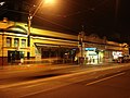
In 1993, there were major re-signalling works between South Yarra and Toorak, [6] with similar works occurring between South Yarra and Richmond in 1994. [6] In 1997, South Yarra was upgraded to a premium station. [11] As such, the station is staffed from the first to the last service each day.

According to Public Transport Victoria data, South Yarra is the eighth-busiest station on the Melbourne metropolitan network, with 4.59 million boardings per year during the 2017/2018 financial year. [12]

In early 2020, it was announced that South Yarra was to undergo a $12 million refurbishment. The entrance to the station on Toorak Road was to be widened, and the layout changed to make the station larger. [13] [14]

Services on the Pakenham and Cranbourne lines will no longer stop at South Yarra when the Metro Tunnel opens, which is scheduled to take place in 2025. The entrance portal to the Metro Tunnel is located near the station, but South Yarra will not be integrated into the new tunnel, which generated some criticism. [15] [16]

Platforms and services

South Yarra station has six platforms: two side platforms and two island platforms with four faces. It is served by Cranbourne, [17] Frankston, [18] Pakenham [19] and Sandringham [20] line trains. V/Line's Bairnsdale rail services (Gippsland line) pass non-stop through the station.

Platform 1:

Platform 2:

Platform 3:

Platform 4:

Platform 5:

Platform 6:

From 2025, Pakenham and Cranbourne lines will no longer serve South Yarra because they will be routed through the Metro Tunnel to Sunbury.

Yarra Trams operates one route via South Yarra station:

Related Research Articles

<span class="mw-page-title-main">City Loop</span> Rail tunnel through the Melbourne CBD

The City Loop is a piece of underground commuter rail infrastructure in the central business district (CBD) of Melbourne, Victoria, Australia

<span class="mw-page-title-main">Richmond railway station, Melbourne</span> Railway station in Melbourne, Australia

Richmond railway station is a commuter railway station and the junction point for the Alamein, Belgrave, Cranbourne, Frankston, Glen Waverley, Lilydale, Pakenham and Sandringham lines, serving the south-eastern inner Melbourne suburb of Richmond, Victoria, Australia. Richmond is a premium status elevated structure station featuring ten platforms, with five island platforms. The stations opened on 8 February 1859 as Punt Road before being renamed Swan Street on 12 December of the same year, it was renamed Richmond on 1 January 1867.

<span class="mw-page-title-main">Hawksburn railway station</span> Railway station in Melbourne, Australia

Hawksburn railway station is a commuter railway station on the Frankston line, serving the south Melbourne suburb of South Yarra, Victoria, Australia. Hawksburn is an unstaffed status below ground structure station featuring four platforms, with an island platform and two side platforms all accessed by a pedestrian bridge. The station is listed on the Victorian Heritage Register, and was opened on 7 May 1879, with the stations’ namesake being the locality of Hawksburn, 600 metres from the station. The station is only partially accessible due to multiple steep access ramps.

<span class="mw-page-title-main">Toorak railway station</span> Railway station in Melbourne, Australia

Toorak railway station is a commuter railway station on the northern boundary of Armadale, a suburb of Melbourne, Victoria, Australia. The station is listed on the Victorian Heritage Register, and was opened on 7 May 1879. The station is named after the nearby suburb of Toorak—located north of the station. The station consists of an island platform and two side platforms all accessed by a pedestrian bridge. There are two principal station buildings located on the central platform and on platform 4, consisting of a small two and one-story brick buildings. These buildings were provided in 1914, as ticketing and staff offices. The station is only partially accessible due to a multiple steep access ramps.

<span class="mw-page-title-main">Armadale railway station, Melbourne</span> Railway station in Melbourne, Australia

Armadale railway station is a commuter railway station in Armadale, a suburb of Melbourne, Victoria, Australia. The station is listed on the Victorian Heritage Register and was opened on 7 May 1879. The station consists of an island platform and two side platforms, all accessed by a pedestrian bridge. There are two principal station buildings located on the central platform and on platform 4, consisting of a small two and one-story brick buildings. These buildings were provided in 1914 as ticketing and staff offices. The station is only partially accessible due to a multiple steep access ramps.

<span class="mw-page-title-main">Malvern railway station, Melbourne</span> Railway station in Melbourne, Australia

Malvern railway station is a commuter railway station that is part of the Melbourne railway network in Victoria, Australia. The station is located on the southern border of Malvern, a suburb of Melbourne, and was opened on 7 May 1879. The station complex consists of an island platform and two side platforms all accessed by a pedestrian bridge. There are two red brick Edwardian-era station buildings, constructed in 1914 as ticketing and staff offices. The entire complex is listed on the Victorian Heritage Register because of its architectural significance and its role in the development of Malvern as a significant metropolitan centre. The station is only partially accessible because of multiple steep access ramps.

<span class="mw-page-title-main">Caulfield railway station</span> Railway station in Melbourne, Australia

Caulfield railway station is a commuter railway station on the northern boundary of Caulfield East, a suburb of Melbourne, Victoria, Australia. Opened in 1879 and rebuilt from 1913 to 1914, the station complex is listed on the Victorian Heritage Register and is noted as an example of Federation Free Style architecture. It is named after the nearby suburb of Caulfield, located southwest of the station.

<span class="mw-page-title-main">Carnegie railway station</span> Railway station in Melbourne, Australia

Carnegie railway station is a commuter railway station located in the suburb of Carnegie, in the southeastern suburbs of Melbourne, Victoria, Australia. The station originally opened in 1879 as Rosstown. The station received its current name in 1909 alongside the renaming of the suburb. The station consists of a single island platform connected to the station concourse on Koornang Road via escalators, lifts and a staircase.

<span class="mw-page-title-main">Murrumbeena railway station</span> Railway station in Melbourne, Australia

Murrumbeena railway station is located on the Pakenham and Cranbourne lines in Victoria, Australia. It serves the south-eastern Melbourne suburb of Murrumbeena, and it opened on 14 May 1879.

<span class="mw-page-title-main">Hughesdale railway station</span> Railway station in Melbourne, Australia

Hughesdale railway station is located on the Pakenham and Cranbourne lines in Victoria, Australia. It serves the south-eastern Melbourne suburb of Murrumbeena, and opened on 28 February 1925.

<span class="mw-page-title-main">Oakleigh railway station</span> Railway station in Melbourne, Australia

Oakleigh railway station is a commuter railway station in the suburb of Oakleigh in the south-east of Melbourne, Victoria, Australia. The station opened in 1877 as the up end of the Gippsland line, with the station being electrified in 1922. The station consists of two sides that are connected to each other via the adjacent roads, and both platforms are connected to each other via a pedestrian subway.

<span class="mw-page-title-main">Huntingdale railway station</span> Railway station in Melbourne, Australia

Huntingdale railway station is a commuter railway station located adjacent to the suburbs of Oakleigh and Huntingdale located in the south east of Melbourne, Victoria in Australia. The station originally opened in 1927 as "East Oakleigh". It did not receive its current name until 1954. The station consists of a single island platform connected to both Railway Avenue and Haughton Road via a pedestrian subway.

<span class="mw-page-title-main">Clayton railway station, Melbourne</span> Railway station in Melbourne, Australia

Clayton railway station is a commuter railway station located in the suburb of Clayton, in the south-eastern suburbs of Melbourne, Victoria, Australia. The station originally opened in 1880 as "Clayton's Road". It did not receive its current name until 1890. The station consists of a single island platform connected to the station concourse on Clayton Road via escalators, lifts and a staircase. The station was previously at grade; however, in 2018, a new elevated station was rebuilt as part of the Level Crossing Removal Project.

<span class="mw-page-title-main">Westall railway station</span> Railway station in Melbourne, Australia

Westall railway station is located on the Pakenham and Cranbourne lines in Victoria, Australia. It serves the south-eastern Melbourne suburb of Clayton South, and opened on 6 February 1951.

<span class="mw-page-title-main">Springvale railway station</span> Railway station in Melbourne, Australia

Springvale railway station is located on the Pakenham and Cranbourne lines in Victoria, Australia. It serves the south-eastern Melbourne suburb of Springvale, and it opened on 1 September 1880 as Spring Vale. It was renamed Springvale on 29 February 1972.

<span class="mw-page-title-main">Yarraman railway station</span> Railway station in Melbourne, Australia

Yarraman railway station is a minor commuter railway station on the Cranbourne and Pakenham lines of the metropolitan railway network in Victoria, Australia, located about 27 km (17 mi) from the Melbourne CBD. It serves neighbourhoods between the south-eastern Melbourne suburbs of Noble Park and Dandenong, and is named after the nearby Yarraman Creek, a first-order tributary of the lower Dandenong Creek/Patterson River system.

<span class="mw-page-title-main">Dandenong railway station</span> Railway station in Melbourne, Australia

Dandenong railway station is the junction for the Cranbourne and Pakenham lines in Victoria, Australia. It serves the south-eastern Melbourne suburb of the same name, and opened on 8 October 1877.

<span class="mw-page-title-main">Pakenham line</span> Passenger rail service in metropolitan Melbourne, Victoria, Australia

The Pakenham line is a commuter railway line in the city of Melbourne, Victoria, Australia. Operated by Metro Trains Melbourne, it is the city's longest metropolitan railway line at 57 kilometres (35 mi). The line runs from Flinders Street station in central Melbourne to Pakenham station in the south-east, serving 27 stations via the City Loop, South Yarra, Caulfield, Oakleigh, and Dandenong. The line operates for approximately 20 hours a day with 24 hour service available on Friday and Saturday nights. During peak hour, headways of up to 5 to 10 minutes are operated with services every 20 minutes during off-peak hours. Trains on the Pakenham line run with a seven-car formation operated by High Capacity Metro Trains.

<span class="mw-page-title-main">Sandringham line</span> Passenger rail service in Melbourne, Australia

The Sandringham line is a commuter railway line in the city of Melbourne, Victoria, Australia. Operated by Metro Trains Melbourne, it is the city's fourth shortest metropolitan railway line at 17.9 kilometres (11.1 mi). The line runs from Flinders Street station in central Melbourne to Sandringham station in the south-east, serving 14 stations via South Yarra, Balaclava, Elsternwick, and Brighton. The line operates from approximately 5am to 12am, daily, with 24 hour service available on Friday and Saturday nights. Services run every 7–8 minutes during peak hour, with services running every 15 minutes during the inter-peak period on weekdays, and every 20 minutes at night and during the day on weekends. Additionally, services run every 60 minutes overnight on Friday and Saturday nights as part of the Night Network.

<span class="mw-page-title-main">Cranbourne line</span> Passenger rail service in metropolitan Melbourne, Victoria, Australia

The Cranbourne line is a commuter railway line in the city of Melbourne, Victoria, Australia. Operated by Metro Trains Melbourne, it is the city's second longest metropolitan railway line at 44 kilometres (27 mi). The line runs from Flinders Street station in central Melbourne to Cranbourne station in the south-east, serving 24 stations via the City Loop, South Yarra, Caulfield, Oakleigh, and Dandenong. The line operates for approximately 20 hours a day with 24 hour service available on Friday and Saturday nights. During peak hour, headways of up to 5 to 15 minutes are operated with services every 15–20 minutes during off-peak hours. Trains on the Cranbourne line run with a seven-car formation operated by High Capacity Metro Trains.

References

  1. 1 2 3 4 Estimated Annual Patronage by Network Segment Financial Year 2005–2006 to 2018–19 Department of Transport
  2. 1 2 3 4 5 6 7 8 9 10 11 12 Railway station and tram stop patronage in Victoria for 2008–2021 Philip Mallis
  3. Annual metropolitan train station patronage (station entries) Data Vic
  4. "South Yarra public transport - Travel Victoria: accommodation & visitor guide". www.travelvictoria.com.au. Retrieved 29 October 2023.
  5. "South Yarra Railway Station". VicScreen. Retrieved 29 October 2023.
  6. 1 2 3 4 5 6 7 8 "South Yarra". vicsig.net. Retrieved 13 January 2023.
  7. Cooper, John Butler (1924). The history of Prahran 1836–1924 : from its first settlement to a city. Melbourne, Vic: Modern Printing Co. p. 307.
  8. "Report of the Victorian Railways Commissioners for the Year Ending 30th June, 1916" (PDF). Parliament of Victoria. Retrieved 7 April 2020.
  9. "Works". Newsrail . Australian Railway Historical Society (Victorian Branch). August 1984. p. 252.
  10. "Works". Newsrail. Australian Railway Historical Society (Victorian Branch). March 1987. p. 91.
  11. "Upgrading Eltham to a Premium Station". Newsrail. Australian Railway Historical Society (Victorian Division). October 1997. pp. 303–315.
  12. "Station Patronage Data 2013–2018". Philip Mallis. Transport for Victoria. Retrieved 4 November 2019.
  13. Jacks, Timna (17 April 2018). "South Yarra station set for a $12 million makeover". The Age . Retrieved 5 May 2023.
  14. "South Yarra Station upgrade". Public Transport Victoria . Retrieved 5 May 2023.
  15. Carey, Adam (15 May 2015). "New underground station for South Yarra ruled out in rail tunnel plans". The Age. Retrieved 5 November 2021.
  16. Gordon, Josh; Willingham, Richard; Preiss, Benjamin (22 October 2015). "Federal rail cash under a cloud over South Yarra station stoush". The Age. Retrieved 5 November 2021.
  17. "Cranbourne Line". Public Transport Victoria.
  18. "Frankston Line". Public Transport Victoria.
  19. "Pakenham Line". Public Transport Victoria.
  20. "Sandringham Line". Public Transport Victoria.
  21. "58 West Coburg - Toorak". Public Transport Victoria.
  22. PROV

Commons-logo.svg Media related to South Yarra railway station, Melbourne at Wikimedia Commons