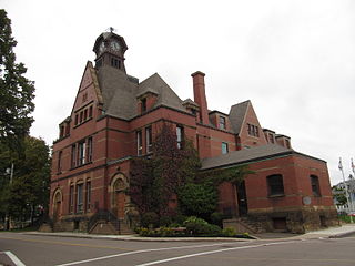
St. Peters Bay | |
---|---|
Municipality of St. Peters Bay | |
Coordinates: 46°25′01″N62°34′52″W / 46.417°N 62.581°W | |
Country | Canada |
Province | Prince Edward Island |
County | Kings County |
Incorporated [1] | 1953 |
Population (2011) [1] | |
• Total | 253 |
Time zone | AST |
• Summer (DST) | ADT |
Area code | 902 |
Telephone Exchange | 961 |
St. Peters Bay is a municipality that holds community status in Prince Edward Island, Canada. [2] It was incorporated in 1953. [1] St. Peters Bay is well known for its annual Blueberry Festival and Parade, which draws in tourists and locals alike.
St. Peters Bay has a humid continental climate (Köppen Dfb). The average annual temperature in St. Peters Bay is 6.2 °C (43.2 °F). The average annual rainfall is 1,115.7 mm (43.93 in) with October as the wettest month. The temperatures are highest on average in July, at around 18.9 °C (66.0 °F), and lowest in February, at around −6.5 °C (20.3 °F). The highest temperature ever recorded in Maniwaki was 34.0 °C (93.2 °F) on 10 August 2001; the coldest temperature ever recorded was −34.5 °C (−30.1 °F) on 7 February 1993.
Climate data for St. Peters Bay Climate ID: 8300562; coordinates 46°27′01″N62°34′33″W / 46.45028°N 62.57583°W ; elevation: 29.7 m (97 ft); WMO ID: 71310; 1991–2020 normals, extremes 1960–present | |||||||||||||
---|---|---|---|---|---|---|---|---|---|---|---|---|---|
Month | Jan | Feb | Mar | Apr | May | Jun | Jul | Aug | Sep | Oct | Nov | Dec | Year |
Record high humidex | 21.1 | 14.5 | 24.8 | 27.8 | 33.6 | 38.4 | 39.9 | 39.0 | 38.4 | 35.5 | 25.8 | 21.7 | 39.9 |
Record high °C (°F) | 17.8 (64.0) | 14.8 (58.6) | 23.6 (74.5) | 26.4 (79.5) | 31.5 (88.7) | 33.0 (91.4) | 33.3 (91.9) | 34.0 (93.2) | 33.0 (91.4) | 27.5 (81.5) | 22.0 (71.6) | 17.9 (64.2) | 34.0 (93.2) |
Mean daily maximum °C (°F) | −2.1 (28.2) | −2.5 (27.5) | 1.2 (34.2) | 6.7 (44.1) | 13.3 (55.9) | 18.9 (66.0) | 23.4 (74.1) | 23.1 (73.6) | 19.1 (66.4) | 12.8 (55.0) | 7.2 (45.0) | 1.6 (34.9) | 10.2 (50.4) |
Daily mean °C (°F) | −6.0 (21.2) | −6.5 (20.3) | −2.5 (27.5) | 2.8 (37.0) | 8.6 (47.5) | 14.3 (57.7) | 18.9 (66.0) | 18.8 (65.8) | 14.9 (58.8) | 9.2 (48.6) | 3.9 (39.0) | −1.6 (29.1) | 6.2 (43.2) |
Mean daily minimum °C (°F) | −9.9 (14.2) | −10.5 (13.1) | −6.2 (20.8) | −1.1 (30.0) | 3.9 (39.0) | 9.6 (49.3) | 14.4 (57.9) | 14.4 (57.9) | 10.8 (51.4) | 5.7 (42.3) | 0.7 (33.3) | −4.8 (23.4) | 2.2 (36.0) |
Record low °C (°F) | −30.0 (−22.0) | −34.5 (−30.1) | −27.8 (−18.0) | −16.1 (3.0) | −8.9 (16.0) | −3.9 (25.0) | 1.7 (35.1) | 0.0 (32.0) | −2.8 (27.0) | −7.5 (18.5) | −15.0 (5.0) | −25.0 (−13.0) | −34.5 (−30.1) |
Record low wind chill | −39.0 | −37.4 | −30.9 | −19.5 | −9.1 | −1.5 | 0.0 | 0.0 | −1.8 | −7.2 | −21.1 | −30.8 | −39.0 |
Average precipitation mm (inches) | 87.8 (3.46) | 73.1 (2.88) | 85.9 (3.38) | 81.3 (3.20) | 76.1 (3.00) | 83.3 (3.28) | 84.4 (3.32) | 89.9 (3.54) | 103.3 (4.07) | 121.1 (4.77) | 113.5 (4.47) | 116.1 (4.57) | 1,115.7 (43.93) |
Average precipitation days (≥ 0.2 mm) | 15.0 | 13.7 | 14.0 | 13.9 | 13.6 | 12.5 | 12.8 | 11.8 | 12.8 | 16.0 | 17.4 | 17.7 | 170.9 |
Average relative humidity (%) (at 1500 LST) | 76.8 | 72.8 | 69.7 | 66.8 | 66.1 | 68.2 | 66.4 | 66.0 | 67.4 | 70.0 | 73.4 | 78.4 | 70.2 |
Source: Environment and Climate Change Canada [3] |
Year | Pop. | ±% |
---|---|---|
1956 | 308 | — |
1961 | 321 | +4.2% |
1966 | 289 | −10.0% |
1971 | 370 | +28.0% |
1976 | 322 | −13.0% |
1981 | 335 | +4.0% |
1986 | 265 | −20.9% |
1991 | 284 | +7.2% |
1996 | 283 | −0.4% |
2001 | 267 | −5.7% |
2006 | 248 | −7.1% |
2011 | 253 | +2.0% |
2016 | 237 | −6.3% |
2021 | 231 | −2.5% |
Source: Statistics Canada [4] [5] [6] [7] [8] [9] [10] [11] [12] [13] [14] [15] |
In the 2021 Census of Population conducted by Statistics Canada, St. Peters Bay had a population of 231 living in 111 of its 130 total private dwellings, a change of -2.5% from its 2016 population of 237. With a land area of 4.44 km2 (1.71 sq mi), it had a population density of 52.0/km2 (134.7/sq mi) in 2021. [15]
The community is served mainly by Prince Edward Island Route 2 and Prince Edward Island Route 16 with other areas of the province.
Summerside is a Canadian city in Prince County, Prince Edward Island. It is the second largest city in the province and the primary service centre for the western part of the island.
Tignish is a Canadian town located in Prince County, Prince Edward Island.
Kugluktuk, known as Coppermine until 1 January 1996, is a hamlet at the mouth of the Coppermine River in the Kitikmeot Region of Nunavut, Canada, on Coronation Gulf, southwest of Victoria Island. It is Nunavut's westernmost community, near the border with the Northwest Territories.
Union Road is a rural municipality in Prince Edward Island, Canada. It is located in Queens County.
North Rustico is a Canadian town located in Queens County, Prince Edward Island.
Coral Harbour is a small Inuit community that is located on Southampton Island, Kivalliq Region, in the Canadian territory of Nunavut. Its name is derived from the fossilized coral that can be found around the waters of the community which is situated at the head of South Bay. The name of the settlement in Inuktitut is Salliq, sometimes used to refer to all of Southampton Island. The plural Salliit, means large flat island(s) in front of the mainland.
O'Leary is a village located in Prince County, Prince Edward Island. Its population in the 2021 Canadian Census was 876 people. O'Leary was incorporated as a village in 1951.
Miscouche is a municipality that holds community status in Prince Edward Island, Canada. It is located in Prince County.
Brackley is a rural municipality in Prince Edward Island, Canada. It is located on the northern boundary of Charlottetown, adjoining the Charlottetown Airport that is in the neighbourhood of Sherwood. Brackley originally incorporated in 1983. It absorbed the adjacent former municipality of Winsloe South via amalgamation on December 15, 2017.
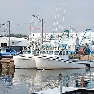
Murray Harbour is a community that holds rural municipality status in Prince Edward Island, Canada. It is located in southeastern Kings County.
Hunter River is a municipality that holds community status in Prince Edward Island, Canada. It is located in Queens County southwest of North Rustico. It is situated on the Hunter River.
Miminegash is a rural municipality in Prince Edward Island, Canada. It is located 8 miles (13 km) northwest of Alberton and 11 miles (18 km) southwest of Tignish. It is part of a small area in Lot 3 known as either the St. Louis, Palmer Road, or Miminegash area. This area is often associated with Tignish due to the shared Acadian roots between these areas.
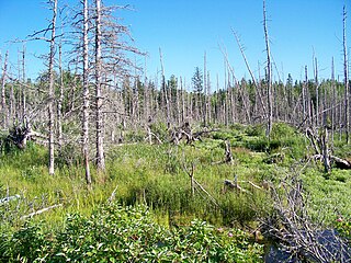
Morell is a rural municipality in Prince Edward Island, Canada. It is located in Kings County east of Bristol.
Murray River is a rural municipality in Prince Edward Island, Canada. It is located in Kings County.
Wellington is a rural municipality in Prince Edward Island, Canada. It is located in Prince County, and extends as Wellington Centre onto Route 2 from Richmond through to St. Nicholas.
St. Louis is a municipality that holds community status in Prince Edward Island, Canada.
Kinkora is a rural municipality in Prince Edward Island, Canada.
Sherbrooke is a rural municipality in Prince Edward Island, Canada.
Miltonvale Park is a municipality that holds community status in Prince Edward Island, Canada. It was incorporated in 1974.
Warren Grove is a municipality that holds community status in Prince Edward Island, Canada. It was incorporated in 1985.