
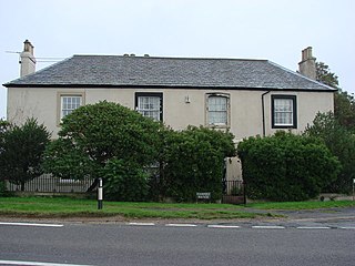
Norton is a village and civil parish in the Metropolitan Borough of Doncaster, on the border with North Yorkshire.
Hampole is a small village and civil parish in the Metropolitan Borough of Doncaster, on the border with West Yorkshire. Historically part of the West Riding of Yorkshire, the eastern boundary of the parish is marked by the Great North Road, and the parish lies in what was once the Barnsdale Forest. It had a population of 187 in 2001, increasing to 203 at the 2011 Census.

Skelbrooke is a small village in the Metropolitan Borough of Doncaster, South Yorkshire, England. It is in the civil parish of Hampole, which had a population of 187.

Clayton is a village in the Metropolitan Borough of Doncaster, on the border with West Yorkshire. It lies to the north of Thurnscoe at an elevation of around 80 metres above sea level.

Maltby is a former mining town and civil parish of 16,688 inhabitants (2011) in the Metropolitan Borough of Rotherham, South Yorkshire, England. It was historically in the West Riding of Yorkshire. It is located about 6 miles (10 km) east of Rotherham town centre and 10 miles (16 km) north-east of Sheffield city centre. It forms a continuous urban area with Hellaby, separated from the rest of Rotherham by the M18 motorway.

Brierley is a town and former civil parish in the Metropolitan Borough of Barnsley in South Yorkshire, England. The civil parish was abolished in 2016. The settlement is tightly clustered and green buffered on a modest escarpment close to the border with West Yorkshire, it is almost wholly in population south of the A628 road, and is less than 2 miles (3 km) to the south west of Hemsworth.

Fenwick is a small village and civil parish in the Metropolitan Borough of Doncaster, on the border with North Yorkshire. It was historically part of the West Riding of Yorkshire until 1974. It is located at an elevation of around 6 metres above sea level and had a population of 113, increasing slightly to 121 at the 2011 Census. The northern boundary of the parish is marked by the River Went.

Adwick upon Dearne is a small village and civil parish on the A6023 road near Mexborough.

Barnburgh is a village and civil parish in the Metropolitan Borough of Doncaster in South Yorkshire, England. The village is adjacent to the village of Harlington - the parish contains both villages, and according to the 2001 census it had a population of 1,979, reducing to 1,924 at the 2011 Census. The village is located 3 miles (4.8 km) north of Mexborough, 2 miles (3.2 km) east of Goldthorpe and 8 miles (13 km) west of Doncaster itself.
Braithwell is a village and civil parish in the Metropolitan Borough of Doncaster in South Yorkshire, England. It is about 1 mile (1.6 km) north from Maltby and 3 miles (5 km) south-east from Conisbrough. According to the 2001 Census the civil parish had a population of 1,056, increasing slightly to 1,060 at the 2011 Census.
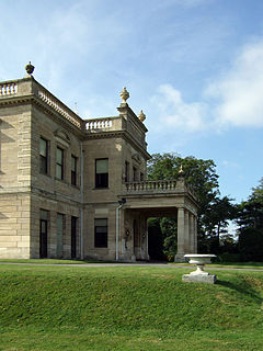
Brodsworth is a village and civil parish in the Metropolitan Borough of Doncaster in South Yorkshire, England, situated about five miles north-west of Doncaster. According to the 2001 census, it had a population of 2,875, increasing to 2,936 at the 2011 Census.

Cadeby is a village and civil parish in the Metropolitan Borough of Doncaster in South Yorkshire, England. The population at the census of 2011 was 203. It is about five miles west of Doncaster, and four miles east of Mexborough.

Wadworth is a village and civil parish in the Metropolitan Borough of Doncaster in South Yorkshire, England. It has a population of 1,229, reducing to 1,137 at the 2011 Census. Notable buildings in the village include Wadworth Hall and the parish church of St John the Baptist.
Bolton upon Dearne is a village in the Metropolitan Borough of Barnsley, South Yorkshire, England, in the part of the Dearne Valley through which the River Dearne passes. Historically part of the West Riding of Yorkshire, it is approximately 7 miles (11 km) east of Barnsley, 10 miles (16 km) west of Doncaster and 8 miles (13 km) north of Rotherham.
Hickleton is a village and civil parish in the Metropolitan Borough of Doncaster in South Yorkshire, England. Historically part of the West Riding of Yorkshire, it had a population of 291, which had reduced slightly to 274 at the 2011 Census.

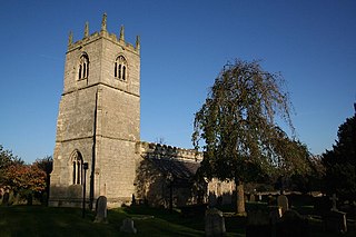
Owston is a small village and civil parish in the Metropolitan Borough of Doncaster in rural South Yorkshire, England. Historically part of the West Riding of Yorkshire, the village is situated amongst mixed farmland and woodland 6 miles (9.7 km) north north west of Doncaster, just west of the A19. It had a population of 170 in 2001, which fell to 145 according to the 2011 Census.

Kirk Bramwith is a village and civil parish in the Metropolitan Borough of Doncaster in South Yorkshire, England. It had a population of 200 in 2001, increasing to 320 at the 2011 Census. The village centre is located on a narrow strip of land, sandwiched between the River Don Navigation to the south east and the New Junction Canal to the north west. It is low-lying, with most of it close to the 16-foot (5 m) contour, and is almost surrounded by drainage ditches.

Loversall is a village and civil parish in the Metropolitan Borough of Doncaster in South Yorkshire, England. It has a population of 128, increasing to 156 at the 2011 Census.

Moss is a village and civil parish in the Metropolitan Borough of Doncaster in South Yorkshire, England. It has a population of 290. increasing to 389 at the 2011 Census. From 1871 to 1953 the village was served by Moss railway station.
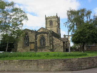
Stainton is a civil parish in the metropolitan borough of Doncaster, South Yorkshire, England. The parish contains 14 listed buildings that are recorded in the National Heritage List for England. Of these, one is listed at Grade II*, the middle of the three grades, and the others are at Grade II, the lowest grade. The parish contains the village of Stainton and the surrounding countryside. Most of the listed buildings are houses and associated structures, farmhouses and farm buildings, and the others are a church, memorials in the churchyard, and a milestone.

