Summerfield, Kansas

Last updated

Summerfield, Kansas
KS99sSignRoad-Summerfield (28267184373).jpg
Summerfield (Feb 2014)
Marshall County Kansas Incorporated and Unincorporated areas Summerfield Highlighted.svg
Location within Marshall County and Kansas
Map of Marshall Co, Ks, USA.png
Coordinates: 39°59′49″N96°20′57″W / 39.99694°N 96.34917°W / 39.99694; -96.34917 [1]
Country United States
State Kansas
County Marshall
Foundedabout 1889
Incorporated 1889
Named for Elias Summerfield
Area
[2]
  Total0.34 sq mi (0.89 km2)
  Land0.34 sq mi (0.89 km2)
  Water0.00 sq mi (0.00 km2)
Elevation
[1]
1,513 ft (461 m)
Population
 (2020) [3]
  Total125
  Density370/sq mi (140/km2)
Time zone UTC-6 (CST)
  Summer (DST) UTC-5 (CDT)
ZIP code
66541
Area code 785
FIPS code 20-68950
GNIS ID 2396000 [1]
Website summerfieldkansas.com

Summerfield is a city in Marshall County, Kansas, United States. [1] As of the 2020 census, the population of the city was 125. [3] The Kansas-Nebraska state border is the north edge of the city.

Contents

History

Summerfield had its start in about 1889 by the building of the railroad through that territory. [4] It was named for Elias Summerfield, a railroad official. [5]

The first post office in Summerfield was established in February 1889. [6]

Geography

According to the United States Census Bureau, the city has a total area of 0.34 square miles (0.88 km2), all of it land. [7]

Demographics

Historical population
CensusPop.Note
1890 102
1900 505395.1%
1910 5549.7%
1920 539−2.7%
1930 398−26.2%
1940 396−0.5%
1950 305−23.0%
1960 237−22.3%
1970 2547.2%
1980 225−11.4%
1990 169−24.9%
2000 21124.9%
2010 156−26.1%
2020 125−19.9%
U.S. Decennial Census

2010 census

As of the census [8] of 2010, there were 156 people, 79 households, and 41 families residing in the city. The population density was 458.8 inhabitants per square mile (177.1/km2). There were 107 housing units at an average density of 314.7 per square mile (121.5/km2). The racial makeup of the city was 98.1% White, 0.6% African American, and 1.3% from two or more races. Hispanic or Latino of any race were 1.3% of the population.

There were 79 households, of which 20.3% had children under the age of 18 living with them, 40.5% were married couples living together, 7.6% had a female householder with no husband present, 3.8% had a male householder with no wife present, and 48.1% were non-families. 39.2% of all households were made up of individuals, and 12.6% had someone living alone who was 65 years of age or older. The average household size was 1.97 and the average family size was 2.68.

The median age in the city was 51.2 years. 19.2% of residents were under the age of 18; 5.1% were between the ages of 18 and 24; 14.7% were from 25 to 44; 39% were from 45 to 64; and 21.8% were 65 years of age or older. The gender makeup of the city was 47.4% male and 52.6% female.

2000 census

As of the census [9] of 2000, there were 211 people, 75 households, and 53 families residing in the city. The population density was 629.8 inhabitants per square mile (243.2/km2). There were 92 housing units at an average density of 274.6 per square mile (106.0/km2). The racial makeup of the city was 99.05% White, 0.47% Native American, and 0.47% from two or more races.

There were 75 households, out of which 33.3% had children under the age of 18 living with them, 64.0% were married couples living together, 6.7% had a female householder with no husband present, and 29.3% were non-families. 26.7% of all households were made up of individuals, and 17.3% had someone living alone who was 65 years of age or older. The average household size was 2.48 and the average family size was 3.02.

In the city, the population was spread out, with 23.7% under the age of 18, 6.2% from 18 to 24, 19.9% from 25 to 44, 16.6% from 45 to 64, and 33.6% who were 65 years of age or older. The median age was 45 years. For every 100 females, there were 78.8 males. For every 100 females age 18 and over, there were 78.9 males.

The median income for a household in the city was $26,250, and the median income for a family was $31,875. Males had a median income of $19,375 versus $14,500 for females. The per capita income for the city was $17,046. About 7.1% of families and 11.8% of the population were below the poverty line, including 17.1% of those under the age of eighteen and 14.0% of those 65 or over.

Education

The community is served by Prairie Hills USD 113 public school district. The school board voted to close Summerfield Elementary School at the end of the 2013-2014 school year.

Further reading

Related Research Articles

<span class="mw-page-title-main">Summerfield, Illinois</span> Village in Illinois, United States

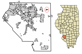
Summerfield is a village in St. Clair County, Illinois, United States. The population was 451 at the 2010 census.

<span class="mw-page-title-main">Waverly, Kansas</span> City in Coffey County, Kansas

Waverly is a city in Coffey County, Kansas, United States. As of the 2020 census, the population of the city was 574.
<span class="mw-page-title-main">Hepler, Kansas</span> City in Crawford County, Kansas

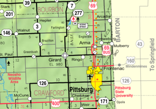
Hepler is a city in Crawford County, Kansas, United States. As of the 2020 census, the population of the city was 90.

<span class="mw-page-title-main">Mulberry, Kansas</span> City in Crawford County, Kansas

Mulberry is a city in Crawford County, Kansas, United States. As of the 2020 census, the population of the city was 409.

<span class="mw-page-title-main">Norcatur, Kansas</span> City in Decatur County, Kansas

Norcatur is a city in Decatur County, Kansas, United States. As of the 2020 census, the population of the city was 159.

<span class="mw-page-title-main">Gove City, Kansas</span> City in Gove County, Kansas

Gove City, more commonly known as Gove, is a city in and the county seat of Gove County, Kansas, United States. As of the 2020 census, the population of the city was 80.

<span class="mw-page-title-main">Edgerton, Kansas</span> City in Kansas, United States

Edgerton is a city in Johnson County, Kansas, United States, and part of the Kansas City metropolitan area. As of the 2020 census, the population of the city was 1,748. It is home to a large BNSF intermodal train facility named Logistics Park Kansas City.

<span class="mw-page-title-main">Westwood Hills, Kansas</span> City in Kansas, United States

Westwood Hills is a city in Johnson County, Kansas, United States. As of the 2020 census, the population of the city was 400. It is the most densely populated city in the Kansas City Metropolitan Area at 6,240 people per square mile. It borders Kansas City, Missouri.

<span class="mw-page-title-main">Kingman, Kansas</span> City in Kingman County, Kansas

Kingman is a city in and the county seat of Kingman County, Kansas, United States. As of the 2020 census, the population of the city was 3,105.

<span class="mw-page-title-main">Meade, Kansas</span> City in Meade County, Kansas

Meade is a city in and the county seat of Meade County, Kansas, United States. As of the 2020 census, the population of the city was 1,505.

<span class="mw-page-title-main">Ness City, Kansas</span> City in Ness County, Kansas

Ness City is a city in and the county seat of Ness County, Kansas, United States. As of the 2020 census, the population of the city was 1,329. Ness City is famous for its four-story Old Ness County Bank Building located downtown, and nicknamed Skyscraper of the Plains.

<span class="mw-page-title-main">Lyndon, Kansas</span> City in Osage County, Kansas

Lyndon is a city in, and the county seat of Osage County, Kansas, United States. As of the 2020 census, the population of the city was 1,037.
<span class="mw-page-title-main">Belleville, Kansas</span> City in Republic County, Kansas

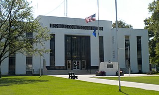
Belleville is a city in and the county seat of Republic County, Kansas, United States. As of the 2020 census, the population of the city was 2,007.

<span class="mw-page-title-main">Andale, Kansas</span> City in Sedgwick County, Kansas

Andale is a city in Sedgwick County, Kansas, United States. As of the 2020 census, the population of the city was 941.
<span class="mw-page-title-main">Mount Hope, Kansas</span> City in Sedgwick County, Kansas

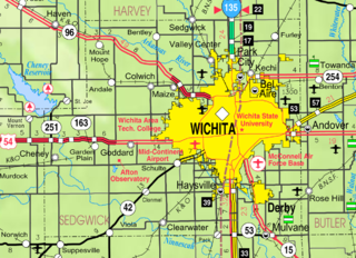
Mount Hope is a city in Sedgwick County, Kansas, United States. As of the 2020 census, the population of the city was 806.
<span class="mw-page-title-main">Alma, Kansas</span> City in Wabaunsee County, Kansas

Alma is a city in and the county seat of Wabaunsee County, Kansas, United States. As of the 2020 census, the population of the city was 802.

<span class="mw-page-title-main">Petersburg, Michigan</span> City in Michigan, United States

Petersburg is a city in Monroe County in the U.S. state of Michigan. The population was 1,171 at the 2020 census.

<span class="mw-page-title-main">Summerfield, Ohio</span> Village in Ohio, United States

Summerfield is a village in Noble County, Ohio, United States. The population was 237 at the 2020 census, down from 254 at the 2010 census.

<span class="mw-page-title-main">Lake Quivira, Kansas</span> City in Kansas, United States

Lake Quivira is a city in Johnson and Wyandotte counties in the State of Kansas, and part of the Kansas City Metropolitan Area. As of the 2020 census, the population of the city was 1,014.

<span class="mw-page-title-main">Summerfield Township, Monroe County, Michigan</span> Civil township in Michigan, United States

Summerfield Township is a civil township of Monroe County in the U.S. state of Michigan. The population was 3,176 at the 2020 census.

References

  1. 1 2 3 4 U.S. Geological Survey Geographic Names Information System: Summerfield, Kansas
  2. "2019 U.S. Gazetteer Files". United States Census Bureau. Retrieved July 24, 2020.
  3. 1 2 "Profile of Summerfield, Kansas in 2020". United States Census Bureau. Archived from the original on May 28, 2022. Retrieved May 28, 2022.
  4. "History Of Summerfield". Marshall County, Kansas Economic Development Office. Retrieved June 14, 2014.
  5. Foster, Emma Elizabeth Calderhead (1917). History of Marshall County, Kansas: Its People, Industries, and Institutions. B.F. Bowen. p. 187.
  6. "Kansas Post Offices, 1828-1961 (archived)". Kansas Historical Society. Archived from the original on October 9, 2013. Retrieved June 14, 2014.{{cite web}}: CS1 maint: unfit URL (link)
  7. "US Gazetteer files 2010". United States Census Bureau. Archived from the original on January 25, 2012. Retrieved July 6, 2012.
  8. "U.S. Census website". United States Census Bureau . Retrieved July 6, 2012.
  9. "U.S. Census website". United States Census Bureau . Retrieved January 31, 2008.