
Frodsham is a market town, civil parish and electoral ward in the unitary authority of Cheshire West and Chester and the ceremonial county of Cheshire, England. Its population was 8,982 in 2001, increasing to 9,077 at the 2011 Census. It is approximately 3 miles (5 km) south of Runcorn, 16 miles (26 km) south of Liverpool, and 28 miles (45 km) southwest of Manchester. The River Weaver runs to its northeast and on the west it overlooks the estuary of the River Mersey. The A56 road and the Chester–Manchester railway line pass through the town, and the M56 motorway passes to the northwest.

Kelsall is a medium-sized agricultural/commuter village and civil parish in the unitary authority of Cheshire West and Chester and the ceremonial county of Cheshire, England. It is located around 8 miles (13 km) east of Chester, 8 miles (13 km) west of Northwich and 4 miles (6 km) north west of Tarporley. The village is situated on Kelsall Hill, a part of the Mid-Cheshire Ridge, the broken line of sandstone hills that divide the west Cheshire Plain from its eastern counterpart. The ridge includes other hills including Peckforton, Beeston, Frodsham and Helsby.

Vale Royal was, from 1974 to 2009, a local government district with borough status in Cheshire, England. It contained the towns of Northwich, Winsford and Frodsham.
Eddisbury is a constituency in Cheshire represented in the House of Commons of the UK Parliament since 2019 by Edward Timpson, a Conservative.

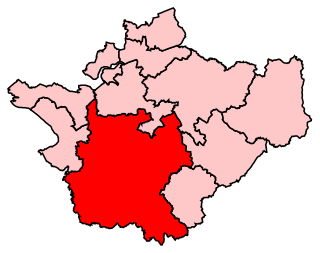
Weaver Vale is a constituency in Cheshire represented in the House of Commons of the UK Parliament since 2017 by Mike Amesbury, a member of the Labour Party..

Guilden Sutton is a civil parish and village in the unitary authority of Cheshire West and Chester and the ceremonial county of Cheshire, England. The village lies approximately 3 miles (5 km) to the east of Chester and is south of the village of Mickle Trafford. The community consists of two churches, a primary school, a post office, a pub, a village hall and several local businesses.

Aston is a village and civil parish in the unitary authority of Cheshire West and Chester and the ceremonial county of Cheshire, England. According to the 2001 census it had a population of 111, reducing slightly to 106 at the 2011 census. The village is just outside the Runcorn urban area.

Kingsley is a civil parish and a village in the unitary authority of Cheshire West and Chester and the ceremonial county of Cheshire, England. It is approximately 5 miles south east of the town of Frodsham.

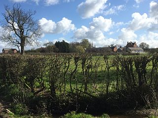
Sutton Weaver is a small village in the civil parish of Sutton Weaver, England. It is in the unitary authority of Cheshire West and Chester, 2 miles (3.2 km) north-east of Frodsham. According to the United Kingdom Census 2011, it had a population of 495 and a total land area of 3,198 sq metres (m2) (thousands). The village has 206 Households with some of the main industries of the village being Wholesale and Retail Trade, Human Health and Social Work Activities and Manufacturing; These three sectors alone account for 36.5% of Occupational Share.
Burton is a small village and former civil parish, now in the parish of Duddon and Burton, in the unitary authority of Cheshire West and Chester and the ceremonial county of Cheshire, England. In the 2001 Census, the parish had a population of 50.

Cheshire West and Chester is a unitary authority with borough status in the ceremonial county of Cheshire, England. It was established on 1 April 2009 as part of the 2009 local government changes, by virtue of an order under the Local Government and Public Involvement in Health Act 2007. It superseded the boroughs of Ellesmere Port and Neston and Vale Royal and the City of Chester; its council assumed the functions and responsibilities of the former Cheshire County Council within its area. The remainder of ceremonial Cheshire is composed of Cheshire East, Halton and Warrington.
Woolstanwood is a village and civil parish in the unitary authority of Cheshire East and the ceremonial county of Cheshire, England, which lies immediately to the west of Crewe, 1½ miles from the centre. The parish also includes the settlements of Brassey Bank and Marshfield Bank. Nearby villages include Wistaston and Worleston.

Chorley is a hamlet and civil parish in the unitary authority of Cheshire East and the ceremonial county of Cheshire, England. The hamlet lies 5 miles to the west of Nantwich and 6 miles to the north east of Malpas. The total population is a little over a hundred people. Nearby villages include Faddiley, Norbury, Ravensmoor and Wrenbury.

Leighton is a scattered settlement and civil parish in the unitary authority of Cheshire East and the ceremonial county of Cheshire, England, which lies immediately north west of Crewe. The parish also includes the village of Barrows Green, which lies on the northern outskirts of Crewe, 1½ miles from the centre. Nearby villages include Bradfield Green and Worleston. The total population of the civil parish was 4,883 at the 2011 Census.

Wardle is a village and civil parish in the unitary authority of Cheshire East and the ceremonial county of Cheshire, England. The village lies on the Shropshire Union Canal, north west of Barbridge Junction, and is 4 miles to the north west of Nantwich, and the parish also includes part of the small settlement of Wardle Bank. The total population is around 250. RAF Calveley was a flight-training station during the Second World War, and the Mark III radio telescope stood on the airfield site in 1966–96. The modern civil parish includes Wardle Industrial Estate and is otherwise largely agricultural. Nearby villages include Barbridge, Calveley and Haughton.

Ridley is a civil parish in the unitary authority of Cheshire East and the ceremonial county of Cheshire, England, which lies to the north east of Malpas and to the west of Nantwich. The parish is largely rural with scattered farms and buildings and no significant settlements. In 2001, the population was a little over 100. Nearby villages include Bulkeley, Bunbury, Faddiley, Peckforton and Spurstow. At the 2011 Census the population had fallen less than 100. Details are included in the civil parish of Peckforton.
Stoak is a small village and civil parish in the unitary authority of Cheshire West and Chester; and the ceremonial county of Cheshire, England.

Hapsford is a village and former civil parish, now in the parish of Dunham-on-the-Hill and Hapsford, in the unitary authority of Cheshire West and Chester and the ceremonial county of Cheshire, England. It is located on the A5117 road, with Helsby to the east and the village of Elton, near Ellesmere Port, to the north west. Junction 14 of the M56 motorway and Chester services motorway service station are sited nearby.

Mouldsworth is a village and civil parish on the outskirts of Chester in the unitary authority of Cheshire West and Chester and the ceremonial county of Cheshire, England. It is located about 8 miles north east of Chester City Centre on the B5393 road. The nearest villages are Manley to the north west and Ashton Hayes to the south west. Delamere Forest is situated to the east of the village. At the 2001 Census the population was recorded at 302, increasing slightly to 327 at the 2011 Census.
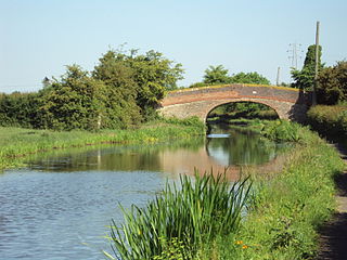
Sutton Weaver is a civil parish in Cheshire West and Chester, England. It is largely rural, and contains the village of Sutton Weaver. The parish is traversed in a north-south direction by the M56 motorway, the A56 road, and the Chester to Manchester Line, and from east to west by the River Weaver and the Weaver Navigation, and the A533 road. It contains twelve buildings that are recorded in the National Heritage List for England as designated listed buildings. Of these one is listed at Grade I, another at Grade II*, and the other ten at Grade II. The structures include houses, farm buildings, and bridges. Most of them are houses or farm buildings, but there is also a bridge and two viaducts.


