Aligarh is a city in the state of Uttar Pradesh in India. It is the administrative headquarters of Aligarh district, and lies 342 kilometres (213 mi) northwest of state capital Lucknow and approximately 130 kilometres (81 mi) southeast of the capital, New Delhi. The districts which adjoin Aligarh are Gautam Buddha Nagar, Bulandshahr, Sambhal, Badaun, Kasganj, Hathras, Etah and Mathura. As of 2011, Aligarh is the 53rd most populous city in India.

Tirur is a Municipality in Malappuram district in the Indian state of Kerala spread over an area of 16.55 square kilometres (6.39 sq mi). It is one of the business centers of Malappuram district and is situated 26 kilometres (16 mi) west of Malappuram and 52.5 kilometres (32.6 mi) south of Kozhikode, on the Shoranur–Mangalore section under Southern Railway. Tirur is also a major regional trading centre for fish and betel leaf and has an average elevation of 2 metres.

Amroha district is one of the 75 districts of Uttar Pradesh state in northern India. Amroha town is the district headquarters. According to the Government of India, the district is one of the Minority Concentrated Districts on the basis of the 2001 census data on population, socio-economic indicators and basic amenities indicators.

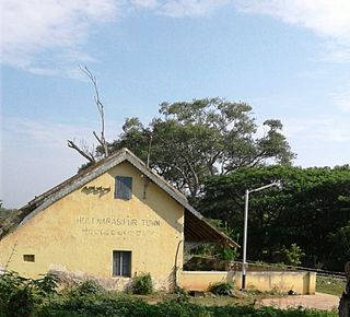
Holenarasipura is a town and taluk in Hassan district of Karnataka. The town is situated on the banks of the Hemavati, one of the tributaries of the Kaveri.

Gajraula is a city and municipal board in Amroha district in the state of Uttar Pradesh, India. Gajraula is also the headquarters of Gajraula block. It is located on NH 9, a four-lane highway connecting Uttarakhand and cities such as Bareilly and Lucknow via Delhi. It is a significant industrial hub in Uttar Pradesh and home to a number of multinational corporations, including Jubliant Life Sciences, RACL Geartech, and Israeli Pharma Teva API, as well as several engineering colleges. Moradabad, Meerut, Bulandsahar, Budaun, Hapur, and Delhi NCR are among the larger nearby cities.
Gangaghat is a city and a municipal board in Unnao district in the state of Uttar Pradesh, India. It's Just 12 km from Unnao, 10 km from Kanpur. It is also known as Shuklaganj and is located on the banks of holy river Ganges about 5 km from Kanpur on the SH 58 to Unnao. The population was 370803 as of the 2001 census. According to the census of 2011 it is 884072. It has 80% of literacy and is 5 km from Kanpur Cantonment. Though it lies in Unnao district, it lies adjacent to Kanpur and hence is a suburb of Kanpur. The city is enlisted as a municipality of Kanpur metropolitan area.
Handwara is a sub-district and a town in Kupwara district of Kashmir. It was known as Uttar Machipora until the division of Baramulla district in the 1980s resulting in the formation of two new districts: Kupwara and Bandipora. It is located on Baramulla-Handwara National Highway NH-701 and is governed by a municipal committee.
Mannachanallur is a Taluk and Town in Tiruchirappalli district in the Indian state of Tamil Nadu. Mannachanallur is famous for rice mills
Mau Aima is an industrial town and a nagar panchayat in Allahabad district in the Indian state of Uttar Pradesh.
Nasrullaganj is a nagar panchayat in Sehore district in the Indian state of Madhya Pradesh. The nearest airport is in Bhopal.
Nehtaur is a city, near Bijnor city in Bijnor district in the northern Indian state of Uttar Pradesh. Nehtaur is an ancient and well known town because of its culture and educational backgrounds. Nehtaur Town was established by the Taga Minister family of Ajmer state when they came from Ranthambhor, Rajasthan after it was captured by Qutubuddin Aibak and the place was called Nai+thour = NEHTAUR. This is how Nehtaur derived its name [Ref. Book-History of Islam in India].

Sambhal(listen) is a city located in the Sambhal district of Uttar Pradesh state in India. The city lies approximately 158 kilometres (98 mi) east of New Delhi and 355 kilometres (220 mi) north-west of state capital Lucknow.

Srisailam is a census town in Nandyal district of the Indian state of Andhra Pradesh. It is the mandal headquarters of Srisailam mandal in Atmakur revenue division. It is located about 160 kilometres (99 mi) from the district headquarters Nandyal, 180 kilometres (112 mi) from Kurnool, and it is located about 264 kilometres (164 mi) from Vijayawada. The town is famous for Mallikarjuna Jyotirlinga Temple and is one of the holy pilgrimage sites for Saivism and Shaktism sects of Hinduism. The town is classified as both Jyotirlinga and Shakti Peetha.
Banga is a town and Municipal council in the Shahid Bhagat Singh Nagar district of Punjab, India. Banga is also one of the sub-division (tehsil) headquarters of the district. Banga located on Phagwara-Rupnagar section of National Highway 344A. It is currently estimated to have a population of about 23,000 and is classified as a class 2 Municipality. The town also incorporates the former village of Jindowal apart from Banga town.
Islamnagar is a Block and Nagar Panchayat in Badaun district in the Indian state of Uttar Pradesh. Its block code is 0174.
Goshainganj, also known as Gosainganj, is a town and nagar panchayat in the Faizabad district of the Indian state of Uttar Pradesh. Located 32 km from the district headquarters Ayodhya, Goshainganj has one of the oldest markets of the district.

Sambhal district is a district of Uttar Pradesh state in India. The district headquarter is Bahjoi town. 993 Villages and 16 Police stations fall under Sambhal district.
Tut is a village in Nakodar in Jalandhar district of Punjab State, India. It is located 6 kilometres (3.7 mi) from Nakodar, 29 kilometres (18 mi) from Kapurthala, 29.5 kilometres (18.3 mi) from district headquarter Jalandhar and 160 kilometres (99 mi) from state capital Chandigarh. The village is administrated by a sarpanch who is an elected representative of village as per Panchayati raj (India).
Bagoran also spelled as Baghoran is a village in Shaheed Bhagat Singh Nagar district of Punjab State, India. It is located 2.7 kilometres (1.7 mi) away from postal head office Mukandpur, 11.2 kilometres (7.0 mi) from Banga, 16.8 kilometres (10.4 mi) from district headquarter Shaheed Bhagat Singh Nagar and 92.5 kilometres (57.5 mi) from state capital Chandigarh. The village is administrated by Sarpanch an elected representative of the village.
Nagam is a town and municipality in Budgam district of the Indian union territory of Jammu and Kashmir. The town is located 16 kilometres from district headquarters Budgam.


