Joya, India

Last updated

Joya
City
UP SH-77 Joya.jpg
UP SH-77 starting at Joya
India Uttar Pradesh location map.svg
Red pog.svg
Joya
Location in Uttar Pradesh, India
Coordinates: 28°50′N78°28′E / 28.833°N 78.467°E / 28.833; 78.467 Coordinates: 28°50′N78°28′E / 28.833°N 78.467°E / 28.833; 78.467
CountryFlag of India.svg  India
State Uttar Pradesh
District Amroha
Government
  TypeNagar Panchayat (Chairman)
Population
 (2011)
  Total18,337
Languages
  Official Khariboli, Haryanvi, Punjabi, Urdu, English
Time zone UTC+5:30 (IST)
The Milk Producing Hub on NH-24 in Western Uttar Pradesh

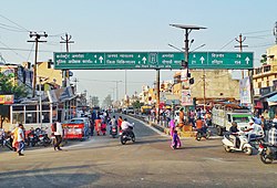
Joya is a nagar panchayat located along highway NH-24 in Amroha district in the Western Uttar Pradesh. It is predominantly a milk producing city. Joya was a gram panchayat before 1988. The late Abrar Hussain was the first chairman of Joya in 1988.

Contents

Growth in development

The growth rate is very high for industries here, due to a well developed infrastructure in Joya.

The Delhi–Mumbai Industrial Corridor Project is a state-sponsored industrial development project aimed at developing an industrial zone spanning across six states in India. The project will see major expansion of infrastructure and industry – including industrial clusters and rail, road, port, air connectivity – in the states along the route of the corridor. The ambitious Delhi Mumbai Industrial Corridor (DMIC) has received major boost with India and Japan inking an agreement to set up a project development fund. The initial size of the fund will be Rs 1,000 Crore (about $212 million). Both the Japanese and Indian governments contribute equally.

The corridor would include six mega investment regions of 200 square kilometers each and will run through seven states: Delhi, western Uttar Pradesh, southern Haryana, eastern Rajasthan, eastern Gujarat, and western Maharashtra. Indrapuram-Moradabad-Kashipur-Haldwani is one of the investment regions selected for development in the first phase of the ambitious Delhi-Mumbai Industrial Corridor. More than 59 per cent of Western Uttar Pradesh's area comes under the project area of this ambitious DMIC project, which is extended up to 150 km on both sides of the alignment of the Delhi-Mumbai Dedicated Freight Corridor. This would open a floodgate of opportunities all along NH-58, NH-2, Yamuna Expressway and NH-24 for developing industrial, urban and supporting infrastructure through public-private initiatives, seven investment regions and 13 industrial areas have been planned along this Corridor and Hapur-Moradabad-Rudrapur-Khatima is one of the investment regions selected for development in the first phase. The Growth Centre Bawal has been evolved as a mega industrial hub and large numbers of multi-national companies have selected Gajraula as their manufacturing base.

Major distances

The above distances show that Joya is near to important areas of neighbouring states as well as its own state. Chandigarh, the capital of Punjab & Haryana, is actually closer to it than the state capital Lucknow. The demographics, language, culture, tradition and activities of this region are much different from those of eastern Uttar Pradesh. Moradabad, Rudrapur, Gajraula, Kashipur and Ghaziabad are very close to the city.

Demographics

As of the 2011 India census, [1] Joya is a Nagar Panchayat located along National Highway 24 just 128 kilometres from Delhi. Joya had a population of 18,377. Males constituted 53% of the population and females 47%. Joya's average literacy rate of 85% is higher than the national average of 74.07%: male literacy is 86%, and female literacy is 82%. In Joya, 12% of the population is under 6 years of age.

Culture

Handicrafts

The handicrafts of Joya include wooden handicrafts such as wooden boxes, gift boxes, wooden utensils, wooden toys, and furniture.

Related Research Articles

Dhule City in Maharashtra, India

Dhule is a city located in the Dhule District in the northwestern part of Maharashtra state, India known as West Khandesh. Situated on the banks of Panzara River, Dhule is the regional headquarters of MIDC, RTO, and MTDC.

<span class="mw-page-title-main">Harit Pradesh</span> Proposed state in India

Harit Pradesh is a proposed new state of India comprising the western parts of Uttar Pradesh state. Harit means Green which signifies the agricultural prosperity of the region and Pradesh means state.

Moradabad City in Uttar Pradesh, India

Moradabad is a city, commissionary and municipal corporation in Moradabad district of Indian state of Uttar Pradesh. Moradabad is situated on the banks of the Ramganga river, at a distance of 167 km (104 mi) from the national capital, New Delhi and 344 km north-west of the state capital Lucknow.

National Highway 8 (India, old numbering) Highway in India

National Highway 8 is a 4-lane National Highway in India. According to estimates, it is the busiest highway in the subcontinent, as it connects the national capital Delhi to the financial capital Mumbai, as well as important cities Gurgaon, Jaipur, Ajmer, Udaipur, Ahmedabad, Vadodara, Surat, Nadiad, Anand and Kheda. The total length is 1428km. Under the new numbering it has become part of the NH48.

Amroha is a city in the state of Uttar Pradesh in India. It is located north-west of Moradabad, near the Ganga River. It is the administrative headquarters of the Amroha district.

Amroha district District of Uttar Pradesh in India

Amroha district is one of the 75 districts of Uttar Pradesh state in northern India. Amroha town is the district headquarters. According to the Government of India, the district is one of the Minority Concentrated Districts on the basis of the 2001 census data on population, socio-economic indicators and basic amenities indicators.

Bawal is a big industrial town located, near Rewari city in Rewari district in Indian state of Haryana. It lies in the National Capital Region (NCR) of India. It is located on national highway NH 48, 11 km from Rewari, the district headquarter, 50 km from Gurugram and 91 km from New Delhi railway station. Bawal Tehsil is a part of the Rewari district. It was one of the three districts of the erstwhile Nabha State under British Raj.

Chandpur is a town and a municipal board in Bijnor district in the Indian state of Uttar Pradesh, India.

Gajraula City in Uttar Pradesh, India

Gajraula is a city and municipal board in Amroha district in the state of Uttar Pradesh, India. Gajraula is also the headquarters of Gajraula block. It is located on NH 9, a four-lane highway connecting Uttarakhand and cities such as Bareilly and Lucknow via Delhi. It is an important industrial city of Uttar Pradesh with some named multinationals like Jubliant Life Sciences, RACL Geartech, Israeli Pharma Teva API etc. and important higher educational institutions like Sri Venkateshwara University and other important engineering colleges there. The surrounding major cities are Moradabad, Meerut, Bulandsahar, Budaun, Hapur and Delhi NCR.

Noorpur is a City and a Municipal Board in Bijnor District in the Indian State of Uttar Pradesh.

Rudrapur, Uttarakhand City in Uttarakhand, India

Rudrapur is a city that serves as the headquarters of the Udham Singh Nagar district in the Indian state of Uttarakhand. Located at a distance of about 250 km (160 mi) northeast of New Delhi and 250 km (160 mi) south of Dehradun, Rudrapur is located in the fertile Terai plains in the southern part of Kumaon division over an area of 27.65 km2. With a population of 140,857 according to the 2011 census of India, it is the 5th most populous city of Uttarakhand.

Thakurdwara is a city in Moradabad district in the indian state of Uttar Pradesh.

Nangal Choudhary is "First Cyber Village of Haryana". It is a town and tehsil in District Mahendragarh at Narnaul in India. A famous personality, Baba Ramdev, belongs to the village which is a part of this region.

Economy of Uttar Pradesh Overview of the economy of Uttar Pradesh

The economy of Uttar Pradesh is the third largest of all the states in India. Nominal GDP of the state for the year 2022-23 is 20.48 trillion (US$260 billion). Uttar Pradesh has an urban population of 4,44,95,063. According to the 2011 census report, 22.76% of Uttar Pradesh's population lives in urban areas. The state has 7 cities with populations exceeding 10 lakh each. After partition in 2000, the new Uttar Pradesh state produces about 92% of the economic output of the old Uttar Pradesh state. According to Planning Commission estimates for the year 2011–12, 29.4% of the state's total population was poor. However, updated findings by NITI Aayog based on NFHS-4 (2015–16), 37.79% of the population was found to be poor.

Delhi, a major metropolitan region of India, is connected to various parts of country through several national highways and expressways. All the highways and expressways from Delhi lead to Haryana or Uttar Pradesh and continue from there.

Kashi Vishwanath Express Daily Express train between New Delhi and Banaras

Kashi Vishwanath Express is an Indian express train that runs between Banaras in Uttar Pradesh and New Delhi railway station.

Syed Nagli is a town in Amroha district in the Indian state of Uttar Pradesh. It is situated on State Highway 51, around 15 Km from Hasanpur and 19 Km from Sambhal. Syed Nagli has its own post office with PIN code 244242 and a police station.

Sambhal district District of Uttar Pradesh in India

Sambhal district is a district of Uttar Pradesh state in India. The district headquarter is Bahjoi town. 993 Villages and 16 Police stations fall under Sambhal district.

Uttarakhand Sampark Kranti Express

Uttaranchal Sampark Kranti Express is a Sampark Kranti Express train which connects Delhi to Ramnagar and Kathgodam of Uttarakhand state in India. The train runs daily via Moradabad, then split into two trains, one is for Ramnagar and another for Kathgodam. It is the shortest-running Sampark Kranti Express of Indian Railways.

National Highway 9 (India) National highway in India

National Highway 9 is a National Highway in India in east-west direction. It starts at Malout in Punjab and ends at Pithoragarh in Pithoragarh district in Uttarakhand. It passes through the states of Punjab, Haryana, Delhi, Uttar Pradesh and Uttarakhand. After renumbering of all national highways by National Highway Authority of India in 2010, the current NH 9 was formed by merging segments of five separate national highways in 2010; these were Old NH 10, Old NH 24, Old NH 87, Old NH 74 and Old NH 125.

References

  1. "Census of India 2001: Data from the 2001 Census, including cities, villages and towns (Provisional)". Census Commission of India. Archived from the original on 16 June 2004. Retrieved 1 November 2008.