
Westminster is an area of Central London, part of the wider City of Westminster.
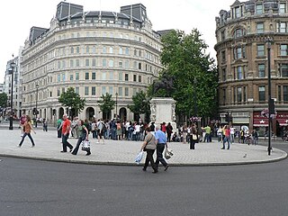
Charing Cross is a junction in London, England, where six routes meet. Clockwise from north these are: the east side of Trafalgar Square leading to St Martin's Place and then Charing Cross Road; the Strand leading to the City; Northumberland Avenue leading to the Thames Embankment; Whitehall leading to Parliament Square; The Mall leading to Admiralty Arch and Buckingham Palace; and two short roads leading to Pall Mall. The name also commonly refers to the Queen Eleanor Memorial Cross at Charing Cross station.

The Royal Borough of Kensington and Chelsea is an Inner London borough with royal status. It is the smallest borough in London and the second smallest district in England; it is one of the most densely populated administrative regions in the United Kingdom. It includes affluent areas such as Notting Hill, Kensington, South Kensington, Chelsea, and Knightsbridge.
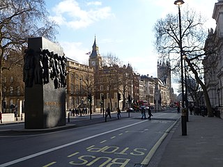
Whitehall is a road and area in the City of Westminster, Central London. The road forms the first part of the A3212 road from Trafalgar Square to Chelsea. It is the main thoroughfare running south from Trafalgar Square towards Parliament Square. The street is recognised as the centre of the Government of the United Kingdom and is lined with numerous departments and ministries, including the Ministry of Defence, Horse Guards and the Cabinet Office. Consequently, the name "Whitehall" is used as a metonym for the British civil service and government, and as the geographic name for the surrounding area.

Covent Garden is a district in London, on the eastern fringes of the West End, between St Martin's Lane and Drury Lane. It is associated with the former fruit-and-vegetable market in the central square, now a popular shopping and tourist site, and with the Royal Opera House, itself known as "Covent Garden". The district is divided by the main thoroughfare of Long Acre, north of which is given over to independent shops centred on Neal's Yard and Seven Dials, while the south contains the central square with its street performers and most of the historical buildings, theatres and entertainment facilities, including the London Transport Museum and the Theatre Royal, Drury Lane.

Pentonville Road is a road in Central London that runs west to east from Kings Cross to City Road at The Angel, Islington. The road is part of the London Inner Ring Road and part of the boundary of the London congestion charge zone.

Chelsea is an affluent area in west London, England, due south-west of Charing Cross by approximately 2.5 miles. It lies on the north bank of the River Thames and for postal purposes is part of the south-western postal area.

The Palace of Whitehall at Westminster was the main residence of the English monarchs from 1530 until 1698, when most of its structures, except notably Inigo Jones's Banqueting House of 1622, were destroyed by fire. Henry VIII moved the royal residence to White Hall after the old royal apartments at the nearby Palace of Westminster were themselves destroyed by fire. Although the Whitehall palace does not survive, the area where it was located is still called Whitehall and has remained a centre of government.

East Dulwich is an area of South East London, England in the London Borough of Southwark. It forms the eastern part of Dulwich, with Peckham to the east and Camberwell to the north. This South London suburb was first developed in the nineteenth century on land owned by the College of God's Gift.

Belgravia is an affluent district in Central London, covering parts of the areas of both the City of Westminster and the Royal Borough of Kensington and Chelsea.
King's Road or Kings Road, is a major street stretching through Chelsea and Fulham, both in west London. It is associated with 1960s style and with fashion figures such as Mary Quant and Vivienne Westwood. Sir Oswald Mosley's Blackshirt movement had a barracks on the street in the 1930s.
Sands End is an area of the ancient parish of Fulham, formerly in the County of Middlesex, which is now the southernmost part of the London Borough of Hammersmith and Fulham, England. In a deep loop of the River Thames, between the tidal Chelsea Creek and the old Peterborough estate, west of Wandsworth Bridge, its northern edge is New King's Road. While wharves, industrial acres and workers' cottages gave way to intensive re-development such as Chelsea Harbour and Imperial Wharf in the last quarter of the 20th-century, it still contains some 300-year-old cottages and 19th century streets.

Soho Square is a garden square in Soho, London, hosting since 1954 a de facto public park let by the Soho Square Garden Committee to Westminster City Council. It was originally called King Square after Charles II. Its statue of Charles II has stood since the square's 1661 founding except between 1875 and 1938; it is today well-weathered. During the summer, Soho Square hosts open-air free concerts. Of its 30 buildings, 16 are listed.

World's End is a district of Chelsea, London, lying at the western end of the Kings Road. Once a Victorian slum area, council housing was built here in the 20th century, including the brutalist architecture World's End estate.

The George Tavern is a Grade II listed public house and music venue located on Commercial Road in Stepney, London. It is owned and operated by artist Pauline Forster.

Great Scotland Yard is a street in the St. James's district of Westminster, London, connecting Northumberland Avenue and Whitehall. It was the location of the rear entrance to the original headquarters of the Metropolitan Police Service of London, giving it the name "Scotland Yard".

The Carlton Tavern is a pub in Kilburn, London that was demolished in 2015 by Tel Aviv-based developer CLTX, which had failed to obtain the necessary planning permission. The council subsequently ordered the pub to be rebuilt brick by brick. It reopened on 12 April 2021. The pub was the only building in the street to survive the Blitz during World War II.
The Markham Arms is a former pub at 138 King's Road, London SW3. It closed as a pub in the early 1990s, and is now a branch of the Santander bank.

Chalton Street Market is a street market in Camden, North London.

Chelsea Town Hall is a municipal building in King's Road, Chelsea, London. The oldest part is a Grade II* listed building and the later part is Grade II listed.


