An editor has nominated this article for deletion. You are welcome to participate in the deletion discussion , which will decide whether or not to retain it. |
Type | Tornado outbreak |
---|---|
Duration | November 29–30, 2022 |
Highest winds |
|
Tornadoes confirmed | 27 |
Max. rating1 | EF3 tornado |
Duration of tornado outbreak2 | 14 hours, 19 minutes |
Largest hail | 2 in (5.1 cm) (WNW of Vaiden, Mississippi) |
Maximum snowfall or ice accretion | 8.5 in (22 cm) in Saint Peter, Minnesota [2] |
Fatalities | 2 fatalities, 3 injuries |
Damage | $115 million [3] |
Power outages | 55,000 [4] |
Areas affected | Southern United States |
Part of the tornado outbreaks of 2022 1Most severe tornado damage; see Enhanced Fujita scale 2Time from first tornado to last tornado |
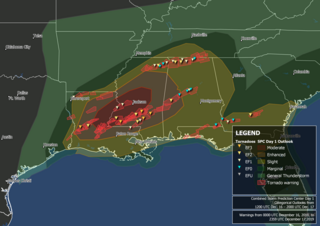
A late-season tornado outbreak in the Southern United States affected the states of Louisiana, Mississippi, Alabama, and Georgia, from the afternoon of November 29 into the morning of November 30, 2022. The outbreak was the result of an intense upper-level trough that materialized over the aforementioned states where increased moisture, atmospheric instability, and elevated wind shear were present, creating conditions highly conducive to supercell thunderstorms. Multiple tornadic storms developed in the risk area, producing numerous tornadoes. Several of these tornadoes were strong and destructive, prompting the issuance of multiple PDS tornado warnings. Two low-end EF3 tornadoes caused severe damage near Clarks, Louisiana and Tibbie, Alabama respectively while the Flatwood and Willow Springs communities north of Montgomery, Alabama was struck by an EF2 tornado, which caused two fatalities. Numerous weaker tornadoes also touched down, including a high-end EF1 tornado that caused considerable damage in Eutaw, Alabama. In all, 27 tornadoes were confirmed.
A significant severe weather event was forecast multiple days in advance of the outbreak, as early models suggested the presence of multiple thunderstorm-enhancing atmospheric conditions over the northeast Ark-La-Tex regions, northwest Mississippi, and extreme southwestern Tennessee. On November 24, the Storm Prediction Center identified a "severe" threat for the aforementioned regions, although most of the highest risk was positioned over northern Louisiana. [5]
As the days passed, and computer weather prediction models identified multiple thunderstorm-enhancing elements over the area, confidence grew in the probability of a severe weather outbreak occurring. On November 27, the SPC issued a Day 3 level 3/enhanced risk for the area, extending all the way through eastern Arkansas, and into western Tennessee. The outlook suggested that a progressive upper-level trough would pass over elevated instability in the area, which coupled with a strong 50-70 kt low-level jet, and 400–500 m2/s2 helicity values, would create conditions conductive to supercell thunderstorm development. An additional damaging wind and hail threat was mentioned. [6]
The threat level was upped to a level 4/moderate risk by the SPC on November 28. The main area of risk was shifted mainly to western Mississippi, extreme southeastern Arkansas, and northeastern Louisiana, where a 15% hatched risk for tornadoes was introduced, indicating the elevated probabilities for strong, long-tracked tornadoes to develop. There was even consideration for a level 5/high risk upgrade, but due to uncertainty in where the highest risk would be, it was maintained at a moderate risk. The outlook highlighted the presence of greater instability than expected, aided by strong wind shear, and steep mid-level lapse rates, which would help in the sustainment of supercell structures, enhancing the tornado risk. [7]
The next day, at 1300 UTC (8:00 am CDT), the SPC maintained the risk level, with some minor corrections to its coverage and 15% tornado risk placement. This outlook presented the presence of convective available potential energy (CAPE) values of 1000-2000 J/kg in the area, and with the previously stated rich moisture, shear, and helicity present in the area, conditions were primed for a tornado outbreak. [8]
As the afternoon advanced, the SPC issued two rare PDS tornado watches encompassing large regions of Louisiana, southeastern Arkansas, and central Mississippi, as atmospheric conditions were very favorable for strong, long-track tornadoes. [9] [10] As the first storm popped up in central Mississippi, a powerful supercell developed in the outskirts of the main risk area, in Covington and Jefferson Davis counties, producing a damaging, multi-vortex tornado that tracked near the town of Bassfield, which was devastated by an EF4 tornado on April 12, 2020. Multiple other tornadoes were reported from this long-tracked supercell. As the afternoon progressed, multiple supercells developed in the main risk area, entering a highly favorable environment for maturing. A storm that developed in the southern edge of the main risk area produced multiple tornadoes, one of which was a large wedge tornado that injured several people in Caldwell Parish, Louisiana, resulting in a PDS tornado warning, only the second ever issued for the month of November. After the event, Andrew Lyons, a forecaster at the Storm Prediction Center, posted a tweet showing how the forecast verified on the Tornado Modified Practically Perfect Probs. [11] [12] [13]
EFU | EF0 | EF1 | EF2 | EF3 | EF4 | EF5 | Total |
---|---|---|---|---|---|---|---|
4 | 7 | 9 | 5 | 2 | 0 | 0 | 27 |
EF# | Location | County / Parish | State | Start Coord. | Time (UTC) | Path length | Max width | Summary |
---|---|---|---|---|---|---|---|---|
EF1 | SW of Tilton | Lawrence | MS | 31°23′01″N90°03′55″W / 31.3837°N 90.0653°W | 22:24–22:28 | 2 mi (3.2 km) | 200 yd (180 m) | A house and a metal shed were damaged, and numerous trees were either snapped or uprooted. [1] [14] |
EF0 | SW of Bassfield | Jefferson Davis, Marion | MS | 31°25′33″N89°49′52″W / 31.4257°N 89.8311°W | 23:02–23:10 | 3.4 mi (5.5 km) | 70 yd (64 m) | A weak, intermittent tornado uprooted and damaged several trees. [14] |
EF1 | N of Bywy to S of Mathiston | Choctaw | MS | 33°27′38″N89°14′33″W / 33.4605°N 89.2425°W | 23:11–23:21 | 6.8 mi (10.9 km) | 330 yd (300 m) | This tornado touched down along MS 9 before moving across the Natchez Trace Parkway. An RV was rolled, the roof of a barn was torn off, and numerous trees were downed before the tornado dissipated after crossing MS 15. [14] |
EF1 | SSW of Bassfield | Jefferson Davis | MS | 31°27′35″N89°45′26″W / 31.4597°N 89.7572°W | 23:14–23:21 | 3.9 mi (6.3 km) | 400 yd (370 m) | Some tin roofing was torn off a large shed, a brick home sustained minor roof damage, and an awning was blown down. The tornado reached its peak intensity of high-end EF1 as it crossed MS 42 shortly before dissipating, and numerous trees were snapped or uprooted in this area. A metal shed had most of its roof removed as well. [14] |
EF3 | SE of Clarks | Caldwell | LA | 31°58′27″N92°03′56″W / 31.9743°N 92.0655°W | 00:03–00:13 | 7.96 mi (12.81 km) | 300 yd (270 m) | This tornado reached its peak intensity of low-end EF3 immediately after it touched down along LA 126. Trees were partially debarked, outbuildings and mobile homes were destroyed, and the ground was deeply scoured in open fields, with clumps of dirt and grass pulled up. Elsewhere along the path, another mobile home was destroyed, a home suffered roof damage, a power pole was snapped, and many trees were snapped or uprooted. One person was injured. [15] |
EF2 | WSW of Wells to ESE of Woodlawn | Lowndes | MS | 33°35′00″N88°25′24″W / 33.5834°N 88.4232°W | 00:26–00:40 | 8.4 mi (13.5 km) | 375 yd (343 m) | This strong tornado first struck the Wells community, where trees were snapped, and a church steeple was blown over. The tornado reached high-end EF2 intensity just south of Woodlawn near MS 12, where a metal fire department building was significantly damaged, two homes had roof and exterior wall loss, other homes had severe roof damage and broken windows, and outbuildings were destroyed. The tornado caused additional tree damage before dissipating. [14] |
EF2 | E of Stringer to S of Paulding | Jasper | MS | 31°50′47″N89°12′22″W / 31.8464°N 89.2062°W | 00:30–00:51 | 11.8 mi (19.0 km) | 300 yd (270 m) | A shed was completely destroyed, with its debris scattered across a sizeable area. A well-built brick home was completely unroofed and had an exterior wall knocked down, with sections of the roof thrown and deposited a considerable distance away. An older wood-frame home lost a substantial part of its roof, and also sustained window and wall damage. Other homes were damaged to a lesser degree, and many trees were snapped or uprooted. [14] |
EF1 | W of Louisville to S of Tollison | Winston, Choctaw | MS | 33°09′06″N89°11′44″W / 33.1516°N 89.1956°W | 00:49–00:55 | 5.2 mi (8.4 km) | 300 yd (270 m) | This low-end EF1 tornado snapped and uprooted numerous softwood trees northwest of Louisville. [14] |
EFU | SW of Richmond | Madison | LA | 32°17′23″N91°22′00″W / 32.2898°N 91.3668°W | 01:06–01:07 | 1.1 mi (1.8 km) | Unknown | A storm chaser observed a tornado near the Tensas River, though a National Weather Service survey team was unable to find evidence of damage due to inaccessible roads. The tornado came from the same storm that produced the Clarks EF3 tornado. [14] |
EFU | N of Thomastown | Madison | LA | 32°23′50″N91°04′46″W / 32.3972°N 91.0795°W | 01:32–01:34 | 0.4 mi (0.64 km) | Unknown | This tornado, which came from the same storm that produced the Clarks EF3 tornado and the Richmond EFU tornado, was photographed and caught on video by several storm chasers. No damage was found. [14] |
EF1 | SE of Penns | Lowndes | MS | 33°19′52″N88°38′11″W / 33.3312°N 88.6363°W | 01:34–01:41 | 2.48 mi (3.99 km) | 250 yd (230 m) | A low-end EF1 tornado damaged or uprooted several trees. [14] |
EF1 | W of Eutaw to S of Moundville | Greene, Hale | AL | 32°50′40″N87°56′24″W / 32.8445°N 87.9401°W | 03:44–04:13 | 19.49 mi (31.37 km) | 1,200 yd (1,100 m) | A large, high-end EF1 tornado first moved through the north side of Eutaw, causing roof damage to some homes, snapping and uprooting numerous trees, and downing power lines. An apartment building had its entire roof torn off, and other nearby apartment buildings sustained less severe roof damage. It continued northeast and impacted the Oak Village community, where a mobile home sustained significant damage, outbuildings were damaged or destroyed, and trees were downed. The tornado continued farther to the northeast, producing more damage to trees and the roofs of homes in Stewart before dissipating south of Moundville. [16] This tornado moved over the same path as a low-end EF3 tornado that struck on March 25, 2021. A high-end EF2 tornado would then move over the entire tracks of both tornadoes just 44 days later on January 12, 2023. [17] |
EF# | Location | County / Parish | State | Start Coord. | Time (UTC) | Path length | Max width | Summary |
---|---|---|---|---|---|---|---|---|
EF0 | WNW of Fairview | Walker | AL | 33°37′25″N87°22′59″W / 33.6237°N 87.3830°W | 06:28–06:30 | 1.99 mi (3.20 km) | 50 yd (46 m) | A few trees were downed along SR 69. Part of the track was in an inaccessible area and was unable to be surveyed. [16] |
EF1 | SW of Magnolia | Amite, Pike | MS | 31°06′12″N90°36′36″W / 31.1033°N 90.6101°W | 06:42–06:59 | 9.77 mi (15.72 km) | 250 yd (230 m) | Numerous large trees were either snapped or uprooted, a house had part of its roof removed, and a barn was destroyed. A mobile home was pushed off its foundation and rolled over, while another mobile home had total roof loss and sustained collapse of a wall. A campground sustained damage near the end of the path. [18] |
EF0 | Locust Fork | Blount | AL | 33°54′54″N86°40′21″W / 33.9149°N 86.6725°W | 06:57–07:02 | 3.46 mi (5.57 km) | 500 yd (460 m) | A weak tornado embedded in a squall line caused roof damage to two barns, rolled and destroyed a camper trailer, and caused minor roof damage to homes and other structures in Locust Fork. Several trees and tree branches were downed as well, some of which landed on structures and caused damage. [1] |
EF1 | SW of Sweet Water to N of Magnolia | Marengo | AL | 32°03′39″N87°54′21″W / 32.0608°N 87.9057°W | 07:11–07:30 | 15.49 mi (24.93 km) | 525 yd (480 m) | A mobile home lost its roof, a couple of outbuildings lost portions of their roofs, and a home lost a patio overhang. Another home sustained roof and shingle damage, and a camper was moved a few feet. Numerous trees were uprooted and snapped, and one tree was blown into a mobile home in the rural community of Wayne, damaging a wall. [16] |
EF0 | S of Macon | Calhoun | AL | 33°40′50″N86°03′50″W / 33.6806°N 86.0640°W | 07:37–07:38 | 0.79 mi (1.27 km) | 300 yd (270 m) | A brief tornado caused minor roof damage to two homes and snapped or uprooted several trees. [16] |
EF2 | N of Cheraw | Marion | MS | 31°09′45″N89°52′51″W / 31.1624°N 89.8809°W | 07:50–07:59 | 6 mi (9.7 km) | 150 yd (140 m) | A cellular tower was knocked over, outbuildings were damaged or destroyed, a home had its roof damaged, a flag pole and a power pole were downed, and numerous trees were snapped or uprooted. [14] |
EF3 | S of State Line, MS to E of Tibbie, AL | Greene (MS), Washington (AL) | MS, AL | 31°20′06″N88°30′18″W / 31.3351°N 88.5049°W | 08:27–08:56 | 20.14 mi (32.41 km) | 700 yd (640 m) | This tornado began near MS 57 in Greene County, where several softwood trees were snapped. The tornado crossed the state line into Washington County and struck Fruitdale, where Fruitdale High School had damage to its roof, windows, and side paneling, and a metal building sustained considerable damage as well. Widespread tree and power line damage was observed throughout Fruitdale before the tornado continued northeastward, strengthening to low-end EF3 intensity as it impacted a wooded area. Numerous large trees were completely mowed down along a nearly 500-yard (460 m) swath, some debarking was observed, and a small farm outbuilding was obliterated. The tornado then weakened to low-end EF2 strength, snapping many additional trees and damaging the roofs of a few homes and a church before dissipating near the small community of Tibbie. [19] In November 2023, this tornado was reanalyzed and had its track receive cosmetic updates based on Planet satellite imagery. The maximum width was also increased from 500 yd (460 m) to 700 yd (640 m). [20] |
EF2 | NW of Boylston to SSE of Wetumpka | Elmore, Montgomery | AL | 32°26′19″N86°19′54″W / 32.4385°N 86.3318°W | 09:14–09:28 | 9.85 mi (15.85 km) | 700 yd (640 m) | 2 deaths – A strong tornado struck the Flatwood and Willow Springs communities north of Montgomery. Several mobile homes were heavily damaged or destroyed, and multiple frame homes suffered moderate to severe structural damage. A cinderblock building that housed the community center in Flatwood was destroyed, with only interior walls left standing. Power poles were downed, and many large trees were snapped or uprooted as well. Two fatalities and a serious injury occurred when an uprooted tree fell on a mobile home; [21] and an additional minor injury was also confirmed when an unanchored mobile home was rolled. [22] |
EF2 | SW of Tallassee to N of Tukabatchee | Elmore | AL | 32°29′21″N86°00′06″W / 32.4892°N 86.0017°W | 09:38–09:49 | 6.26 mi (10.07 km) | 400 yd (370 m) | A low-end EF2 tornado touched down shortly after the previous tornado dissipated. A home lost part of its roof and had an exterior wall knocked down, an outbuilding was damaged, and many trees were snapped or uprooted. [23] |
EF0 | E of Buckhorn | Pike | AL | 31°49′18″N85°46′16″W / 31.8216°N 85.7711°W | 11:42–11:44 | 1.42 mi (2.29 km) | 150 yd (140 m) | A weak tornado embedded in a squall line uprooted several trees and broke tree branches. [16] |
EF0 | SE of Brundidge | Pike | AL | 31°40′56″N85°45′13″W / 31.6823°N 85.7535°W | 11:45–11:46 | 0.79 mi (1.27 km) | 150 yd (140 m) | A brief, weak tornado embedded in a squall line downed a few trees. [16] |
EF0 | N of Texasville | Barbour | AL | 31°44′19″N85°29′09″W / 31.7385°N 85.4857°W | 12:06–12:17 | 6.6 mi (10.6 km) | 300 yd (270 m) | Four chicken houses at a chicken farm were significantly damaged, with metal roofing torn off and scattered downwind. A riding arena and a farmhouse on the property sustained minor damage. Many trees were snapped or uprooted, one of which caused a car accident on SR 131. [16] |
EF1 | N of Slocomb to WSW of Malvern | Geneva | AL | 31°08′N85°35′W / 31.14°N 85.58°W | 12:42–12:44 | 1.8 mi (2.9 km) | 50 yd (46 m) | A house sustained significant roof damage, a carport was damaged, and the rear window was blown out of an SUV. Trees were snapped, and a pole was bent as well. [1] |
EFU | W of Hartsfield | Colquitt | GA | 31°13′N83°59′W / 31.22°N 83.99°W | 14:26–? | 0.1 mi (0.16 km) | 25 yd (23 m) | A barn was damaged. [24] [25] |
EFU | NNW of Funston | Colquitt | GA | 31°14′N83°53′W / 31.23°N 83.89°W | 14:38–? | 0.1 mi (0.16 km) | 25 yd (23 m) | A brief tornado was videoed in a field doing no damage. [26] [27] |
Schools in each affected state canceled/postponed classes or closed early. Northwestern State University campuses in Louisiana also closed early and postponed or canceled classes. [28] Multiple Mississippi school districts closed early on November 29 in anticipation of the inclement weather, including those of Claiborne, Copiah, Lawrence, and Madison counties. [29] Shelton State Community College in Alabama closed its campus at 4:00 p.m. CST. [30] The storm brought 18,000 power outages to Austin. [31] Alabama recorded 35,000 power outages while Mississippi saw 6,800 power outages. Close to 5 in (130 mm) of rain fell. [32] Minneapolis recorded their largest November snowstorm since 1991, with 8.4 in (21 cm) of snow falling in the city. [33] In New York City, heavy rain and strong wind resulted in the Marine Park Bridge and Cross Bay Bridge being closed to pedestrians, [34] and the FAA temporarily stopping all flights into and out of LaGuardia Airport. [35] Wind gusts reached 63 mph (101 km/h) at Albany International Airport. [36] Almost 73,000 customers lost power due to the storm in Maine. [37]
The Tornado outbreak sequence of March 9–13, 2006 was an early season and long lasting tornado outbreak sequence in the central United States that started on the morning of March 9 and continued for over four days until the evening of March 13. The outbreak produced 99 confirmed tornadoes, which killed a total of 10 people. The Storm Prediction Center (SPC) issued multiple elevated outlook throughout the sequence, including a rare high risk for March 12, which would end up being the most intense day of the outbreak, producing 62 in total. 11 F3 tornadoes were tallied, and a violent F4 tornado touched down in Monroe County, Missouri, becoming the strongest of the outbreak. Multiple tornado emergencies were issued for tornadoes throughout the outbreak as well. An intense F3 tornado that affected the towns of Renick and Maddison in Missouri killed 4 people and injured dozens others, becoming the deadliest of the sequence. Multiple of the tornadoes were long-tracked in nature, with 6 of them having paths exceeding 30 miles (48 km). One particular supercell thunderstorm during the outbreak persisted for many hours and progressed in excess of 800 miles (1,300 km) through Oklahoma, Kansas, Missouri, Illinois, Indiana, and extreme southern Michigan.
This page documents the tornadoes and tornado outbreaks that occurred in 2007, primarily in the United States. Most tornadoes form in the U.S., although some events may take place internationally, particularly in parts of neighboring southern Canada during the summer season. Some tornadoes also take place in Europe, e. g. in the United Kingdom or in Germany.
This page documents notable tornadoes and tornado outbreaks worldwide in 2008. Strong and destructive tornadoes form most frequently in the United States, Bangladesh, and Eastern India, but they can occur almost anywhere under the right conditions. Tornadoes also develop occasionally in southern Canada during the Northern Hemisphere's summer and somewhat regularly at other times of the year across Europe, Asia, and Australia. Tornadic events are often accompanied with other forms of severe weather, including strong thunderstorms, strong winds, and hail.
From May 3 to May 11, 2003, a prolonged and destructive series of tornado outbreaks affected much of the Great Plains and Eastern United States. Most of the severe activity was concentrated between May 4 and May 10, which saw more tornadoes than any other week-long span in recorded history; 335 tornadoes occurred during this period, concentrated in the Ozarks and central Mississippi River Valley. Additional tornadoes were produced by the same storm systems from May 3 to May 11, producing 363 tornadoes overall, of which 62 were significant. Six of the tornadoes were rated F4, and of these four occurred on May 4, the most prolific day of the tornado outbreak sequence; these were the outbreak's strongest tornadoes. Damage caused by the severe weather and associated flooding amounted to US$4.1 billion, making it the costliest U.S. tornado outbreak of the 2000s. A total of 50 deaths and 713 injuries were caused by the severe weather, with a majority caused by tornadoes; the deadliest tornado was an F4 that struck Madison and Henderson counties in Tennessee, killing 11. In 2023, tornado expert Thomas P. Grazulis created the outbreak intensity score (OIS) as a way to rank various tornado outbreaks. The tornado outbreak sequence of May 2003 received an OIS of 232, making it the fourth worst tornado outbreak in recorded history.
This page documents the tornadoes and tornado outbreaks of 2011. Extremely destructive tornadoes form most frequently in the United States, Bangladesh, Argentina and Eastern India, but they can occur almost anywhere under the right conditions. Tornadoes also appear regularly in neighboring southern Canada during the Northern Hemisphere's summer season, and somewhat regularly in Europe, Asia, and Australia.
This page documents the tornadoes and tornado outbreaks of 2012. Extremely destructive tornadoes form most frequently in the United States, Bangladesh, Brazil and eastern India, but they can occur almost anywhere under the right conditions. Tornadoes also appear regularly in neighboring southern Canada during the Northern Hemisphere's summer season, and somewhat regularly in Europe, Asia, Argentina, and Australia.
In the afternoon hours of February 10, 2013, a large multiple-vortex tornado devastated the cities of West Hattiesburg, Hattiesburg, and Petal, Mississippi. The tornado was one of eight that touched down in southern Mississippi and southwestern Alabama that day. It reached a maximum path width of 0.75 miles (1.21 km) in its path through the Hattiesburg area and reached estimated maximum sustained winds of 170 mph (270 km/h) in Oak Grove neighborhood of West Hattiesburg. It destroyed many structures and impacted University of Southern Mississippi and two high schools. Mississippi was declared a federal disaster area by President Barack Obama, and a state of emergency was issued by Mississippi Governor Phil Bryant.
This page documents notable tornadoes and tornado outbreaks worldwide in 2017. Strong and destructive tornadoes form most frequently in the United States, Brazil, Bangladesh, and Eastern India, but they can occur almost anywhere under the right conditions. Tornadoes also develop occasionally in southern Canada during the Northern Hemisphere's summer and somewhat regularly at other times of the year across Europe, Asia, Argentina and Australia. Tornadic events are often accompanied with other forms of severe weather, including strong thunderstorms, strong winds, and hail. There were 1,522 reports of tornadoes in the United States in 2017, of which 1,418 were confirmed. Worldwide, 43 fatalities were confirmed in 2017: 35 in the United States, five in China, two in Paraguay, and one in Brazil.
A significant severe weather and tornado outbreak affected the Southern United States between December 16–17, 2019. Discrete supercells developed in the early morning on December 16 and moved northeast, spawning multiple strong, long-tracked tornadoes in cities such as Alexandria and in Laurel before congealing into an eastward-moving squall line. During the outbreak, the National Weather Service issued several PDS tornado warnings as well as a rare tornado emergency for Alexandria. In addition to this, the Storm Prediction Center issued six tornado watches for the outbreak. The event happened to take place on the same date of another outbreak in a similar area 19 years earlier.
A multi-day severe weather and tornado outbreak impacted the Southeastern and Mid-Atlantic United States from February 5–7. A powerful upper-level trough progressed eastward across the country, intersecting an abundant supply of moist air to produce severe weather. An eastward-propagating cold front supported a damaging squall line across the Southeast U.S. on February 5–6; supercell thunderstorms ahead of this line also produced numerous tornadoes. One EF1 tornado in the pre-dawn hours of February 6 killed one person in Demopolis, Alabama. On the morning of February 7, a secondary front progressed across Maryland and Virginia, unexpectedly leading to hundreds of damaging wind reports across Virginia, Maryland, Delaware, New Jersey, New York, Connecticut, Rhode Island, and Massachusetts. Five tornadoes were reported in the Washington, D.C., area, the most on record for a wintertime severe weather event. Across the three-day outbreak, 37 tornadoes were confirmed, including several that were strong and long-tracked. The tornado outbreak was part of a much larger storm complex that would eventually become European windstorm Storm Ciara.
On April 22, 2020, an outbreak of discrete supercell thunderstorms across portions of Oklahoma, Texas, and Louisiana led to widespread severe weather, including multiple strong tornadoes. Two people were killed by a high-end EF2 that struck the town of Madill, Oklahoma, and three more were killed by an EF3 wedge tornado that moved through Onalaska, Texas. Dozens of others were injured as well. The event came to fruition as a trough progressed eastward across the United States, interacting with a moist and unstable environment. Tornado activity continued into Arkansas, Louisiana, Mississippi, Alabama, Florida, and Georgia overnight into the day on April 23. Isolated tornado activity also occurred during the overnight hours on April 21.
A tornado outbreak occurred on Saint Patrick's Day in the Deep South. Mississippi and Alabama were greatly affected, with numerous tornadoes being confirmed, including four that were rated EF2. Six people were injured by four different tornadoes across Alabama during the outbreak. A non-tornadic fatality also occurred due to a car crash near Natchez, Mississippi. The outbreak began the day before, with a couple tornadoes in Mississippi, and continued over the next two days. The storm moved eastward and affected portions of Florida, Georgia, the Carolinas, and Virginia on March 18, spawning more tornadoes and causing wind damage before the storms pushed offshore that night. In total, 51 tornadoes were confirmed during the event, including 25 in Alabama, making it the sixth-largest tornado event in the state's history, and is sometimes locally referred to as the Saint Patrick's Day tornado outbreak of 2021. The same areas would be hit again by a more significant and destructive tornado outbreak sequence one week later.
Hurricane Ida generated a tornado outbreak as it traversed the Southeastern, Mid-Atlantic, and Northeastern United States. Thirty-six confirmed tornadoes touched down from Mississippi to Massachusetts; one person was killed in Upper Dublin Township, Pennsylvania, and several people were injured in Alabama, New Jersey, and Pennsylvania. The most active and destructive part of the outbreak occurred during the afternoon of September 1, when several strong tornadoes struck Maryland, New Jersey, and Pennsylvania, including an EF3 tornado which impacted Mullica Hill, New Jersey. The same storm later dropped an EF1 tornado that prompted a tornado emergency for Burlington, New Jersey and Croydon, and Bristol, Pennsylvania, the first of its kind in the Northeast, as well as the first such alert associated with a tropical cyclone or its remnants. This outbreak severely impacted New Jersey and the Philadelphia Metropolitan Area, a region which had been significantly impacted by strong tornadoes from another outbreak that occurred just over a month prior, as well as several weak tornadoes from the remnants of Tropical Storm Fred two weeks earlier. Overall, the 36 tornadoes killed one person and injured seven others.
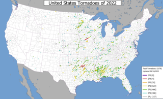
This page documents notable tornadoes and tornado outbreaks worldwide in 2022. Strong and destructive tornadoes form most frequently in the United States, Argentina, Brazil, Bangladesh, and Eastern India, but can occur almost anywhere under the right conditions. Tornadoes also develop occasionally in southern Canada during the Northern Hemisphere's summer and somewhat regularly at other times of the year across Europe, Asia, Argentina, Australia and New Zealand. Tornadic events are often accompanied by other forms of severe weather, including strong thunderstorms, strong winds, and hail. Worldwide, 32 tornado-related deaths were confirmed: 23 in the United States, three in China, two each in Poland and Russia, and one each in the Netherlands and Ukraine.
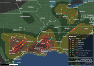
A large tornado outbreak struck the Southern region of the United States on March 21–22, 2022, before transitioning to the Eastern United States on March 23. The outbreak started with numerous supercell thunderstorms and severe squall lines developing in central Texas and southern Oklahoma, prompting the issuance of numerous tornado warnings, including multiple PDS tornado warnings. An EF3 tornado caused considerable damage in Jacksboro, Texas, while an EF2 tornado from the same storm caused a fatality in Sherwood Shores. Other strong tornadoes caused damage near College Station and in the Austin and Houston metropolitan areas. Severe and tornadic activity continued into the next day as the system moved eastward with numerous tornadoes reported in Mississippi and Alabama. On the evening of March 22, a supercell moved through the New Orleans metropolitan area, with an EF3 tornado producing severe damage in Arabi, resulting in one death and at least two injuries. Widespread flooding also accompanied the decaying squall line in Alabama. Tornadoes occurred on March 23 over the Eastern United States, associated with the same system, including EF2 tornadoes near Pickens, South Carolina, and Gladesboro, Virginia. In all, 85 tornadoes were confirmed.
Between March 29–31, 2022, a line of strong to severe thunderstorms and multiple supercells swept through portions of the United States and brought widespread wind damage and several strong tornadoes across a large part of the Midwestern, Southern, and Eastern United States. An EF3 tornado was confirmed in Springdale, Arkansas, while an EF1 tornado passed close to downtown Jackson, Mississippi. Numerous tornadoes, some of which were strong occurred over Mississippi, Alabama the evening of March 30 and into the early morning of March 31. Multiple tornadoes also occurred in the Florida Panhandle, including an intense EF3 tornado that killed two people and injured three others near Alford, Florida, and in other states such as North Carolina and Pennsylvania. Producing a total of 90 tornadoes, this was the largest tornado outbreak of 2022.
From April 4–5, 2022, a mesoscale convective system and numerous discrete supercells produced a swath of severe weather and several tornadoes in the Southeastern United States, including several strong, long tracked tornadoes. An EF3 tornado damaged or destroyed several homes in Bonaire, Georgia while a large EF3 tornado prompted a tornado emergency for Allendale and Sycamore, South Carolina. A violent EF4 tornado in Black Creek, Georgia resulted in one fatality as it destroyed several neighborhoods, and another large EF3 tornado caused widespread heavy tree damage northeast of Ulmer, South Carolina. More severe storms occurred across a large portion of the Southeast ahead of a cold front on April 6–7, with more tornadoes reported in South and Central Georgia and further south into Florida, all of which were weak. Along with the one tornadic death, trees felled by straight-line winds killed one person each in Louisiana and Texas.
The April 2022 North American storm complex affected much of the Rocky Mountains and the Midwestern United States with tornadoes, heavy snow, and gusty winds. The system in general first began impacting the Northwest on April 11, before moving eastward into the Rocky Mountains the following day. It was also responsible for producing a large severe weather outbreak of tornadoes and damaging straight-line wind in the Midwest and South while contributing to a powerful blizzard in the upper Midwest states of North and South Dakota.
A four-day tornado outbreak affected the Central and Southern United States in mid-December 2022. The outbreak produced strong tornadoes in Oklahoma, Texas, Louisiana, Mississippi, Alabama, and Georgia, resulting in severe damage and three fatalities. On December 13, a high-end EF1 tornado was caught on video from multiple angles as it caused considerable damage in Grapevine, Texas, where five people were injured, and multiple EF2 tornadoes caused significant damage in other parts of Texas and Oklahoma that morning. Two large EF2 tornadoes occurred near DeBerry, Texas and Keachi, Louisiana to the southwest of Shreveport, Louisiana, with the second one causing severe damage and two fatalities. An EF3 tornado struck the northern fringes of Farmerville, causing major structural damage and 14 injuries.
An intense low-pressure system produced widespread impacts across the United States in early March 2023. Additionally, an outbreak of 35 tornadoes affected 12 states from the Southern United States to the Great Lakes. In all, the storm system killed 13 people due to flooding and strong winds. At least 17 other people were injured.