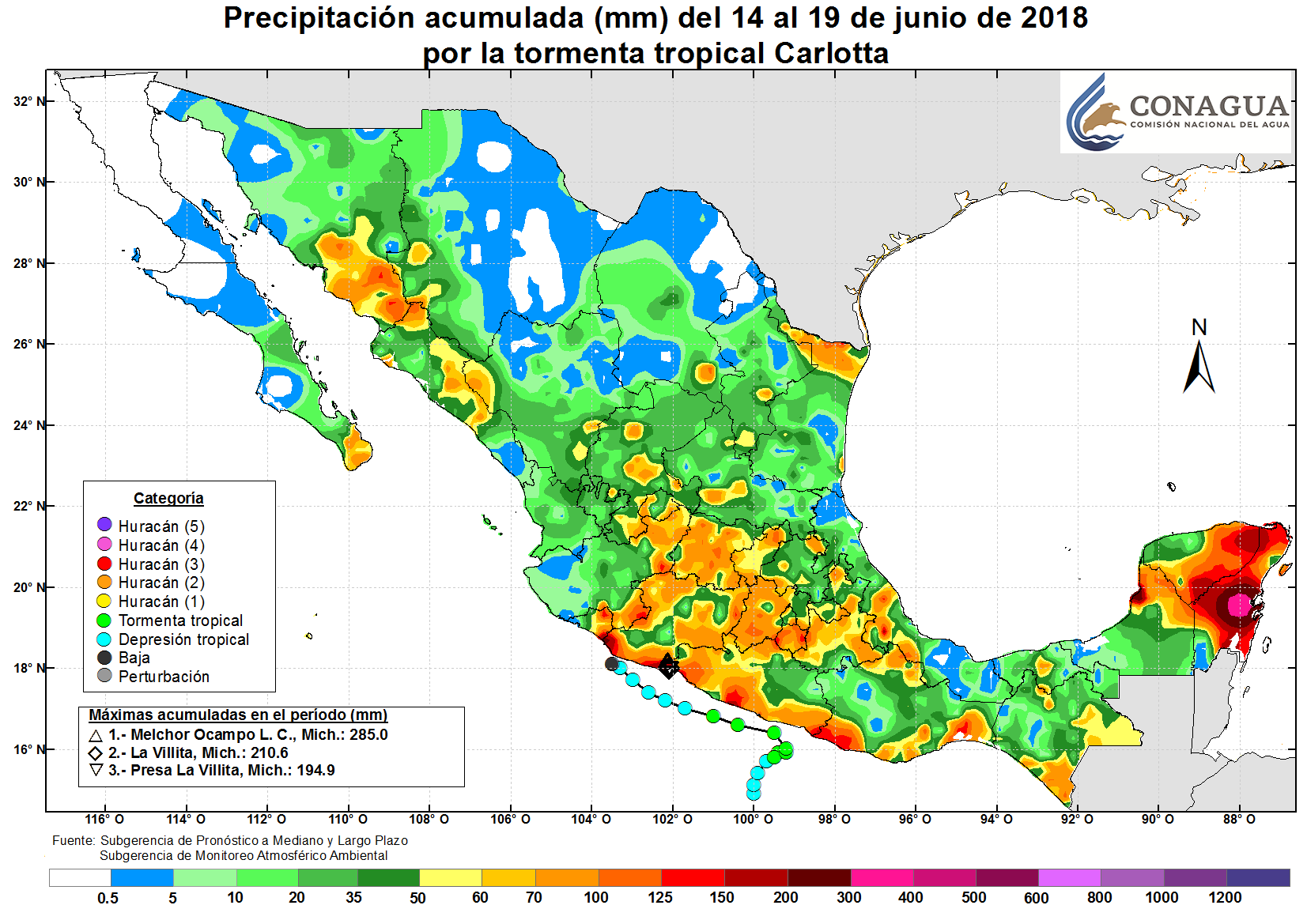
Tropical Storm Carlotta (2018)

Last updated
Map key
  Tropical depression (≤38 mph, ≤62 km/h)
  Tropical storm (39–73 mph, 63–118 km/h)
  Category 1 (74–95 mph, 119–153 km/h)
  Category 2 (96–110 mph, 154–177 km/h)
  Category 3 (111–129 mph, 178–208 km/h)
  Category 4 (130–156 mph, 209–251 km/h)
  Category 5 (≥157 mph, ≥252 km/h)
  Unknown
Storm type
Disc Plain black.svg Tropical cyclone
Solid black.svg Subtropical cyclone
ArrowUp.svg Extratropical cyclone, remnant low, tropical disturbance, or monsoon depression

Tropical Storm Carlotta formed as the result of a breakdown in the Intertropical Convergence Zone to the south of Mexico. A tropical wave that traversed Central America around June 11 may have contributed to the storm's formation as well. [1] On June 12, the Miami-based National Hurricane Center (NHC) reported that a broad area of low pressure had formed several hundred miles south of southeastern Mexico. [2] The NHC continued to monitor the disturbance over the next two days as it drifted northward. [3] Initially, strong upper-level winds prevented development, [2] but the system increased in organization unexpectedly on June 14. [4] Following further structural improvements, the NHC upgraded the system to tropical depression status at 18:00 UTC while it was located about 140 mi (220 km) south of Acapulco. [1] Around that time, the NHC forecast that a mid-level ridge over Mexico would weaken the following day, and would leave the depression in an area of light steering currents. [5] Despite being located in a favorable environment with low to moderate wind shear and sea surface temperatures exceeding 86 °F (30 °C), [6] the depression experienced minimal change in intensity over the next 18 hours. After the system's center reformed farther north, the NHC amended its intensity forecast to indicate reduced strengthening, citing the fact that the system would spend less time over water. [7] Around 18:00 UTC on June 15, the system strengthened into a tropical storm, after which it was assigned the name Carlotta. The system's intensity then leveled off for about twelve hours. [1]

Early on June 16, Carlotta's forward motion began to fluctuate, changing from northeast to southeast in six hours. [8] The storm began to intensify again around 06:00 UTC as it stalled off the coast of Mexico. [1] [9] Soon after, the cyclone began moving in a northerly direction. [10] Over the next twelve hours, Carlotta experienced little change in organization before peaking at 00:00 UTC on June 17, with maximum sustained winds of 65 mph (100 km/h) and a minimum central pressure of 997 mbar (29.44 inHg) while located only 30 mi (50 km) south-southeast of Acapulco. [1] Around that time, the NHC noted that the system's structure had improved significantly, with a contracting eye and more symmetric eyewall. [11] As the system started tracking towards the northwest, Carlotta began to weaken because of increasing interaction with land and northerly wind shear. [12] Around 18:00 UTC on the June 17, the storm weakened into a tropical depression after lacking organized deep convection for several hours. [1] [13] Over the next day, the depression continued to weaken before degenerating into a remnant low on June 19 at 00:00 UTC. [1] Shortly afterwards, Carlotta's upper-level circulation decoupled entirely and drifted towards the southwest, while the low- and mid-level remnants remained. [14] The system's remnants dissipated around 06:00 UTC while located offshore of the Mexican coast between Manzanillo and Zihuatanejo, having never made landfall as a tropical cyclone. [1]

Preparations and impact

Tropical Depression Carlotta weakening off the southern coast of Mexico on June 18. Carlotta 2018-06-18 1725Z.jpg
Tropical Depression Carlotta weakening off the southern coast of Mexico on June 18.

On June 14 at 21:00 UTC, the Government of Mexico issued a tropical storm watch for Tecpan de Galeana to Punta Maldonado, [15] which was upgraded to a tropical storm warning six hours later. [16] At 15:00 UTC, the next day, the tropical storm warning was extended to Lagunas de Chacahua. [17] Six hours later, the warning was discontinued for Tecpan de Galeana to west of Acapulco. [18] On June 17 at 03:00 UTC, the warning was extended westward from Acapulco to Tecpan de Galeana and cancelled to the east of Punta Maldonado. [19] At 09:00 UTC, the warning was discontinued east of Tecpan de Galeana and extended westward to Lazaro Cardenas. [20] The tropical storm warning was canceled at 18:00 UTC, after the storm weakened into a tropical depression. [21]

Tropical Storm Carlotta caused flooding in southern Mexico, with the states of Aguascalientes, Guerrero, Michoacán, Oaxaca, and Puebla, being affected, as well as the Yucatán Peninsula. In the Yucatán Peninsula, Carlotta, a tropical wave, and another low-pressure system dropped 70–400 mm (3–20 in) of rain, causing severe flooding. [22] [23] In the Tizimín Municipality, the Popolnáh police station was inundated and the DN-III-E Plan, a plan for the coordination of search and rescue operations and disaster aid, was activated to help with recovery efforts. [23]

In Oaxaca, severe flooding killed one individual. Fishermen recovered the body of a 29-year-old man about 10 mi (20 km) off the coast after he was dragged away by flood waters and drowned. [24] The proximity of the storm prompted the closure of the ports of Huatulco, Puerto Ángel, and Puerto Escondido as well as the suspension of fishing operations. [25] Multiple landslides also occurred as a result of the extreme rainfall. [26] [27] Only minor damage was reported in Guerrero. In the Costa Chica region, the storm damaged several palapas on a beach and the fishing equipment of at least 80 families, preventing them from working. [28] In the municipalities of Tecpan de Galeana, Zihuatanejo and Petatlán, 42 homes were inundated by flood waters. A total of 138 trees were downed in Acapulco and several other municipalities. In Acapulco, a hospital sustained damage to its windows and four injuries were reported. Additionally, 32 neighborhoods lost power, nine houses lost their roofs, and 11 roads collapsed. [29] [30] In Tehuacán, Puebla, homes and businesses were flooded, multiple cars were stranded, and several trees fell. Nearby, a state highway and a bridge collapsed, cutting off several towns in the area. [31]

In Michoacán, multiple cities along the coast experienced severe flooding. In Melchor Ocampo, a peak rainfall total of 285.0 mm (11.2 in) occurred. Approximately 211 mm (8.31 in) of rain fell in La Villita while 195 mm (7.68 in) was recorded in Presa La Villita. [22] Rainfall caused the Acalpican River to overflow its banks. [32] In the Tiquicheo Municipality, 10 houses were flooded after a river near the city overflowed its banks. [33] Multiple homes were inundated in the Zamora Municipality. In Pátzcuaro, multiple landslides occurred, damaging roads in the region. In Nuevo Urecho, the overflow of the Los Hervores River damaged water pumps, resulting in a water shortage throughout the municipality. [34] Throughout the storm, 35 temporary shelters were in operation in Michoacán. [35] [32] The insurance claims statewide reached MX$156 million (US$7.6 million). [36]

In Aguascalientes, Carlotta caused infrastructural damage and two indirect deaths in Aguascalientes City. Rainfall from the system flooded streets, sweeping away dozens of cars and prompting the rescue of several people. Two women became trapped in their vehicle because of rising flood waters and died of carbon monoxide poisoning. [37] [38] After 57 mm (2.2 in) of rain fell, [39] the city's drainage system failed, [38] 12 houses were flooded, and 12 trees fell. [37] A waterspout was reported in the state. Mexican authorities alerted the public that the El Cedazo dam had the potential to overflow because of the heavy rainfall, [38] [39] although this did not occur. [40]

See also

Related Research Articles

<span class="mw-page-title-main">2012 Pacific hurricane season</span> Hurricane season in the Pacific Ocean

The 2012 Pacific hurricane season was a moderately active Pacific hurricane season that saw an unusually high number of tropical cyclones pass west of the Baja California Peninsula. The season officially began on May 15 in the eastern Pacific Ocean, and on June 1 in the central Pacific (from 140°W to the International Date Line, north of the equator; they both ended on November 30. These dates conventionally delimit the period of each year when most tropical cyclones form in these regions of the Pacific Ocean. However, the formation of tropical cyclones is possible at any time of the year. This season's first system, Tropical Storm Aletta, formed on May 14, and the last, Tropical Storm Rosa, dissipated on November 3.

<span class="mw-page-title-main">Tropical Storm Dalila (2007)</span> Pacific tropical storm in 2007

Tropical Storm Dalila caused flooding in western Mexico in late July 2007. The seventh tropical cyclone and the fourth named storm of the 2007 Pacific hurricane season, Dalila developed from a tropical wave located well southwest of Mexico on July 22. Initially, northeasterly shear caused the depression to remain disorganized, though by early on July 24, it was upgraded to Tropical Storm Dalila. During the next twenty-four hours, Dalila strengthened slightly further while tracking steadily northwestward, attaining peak winds of 60 mph (97 km/h) early on the following day. Shortly thereafter, Dalila either crossed or moved very close to Socorro Island on July 25. Due to decreasing sea surface temperatures, the storm slowly began to weaken, after curving west-northwestward. Early on July 27, Dalila was downgraded to a tropical depression, several hours before degenerating into a remnant low pressure area.

<span class="mw-page-title-main">Tropical Storm Julio (2002)</span> Tropical storm in 2002

Tropical Storm Julio was a weak and short-lived tropical storm that made landfall along the southern Mexican coast in September 2002. The twelfth named storm of the 2002 Pacific hurricane season, Julio originated from an area of convection that organized into a tropical depression on September 25. Initially forecast to stay offshore, the depression moved northward and strengthened into a tropical storm that same day. Julio turned to the northwest and peaked as a minimal tropical storm just before landfall near Lázaro Cárdenas, on September 26. The storm soon weakened into a tropical depression and rapidly dissipated over Mexico that day.

<span class="mw-page-title-main">Tropical Storm Odile (2008)</span> Pacific tropical storm in 2008

Tropical Storm Odile was a late season tropical storm that formed during the 2008 Pacific hurricane season and affected parts of southern Mexico. A tropical depression formed on October 8, and became Tropical Storm Odile 18 hours later. The storm paralleled the south coast of Mexico, with the center located only several miles offshore. After peaking in intensity, increasing southeasterly vertical wind shear induced a trend of rapid weakening on the storm. Correspondingly, Odile was downgraded to a tropical depression early on 12 October, subsequently degenerating into a remnant low about 55 mi (85 km) south of Manzanillo, Colima. From thereon, the low proceeded slowly south-southwestward before dissipating on October 13. Since Odile stayed at sea, its effects along coastlines were limited. The most notable damages were caused by flooding along the southern coast of Mexico, mostly in Chiapas, Oaxaca, Guerrero and Michoacán. The exact amount of damage, however, remains unknown, and no fatalities were reported as a result of the storm.

<span class="mw-page-title-main">Tropical Depression Two-E (2006)</span> Pacific tropical depression in 2006

Tropical Depression Two-E was a short-lived tropical cyclone that brought heavy rainfall to southwestern Mexico. It was the only cyclone during the month in the eastern North Pacific Ocean, forming on June 3 from a tropical wave. The depression initially moved northeastward, threatening the Mexican states of Michoacán and Guerrero with a potential of it attaining tropical storm status. It remained a tropical depression, weakening due to land interaction and wind shear, and on June 5 it dissipated just off the coast. Rainfall from the depression peaked at 19.1 inches (486 mm) in Acapulco, which resulted in mudslides and flooding. A total of 42 houses were flooded, and 72 people were forced to leave their homes due to the storm; no deaths were reported.

<span class="mw-page-title-main">2013 Pacific hurricane season</span> Hurricane season in the Pacific Ocean

The 2013 Pacific hurricane season was the first to see twenty named storms since 2009 but also had the ninth fewest ACE units on record, as many of the storms were weak and short-lived. The season officially began on May 15 in the Eastern Pacific and started on June 1 in the Central Pacific; both ended on November 30. These dates conventionally delimit the period of each year when most tropical cyclones form east of the International Dateline in the North Pacific basin. The first cyclone, Tropical Storm Alvin, formed on May 15, and the last, Tropical Storm Sonia, dissipated on November 4.

<span class="mw-page-title-main">Hurricane Erick (2013)</span> Category 1 Pacific hurricane in 2013

Hurricane Erick brought minor impacts to the western coastline of Mexico in July 2013, and was the last of a succession of four Category 1 hurricanes to affect the Pacific coast of Mexico early in the 2013 Pacific hurricane season. The fifth named storm and fourth hurricane of the annual season, Erick originated from a tropical wave that moved off the western coast of Africa on June 18. The wave tracked swiftly westward with little development, emerging into the eastern Pacific on July 1. As a result of favorable environmental conditions, the wave developed into a tropical depression on July 4, and further into Tropical Storm Erick at 0000 UTC on July 5. Steered generally west-northwest, Erick intensified into a Category 1 hurricane and reached its peak intensity with winds of 80 mph (130 km/h) on July 6. Its proximity to land and track over increasingly cooler waters caused the storm to deteriorate into a tropical storm the following day, though it remained at such intensity until degenerating into a remnant low early on July 9. The remnant circulation dissipated a few hours later, southwest of Baja California Sur.

<span class="mw-page-title-main">Tropical Storm Trudy (2014)</span> Pacific tropical storm in 2014

Tropical Storm Trudy was a short-lived tropical cyclone in October 2014 that caused significant flooding in southern Mexico. The storm originated from an area of low pressure associated with a monsoon trough near Central America in early October. A slow-moving system, the low eventually consolidated into a tropical depression on October 17 near the Mexican coastline. Favorable environmental conditions aided rapid development of Trudy. Within 15 hours of its designation, an eye formed over the storm's center. Trudy ultimately achieved its peak intensity as a strong tropical storm with 65 mph (100 km/h) winds as it made landfall just southeast of Marquelia, Mexico. The region's mountainous terrain quickly weakened Trudy and the cyclone dissipated early on October 19. Though the cyclone dissipated, its remnant energy later contributed to the formation of Tropical Storm Hanna in the Atlantic.

<span class="mw-page-title-main">Hurricane Carlos (2015)</span> Category 1 Pacific hurricane in 2015

Hurricane Carlos was an unusually small tropical cyclone which affected the western coast of Mexico in June 2015. Forming as the third named storm and hurricane of the annual hurricane season, Carlos developed from a trough first noted by the National Hurricane Center on June 7. The disturbance gradually organized and was designated as a tropical depression three days later while south of the Mexican Pacific coast. Drifting slowly northwestward, the depression was upgraded further to a tropical storm. Although persistent wind shear and dry air hampered intensification early on, Carlos strengthened into a hurricane on June 13 after moving into a more favorable environment. However, the return of dry air and upwelling of cooler waters caused the system to deteriorate into a tropical storm. Paralleling the Mexican coast, Carlos later regained hurricane intensity on June 15 and attained peak winds of 90 mph (140 km/h) a day later. The reprieve was brief, however, as the onset of wind shear, land interaction, and dry air afterward led to rapid weakening. On June 17, Carlos degenerated into a remnant area of low pressure, having made landfall in Jalisco earlier that day. By the morning of June 18, Carlos was declared to have completely dissipated.

<span class="mw-page-title-main">Hurricane Marty (2015)</span> Pacific tropical cyclone in 2015

Hurricane Marty was a tropical cyclone that produced heavy rains and flooding in several states in Southwestern and Western Mexico. The twentieth named storm and twelfth hurricane of the annual hurricane season, Marty developed from a tropical wave on September 26, 2015, to the southwest of Acapulco, Guerrero, in Mexico. Initially a tropical depression, the system strengthened into a tropical storm early on the following day. Due to favorable atmospheric conditions, Marty continued to intensify, but wind shear sharply increased as the storm approached a large mid- to upper-level trough. Despite this, the cyclone deepened further, becoming a hurricane on September 28 and peaking with sustained winds of 80 mph (130 km/h) shortly thereafter. Wind shear quickly took its toll on the hurricane, weakening it to a tropical storm early on September 29. About 24 hours later, Marty degenerated into a post-tropical low-pressure area offshore Guerrero. The low further degenerated into a trough later on September 30, and eventually dissipated on October 4.

<span class="mw-page-title-main">2018 Pacific hurricane season</span> Hurricane season in the Pacific Ocean

The 2018 Pacific hurricane season was one of the most active Pacific hurricane seasons on record, producing the highest accumulated cyclone energy value on record in the basin. The season had the fourth-highest number of named storms – 23, tied with 1982. The season also featured eight landfalls, six of which occurred in Mexico. The season officially began on May 15 in the Eastern Pacific, and on June 1 in the Central Pacific; they both ended on November 30. These dates conventionally delimit the period of each year when most tropical cyclones form in the Pacific basin. However, tropical cyclone formation is possible at any time of the year, as illustrated when the first tropical depression formed on May 10, five days prior to the official start of the season.

<span class="mw-page-title-main">Hurricane Bud (2018)</span> Category 4 Pacific hurricane in 2018

Hurricane Bud was a Category 4 hurricane that brought winds and severe flooding to Mexico throughout its existence as a tropical cyclone in June 2018. It was the second named storm, hurricane, and major hurricane of the 2018 Pacific hurricane season. Bud originated from a tropical wave that departed from Western Africa on May 29. It traveled across the Atlantic Ocean before entering the Northeast Pacific Ocean late on June 6. The system moved towards the northwest and steadily organized, becoming a tropical depression on June 9 and Tropical Storm Bud early the next day. Favorable upper-level winds, ample moisture aloft, and warm sea surface temperatures allowed the storm to rapidly intensify to a hurricane late on June 10, and further to a major hurricane on the following day. Bud ultimately peaked the next morning with maximum sustained winds of 140 mph (230 km/h) and a minimum central pressure of 943 mbar. Its track curved more northward while the storm rapidly succumbed to the effects of upwelling. Bud made landfall on Baja California Sur as a minimal tropical storm early on June 15. On the next day, land interaction and increasing wind shear caused Bud to degenerate into a post-tropical cyclone. It opened up into a trough of low-pressure on June 16. The remnants of Bud moved towards the Southwestern United States, bringing tropical moisture and gusty winds to the region.

<span class="mw-page-title-main">2021 Pacific hurricane season</span> Hurricane season in the Pacific Ocean

The 2021 Pacific hurricane season was a moderately active Pacific hurricane season, with above-average activity in terms of number of named storms, but below-average activity in terms of major hurricanes, with 19 named storms, 8 hurricanes, and 2 major hurricanes forming in all. It also had a near-normal accumulated cyclone energy (ACE). The season officially began on May 15, 2021 in the Eastern Pacific Ocean, and on June 1, 2021, in the Central Pacific in the Northern Hemisphere. The season ended in both regions on November 30, 2021. These dates historically describe the period each year when most tropical cyclogenesis occurs in these regions of the Pacific and are adopted by convention. However, the formation of tropical cyclones is possible at any time of the year, as illustrated by the formation of Tropical Storm Andres on May 9, which was the earliest forming tropical storm on record in the Eastern Pacific. Conversely, 2021 was the second consecutive season in which no tropical cyclones formed in the Central Pacific.

<span class="mw-page-title-main">Tropical Storm Vicente (2018)</span> Eastern Pacific tropical cyclone with landfall in Mexico

Tropical Storm Vicente was an unusually small tropical cyclone that made landfall as a tropical depression in the Mexican state of Michoacán on October 23, 2018, causing deadly mudslides. The 21st named storm of the 2018 Pacific hurricane season, Vicente originated from a tropical wave that departed from Africa's western coast on October 6. The wave traveled westward across the Atlantic and entered the Eastern Pacific on October 17. The disturbance became better defined over the next couple of days, forming into a tropical depression early on October 19. Located in an environment favorable for further development, the system organized into Tropical Storm Vicente later that day.

<span class="mw-page-title-main">Tropical Storm Ileana (2018)</span> Pacific tropical cyclone

Tropical Storm Ileana was a small tropical cyclone that affected western Mexico in early August 2018, causing deadly flooding. The eleventh tropical cyclone and ninth named storm of the 2018 Pacific hurricane season, Ileana originated from a tropical wave that the National Hurricane Center began monitoring on July 26 as the wave left the west coast of Africa. The wave traveled across the Atlantic Ocean with no thunderstorm activity, before crossing into the Eastern Pacific Ocean early on August 4. Rapidly developing, the disturbance organized into a tropical depression on the evening of the same day. Initially, the depression was well-defined, but it soon degraded due to northerly wind shear. Despite the unfavorable conditions, the system began to strengthen on August 5, becoming Tropical Storm Ileana. A day later, on August 6, Ileana began to develop an eyewall structure as it reached its peak intensity with winds of 65 mph (100 km/h) and a pressure of 998 mbar (29.47 inHg). The storm gradually became intertwined with the nearby Hurricane John; over the next day, the circulation of John disrupted Ileana before ultimately absorbing it on August 7.

<span class="mw-page-title-main">Tropical Storm Dolores (2021)</span> Pacific tropical storm in 2021

Tropical Storm Dolores was a strong tropical storm that affected several states in southwestern Mexico in June 2021. The fourth named storm of the 2021 Pacific hurricane season, Dolores developed from a low-pressure area that formed offshore the state of Oaxaca on June 16, 2021. The area steadily developed deep convection and a closed surface circulation, becoming Tropical Depression Four-E around 09:00 UTC on June 18. The depression quickly strengthened to Tropical Storm Dolores six hours later. As it gradually approached the coast, Dolores steadily intensified despite its proximity to land. It reached peak intensity at 15:00 UTC on June 19 with maximum sustained winds of 70 mph (115 km/h) and a minimum barometric pressure of 990 millibars (29 inHg), just below hurricane strength. Shortly afterward, Dolores made landfall just northwest of Punta San Telmo, Mexico, near the Colima-Michoacán state border. The storm rapidly weakened as it moved inland and dissipated early on June 20 over Zacatecas. However, the storm's mid-level circulation continued northward, before it dissipated later that day.

<span class="mw-page-title-main">Hurricane Nora (2021)</span> Category 1 Pacific hurricane in 2021

Hurricane Nora was a large tropical cyclone that made landfall in southern Mexico, and later went to affect Baja California. The fourteenth named storm and fifth hurricane of the 2021 Pacific hurricane season, the system was first monitored by the National Hurricane Center (NHC) as an area of low pressure near the coast of Mexico. It intensified into Tropical Depression Fourteen-E, but the depression struggled to develop as a result of wind shear. It further intensified to a tropical storm and was named Nora as it tracked west-northwest. It peaked as a Category 1 hurricane with winds of 85 miles per hour (140 km/h) on August 28, before grazing the Mexico coastline and making landfall two separate times, dissipating on August 30. According to the National Hurricane Center's Tropical Cyclone Report, three direct deaths occurred as a result of Nora.

<span class="mw-page-title-main">Hurricane Rick (2021)</span> Category 2 Pacific hurricane in 2021

Hurricane Rick was the fifth named storm and fourth hurricane to make landfall along the Pacific coast of Mexico in 2021. The seventeenth named system and the eighth hurricane of the 2021 Pacific hurricane season, Rick formed as a low pressure system and was quickly upgraded to a tropical depression on October 21. Late on October 22, the storm was designated as a tropical storm and was given the name Rick. A few hours later, on October 23, the storm was upgraded to a hurricane. Rick continued to intensify and reached peak intensity early on October 25, making landfall as a Category 2 hurricane at 10:00 UTC that morning.

<span class="mw-page-title-main">Hurricane Blas (2022)</span> Category 1 Pacific hurricane in 2022

Hurricane Blas was a Category 1 hurricane that brought winds and flooding to several Mexican states in June 2022. The second named storm and second hurricane of the 2022 Pacific hurricane season, Blas developed from a low-pressure area off the coast of southwestern Mexico. It became a tropical depression on June 14. and strengthened into a tropical storm later that same day. Blas became a hurricane the next day, while paralleling the coast. The system reached its peak intensity on June 17, at 15:00 UTC, with maximum sustained winds of 80 knots and a central pressure of 976 mbar (28.82 inHg). Later, Blas turned to the west and weakened, becoming a tropical depression on June 20, before transitioning into a post-tropical cyclone on that same day.

<span class="mw-page-title-main">Hurricane Beatriz (2023)</span> Category 1 Pacific hurricane in 2023

Hurricane Beatriz was a Category 1 Pacific hurricane that caused widespread flooding along much of the Pacific coast of southwestern Mexico in late June and early July 2023. The second named storm and second hurricane of the 2023 Pacific hurricane season, Beatriz developed from an area of low pressure that first formed offshore of southern Mexico on June 25. The disturbance was slow to organize, but due to the impending threat it posed to the Mexican coast, advisories were initiated on it as Potential Tropical Cyclone Two-E at 03:00 UTC on June 29. The system organized into a tropical depression six hours later. Later that day, the depression strengthened into a tropical storm and was named Beatriz. Closely paralleling the coast of Mexico, Beatriz rapidly intensified into a hurricane at 15:00 UTC on June 30. The storm peaked in intensity shortly after with maximum sustained winds of 85 mph (137 km/h) and a minimum barometric pressure of 992 mbar (29.3 inHg). Early on July 1, the hurricane's center brushed the coast near Punta San Telmo, after which it steadily lost organization. Beatriz weakened to a tropical storm shortly thereafter, and the system dissipated entirely by 18:00 UTC that day offshore of Cabo Corrientes.

References

  1. 1 2 3 4 5 6 7 8 9 Pasch, Richard (19 December 2018). Tropical Cyclone Report: Tropical Storm Carlotta (2018) (PDF) (Report). National Hurricane Center. Archived (PDF) from the original on 2 March 2019. Retrieved 28 February 2019.
  2. 1 2 Blake, Eric (12 June 2018). Eastern Pacific Tropical Weather Outlook [1100 AM PDT Tue Jun 12 2018] (Report). NHC Graphical Outlook Archive. National Hurricane Center. Archived from the original on 25 February 2020. Retrieved 10 March 2019.
  3. Blake, Eric (14 June 2018). Eastern Pacific Tropical Weather Outlook [500 AM PDT Thu Jun 14 2018] (Report). NHC Graphical Outlook Archive. National Hurricane Center. Archived from the original on 1 April 2019. Retrieved 10 March 2019.
  4. Blake, Eric (13 June 2018). Eastern Pacific Tropical Weather Outlook [1100 AM PDT Wed Jun 13 2018] (Report). NHC Graphical Outlook Archive. National Hurricane Center. Archived from the original on 1 April 2019. Retrieved 10 March 2019.
  5. Blake, Eric (14 June 2018). Tropical Depression Four-E Discussion Number 1 (Report). National Hurricane Center. Archived from the original on 16 August 2019. Retrieved 10 March 2019.
  6. Zelinsky, David (15 June 2018). Tropical Depression Four-E Discussion Number 2 (Report). National Hurricane Center. Archived from the original on 25 February 2020. Retrieved 10 March 2019.
  7. Blake, Eric (15 June 2018). Tropical Depression Four-E Discussion Number 4 (Report). National Hurricane Center. Archived from the original on 25 February 2020. Retrieved 10 March 2019.
  8. Cangialosi, John (16 June 2018). Tropical Storm Carlotta Discussion Number 6 (Report). National Hurricane Center. Archived from the original on 25 February 2020. Retrieved 11 March 2019.
  9. Avila, Lixion (16 June 2018). Tropical Storm Carlotta Discussion Number 7 (Report). National Hurricane Center. Archived from the original on 25 February 2020. Retrieved 11 March 2019.
  10. Pasch, Richard (16 June 2018). Tropical Storm Carlotta Advisory Number 9 (Report). National Hurricane Center. Archived from the original on 25 February 2020. Retrieved 11 March 2019.
  11. Cangialosi, John (17 June 2018). Tropical Storm Carlotta Discussion Number 10 (Report). National Hurricane Center. Archived from the original on 16 August 2019. Retrieved 11 March 2019.
  12. Avila, Lixion (17 June 2018). Tropical Storm Carlotta Discussion Number 11 (Report). National Hurricane Center. Archived from the original on 25 February 2020. Retrieved 11 March 2019.
  13. Pasch, Richard (17 June 2018). Tropical Depression Carlotta Discussion Number 13 (Report). National Hurricane Center. Archived from the original on 25 February 2020. Retrieved 11 March 2019.
  14. Stewart, Stacy (19 June 2018). Post-Tropical Cyclone Carlotta Discussion Number 18 (Report). National Hurricane Center. Archived from the original on 16 August 2019. Retrieved 11 March 2019.
  15. Blake, Eric (14 June 2018). Tropical Depression Four-E Advisory Number 1 (Report). National Hurricane Center. Archived from the original on 25 February 2020. Retrieved 10 March 2019.
  16. Zelinsky, David (15 June 2018). Tropical Depression Four-E Advisory Number 2 (Report). National Hurricane Center. Archived from the original on 25 February 2020. Retrieved 10 March 2019.
  17. Blake, Eric (15 June 2018). Tropical Depression Four-E Advisory Number 4 (Report). National Hurricane Center. Archived from the original on 25 February 2020. Retrieved 11 March 2019.
  18. Blake, Eric (15 June 2018). Tropical Storm Carlotta Advisory Number 5 (Report). National Hurricane Center. Archived from the original on 25 February 2020. Retrieved 11 March 2019.
  19. Cangialosi, John (17 June 2018). Tropical Storm Carlotta Advisory Number 10 (Report). National Hurricane Center. Archived from the original on 1 April 2019. Retrieved 11 March 2019.
  20. Avila, Lixion (17 June 2018). Tropical Storm Carlotta Advisory Number 11 (Report). National Hurricane Center. Archived from the original on 25 February 2020. Retrieved 11 March 2019.
  21. Pasch, Richard (17 June 2018). Tropical Depression Carlotta Intermediate Advisory Number 12A (Report). National Hurricane Center. Archived from the original on 16 August 2019. Retrieved 11 March 2019.
  22. 1 2 "Precipitación acumulada (mm) del 14 al 19 de junio de 2018 por la tormenta tropical Carlotta" (Map). gob.mx (in Spanish). Conagua. Archived from the original on 13 April 2020. Retrieved 12 March 2019.
  23. 1 2 Rodriguez, Yazmin (17 June 2018). "Tormenta tropical Carlotta afecta a 170 familias en Yucatán". El Universal (in Spanish). Archived from the original on 25 February 2020. Retrieved 9 April 2019.
  24. "Recuperan cuerpo de joven que cayó a arroyo en Oaxaca". Televisa News (in Spanish). 20 June 2018. Archived from the original on 10 August 2019. Retrieved 7 April 2019.
  25. "Alerta en Oaxaca por cercanía de 'Carlotta'; cierran puertos a la navegación". Televisa News (in Spanish). 15 June 2018. Archived from the original on 16 March 2020. Retrieved 7 April 2019.
  26. Alvarez, Xochitl; Carrizales, David (20 June 2018). "Lluvias provcan serveras inundaciones en Aguascalientes y Nuevo Leon". El Universal (in Spanish). Archived from the original on 25 February 2020. Retrieved 9 April 2019.
  27. "Tormentas por 'Carlotta' causan derrumbe en carretera de Oaxaca". Debate (in Spanish). 19 June 2018. Archived from the original on 25 February 2020. Retrieved 9 April 2019.
  28. "'Carlotta' provoca daños menores en Costa Chica de Guerrero". Televisa News (in Spanish). 17 June 2018. Archived from the original on 19 March 2020. Retrieved 9 April 2019.
  29. "Carlotta deja daños en 19 municipios de Guerrero". El Sol de México (in Spanish). 18 June 2018. Archived from the original on 31 March 2019. Retrieved 9 April 2019.
  30. Reyes, Laura (17 June 2018). "La tormenta 'Carlotta' deja daños en Guerrero". Expansion (in Spanish). CNN Espanol. Archived from the original on 25 February 2020. Retrieved 9 April 2019.
  31. "Lluvias intensas de 'Carlotta' causan inundaciones en Tehuacán, Puebla". Televisa News (in Spanish). 18 June 2018. Archived from the original on 25 February 2020. Retrieved 9 April 2019.
  32. 1 2 "Reportan lluvias en inundaciones en Michoacán por 'Carlotta'". Televisa News (in Spanish). 18 June 2018. Archived from the original on 14 August 2019. Retrieved 7 April 2019.
  33. Fuentes, Christian (19 June 2018). "El agua se mete a las casas en Tiquicheo; el alcalde, damnificado". La Voz de Michoacán (in Spanish). Archived from the original on 7 April 2019. Retrieved 7 April 2019.
  34. ""Carlotta" deja su huella en Michoacán". La Voz de Michoacán (in Spanish). 19 June 2018. Archived from the original on 7 April 2019. Retrieved 7 April 2019.
  35. Jaramillo, Tere (21 June 2018). "Tormenta tropical provocará lluvias en Michoacán". La Voz de Michoacán (in Spanish). Archived from the original on 7 April 2019. Retrieved 7 April 2019.
  36. ""Carlotta" afecta varias comunidades de Michoacán y cerca de 4 mil hectáreas de cultivo". El Universal (in Spanish). 19 June 2018. Archived from the original on 11 July 2019. Retrieved 7 April 2019.
  37. 1 2 Torres, David Julián (19 June 2018). "[Videos] Cobra dos vidas y deja afectaciones, intensa lluvia en Aguascalientes". El Sol de México (in Spanish). Archived from the original on 31 March 2019. Retrieved 31 March 2019.
  38. 1 2 3 "Video: Tromba deja dos muertos y vehículos arrastrados en Aguascalientes". La Silla Rota (in Spanish). 20 June 2018. Archived from the original on 31 March 2019. Retrieved 31 March 2019.
  39. 1 2 "Dos mueren atrapados en sus autos tras inundaciones en Aguascalientes". PSN en Linea (in Spanish). 20 June 2018. Archived from the original on 31 March 2019. Retrieved 31 March 2019.
  40. "Presa de Los Gringos Casi al 100% de su capacidad". Hidrocalidodigital (in Spanish). 21 June 2018. Archived from the original on 21 June 2018. Retrieved 10 May 2019.
Tropical Storm Carlotta
Carlotta 2018-06-16 2001Z.jpg
Tropical Storm Carlotta strengthening off the southwestern coast of Mexico on June 16