Known originally as Peach Grove, the area received the designation "Tysons Crossroads" after the Civil War.[11] William Tyson, a Maryland native from Cecil County, purchased a tract of land from A. Lawrence Foster.[12] Tyson served as postmaster of the now discontinued Peach Grove Post Office from 1854 to 1866.[13]
20th century
As recently as the 1950s, Tysons was a quiet rural intersection flanked by a few small stores and a fruit stand operated by the Tyson descendants, who sold apples and apple cider from the corner of their property. In 1963, the Tysons area moved from a country crossroads to a giant commercial urban area with the awarding of contracts at the interchange of VA Route 7 and VA Route 123.
In 1962, the Fairfax County Board of Supervisors approved the Tysons Corner Shopping Center, now Tysons Corner Center, which was planned to be 88.13 acres (356,600m2) within a 150 acres (0.61km2) triangle bordered by Chain Bridge Road, Leesburg Pike, and the Capital Beltway. Developers proclaimed it the largest enclosed mall in the world when it opened on July 25, 1968.[14]
In the early 21st century, an influx of technology companies into Northern Virginia led to new office buildings and hotels to the landscape. The rapid growth of Tysons in comparison to other locations near the Capital Beltway has been the topic of numerous studies.[15] One factor was the aggressive promotion of Tysons by Earle Williams, for many years the CEO of the defense contracting firm Braddock Dunn & McDonald.[15] Tysons serves as a downtown of Fairfax County, with one quarter of all office space and one eighth of all retail in the county, despite occupying just 1% of the county. It is an auto-oriented edge city with severe traffic congestion, and faces competition from the urban areas of Arlington and newer suburban edge cities such as Dulles.
In 2008, the Fairfax County Board of Supervisors unanimously voted to begin a 40-year plan to urbanize Tysons around the coming four stops of Washington Metro's Silver Line in the vein of neighboring Arlington County's Rosslyn-Ballston corridor.[16] A preliminary estimate from the Fairfax County Department of Transportation suggested that $7.83 billion in transportation infrastructure projects would be necessary to transform Tysons Corner into a high-density urban center from 2010 to 2050, most of which would be allocated to both construction phases of the Silver Line. Existing plans call for construction of a grid layout for streets around the rail stations, projected to cost $742 million. An additional $1 billion will be spent on further transit and street grid projects from 2030 to 2050.[17]
In November 2012, the county approved Arbor Row, a 2,500,000ft (762,000m) mixed-used development of office and residential high-rises, ground-floor retail, and underground parking near the Tysons Corner (now Tysons) station.[18] In April 2013, the county approved Scotts Run Station South, a 6,700,000ft (2,042,160m) development containing 17 buildings, including six office and residential buildings, one hotel, and ground-floor retail near the McLean Station. This development alone will be larger than Reston Town Center.[19][20]
Ahead of the Washington Metro Silver Line opening in mid-2014, the Fairfax County Board of Supervisors and the Tysons Partnership, a nonprofit association that represents the area's stakeholders, began rebranding the area as simply "Tysons", dropping "Corner" from the name. The change started as a matter of convenience, but later took hold to market the change in the area's character, according to members of the board. The change was unofficial at the time, and either "Tysons" or "Tysons Corner" could be used in addresses.[5] But in November 2015, the U.S. Census Bureau announced the CDP's name would officially be changed to Tysons as of the next summer.[21]
Tysons is seen as a modern prototype of an edge city. In its 40-year history, it has been given substantial redevelopment offers for the next 20 to 30 years.[22] The area has seen growing interest as plans to make it an urban center were begun in 2010. Private-sector development in the United States in combination with political groups have begun the planning process behind the redevelopment of Tysons.[23] Two forces are at work in the creation of an edge city, as it can be beneficial to both parties. With the redevelopment process taking place there has been an aggressive push to bring in businesses to Tysons. Edge cities such as Tysons have specific regional accessibility that has been enhanced by major projects funded by federal and state governments.[23] One of the bigger enhancements to transportation specifically to Tysons was the construction "of the Washington Dulles International Airport and an associated access road and the Capital Beltway but also expansions to state roads".[24]
The plan remains to see Tysons become Fairfax County's downtown core.[25] So far, "eight districts have been delimited, with four centered on new metro stations being transit-oriented development districts".[25] Future plans for transportation around the area continue to be made. "The aims of the plan are for 75% of development to be within half a mile of metro stations, an urban center of 200,000 jobs and 100,000 residents, a jobs balance of 4.0 per household".[25]
The community lies in the Piedmont upland, about 3.7 miles (6.0km) south-southwest of the Potomac River.[7][28] The highest natural point in Fairfax County, at 520 feet (160m) above sea level, is in Tysons.[29] Wolftrap Creek, a tributary of nearby Difficult Run, forms the community's northwestern border. Two of the creek's tributaries, Moomac Creek and the Old Courthouse Spring Branch, flow north through northwest Tysons. Scott Run, a tributary of the Potomac, flows north through eastern Tysons.[7]
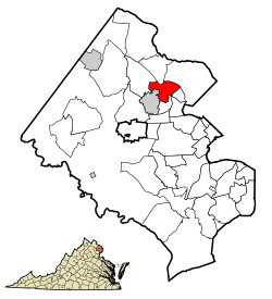
According to the U.S. Census Bureau, the community has an area of 4.27 square miles (11.1km2), of which 4.26 square miles (11.0km2) is land and 0.01 square miles (0.026km2) is water.[8]
Tysons was one of the inspirations for, and figures prominently in, Joel Garreau's pioneering study of the edge city phenomenon.[10] Among the reasons for calling Tysons an edge city is that, in contrast to typical "bedroom" suburbs, people commute into it in the morning and away from it at night, with a daytime population greater than 100,000 and a nighttime population of fewer than 20,000.[31] Planners envision up to 200,000 jobs and 100,000 residents in coming decades.[16]
2020 Census
As of the 2020 census (some information from the 2022 American Community Survey) there were 26,374 people, 14,222 housing units and 13,494 households residing in the CDP. The population density was 6,176.6 inhabitants per square mile (2,384.8/km2). The average housing unit density was 3,330.7 per square mile (1,281.3/km2). The racial makeup of the CDP was 48.86% White, 6.39% African American, 0.17% Native American, 32.40% Asian, 0.03% Pacific Islander, 3.13% from other races, and 9.03% from two or more races. Hispanic or Latino of any race was 8.63% of the population.[32]
Of the households, 41% were married couples, 22.1% were a male householder with family but no spouse, and 29% were a female householder with family but no spouse. The average family household had 2.81 people.[32]
The median age was 36.1, 16.8% of people were under the age of 18, and 13.1% were 65 years of age or older. Of the residents the largest ancestry is, 7.8% had German ancestry, 48.3% spoke a language other than English at home, and 41.5% were born outside the United States, 49.2% of whom were naturalized citizens.[32]
The median income for a household in the CDP was $129,468, and the median income for a family was $157,611. 5.5% of the population were military veterans, and 80.6% had a bachelor's degree or higher. In the CDP 6.8% of the population was below the poverty line, including 5.7% of those under age 18 and 13.2% of those age 65 or over, with 4.6% of the population without health insurance.[32]
2010 census
As of the 2010 census, there were 19,627 people, 9,481 households, and 4,754 families residing in the community. The population density was 4,607.3 inhabitants per square mile (1,778.9/km2). There were 10,637 housing units at an average density of 2,496.9 per square mile (964.1/km2). The racial makeup of the community was 60.9% White, 27.5% Asian, 4.9% African American, 0.2% American Indian, 0.1% Pacific Islander, 1.9% from other races, and 4.5% from two or more races. Hispanics and Latinos of any race were 8.1% of the population.[6]
There were 9,481 households, out of which 23.5% had children under the age of 18 living with them, 39.8% were married couples living together, 2.9% had a male householder with no wife present, 7.4% had a female householder with no husband present, and 49.9% were non-families. 40.7% of all households were made up of individuals, and 18.4% had someone living alone who was 65 years of age or older. The average household size was 2.07, and the average family size was 2.87.[6]
The age distribution of the community was 18.4% under the age of 18, 6.6% from 18 to 24, 40.4% from 25 to 44, 23.5% from 45 to 64, and 11.1% who were 65 years of age or older. The median age was 35.8 years. The gender makeup of the community was 47.7% male and 52.3% female.[6]
The median income for a household in the community was $94,083, and the median income for a family was $131,717. Males had a median income of $85,645 versus $66,019 for females. The community's per capita income was $64,294. About 2.8% of families and 4.2% of the population were below the poverty line, including 1.3% of those under age 18 and 14.3% of those age 65 or over.[6]
Tysons is Fairfax County's central business district with the largest concentration of office space in Northern Virginia.[9] It had 46 million sq ft (4.3 million m2) of office and retail space as of 2008, making it a classic example of an edge city.[16] As of 2013, Tysons had 14 million sq ft (1.3 million m2) of office and retail space approved or under construction, approximately one-third of a 45 million sq ft backlog of projected urban development in close proximity to the area's four Metro Silver Line stations.[33]
Tysons includes a technology industry base and network infrastructure. In 2007, roughly 1,200 technology companies operated in Tysons. 31.6% of the jobs in the Tysons submarket and 20.2% of the companies in the submarket were in the technology sector.[9]
With 115,000 office and retail workers, Tysons is the nation's 12th-largest employment center.[51] As of 2012, 75.6% of the population over age 16 was in the labor force. 0.6% was in the armed forces, and 75.0% was in the civilian labor force with 70.4% employed and 4.5% unemployed. The occupational composition of the employed civilian labor force was: 66.4% in management, business, science, and arts; 20.3% in sales and office occupations; 10.5% in service occupations; 2.1% in natural resources, construction, and maintenance; 0.7% in production, transportation, and material moving. The three industries employing the largest percentages of the working civilian labor force were professional, scientific, and management, and administrative and waste management services (28.8%); educational services, health care, and social assistance (13.3%); and public administration (12.8%).[6]
The cost of living in Tysons is very high; compared to a U.S. average of 100, the cost of living index for the community is 140.4.[52] As of 2022, the median home value in the community was $620,800, the median selected monthly owner cost was $3,118 for housing units with a mortgage and $1,297 for those without, and the median gross rent was $2,426.[32]
Government
As it is unincorporated, Tysons has no municipal government. The Fairfax County Government provides local government services directly.[53] For the purposes of representation on the Fairfax County Board of Supervisors, Tysons is in the Board's Hunter Mill and Providence Districts.[54]
Companies in Tysons typically use McLean or Vienna addresses, but in 2011, the United States Postal Service approved the use of Tysons Corner as a postal address for the 22102 and 22182 ZIP codes of McLean and Vienna, respectively.[55]
Interstate 495, the Capital Beltway, runs generally north–south through eastern Tysons. Virginia State Route 267, the east-west Dulles Toll Road, runs along the community's northern border. The I-495/VA 267 interchange is located in the northeastern part of the community. Virginia State Route 7 runs southeast–northwest through Tysons, intersecting Virginia State Route 123, which runs northeast–southwest, in the community's center.[59]
In February 2017, VDOT began construction on the Jones Branch Connector, a half-mile roadway that crosses Interstate 495 and connects Central and Tysons East and is projected to carry more than 32,000 vehicles per day by 2040. The bridge opened to traffic in 2018, and work was completed in 2020.[66][67] The connection improved the operations along the adjacent road systems. This connection extended and widened existing lanes eastward along Scotts Crossing Road, ending at Route 123 adjacent to the McLean Metro Station.
Phelps, Nicholas A. (2012). "The Growth Machine Stops? Urban Politics and the Making and Remaking of an Edge City". Urban Affairs Review. 48 (5): 670–700. doi:10.1177/1078087412440275. S2CID145759247.
This page is based on this Wikipedia article Text is available under the CC BY-SA 4.0 license; additional terms may apply. Images, videos and audio are available under their respective licenses.