
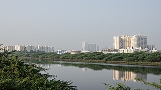
Tambaram is a southern suburb of Chennai, India. Located in the Chengalpattu district of Tamil Nadu, it is governed by Tambaram City Municipal Corporation and is a part of the Chennai Metropolitan Area.

Chromepet is a suburban neighbourhood of Chennai, India. Located in the southern Chennai Metropolitan Area, it is governed by the Tambaram Municipal Corporation. Chromepet is located 22 km from the Chennai Central Railway Station, and lies on the Grand Southern Trunk, close to Thirumudivakkam and Tambaram, and next to Pallavaram. The 200-feet road connects Chromepet with Thoraipakkam. Chromepet is 6 km from Outer Ring Road, Thirumudivakkam, and 4 km south of the Chennai International Airport at Trisulam.
Chitlapakkam is a residential locality in Chennai, Tamil Nadu, India. It is well known for its small, perennial lake and adjoining ecosystems.
Sembakkam is a residential locality in Tambaram City in Tamil Nadu State, India. It is located between Tambaram and Medavakkam and belongs to Tambaram Taluk Region.
Sholinganallur, also spelled Solinganalloor or Sozhinganalloor, is a southern neighbourhood of Chennai, India.
Vandalur is a census town and residential locality in southern part of the metropolitan city of Chennai, India. It is a neighbourhood in the southwestern part of Chennai. Vandalur serves as the southern gateway to Chennai city. It has the Arignar Anna Zoological Park, which contain some rare species of wild flora and fauna. The neighbourhood is served by Vandalur railway station of the Chennai Suburban Railway network.
Iyyappanthangal is a western neighborhood of Chennai, Tamilnadu, India. It comes under Mangadu Municipality of Chennai Metropolitan Area (CMA), governed by CMDA. It is located 20 kilometres (12 mi) away from Fort St George on the Mount-Poonamallee Road. The nearest railway stations are at Guindy about 11 kilometres (6.8 mi) away and Avadi about 12 kilometres (7.5 mi) away. The Porur Junction where a much needed road overbridge on the busy Guindy–Poonamallee stretch was built after a very long delay of nearly five years is just about 2 km from Iyyapanthangal and the Poonamallee Junction is just about 6 km from the town.
Grand Southern Trunk Road (or) National Highways 45 is an arterial road in Tamil Nadu. It is also known as Chennai–Trichy Highway. The Road starts from Kathipara Junction in St Thomas Mount, Chennai towards Tiruchirappalli. It branches out from Anna Salai.
The Greater Chennai Metropolitan Area, or simply the Chennai Metropolitan Area (CMA), is the third-most populous metropolitan area in India, the 22nd-most in Asia, and the 40th-most in the world. The CMA consists of the core city of Chennai, which is coterminous with the Chennai district, and its suburbs in Kanchipuram, Chengalpattu, Thiruvallur, and Ranipet districts. The Chennai Metropolitan Development Authority (CMDA) is the nodal agency that handles town planning and development within the metro area. Since 1974, an area encompassing 1,189 km2 (459 sq mi) around the city has been designated as the CMA and the CMDA has been designated as the authority to plan the growth of the city and the area around it. But in October 2022 the area of CMA was expanded five-fold to 5,904 km2 (2,280 sq mi).
Chennai Monorail was a proposal for a number of lines as part of mass transit system for the Indian city of Chennai. Originally the city planned to use monorail on all lines but many were subsequently changed to railways as part of the Chennai Metro.
The Outer Ring Road, officially State Highway 234, is a major transport corridor along the periphery of Chennai Metropolitan Area (CMA) by the Chennai Metropolitan Development Authority (CMDA). It is 62 km long connecting GST Road at Perungalathur, GST Road at Vandalur, NH 48 at Nazarethpettai, NH 716 at Pattabiram to NH 16 at Vijayanaallur and to TPP road at Minjur. On 29 August 2010, the then Tamil Nadu Deputy Chief Minister M. K. Stalin laid the foundation for the first phase of the project from Vandalur to Nemilichery covering a distance of 30 kilometres (19 mi). The Chennai ORR generally covers Avadi North, West and South, Redhills, Minjur and Tambaram neighbourhoods. Chennai Outer ring road had a plan of Chennai metro rail CMRL which is going to build up at gap between two roads.

Irumbuliyur Junction is one of the important junctions in the city of Chennai, India. It is located at Irumbuliyur near Tambaram in Chennai at the intersection of NH 45 with the Chennai Bypass.

Kovilambakkam is a southern suburb of Chennai, India. It is located in Chengalpattu district in the state of Tamil Nadu, about 26 km from Chennai city center and 12 km from Tambaram. The neighbourhood spans the areas of Sunnambu Kolathur, Chinna Kovilambakkam and Periya Kovilambakkam.
West Tambaram is a locality in Tambaram Tamil Nadu, India, located in the Chennai Metropolitan city. It is one of the main commercial and residential areas of the metropolitan region. Its main features include shopping centres such as Annai retail, More, Domino's, several colleges, schools, banks and public libraries. Shanmugam Road is a main shopping street located opposite to tambaram railway station which includes wholesale grocery as well as a huge vegetable market. Tambaram Mudichur road The main road through West Tambaram connects the Chennai Neighbourhood of Lakshmi Nagar, Krishna Nagar, Bharathi Nagar, Old Perungalathur, Madhana Puram, Mullai Nagar TNHB colony and Mudichur, ending at the Vandalur - Oragadam road. West Tambaram has been growing rapidly since the development of the Vandaloor-Nemilichery Outer Ring Road.

The Chennai Egmore–Thanjavur main line connects Chennai Egmore and Thanjavur Junction both in the Indian state of Tamil Nadu. The Chennai Egmore–Thanjavur main line is part of Chennai–Viluppuram–Chidambaram-Mayiladuthurai–Kumbakonam–Thanjavur–Tiruchirappalli line. There are several branch lines : Chengalpattu–Arakkonam links to Chennai Central–Bengaluru City line, Guntakal–Chennai Egmore section, Viluppuram–Puducherry, Cuddalore–Virudhachalam, Mayiladuthurai–Thiruvarur, and Peralam–Nagapattinam sectors. The line connects the Kaveri delta to Chennai.
Mudichur is a Residential Locality in Chennai Metropolitan Area in Tamil Nadu.
Mannivakkam is a town of Chennai Metropolitan City in the Indian state of Tamil-Nadu India. Mannivakkam lies between Vandalur and Mudichur, 7.5 kilometers from Tambaram and 2 kilometers from Vandalur. Mannivakkam is listed in CMDA's Chennai Metropolitan Area (CMA) master plan as village number 1 under Kattankolathur Panchayat Union. The town is well connected with industrial areas such as Oragadam and Sriperambadur by road and also with Maraimalai Nagar and Mahindra World City, Chennai by road as well as suburban railways.

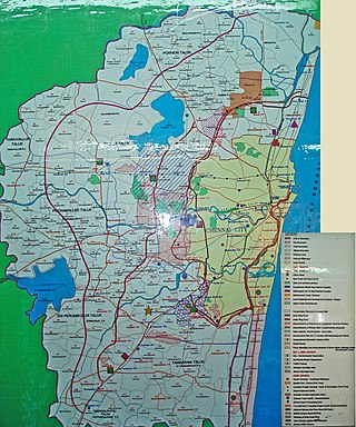
Tambaram City Municipal Corporation is the civic body administering the southern suburbs of Chennai in the Chengalpattu district of Tamil Nadu, India. It covers an area of 87.64 sq. km in the Pallavaram and Tambaram taluks adjacent to the limits of Greater Chennai Corporation, and has an estimated 2021 population of 960,887.

Chengalpattu District is one of the 38 districts of Tamil Nadu, in India. The district headquarters is located at Chengalpattu. Chengalpattu district came into existence on 29 November 2019 when it was carved out of Kanchipuram district after the announcement about the bifurcation of districts on 18 July 2019.


