
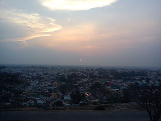
Chengalpattu, previously known as Chingleput, is a town and the headquarters of Chengalpattu district of the state Tamil Nadu, India. The town is located near to the industrial and IT hub. It is the headquarters of the district and is 56 kilometres (35 mi) away from the state capital, Chennai on the National Highway 45.

Adambakkam is a neighbourhood of Chennai, India. It is primarily a residential locality situated in South Chennai. Adambakkam area comes under Velachery taluk and Alandur taluk, Chennai District of Chennai Corporation. Adambakkam is surrounded by areas namely, Alandur in the North-West, Nanganallur in the West, Madipakkam in the South, Velachery in the East and Guindy in the North. Earlier, one part of Adambakkam was under the direct governance of Chennai Corporation. From October 2011 onwards, the entire area was merged with the Chennai Corporation. Upon completion of the MRTS extension line, the neighbourhood will be served by Adambakkam railway station. Its Proximity to commercial localities like Velachery, accessible railway stations, Metro Stations and road transport routes makes Adambakkam an ideal choice of location to live.
Ambattur is a northwestern neighbourhood of Chennai, India. It is located in Ambattur taluk of the Chennai District, surrounded by Avadi, Anna Nagar, Padi, Mogappair, Kallikuppam, Surapet, Korattur, Ayappakkam, Athipet and Thiruverkadu. It covers an area of 45 km2 (17 sq mi). The neighbourhood is served by Ambattur railway station of the Chennai Suburban Railway. Ambattur has its origins in a village of the same name which can be located at present as areas opposite to Ambattur telephone exchange. Ambattur was a village with large extents of agricultural farm lands irrigated by the once-sprawling Ambattur Lake. In 2011, the neighborhood had a population 466,205.

Parangimalai is a small hillock in the Chennai district of Tamil Nadu, India, near the neighbourhood of Guindy and very close to Chennai International Airport. By extension, it is also the name of the neighbourhood surrounding the hillock.

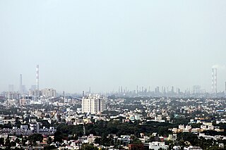
Chennai district, formerly known as Madras district, is one of the 38 districts in the state of Tamil Nadu, India. It is the smallest and the most densely populated district in the state. The district is coterminous with the city of Chennai, which is administered by the Greater Chennai Corporation. It is surrounded by Tiruvallur district in the north and the west, Kanchipuram district in the south-west, Chenglpattu district in the south, and the Bay of Bengal in the east.
Perambur is a neighbourhood located in the northern region of Chennai, Tamil Nadu, India.
Puzhuthivakkam, commonly known as Ullagaram or Ullagaram–Puzhuthivakkam, is a southern neighbourhood of Chennai in Tamil Nadu, India. Puzhuthivakkam loosely translates to dust neighborhood. The neighbourhood is part of the Greater Chennai Corporation, following Chennai's expansion into Kanchipuram district. Puzhuthivakkam is located between the neighborhoods of Madipakkam, Adambakkam, Velachery, Pallikaranai, and Nanganallur. Puzhuthivakkam was initially developed in the late 1960s and early 1970s. Upon completion of the MRTS extension line, the neighborhood will be served by Puzhuthivakkam railway station. As of 2011, the town had a population of 53,322.

Poonamallee is a town and suburb of Chennai, India under the Chennai Metropolitan Area. It was historically called Pushpagirimangalam, later renamed in Tamil as Poovirundhavalli, and now colloquially called as Poondhamalli. It is the headquarters of the Poonamallee taluk of the Tiruvallur district in the Indian state of Tamil Nadu. The nearest Railway station is at Avadi. It acts as the gateway to the city from its western side. It is a town with rich cultural heritage and also a fast-growing areas in the city. As of 2011, the town had a population of 57,224. There are plans to merge the areas under Poonamallee Municipality with Avadi Municipal Corporation.

Tiruttani is a town in the Tiruvallur district, a suburb of Chennai within the Chennai Metropolitan Area, located in the state of Tamil Nadu, India. The town is renowned for the Tiruttani Murugan Temple, which is one of the Arupadaiveedu and is dedicated to Kartikeya (Murugan). Tiruttani was added to the Chennai Metropolitan Area in October 2022.
Thiruverkadu is a Western suburb of Chennai, Tamil Nadu. It comes under Thiruvallur district administration. It is famous for its Devi Karumariamman Temple. There is also Vedapureeswarar Temple in Thiruverkadu, where Lord Shiva and Goddess Parvathi are seen in their wedding pose inside the sanctum sanctorum. As of 2011, the town had a population of 62,289. It is a town with rich cultural heritage and also a fast-growing areas in the city.
Anakaputhur is a neighborhood in the city of Tambaram, situated within the Chennai Metropolitan Area, Tamil Nadu, India.
Edappadi is a municipality in the Salem district in the state of Tamil Nadu, India. Edappadi was once known for its thriving power loom industry. The economy is diversified by agriculture, heavy truck transport, granite, entertainment and foundries.

Oddanchatram is a town in Dindigul district in the Indian state of Tamil Nadu. Oddanchatram is a region in the southwest of Tamil Nadu. The Town was carved out of Madurai District in 1985. Oddanchatram is also famous for vegetable and cattle market. As of 2011, the town had a population of 30,064. It is known as vegetable city of Tamil Nadu. Oddanchatram vegetable market is the largest supplying of vegetables in Tamilnadu and Kerala. Agriculture is the major economic support for the town.
Katthivakkam is an residential and industrial area located in the northern part of Chennai. It is a part of zone 1 in Greater Chennai Corporation. It is under Thiruvottiyur taluk in Chennai district. It is a part of Thiruvottiyur(state assembly constituency) and Chennai North. Formerly a town and a municipality of Thiruvallur district in the Indian state of Tamil Nadu, it has now been absorbed by Chennai city in September 2011 and within Chennai District limit since January 2018. The neighbourhood is served by Katthivakkam railway station. As of 2011, the town had a population of 36,617.
Madhavaram is a neighbourhood of Chennai, Tamil Nadu, India. Located in the northern part of Chennai, it is also a taluk in Chennai District and a zone in Greater Chennai Corporation. It is located in between Perambur and Kodungaiyur. As of 2011, the neighbourhood had a population of 119,105. The Chennai district was expanded on 16 August 2018 by transferring Madhavaram taluk from Tiruvallur district to Chennai district.

Madurantakam is the southernmost suburb of Chennai city and a municipality in Chengalpattu district in the Indian state of Tamil Nadu. The town is known for the artificial and second largest lake in Tamil Nadu, the Madurantakam lake. It is said to have been built by the Chola King Uttama Chola, also called as Maduranthaka, during his reign. It is also home to the Eri-Katha Ramar Temple. As of 2011, the town had a population of 30,796.
Manali is an industrial and residential part of Chennai, India. It is a zone in Greater Chennai Corporation located in the northern part of Chennai district in the Indian state of Tamil Nadu. As of 2011, the neighborhood had a population of 35,248.
Hosur is an industrial city located in Krishnagiri district in the Tamil Nadu state of India. Hosur is one of the 21 municipal corporations in Tamil Nadu. It is located on the bank of the river River Ponnaiyar, 40 kilometres (25 mi) southeast of Bengaluru and 306 kilometres (190 mi) west of Chennai, the state capital. Hosur is home to major manufacturing industries including Stellantis, Ashok Leyland, Titan, TVS Motors, Caterpillar, Ather Energy, Schaeffler, and many others.
Gerugambakkam is a residential-industrial neighborhood in the South-Western part of Chennai, a metropolitan city in Tamil Nadu, India.It belongs to the Kundrathur taluk of Kanchipuram District, Tamil Nadu, India. It forms a suburb of Chennai city.
Alandur taluk is a taluk of the district of Chennai in the Indian state of Tamil Nadu. The centre of the taluk is the neighbourhood of Alandur. The headquarters of the taluk is Guindy division. On 4 January 2018, Chennai district was expanded by annexing Alandur taluk.


