Maduravoyal Junction is an important junction in Chennai. It is located to the west of Koyambedu Junction at the intersection of National Highway 4 (India) (NH4) and Chennai Bypass.
A Cloverleaf interchange was constructed at this junction similar to the one in Kathipara Junction by the National Highways Authority of India (NHAI) as part of the ₹ 4050-million Chennai Bypass project (Phase II). The construction of the flyover was completed in June 2010. [1] The project was delayed because of the loose soil at the junction. It was rectified by erecting pillars. [2] The flyover has four loops that coalesce in a clover-shaped structure. The loops are available for vehicles proceeding from Tambaram to Koyambedu, Poonamallee to Tambaram, Puzhal to Poonamallee, and Koyambedu to Puzhal. The feature project maduravayol to thuraimugam (chennai port) parakkum thanga natkara salai starts from maduravoyal.
Pammal is a suburban neighbourhood of Chennai, Tamil Nadu, India. It is located 22 kilometers from Chennai Central Railway Station. It is located next to Pallavaram on the western side. It lies on the western side of the Grand Southern Trunk Road and close to Chennai International Airport. It is 7 kilometers away from Tambaram. The neighborhood is served by Pallavaram Railway Station of the Chennai Suburban Railway Network. Pammal falls under Chengalpattu District.
Maduravoyal is a residential neighbourhood located in the west of Chennai, India. As of 2011, the town had a population of 86,195.
Iyyappanthangal is a western neighborhood of Chennai, Tamilnadu, India. It comes under Mangadu Municipality of Chennai Metropolitan Area (CMA), governed by CMDA. It is located 20 kilometres (12 mi) away from Fort St George on the Mount-Poonamallee Road. The nearest railway stations are at Guindy about 11 kilometres (6.8 mi) away and Avadi about 12 kilometres (7.5 mi) away. The Porur Junction where a much needed road overbridge on the busy Guindy–Poonamallee stretch was built after a very long delay of nearly five years is just about 2 km from Iyyapanthangal and the Poonamallee Junction is just about 6 km from the town.
Grand Southern Trunk Road or National Highway 45 is an arterial road in the Indian state of Tamil Nadu. It is also known as Chennai–Trichy Highway. The road starts from Kathipara Junction in St Thomas Mount, Chennai towards Tiruchirappalli. It branches out from Anna Salai.

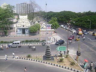
Kathipara Junction is an important road junction in Chennai, India. It is located at Alandur at the intersection of the Grand Southern Trunk Road, Inner Ring Road, Anna Salai and Mount-Poonamallee Road. Kathipara flyover is the largest cloverleaf flyover in South Asia.
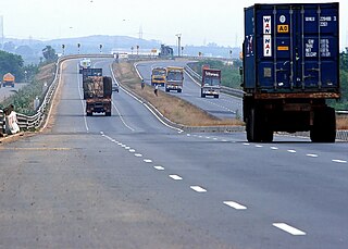
The Chennai Bypass Road is a full-access controlled expressway that interconnects four radial Indian National Highways around Chennai, India covering a distance of 32 km (20 mi) from Perungalathur on NH-32 to puzhal on NH-16 via Maduravoyal at a cost of ₹ 4.05 billion. Constructed as part of the National Highway Development Project to decongest the city of transiting vehicles, the expressway interconnects NH-32, NH-48, NH-716 and NH-16. This expressway now forms a part of the circular transportation corridor.
The Chennai Port – Maduravoyal Expressway is a 20.6-kilometre (12.8 mi) long, six lane, double-decker elevated expressway under construction in the city of Chennai, Tamil Nadu, India. The corridor begins at Chennai Port Gate No. 10 and travels along the bank of the Cooum River till it reaches Koyambedu and along the median of NH4 thereon till it reaches Maduravoyal.
Chennai Monorail was a proposal for a number of lines as part of mass transit system for the Indian city of Chennai. Originally the city planned to use monorail on all lines but many were subsequently changed to railways as part of the Chennai Metro.
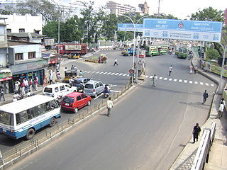
The Padi Lucas Junction is the intersection of NH 205 and Inner Ring Road in the city of Chennai and is one of the most important junctions in the city. It is located in Anna Nagar north of Koyambedu Junction. An elevated rotary has been constructed at this junction as part of the NHDP by NHAI to ease the traffic congestion. It was built at a cost of ₹ 1,300 million and was opened for traffic on 20 February 2009.
The Madhya Kailash Junction is an important junction in the southern part of the city of Chennai. It is located at the beginning of the Rajiv Gandhi Salai which intersects the Sardar Patel Road in the form of "T".
Chennai High Speed Circular Transportation Corridors (HSCTC) is an urban road transit in the form of elevated concentric beltways planned for the city of Chennai. The beltways are envisaged as an elevated 2-tier system with design speed of 80 km/h. The top tier is a 2-lane dedicated corridor for the Chennai BRTS system. The second tier is a 4-lane road for 4-wheelers (no buses and autos).

Irumbuliyur Junction is one of the important junctions in the city of Chennai, India. It is located at Irumbuliyur near Tambaram in Chennai at the intersection of NH 45 with the Chennai Bypass.

St. Thomas Mount-Poonamallee Road, popularly known as the Mount-Poonamallee Road (SH-55), is an arterial road in the city of Chennai, India. It runs for 11 kilometres from Kathipara Junction to the NH 4 highway connecting St. Thomas Mount with the suburb of Poonamallee. About 5 kilometres of the Mount-Poonamallee Road is located in the Alandur taluk of Chennai district, part of Maduravoyal Taluk in Chennai district and the remainder in the Poonamallee taluk of Thiruvallur district.
EVR Periyar Salai (EVR High Road), earlier known as Poonamallee High Road(NH 48) and originally the Grand Western Trunk Road, is an arterial road in Chennai, India. It is the longest road in Chennai. Running from east to west, the 14-kilometre (8.7 mi) road starts at Muthuswamy Bridge near Madras Medical College at Park Town and ends near Maduravoyal Junction via Kilpauk, Aminjikarai, Anna Nagar Arch, Arumbakkam, Koyambedu. It further continues west towards Poonamallee and traverses Sriperumbudur, Walajapet, and Ranipet.
Moolakadai Junction is an important road junction in Chennai, India. It is located at Moolakadai at the intersection of the Grand Northern Trunk Road, Madhavaram High Road, Tondiarpet High Road, Kamaraj Road.

Vadapalani Metro station is a Metro railway station on the Line 2 of the Chennai Metro, which is currently under operation. The station is among the elevated stations along corridor II of the Chennai Metro, Chennai Central–St. Thomas Mount stretch. The station serves the neighbourhoods of Vadapalani and Kodambakkam.
Chennai is home to the second largest vehicular population in India, behind New Delhi. The total road network in the city's metropolitan area is 2,780 km. With Chennai's vehicular population having experienced a surge in the late 1990s, several flyovers were built to reduce the traffic congestion in the city. Of about ₹ 15,600 million invested by the state government between 2005 and 2016, Chennai cornered a major chunk of the investment. As of 2016, there were 42 functional flyovers in the city and about 30 bridges, catering to the city's vehicular population of about 12 million, including about 600,000 cars. In addition, more than 36 flyovers are in the pipeline.
Pallavaram–Kundrathur–Poonamallee Road or State Highway 113A is an arterial road in Chennai City connecting Grand Southern Trunk Road in Pallavaram with Trunk Road in Kumananchavadi in Poonamallee running for a length of 13 kilometres (8.1 mi). The road is also known as Pammal Main Road. The road runs through Pammal, Anakaputhur, Kundrathur, Mangadu and Kumanan Chavadi.
Light Rail is a planned urban rail transit in Chennai, India along with other transit systems like Chennai Metro, Chennai Suburban Railway, and MRTS CMRL announced feasibility of Light Rail between Tambaram and Velachery. Originally, the route was Planned for Chennai Monorail between Vandalur and Velachery. Later it was taken over for Light Rail.
| Organisations |
| ||||||||||
|---|---|---|---|---|---|---|---|---|---|---|---|
| Air |
| ||||||||||
| Rail |
| ||||||||||
| Road |
| ||||||||||
| Water | |||||||||||