
In modern mapping, a topographic map or topographic sheet is a type of map characterized by large-scale detail and quantitative representation of relief features, usually using contour lines, but historically using a variety of methods. Traditional definitions require a topographic map to show both natural and artificial features. A topographic survey is typically based upon a systematic observation and published as a map series, made up of two or more map sheets that combine to form the whole map. A topographic map series uses a common specification that includes the range of cartographic symbols employed, as well as a standard geodetic framework that defines the map projection, coordinate system, ellipsoid and geodetic datum. Official topographic maps also adopt a national grid referencing system.
Topography is the study of the forms and features of land surfaces. The topography of an area may refer to the land forms and features themselves, or a description or depiction in maps.

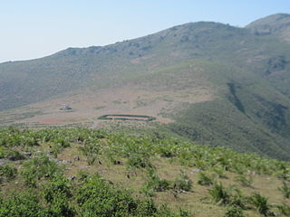
Anamudi or Anai Mudi is a mountain located in Ernakulam district and Idukki district of the Indian state of Kerala. It is the highest peak in the Western Ghats and in South India, at an elevation of 2,695 metres (8,842 ft) and a topographic prominence of 2,479 metres (8,133 ft). The name Anamudi literally translates to "elephant's head" a reference to the resemblance of the mountain to an elephant's head. Anamudi is the highest mountain in peninsular India as well as the largest mountain in Kerala.

The elevation of a geographic location is its height above or below a fixed reference point, most commonly a reference geoid, a mathematical model of the Earth's sea level as an equipotential gravitational surface . The term elevation is mainly used when referring to points on the Earth's surface, while altitude or geopotential height is used for points above the surface, such as an aircraft in flight or a spacecraft in orbit, and depth is used for points below the surface.
Madhira is a municipality situated in the Khammam district of the Indian state of Telangana, falling within the Madhira Assembly Constituency. This area is located in the Madhira mandal of Khammam division and is positioned approximately 230 kilometers east of the state capital, Hyderabad. Additionally, it is situated 53 kilometers from the district headquarters Khammam and is bordered by Andhra Pradesh state on three sides.
Kakkad is a suburb of Kannur Town in Kannur district of Kerala state, south India. It is located 4 km from Kannur town, at an average elevation of 18 metres above the sea level.

Krishnarajanagara is a town in Mysore district in the Indian state of Karnataka. It is also the administrative center of Krishnarajanagara Taluk.
Adavad, also spelled Adawad or Adwad, is a village in the Chopda Tehsil of Jalgaon District, Maharashtra, India. It is situated at the southern base of the Satpura Hills, about 30 kilometres northwest of the district seat Jalgaon, and 13 kilometres east of the subdistrict seat Chopda. As of the year 2011, it has a total population of 24,357.
Nitte is a village in Karkala Taluk, Udupi District, Karnataka, India. It is located on the way from Padubidri to Karkala, about 26 kilometres southeast of the district capital Udupi, and 7 kilometres southwest of the taluka capital Karkala. In the year 2011, the village is home to 12,354 inhabitants.

Wandoor is a town in Nilambur Taluk, Malappuram District, Kerala, India. It is located on the southeast of Chaliyar River, about 24 kilometres northeast of the district seat Malappuram, and 8 km south of the taluk seat Nilambur. In the year 2011, the town has a population of 50,973.

Hafizabad is a city and capital of Hafizabad District located in Punjab, Pakistan. It is located to the east of Chenab River. As of 2017, its total population is 245,751.
B. Kothakota is a town and headquarter of B. Kothakota Mandal, Annamayya district, Andhra Pradesh, India. It is located near the state border with Karnataka, approximately 68 kilometres southwest of the district capital Rayachoti. In the year 2011, the town has a total population of 26,191.

Thevalakkara is a village in the Karunagappally Taluk, Kollam District of the state of Kerala, India. It is located near the coast of the Indian Ocean, about 13 kilometres north of the district capital Kollam, and 7 kilometres southeast of the subdistrict capital Karunagappally. It contains a Devi temple along with a church and a mosque. The kadappa at Thevalakara is where ship masts (kadappa) were made for centuries. In 2011, it has a total population of 42,977.
Chinchali is a village in Raybag Taluk, Belagavi District, Karnataka, India. It is located near the state boundary with Maharashtra, approximately 84 kilometres north of the district seat Belgaum, and 10 kilometres northeast of the taluk seat Raibag. In the year 2011, the village has a population of 18,986.
Mohare is a village in Bailhongal Taluk, Belagavi District of Karnataka, India. It is located near the state border with Maharashtra, about 26 kilometres east of the district seat Belgaum, and 16 kilometres northwest of the taluk seat Bailhongal. As of 2011, it has a total population of 2,365.
Pimpalgaon Baswant is a town in Niphad Taluk, Nashik District, Maharashtra, India. It is located to the north of Kadva River, about 28 kilometres northeast of the district capital Nashik, and 16 kilometres northwest of the taluk capital Niphad. In the year 2011, it is home to 41,559 inhabitants.
Deomali, is a mountain peak in the Chandragiri-Pottangi subrange of the Eastern Ghats. It is located near Koraput town in the Koraput district of Odisha, India.
Arma Konda or Sitamma Konda, is a mountain peak in the northern part of the Eastern Ghats and located in Godavari River basin. It is located in the Madugula Konda sub-range north of Paderu village in Andhra Pradesh, India.


