Adyar is a large neighbourhood in south Chennai, Tamil Nadu, India. It is among the most upscale neighborhoods in Chennai.

Tharamani is an area in the south Indian city of Chennai. It is known for the presence of the city's first IT parks and numerous government educational and research institutions. It is located adjacent to the posh residential area of Adyar and Besant Nagar in South Chennai. It is an Estate with Express IT Companies, making it a massive located neighbourhood in the IT Expressway.

Chennai district, formerly known as Madras district, is one of the 38 districts in the state of Tamil Nadu, India. It is the smallest and the most densely populated district in the state. The district is coterminous with the city of Chennai, which is administered by the Greater Chennai Corporation. It is surrounded by Tiruvallur district in the north and the west, Kanchipuram district in the south-west, Chenglpattu district in the south, and the Bay of Bengal in the east.
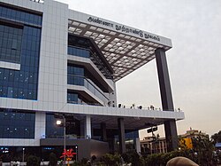
Guindy is a neighborhood of Chennai, Tamil Nadu. The Kathipara junction where Anna Salai, Mount-Poonamallee Road, Inner Ring Road, 100 Feet Road or Jawaharlal Nehru Road, and GST Road meet here. It is one of the important nodal points of road traffic in the metropolitan area. It is also a commercial hub. Here is headquarters of Ashok Leyland This junction serves as the entry point to the city limits from the suburbs. It is surrounded by Saidapet in the North, Kotturpuram and Adyar towards the East, Velachery in the South, Adambakkam and Alandur in the South-West, Parangimalai in the West and Ekkatutthangal in the North-West. Guindy is home to many important landmarks in the city, the most famous amongst them being the Guindy National Park. It also serves as a main hub for several small and medium scale industries. Transportation to/from the neighborhood is catered by Guindy railway station and Guindy metro station.

Saidapet, also known as Saidai, is a neighbourhood in Chennai, India, situated in the northern banks of the Adyar River and serves as an entry point to Central Chennai. It is surrounded by West Mambalam in the North, C.I.T Nagar in the North-East, Nandanam in the East, Guindy in the South, Jafferkhanpet and Ashok Nagar in the North-West. The Saidapet Court, the only other court of judicature in Chennai city apart from the Madras High Court, and the Saidapet bus depot are located here. Prior to its incorporation in Madras city, Saidapet functioned as the administrative headquarters of Chingleput district. The neighbourhood is served by Saidapet railway station of the Chennai Suburban Railway Network.

Poonamallee is a town and suburb of Chennai, India under the Chennai Metropolitan Area. It was historically called Pushpagirimangalam, later renamed in Tamil as Poovirundhavalli, and now colloquially called as Poondhamalli. It is the headquarters of the Poonamallee taluk of the Tiruvallur district in the Indian state of Tamil Nadu. The nearest Railway station is at Avadi. It acts as the gateway to the city from its western side. It is a town with rich cultural heritage and also a fast-growing areas in the city. As of 2011, the town had a population of 57,224. There are plans to merge the areas under Poonamallee Municipality with Avadi Municipal Corporation. It is an immediate neighbour of Chennai city and a part of the Chennai Metropolitan Area.
West Mambalam is a residential and commercial area in Chennai, India. It is known for its shops, bazaars and Hindu temples. It is bounded by Kodambakkam to the north and Saidapet to the south. T. Nagar and Nandanam stretch all along its eastern frontiers while Ashok Nagar lies to its west. The Ayodhya Mandapam is an important landmark.

Anna Salai, formerly known as St. Thomas Mount Road or simply Mount Road, is an arterial road in Chennai, India. It starts at the Cooum Creek, south of Fort St George, leading in a south-westerly direction towards St. Thomas Mount, and ends at the Kathipara Junction in Guindy. Beyond the Kathipara Junction, a branch road arises traversing westwards to Poonamallee to form the Mount-Poonamallee Road while the main branch continuing southwards to Chennai Airport, Tambaram and beyond to form Grand Southern Trunk Road. Anna Salai, which is more than 400 years old, is acknowledged as the most important road in Chennai city. The head offices of many commercial enterprises and public buildings are located along Anna Salai. It is the second longest road in Chennai, after EVR Periyar Salai.
Greenways Road is a road and neighbourhood in Chennai, India. It is lined with the official residences of ministers of Tamil Nadu state government and judges of Chennai High Court. It also houses the Tahsildar district magistrate office of the Mylapore-Triplicane taluk. A park and memorial named after B. R. Ambedkar, the Tamil Nadu Dr. Ambedkar Law University, Tamil Nadu Judicial Academy, Jesus Calls Prayer Tower, Kutchipudi Art Academy, Tamil Nadu Government Music College, Tamil Nadu Human Rights Commission, Anna Institute of Management, Dr. MGR Janaki College of Arts and Science for Women are located on this road. Part of this road is now renamed after D. G. S. Dinakaran. After the Eliphanstone Bridge was built a new road connecting Adyar to Greenways Road named Adyar Bridge Road was formed. Meenakshi Cinetone, one of the oldest cinema studios in Chennai and Jupiter Studios was also located on this road.

Chennai is located at 13.04°N 80.17°E on the southeast coast of India and in the northeast corner of Tamil Nadu. It is located on a flat coastal plain known as the Eastern Coastal Plains. The city has an average elevation of 6 metres (20 ft), its highest point being 60 m (200 ft). Chennai is 2,184 kilometres south of Delhi, 1,337 kilometres southeast of Mumbai, and 1,679 kilometers southwest of Kolkata by road.

Sardar Patel Road is an arterial road in Chennai, India, which runs from Mount Road eastwards through Guindy and Adyar for 3.2-kilometre (2.0 mi) up to the sea coast where it turns north and crosses the Adyar River to Raja Annamalaipuram.
Madhavaram Milk Colony is a neighbourhood in northern Chennai, a metropolitan city in Chennai district in the Indian state of Tamil Nadu.
Mambalam taluk is a taluk of the city district of Chennai in the Indian state of Tamil Nadu. It was formed in December 2013 from parts of the former Egmore-Nungambakkam taluk and the Mambalam-Guindy taluk. It comprises the neighbourhoods of K. K. Nagar, Kodambakkam, Mambalam, Saligramam, Saidapet and Virugambakkam.
Chinnamalai, translated in English as Little Mount, is a hillock that lies on the bank of Adayar River in the Saidapet taluk of Chennai, Tamil Nadu, India. Anna Salai, previously called Mount Road, is a long road in Chennai that stretches between Chennai northern side to the southern side at Little Mount. There is a proposed footbridge, which will allow pedestrian access to Little Mount avoiding road traffic; this will be 100 m away from the already existing walkway bridge, and built by the State Highways department of Tamil Nadu.

The Adyar River, which originates near the Chembarambakkam Lake in the Kanchipuram district, is one of the three rivers that winds through Chennai, Tamil Nadu, India, and joins the Bay of Bengal at the Adyar estuary. The 42.5-kilometre (26.4 mi) long river contributes to the estuarine ecosystem of Chennai. Despite the high pollution levels, boating and fishing take place in this river. The river collects surplus water from about 200 tanks and lakes, small streams and the rainwater drains in the city, with a combined catchment area of 860 square kilometres (331 sq mi). Most of the waste from the city is drained into this river and the Cooum.

B. M. Birla Planetarium is a large planetarium in Chennai, India. The fifth B. M. Birla planetarium in the country, it is located at Kotturpuram in the Periyar Science and Technology Centre campus which houses eight galleries, namely, Physical Science, Electronics and Communication, Energy, Life Science, Innovation, Transport, International Dolls and Children and Materials Science, with over 500 exhibits. Built in 1988 in the memory of the great industrialist and visionary of India B. M. Birla, it is considered the most modern planetarium in India, providing a virtual tour of the night sky and holding cosmic shows on a specially perforated hemispherical aluminium inner dome. Other Birla planetariums in India include the M. P. Birla Planetarium in Kolkata, the Birla Planetarium in Hyderabad, and the planetariums in Tiruchirapalli and Coimbatore.

Chingleput district was a district in the Madras Presidency of British India. It covered the area of the present-day districts of Kanchipuram, Chengalpattu and Tiruvallur and parts of Chennai city. It was sub-divided into six taluks with a total area of 7,970 square kilometres (3,079 sq mi). The first capital was the town of Karunguzhi, with an interruption between 1825 and 1835, administrative headquarters were transferred to Kanchipuram. In 1859, the capital Saidapet, now a neighbourhood in the city of Chennai, was made the administrative headquarters of the district.

Kotturpuram is a railway station on the Chennai MRTS. Situated on the banks of the Buckingham canal, the station is accessible through Ponniamman Koil Road in Kotturpuram.
Central Chennai is the part of Chennai city between the Coovum River and the Adyar River. While mostly grouped under South Chennai, Central Chennai is a term which has gained currency in recent times due to the rapid expansion of the city southwards. Covering the eastern neighbourhoods of Royapettah, Chepauk, Teynampet, Alwarpet, Mylapore, Triplicane and Mandaveli, western neighbourhoods of Vadapalani, Virugambakkam, Valasaravakkam, Alapakkam, Maduravoyal, Mogappair and Ambattur, and central neighbourhoods of Nungambakkam, Kodambakkam, Mambalam, T. Nagar, Nandanam and Saidapet, Central Chennai is largely upper class-upper middle class. The eastern part is largely upper class with two of the costliest pieces of real estate - the Boat Club Road and Poes Garden being located here while the western part is mainly middle class. Kodambakkam is the location of the Tamil film industry or Kollywood.
Guindy taluk is a taluk of the city district of Chennai in the Indian state of Tamil Nadu. It was formed in December 2013 from parts of the erstwhile Mambalam-Guindy taluk and the Mylapore-Triplicane taluk. It comprises the neighbourhoods of Adyar, Alandur, T. Nagar, Ekkaduthangal, Guindy and Kotturpuram.