Nanganallur

Last updated

Nanganallur
Nickname: 
Temple town
Chennai area locator map.svg
Red pog.svg
Nanganallur
Nanganallur நங்கநல்லூர் (Chennai)
India Tamil Nadu location map.svg
Red pog.svg
Nanganallur
Nanganallur (Tamil Nadu)
India location map.svg
Red pog.svg
Nanganallur
Nanganallur (India)
Coordinates: 12°58′51″N80°11′18″E / 12.9807°N 80.1882°E / 12.9807; 80.1882
Country Flag of India.svg  India
State Tamil Nadu
District Chennai
MetroChennai
ZoneAlandur (Zone 12)
Ward166, 167
Government
  Body Greater Chennai Corporation
Elevation
53 m (174 ft)
Languages
  Official Tamil
Time zone UTC+5:30 (IST)
PIN
600061
Vehicle registration TN-22
Planning agency CMDA
Civic agencyGreater Chennai Corporation

Nanganallur or Nangainallur is one of the southern neighbourhoods of Chennai, India. Since September 2011, it has become a part of Chennai Corporation. It is a residential area close to the Chennai International Airport.

Contents

Demographics

As of the 2001 Indian census, Nanganallur had a population of 86,230. As a result of Chennai's booming IT business and setting up of IT parks in the suburbs, a lot of people moved in to suburbs like Nanganallur.

Towards the end of 2009, it was announced that the Chennai Corporation would be expanded to cover the surrounding 42 local bodies. This was confirmed by the new government in 2011. Nanganallur has thus become a part of Chennai Corporation from September 2011.

Sporting facilities

Nanganallur has a roller skating rink on 100 Feet Road near the Civil Aviation Colony. Developed on a 12,000-square-foot (1,100 m2) open ground by the Alandur Municipality. It was opened in June 2011 at a cost of 3.1 million. The rink is 325 feet (99 m) long and 30 feet (9.1 m) wide and it is the longest in the whole of Tamil Nadu. The facility has an office room. [1]

Living and schools

Educational institutions here include Jaigopal Garodiya Girls Higher Secondary School, Modern Senior Secondary School, The Hindu Colony Chellammal Vidyalaya Senior Secondary School, Rajkumar Sulochana Matric Hr. Sec. School, Nehru Govt Girls Higher Sec. School, Kendriya Vidyalaya Minambakkam and DGQA, Prince Matriculation Higher Secondary School, St. Peter's Matriculation Higher Secondary School (one of the oldest schools in Nanganallur which has its presence for over 150 years), and P.M.S. Matriculation Higher Secondary School.

The Indian Coast Guard has its residential enclave for its personnel near Nanganallur.

Infrastructure and connectivity

1st Main Road in Nanganallur,Chennai Streets in Nanganallur,Chennai.jpg
1st Main Road in Nanganallur,Chennai

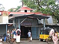
Nanganallur is connected by suburban trains at nearby railway station Palavanthangal and Meenambakkam and also through MTC city buses. Buses which ply to or through Nanganallur are 52L, 52K, 52P, M18C, M18N, M21G, M154B, M1A, MN45B, M152N. Three or four mini buses are introduced in Nanganallur route. Access from the city is through the main road from the Grand Southern Trunk Road at the Trident Hotel Junction, just north of the airport. Nanganallur has two Subways Palavanthangal and Thillai Ganga Nagar to connect to GST road. But heavy rains could create problems for residents to reach the city by usually flooding the Palavanthangal subway. The inner ring road from Thillai Ganga Nagar Subway connects Nanganallur to Velachery and is a major lifeline to the people for commuting to the city during the monsoons.

There are two railway stations serving the neighbourhood, namely, the Palavanthangal railway station and the Meenambakkam railway station. Most people in the neighbourhood use Palavanthangal railway station to reach Nanganallur. The nearest Chennai Metro railway station is Nanganallur road.

The problem of connectivity from Nanganallur to GST and other main parts of the city has been a long-standing one. AS Nangallur lacks frequent bus services, residents have been relying on sub-urban trains plying through Pazhavanthangal station as their only means of quick and reliable transport. With no direct buses to Velachery (which is a stone's throw away), Nanganallur has become cut off from all major parts of the city with accessibility restricted to only commuters with private modes of transport.

Temples

There are lot of temples around this area. The main temples are Dharmalingeshwarar Temple, Ardhanareeshwarar Temple, Vembuli Amman temple, Adivyathihara Bhakthanjaneya temple (32-feet Hanuman temple), Raja Rajeshwari temple, Uthira Guruvayurappan temple, Lakshmi Narasimha temple, Karumariamman temple, Ragavendra temple, Lakshmi Hayagrivar temple, Sri Iyappan Temple, Sri Sakthi Vinayagar Temple( which has rich tradition in pooja to Maa Varahi & Sakthi VEL Pooja) - in TNGO COLONY, Sri Kubera Ganapathi Temple in the Hindu Civil Aviation Colony and Sri Varasithi Vinayagar Temple in Hindu Colony, Thirumal Marugan Temple among others.

Hospitals

Location in context

Related Research Articles

<span class="mw-page-title-main">Adambakkam</span> Neighborhood of Chennai, India

Adambakkam is a neighbourhood of Chennai, India. It is primarily a residential locality situated in South Chennai. Adambakkam area comes under Velachery taluk and Alandur taluk, Chennai District of Chennai Corporation. Adambakkam is surrounded by areas namely, Alandur in the North-West, Nanganallur in the West, Madipakkam in the South, Velachery in the East and Guindy in the North. Earlier, one part of Adambakkam was under the direct governance of Chennai Corporation. From October 2011 onwards, the entire area was merged with the Chennai Corporation. Upon completion of the MRTS extension line, the neighbourhood will be served by Adambakkam railway station. Its Proximity to commercial localities like Velachery, accessible railway stations, Metro Stations and road transport routes makes Adambakkam an ideal choice of location to live.

Ambattur is a northwestern neighbourhood of Chennai, India. It is located in Ambattur taluk of the Chennai District, surrounded by Avadi, Anna Nagar, Padi, Mogappair, Kallikuppam, Surapet, Korattur, Ayappakkam, Athipet and Thiruverkadu. It covers an area of 45 km2 (17 sq mi). The neighbourhood is served by Ambattur railway station of the Chennai Suburban Railway. Ambattur has its origins in a village of the same name which can be located at present as areas opposite to Ambattur telephone exchange. Ambattur was a village with large extents of agricultural farm lands irrigated by the once-sprawling Ambattur Lake. In 2011, the neighborhood had a population 466,205.

<span class="mw-page-title-main">Anna Nagar</span> Neighborhood of Chennai, India

Anna Nagar, is a neighbourhood in the metropolitan city of Chennai, India. Named after former chief minister of Tamil Nadu C. N. Annadurai, it is located in the north-western part of Chennai and forms a part of the Aminjikarai taluk and the Anna Nagar Zone. It is one of the prime residential areas in Chennai and is home to several prominent doctors, lawyers and politicians. Real estate prices are among the highest in the city. A recent addition to the area is VR Chennai Mall, located near Shanthi Colony and Thirumangalam junction.

Velachery is a suburb and neighborhood in Chennai. It is located in the southern part of the city sharing borders with Guindy in the north, Taramani in the east, Perungudi in the south-east, Pallikaranai in the south, Madipakkam in south-west, Adambakkam in the west and north-west. It is the headquarters of Velachery taluk and straddles the boundary between Chennai and Kancheepuram districts.

Meenambakkam is a southern neighbourhood of Chennai in the Indian state of Tamil Nadu. It is home to Chennai International Airport, the Airports Authority of India regional office, and the DGQA Complex. It was under the reign of the Pallava kingdom. The name Meenambakkam signifies that it is a settlement near the coast. Pakkam means a settlement near to the coast. Meenambakkam was cherished with lakes, ponds and borderlines the Adyar river. This makes it a rich source of fishes. Hence the name Meenambakkam was coined.

Alandur is a zone of Chennai corporation, and an urban node in Chennai district in Guindy division in the state of Tamil Nadu, India. It is Surrounded by Guindy in the North and East, Adambakkam in the South, Pazhavanthangal in the South-West and St Thomas Mount in the North-West. As of 2011, Alandur had a population of 164,430. The town agglomeration of Alandur will have an estimated population of 300,000 by 2030. Alandur neighbours the St. Thomas Mount Cantontment, the Officers Training Academy of the Indian army and the nearby towns of Guindy and Adambakkam. M. G. Ramachandran, a former chief minister of Tamil Nadu started his political career by winning his first legislative election from Alandur in 1967. Alandur also holds famous landmarks of Chennai namely Nehru Statue and Kathipara Junction.

Pammal is a neighborhood in the city of Tambaram, situated within the Chennai Metropolitan Area, Tamil Nadu, India.

Arumbakkam is a residential locality in Chennai.

<span class="mw-page-title-main">Tirusulam</span> Census Town in Chengalpattu district

Tirusulam is a census town in Chengalpattu district falling within the Chennai metropolitan area,adjoining the Chennai International Airport, with the cargo terminal located at the adjacent Meenambakkam.

Madhavaram is a neighbourhood of Chennai, Tamil Nadu, India. Located in the northern part of Chennai, it is also a taluk in Chennai District and a zone in Greater Chennai Corporation. It is located in between Perambur and Kodungaiyur. As of 2011, the neighbourhood had a population of 119,105. The Chennai district was expanded on 16 August 2018 by transferring Madhavaram taluk from Tiruvallur district to Chennai district.

<span class="mw-page-title-main">Maduranthakam</span> Town in Tamil Nadu, India

Madurantakam is the southernmost suburb of Chennai city and a municipality in Chengalpattu district in the Indian state of Tamil Nadu. The town is known for the artificial and second largest lake in Tamil Nadu, the Madurantakam lake. It is said to have been built by the Chola King Uttama Chola, also called as Maduranthaka, during his reign. It is also home to the Eri-Katha Ramar Temple. As of 2011, the town had a population of 30,796.

<span class="mw-page-title-main">Pallikaranai</span> Neighbourhood in Chennai, Tamil Nadu, India

Pallikaranai is a neighborhood and a residential area in south Chennai, Tamil Nadu, India. Located in proximity to the IT industry in Old Mahabalipuram Road, Chennai's central business districts and the automobile hub in GST road has attracted more population to Pallikaranai in the 2000s. Pallikaranai became a part of the Chennai Corporation in July 2011.

Sembakkam is a neighborhood in the city of Tambaram, situated within the Chennai Metropolitan Area, Tamil Nadu, India.

Vandalur is a census town and taluk headquarters in the Chengalpattu district lying south of the metropolitan city of Chennai, India. Vandalur serves as the southern gateway to Chennai city. It has the Arignar Anna Zoological Park, which contain some rare species of wild flora and fauna. The town is served by Vandalur railway station of the Chennai Suburban Railway network.

Villivakkam is a neighbourhood of Chennai, Tamil Nadu, India. It is served by the Villivakkam railway station on the Chennai Central–Arakkonam suburban section. Villivakkam is the largest state assembly constituency in Tamil Nadu in terms of number of voters.

Mugalivakkam is a neighbourhood of Chennai. It is located in Sriperumbudur taluk of Kanchipuram district, in Tamil Nadu. It is situated 16 km south-west of Chennai on the Mount-Poonamallee Road. It is bounded by Porur on the North Meenambakkam and Manapakkam on the South and South East, Madhanandhapuram and Gerugambakkam on the South West and Ramapuram on the North East directions. The nearest railway station is at Guindy which is about 6 kilometres away. Porur junction is around 2 km away and Kathipara Junction is around 5 km away.

Korattur is a neighbourhood situated in the western part of Chennai. It is a part of the Ambattur Zone of Chennai Corporation and located along the Chennai-Bangalore/Mumbai railroad about 12 km from the Chennai Central. It is developed with TNHB Layouts similar to Anna Nagar and the southern section of Korattur located near Padi is often considered to be an integral part of Anna Nagar.

Pazhavanthangal is a southern neighbourhood of Chennai, India. It is served by the Pazhavanthangal railway station of the Beach-Tambaram suburban railway route in Chennai. It is one of the neighborhoods that is very close to the Chennai International Airport. It comes under the Alandur constituency.

Madhavaram Milk Colony is a neighbourhood in northern Chennai, a metropolitan city in Chennai district in the Indian state of Tamil Nadu.

Keelkattalai is a neighborhood in the City of Tambaram, Tamil Nadu and part of the Chennai metropolitan area. Formerly a part of Pallavaram Municipality,it was merged into Tambaram City Municipal Corporation in 2021.

References