Chennai, formerly known as Madras, is the capital and largest city of Tamil Nadu, the southernmost state of India. It is located on the Coromandel Coast of the Bay of Bengal. According to the 2011 Indian census, Chennai is the sixth-most populous city in India and forms the fourth-most populous urban agglomeration. Incorporated in 1688, the Greater Chennai Corporation is the oldest municipal corporation in India and the second oldest in the world after London.

Marina Beach, or simply the Marina, is a natural urban beach in Chennai, Tamil Nadu, India, along the Bay of Bengal. The beach runs from near Fort St. George in the north to Foreshore Estate in the south, a distance of 6.0 km (3.7 mi), making it the second longest urban beach in the world, after Cox's Bazar Beach. It is a prominent landmark in Chennai.

Adyar is a large neighbourhood in south Chennai, Tamil Nadu, India. It is among the most upscale neighborhoods in Chennai.

The Chennai Mass Rapid Transit System, commonly referred to as Chennai MRTS, is a metropolitan rail transit system in Chennai, India. It is operated by Southern Railway of the state-owned Indian Railways. Opened in 1995, it was the first elevated railway line in India. The railway line runs from Chennai Beach to Velachery, covering a distance of 19.34 km (12.02 mi) with 18 stations and is integrated with the wider Chennai suburban railway network.

Tharamani is an area in the south Indian city of Chennai. It is known for the presence of the city's first IT parks and numerous government educational and research institutions. It is located adjacent to the posh residential area of Adyar and Besant Nagar in South Chennai. It is an Estate with Express IT Companies, making it a massive located neighbourhood in the IT Expressway.

Besant Nagar is an upscale, exclusive residential neighbourhood in South Chennai, India. It is located along the coast of the Bay of Bengal.

Greater Chennai Corporation (GCC) is a local government for the City of Chennai in the Chennai Metropolitan Area of Tamil Nadu, India. Inaugurated on 29 September 1688, under a royal charter issued by King James II of England on 30 December 1687 as the Corporation of Madras, it is the oldest municipal body of the Commonwealth of Nations outside Great Britain. It is the largest municipal corporation in Tamil Nadu with an area of 426 km2. It is headed by a mayor, who presides over 200 councillors, each of whom represents one of the 200 wards of the city. It is the second oldest corporation in the world after the City of London. The city limits, which had been expanded several times over the years, is currently coterminous with the Chennai district. It is one of the four municipal corporations located within the Chennai Metropolitan Area, the other three being the Tambaram Corporation, Avadi City Municipal Corporation and Kanchipuram Municipal Corporation.

Tambaram is a city located within the Chennai Metropolitan Area in the Indian State of Tamil Nadu. The city is governed by Tambaram City Municipal Corporation.

Transport in Chennai includes various modes of air, sea, road and rail transportation in the city and its suburbs. Chennai's economic development has been closely tied to its port and transport infrastructure, and it is considered one of the best infrastructure systems in India.

Rukmini Devi Arundale was an Indian theosophist, dancer and choreographer of the Indian classical dance form of Bharatanatyam, and an activist for animal welfare.

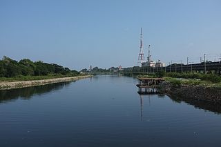
The Cooum River, or simply Koovam, is one of the shortest classified rivers draining into the Bay of Bengal. This river is about 72 km (45 mi) in length, flowing 32 km (20 mi) in the city of Chennai and the rest in rural part. The river is highly polluted in the urban area (Chennai). Along with the Adyar River running parallel to the south and the Kosasthalaiyar River, the river trifurcates the city of Chennai and separates Northern Chennai from Central Chennai. It is also sometimes known as Thiruvallikenni river
The flora and fauna of Chennai are the plants and animals in Chennai, India.

Chennai Port, formerly known as Madras Port, is the second largest container port of India, behind Mumbai's Jawaharlal Nehru Port also known as Nhava Sheva. The port is the largest one in the Bay of Bengal. It is the third-oldest port among the 12 major ports of India with official port operations beginning in 1881, although maritime trade started much earlier in 1639 on the undeveloped shore. It is an artificial and all-weather port with wet docks. Once a major travel port, it became a major container port in the post-Independence era. An established port of trade of British India since the 1600s, the port remains a primary reason for the economic growth of Tamil Nadu, especially for the manufacturing boom in South India, and has contributed greatly to the development of the city of Chennai. It is due to the existence of the port that the city of Chennai eventually became known as the Gateway of South India.

Thiruvallikeni known as Triplicane, is one of the oldest neighbourhoods of Chennai, India. It is situated on the Bay of Bengal coast and about 0.6 km (0.37 mi) from Fort St George. The average elevation of the neighbourhood is 14 metres above sea level.

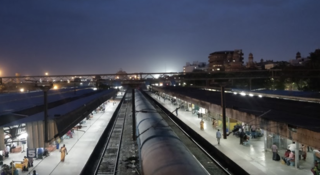
Chennai Beach is a railway terminus of the Southern Railway network in Parry's Corner, Chennai, India. Built on reclaimed land, the station serves the suburban services of the Chennai Suburban Railway and Mass Rapid Transit System (Chennai) and a few passenger trains. It serves as the northern terminus for the Chennai MRTS line. The station is named after High Court Beach, which was later built up as part of Chennai Port, and not after the Marina Beach, which is located a few kilometres away and is served by Chepauk, Triplicane and Lighthouse stations of the MRTS line. The station consists of 1500 square metres of open parking area.

Foreshore Estate is a neighbourhood in Chennai, India. It is situated along the southern stretch of the Marina Beach. The proposed Marina Business centre commercial complex on 25 acre land at Foreshore Estate in Chennai, is planned to develop by the State Government of Tamil Nadu.

Edward Elliot's Beach, simply called as Elliot's Beach and popularly known as Besant Nagar Beach or the Bessie, is a natural urban beach located in the Besant Nagar neighbourhood of Chennai, Tamil Nadu, India. It is located next to the southern tip of the Marina Beach, and was named after Edward Elliot, a chief magistrate and superintendent of police of the Madras Presidency in colonial India. It has the Shrine of Our Lady of Good Health—also known as Annai Vailankanni Church—on its shore, and the Ashtalakshmi Temple nearby.

George Town is a neighbourhood in Chennai, Tamil Nadu, India. It is near the Fort Saint George, Chennai. It is also known as Muthialpet and Parry's corner. It is an historical area of Madras city from where its expansion began in the 1640s. It extends from the Bay of Bengal in the east to Park town on the west. The Fort St. George is on the south, to Royapuram in the north. The Fort St. George houses the Tamil Nadu Legislative Assembly and the Secretariat. The High court of Tamil Nadu at Chennai, Dr. Ambedkar Law College, Stanley Medical College and Hospital are located here.
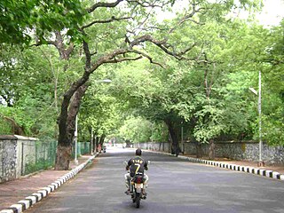
As of 2019, there are 632 parks in Chennai City, including 142 parks in the north zone, 224 in the central zone, and 266 in the south zone. They range in size from 700 square metres to 5,000 square metres. A couple of the parks, including the Anna Nagar Tower Park, are spread across acres. In 2018, the city's green cover was estimated to be 14.9 percent, up from an estimated 4.5 percent in 2011. The per capita green cover of the city has been estimated at 8.5 square meters, as against the World Health Organization recommendation of 9 square meters of green cover per capita in cities. The city lost around 100,000 trees in December 2016 because of Cyclone Vardah. As of 2018, the city's tree cover is estimated to be around 64.06 sq km. This is just over 15 percent of the entire city. The most dominant species of trees in the city are copper pod, Indian beech, neem, gulmohar, raintree, and tropical almond. The overall extent of open space in the city is 34.58 km2. In all, the city has 121 species of trees belonging to 94 genera and 42 families. Teynampet zone remains the most diverse with 68 species, and Manali zone with just 38 species is the least. With 51 parks, Adyar remains the zone with the highest number of parks in the city, and Tiruvottiyur zone scores the least with only 4 parks. The share of Chennai's greenspace is dominated by the Guindy National Park, with an area of 2.71 sq km, which covers a vast area south of the Adyar River.


