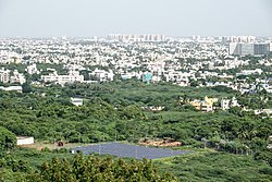
Porur is a neighbourhood of Chennai, India. It is situated in the Maduravoyal taluk of Chennai district in the southern part of the city. Since 2011, it has been a part of the Chennai Corporation and included in zone number 11.
Alandur is a zone of Chennai corporation, and an urban node in Chennai district in Guindy division in the state of Tamil Nadu, India. It is Surrounded by Guindy in the North and East, Adambakkam in the South, Pazhavanthangal in the South-West and St Thomas Mount in the North-West. As of 2011, Alandur had a population of 164,430. The town agglomeration of Alandur will have an estimated population of 300,000 by 2030. Alandur neighbours the St. Thomas Mount Cantontment, the Officers Training Academy of the Indian army and the nearby towns of Guindy and Adambakkam. M. G. Ramachandran, a former chief minister of Tamil Nadu started his political career by winning his first legislative election from Alandur in 1967. Alandur also holds famous landmarks of Chennai namely Nehru Statue and Kathipara Junction.

Poonamallee is a town and suburb of Chennai, India under the Chennai Metropolitan Area. It was historically called Pushpagirimangalam, later renamed in Tamil as Poovirundhavalli, and now colloquially called as Poondhamalli. It is the headquarters of the Poonamallee taluk of the Tiruvallur district in the Indian state of Tamil Nadu. The nearest Railway station is at Avadi. It acts as the gateway to the city from its western side. It is a town with rich cultural heritage and also a fast-growing areas in the city. As of 2011, the town had a population of 57,224. There are plans to merge the areas under Poonamallee Municipality with Avadi Municipal Corporation.

Nandambakkam is a western neighbourhood of Chennai, India. It is known for the Chennai Trade Centre and the Surgical Instruments Factory. In 2011 Nandambakkam was included to Chennai district by the Government of Tamil Nadu.
Mangadu is a neighborhood to the west of Chennai, India. Literally meaning a mango forest, Mangadu Municipality is about 18 km from Chennai Central railway station, 14 km from Chennai International Airport and 13 km from CMBT.

Gummidipoondi is an industrial town in Chennai Metropolitan Region of Thiruvallur district in the Indian state of Tamil Nadu. Notably, it is the northernmost assembly constituency and settlement in the state of Tamil Nadu.
Kaveripakkam is a town panchayat in Ranipet district in the Indian state of Tamil Nadu.
Minjur is a town located in the outskirts of North Chennai, India. It is located in the Thiruvallur district in the Indian state of Tamil Nadu. Minjur is called 'Vada Kanchi' meaning North Kanchipuram. The town has two famous temples for Shiva and Vishnu, similar to Kanchipuram. The neighbourhood is served by Minjur railway station of the Chennai Suburban Railway Network.
Palavakam is a locality in the south of Chennai and census town in Chennai district in the Indian state of Tamil Nadu. It is located on the East Coast Road about 6 km south of Adyar.
Panapakkam is a panchayat town in Nemili Taluk of Ranipet district in the Indian state of Tamil Nadu.This town is located about 30 kilometres from Ranipet and 85 kilometres from Chennai. Panapakkam is supposedly one of the hottest towns in India, where the temperature can exceed 43 °C (110 °F) for several days in peak of the summer. Petrol pump station PALANI AGENCIES BPCL Petrol pump

Perungalathur is a neighborhood in the city of Tambaram, situated within the Chennai Metropolitan Area, Tamil Nadu, India.

Polur is a scenic town and a Religious site for Lord Narasimha called Sampathgiri, divisional headquarters and a market center in Tiruvannamalai district of Tamil Nadu in India. Located at the foothills of Javvadhi hills, a popular section of Eastern Ghats, Polur is often regarded as Gateway of Eastern ghats. Polur was once a eminent center of Tamil Jainism. The town is home to Dharani sugars, chemicals and fertiliser Pvt., Ltd, and number of agro based industries including coir industries. The famous Chittor - Cuddalore road passes through the town. The town is located 29 Kilometres north of city of Tiruvannamalai and 45 kilometres south of Vellore Metropolis.
Ponneri is a town located in Chennai Metropolitan Area, Thiruvallur district in the Indian state of Tamil Nadu. It is located in Ponneri taluk. Ponneri is major destination for Andhra Pradesh people to buy goods. It is a part of the area Chennai Metropolitan Development Authority (CMDA) and a vital locality in Chennai Metropolitan Area.
Pulhal is a Northwestern residential town in Chennai district in the Indian state of Tamil Nadu. Pulhal is located on the banks of Pulhal Lake. The town is known for Pulhal Central Prison.
Ramapuram is a neighbourhood in the western part of Chennai, India. It is situated on the Mount-Poonamallee Road at a distance of 3 kilometres from Guindy. Ramapuram forms a part of Maduravoyal taluk, Chennai district. Ramapuram is located at an altitude of 42 m above the mean sea level with the geographical coordinates of 13.010600°N 80.193180°E.

Singaperumal Koil is a satellite town city of Chennai located between Chengalpattu and Maraimalai Nagar in Chengalpattu district in the Indian state of Tamil Nadu. It is a part of the area Chennai Metropolitan Development Authority (CMDA) and a vital locality in Chennai Metropolitan Area.
Iyyappanthangal is a neighborhood to the west of Chennai, Tamilnadu, India. It comes under Mangadu Municipality of Chennai Metropolitan Area (CMA), governed by CMDA. It is located 20 kilometres (12 mi) away from Fort St George on the Mount-Poonamallee Road. The nearest railway stations are at Guindy about 11 kilometres (6.8 mi) away and Avadi about 12 kilometres (7.5 mi) away. The Porur Junction where a much-needed road overbridge on the busy Guindy–Poonamallee stretch was built after a very long delay of nearly five years is just about 2 km from Iyyapanthangal and the Poonamallee Junction is just about 6 km from the town.
Cheyyur taluk is a taluk of Chengalpattu district of the Indian state of Tamil Nadu. The headquarters of the taluk is the town of Cheyyur.
Gerugambakkam is a residential-industrial neighborhood in the South-Western part of Chennai, a metropolitan city in Tamil Nadu, India.It belongs to the Kundrathur taluk of Kanchipuram District, Tamil Nadu, India. It forms a suburb of Chennai city.
Moulivakkam is a neighbourhood of Chennai. It is situated 18 km south-west of Chennai on the Arcot Road. It comes under Mangadu municipality and is bounded by Porur on the north, Kolappakkam on the south, Mugalivakkam on the east and Manapakkam on the south-east directions. The nearest railway station is at Guindy, which is about 6 kilometres away. The Porur junction is around 3 km away and Kathipara Junction is around 5 km away.