Kanchipuram district is one of the 38 districts in the state of Tamil Nadu in India. The area comprising the present day Kancheepuram district was earlier a part of Chingleput district. The original Chingleput district was split in 1997 into form the present day Kanchipuram and Tiruvallur districts.

Tambaram is a city located within the Chennai Metropolitan Area in the Indian State of Tamil Nadu. The city is governed by Tambaram City Municipal Corporation.

Ariyalur district is an administrative district, one of the 38 districts in the state of Tamil Nadu in India. The district headquarters is located at Ariyalur. The district encompasses an area of 1,949.31 km2.
Tiruvallur district, also spelled as Thiruvallur district, is one of the 38 districts in the Indian state of Tamil Nadu. The fast developing city of Tiruvallur is the district headquarters. The district has a mixture of urban and rural characteristics. The eastern part of Tiruvallur district is dominated by urban characteristics while the Northern part of the district has influence of Andhra culture due to its position. In 2011, the district had a population of 3,728,104 with a sex-ratio of 987 females for every 1,000 males.

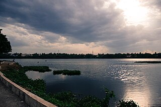
Tiruvallur is a Grade I municipality in the Indian state of Tamil Nadu. It is located on the banks of Coovum river about 46 km (29 mi) from downtown Chennai (Madras) and just 5 km from megacity border, in the western part of the Chennai Metropolitan Area (CMA). It is a satellite town of Chennai and is the administrative headquarters of Tiruvallur District. The town is known for the Veeraraghava Swamy Temple, one of the 108 sacred shrines of Vaishnavites. The tank festival is held at a pond near this temple. A Shiva temple near this shrine which is popular among the locals. There is also a 40-foot (12 m) tall Viswaroopa Panchamukha Hanuman temple, where the murti is made of a single green granite stone.

Chennai district, formerly known as Madras district, is one of the 38 districts in the state of Tamil Nadu, India. It is the smallest and the most densely populated district in the state. The district is coterminous with the city of Chennai, which is administered by the Greater Chennai Corporation. It is surrounded by Tiruvallur district in the north and the west, Kanchipuram district in the south-west, Chenglpattu district in the south, and the Bay of Bengal in the east.

Sriperumbudur, also known as Thiruperumbudur, is a town panchayat and the headquarters of Sriperumbudur taluk located in Kanchipuram district of the Indian state of Tamil Nadu. Located 40 kilometers southwest of the capital city of Chennai on the National Highway 4, it falls under the Chennai Metropolitan Area. Since 2000, Sriperumbudur has seen rapid industrialisation. It is known for being the birthplace of Sri Ramanuja, one of the most prominent Hindu Vaishnava saints. The former Indian Prime Minister Rajiv Gandhi was assassinated here in 1991.

Vellore district is one of the 38 districts in the Tamil Nadu state of India. It is one of the eleven districts that form the north region of Tamil Nadu. Vellore city is the headquarters of this district. As of 2011, the district had a population of 1,614,242 with a sex ratio of 1,007 females for every 1,000 males. In 2017 Vellore district ranked eleventh in list of districts in Tamil Nadu by Human Development Index.

Tiruttani is a historic temple town situated in the Tiruvallur district and serves as a suburb of Chennai within the Chennai Metropolitan Area in the southern Indian state of Tamil Nadu. The town is famous for the Tiruttani Murugan Temple, an ancient Hindu temple dedicated to Kartikeya, also known as Murugan, the Hindu god of war. This temple is one of the Arupadaiveedu, a group of six significant abodes of Murugan. Tiruttani was officially incorporated into the Chennai Metropolitan Area in October 2022, signifying its growing importance and influence within the region..

Gummidipoondi is an industrial town in Chennai Metropolitan Region of Thiruvallur district in the Indian state of Tamil Nadu. Notably, it is the northernmost assembly constituency and settlement in the state of Tamil Nadu.
Madhavaram is a neighbourhood of Chennai, Tamil Nadu, India. Located in the northern part of Chennai, it is also a taluk in Chennai District and a zone in Greater Chennai Corporation. It is located in between Perambur and Kodungaiyur. As of 2011, the neighbourhood had a population of 119,105. The Chennai district was expanded on 16 August 2018 by transferring Madhavaram taluk from Tiruvallur district to Chennai district.
Padianallur is a village in Sholavaram Block in Thiruvallur district of Indian state Tamil Nadu. It is located 34 km towards East from District headquarters Tiruvallur. 4 km from Sholavaram. 20 km from State capital Chennai.
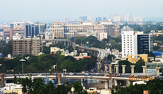
Greater Chennai Metropolitan Area, or simply the Chennai Metropolitan Area (CMA), is fourth-most populous metropolitan area in India and the 35th most populous in the world.
Kattupakkam is a suburb of Chennai, in Tiruvallur district, Tamil Nadu, India. It is located in the western side of the city.

Tiruvannamalai district is the second largest district in Tamil Nadu by area after Dindigul District and one of the 38 districts in the state of Tamil Nadu, in South India. It was formed in the year 1989 through the bifurcation of North Arcot into the Tiruvannamalai Sambuvarayar and Vellore Ambedkar districts. The city of Tiruvannamalai is the district headquarters.
Vilangadupakkam, is a suburb located North of Chennai, a metropolitan city in Tamil Nadu, India.
Kolathur is a neighborhood located in the northwestern region of Chennai, in Tamil Nadu, India.
Pushparatheswarar Temple is a Shiva temple situated at Gnayiru in Tiruvallur district, Tamil Nadu in India.


