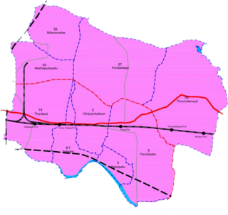
Chromepet is a suburb located in the southern part of Chennai, India. It is situated around 22 km from the Chennai Central Railway Station and 4 km south of the Chennai International Airport on the Grand Southern Trunk. Formerly a part of Pallavaram Municipality, it is now governed by the Tambaram City Municipal Corporation.Neighbouring areas include Thirumudivakkam, Tambaram, and Pallavaram. The 200-feet road connects Chromepet with Thoraipakkam.
Gopalapuram is a prime residential locality in Chennai, Tamil Nadu, India. It is surrounded by Royapettah in the North and East, Mylapore in the South-East, Teynampet in the South and Thousand Lights in the West. It is located 17 km (11 mi) from the Chennai International Airport and 3 km (1.9 mi) from Chennai Central railway station. It is located in between Dr. Radhakrishnan Salai and Anna Salai. Avvai Shanmugam Road passes through Gopalapuram, dividing it into North Gopalapuram and South Gopalapuram. Gopalapuram comes under Chennai Central Lok Sabha constituency.
Egmore is a neighbourhood of Chennai, India. Situated on the northern banks of the Coovum River, Egmore is an important residential area as well as a commercial and transportation hub. The Egmore Railway Station was the main terminus of the Madras and Southern Mahratta Railway and later, the metre gauge section of the Southern division of the Indian Railways. It continues to be an important railway junction. The Government Museum, Chennai is also situated in Egmore. Other important institutions based in Egmore include the Government Women and Children's Hospital, the Tamil Nadu State Archives and the Tamil Nadu Archaeology Department. The Wesley Church, Egmore is the oldest church of the region.
Ayyappa Nagar is a residential area within Madipakkam, a southern suburb of Chennai, in Tamil Nadu, India.
Pammal is a southern suburb in Chennai, Tamil Nadu, India.
Maduravoyal is a residential neighbourhood located in the west of Chennai, India. As of 2011, the town had a population of 86,195.
Pulhal is a Northwestern residential town in Chennai district in the Indian state of Tamil Nadu. Pulhal is located on the banks of Pulhal Lake. The town is known for Pulhal Central Prison.
Aminjikarai, originally Amaindakarai, is one of the oldest neighbourhoods in Chennai, Tamil Nadu, India. The arterial Poonamallee High Road runs through it. Aminjikarai was annexed to Madras District in 1946, and Arumbakkam and Anna Nagar were carved out of Aminjikarai in the 1950s and 1970s, respectively. The Nelson Manickam Road which traverses Aminjikarai is an important commercial road in Chennai city.

Tamil Nadu has the second largest state economy in India. The state also hosts the highest number of factories in the country. The state is 48.40% urbanised, accounting for around 9.26% of the urban population in the country, while the state as a whole accounted for 5.96% of India's total population in the 2011 census. Services contributes to 54% to the gross domestic product of the state, followed by manufacturing at 33% and agriculture at 13%.

Alwarpet is a residential zone in central Chennai and is a part of the greater Teynampet region. It is surrounded by Teynampet in the north and west, Mylapore, Mandavelli and Abhiramapuram in the east, Raja Annamalaipuram in the south, and Nandanam in the southwest. It is among the most upscale neighbourhoods in Chennai. The geographical location of this area allows centralized access to all parts of the city, so it is typically called as "Heart of Chennai". The Central Railway station is about 7 km (4.3 mi) and Chennai International Airport is around 11 km (6.8 mi). The nearest Metro station is Teynampet metro station. A new exclusive station for Alwarpet has been proposed under Phase II of the Chennai Metro Rail Project which is likely to begin by March 2021 and expected to be completed within 5-7 years.

Mandaveli is a neighborhood in Chennai, India. It is also termed usually as Mandavelipakkam which in the Tamil language "Mandhai" is 'herd of cattle' and "Veli" is 'grassland'.
Pattabiram is a neighbourhood situated on the western part of Chennai, India. The suburb, which falls under Avadi Municipal Corporation, is about 25 km from the Chennai Central railway station.
Located in the Indian state of Tamil Nadu, Vinayagapuram is a northern region of Chennai city's Chennai district.
MKB Nagar, also known as Maha kavi Bharathi Nagar, is mainly a residential locality in the northern part of the metropolitan city of Chennai, Tamil Nadu state, India. It was earlier known as Tamil Nadu Housing Board Colony until 1982.
Gerugambakkam is a residential-industrial neighborhood in the South-Western part of Chennai, a metropolitan city in Tamil Nadu, India.It belongs to the Kundrathur taluk of Kanchipuram District, Tamil Nadu, India. It forms a suburb of Chennai city.
Chennai–Thiruvallur High Road, formerly known as Madras–Thiruvallur High Road, is one of the chief routes connecting the northwestern suburbs of Chennai, India. Starting from Padi Junction, the road connects the neighbourhoods of Padi, Ambattur, Thirumullaivoyil, Avadi, Pattabiram, Thirunindravur, and Thiruvallur. It is one of the four national highways that radiates out of Chennai city and is part of National Highway 205.
Kadapakkam vilmbur village, is a developing residential area in North Chennai, a metropolitan city in Tamil Nadu, India

Avadi City Municipal Corporation is the civic body governing the City of Avadi, in Chennai Metropolitan Area in the Tiruvallur district of Tamil Nadu, India. Avadi City Municipal Corporation has 48 wards with a population of 344,701 spreads over 65 sq.km. It is headed by an executive mayor and governed by a commissioner. It is one of the four municipal corporations within the Chennai Metropolitan Area, the other three being the central Greater Chennai Corporation,the satellite Tambaram City Municipal Corporation and the Kancheepuram City Municipal Corporation.
A. Thamizhmahan Hussain is an Indian politician and Presidium Chairman of the All India Anna Dravida Munnetra Kazhagam party from 23 June 2022. Being One of the founding members of All India Anna Dravida Munnetra Kazhagam, He also served as All World M.G.R. Forum Secretary. He is the Former Chairperson of Tamil Nadu Waqf Board from 2012 to 2016.


